Kannapolis (/kəˈnæpəlɪs/) is a city in Cabarrus and Rowan counties, in the U.S. state of North Carolina, northwest of Concord and northeast of Charlotte and is a suburb in the Charlotte metropolitan area. The city of Kannapolis was incorporated in 1984. The population was 53,114 at the 2020 census, which makes Kannapolis the 19th largest city in North Carolina. It is the home of the Kannapolis Cannon Ballers, the Low-A baseball affiliate of the Chicago White Sox, and it is the hometown of the Earnhardt racing family. It is also the headquarters for the Haas F1 racing team. The center of the city is home to the North Carolina Research Campus, a public-private venture that focuses on food, nutrition, and biotech research.
| Name: | Kannapolis city |
|---|---|
| LSAD Code: | 25 |
| LSAD Description: | city (suffix) |
| State: | North Carolina |
| County: | Cabarrus County, Rowan County |
| Founded: | 1906 |
| Incorporated: | 1984 |
| Elevation: | 780 ft (237.74 m) |
| Total Area: | 34.06 sq mi (88.22 km²) |
| Land Area: | 33.50 sq mi (86.76 km²) |
| Water Area: | 0.56 sq mi (1.46 km²) |
| Total Population: | 53,114 |
| Population Density: | 1,585.54/sq mi (612.18/km²) |
| ZIP code: | 28081, 28082, 28083 |
| FIPS code: | 3735200 |
| GNISfeature ID: | 1021013 |
| Website: | kannapolisnc.gov |
Online Interactive Map
Click on ![]() to view map in "full screen" mode.
to view map in "full screen" mode.
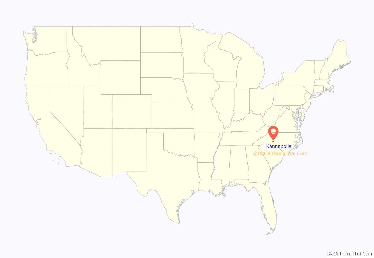
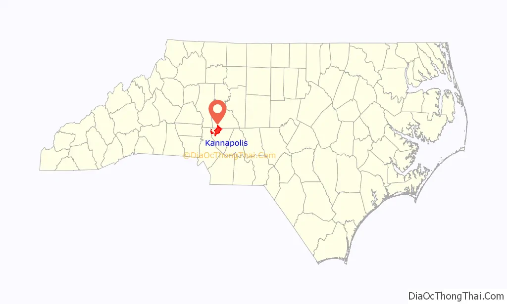
Kannapolis location map. Where is Kannapolis city?
History
Name
Early meaning and usage of the city’s name was a direct reference to Cannon Mills Corporation, or James William Cannon himself. Early published name variations include “Cannon-opolis” and “Cannapolis”. A widely accepted origin of the word “Kannapolis” comes from the combination of the Greek words kanna (reeds, not looms) and polis (city), which some believed meant “City of Looms”. Dr. Gary Freeze, Catawba College history and politics department chairman, said a Concord newspaper used the name “Cannon City” in 1906. After mill workers or newspapers called the town “Cannapolis”, J.W. Cannon asked Cabarrus County commissioners to give the town the name, but starting with a “K”. Kannapolis historian Norris Dearmon said the K might have been to distinguish the town from his Concord mill village. Since, Freeze said, “Jim Cannon didn’t study Greek,” Cannon did not name the town “city of looms”. In 1906 J.W. Cannon purchased the land that later became Kannapolis, and acquired a total of 1,008 acres in Cabarrus and Rowan Counties. Approximately 808 of those acres of farmland, purchased along the historic wagon road between Salisbury and Charlotte, became the location of the new textile mill, Cannon Manufacturing. Cannon Manufacturing began production in 1908. In 1914 Cannon Manufacturing became known as the world’s largest producer of sheets and towels. Shortly after, Mr. Cannon opened plants in Rowan County, Concord and in South Carolina totaling 20,000 workers. Mill founder J.W. Cannon’s youngest son, Charles A. Cannon, consolidated all the separate mills into the giant Cannon Mills Company in 1928.
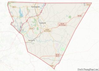
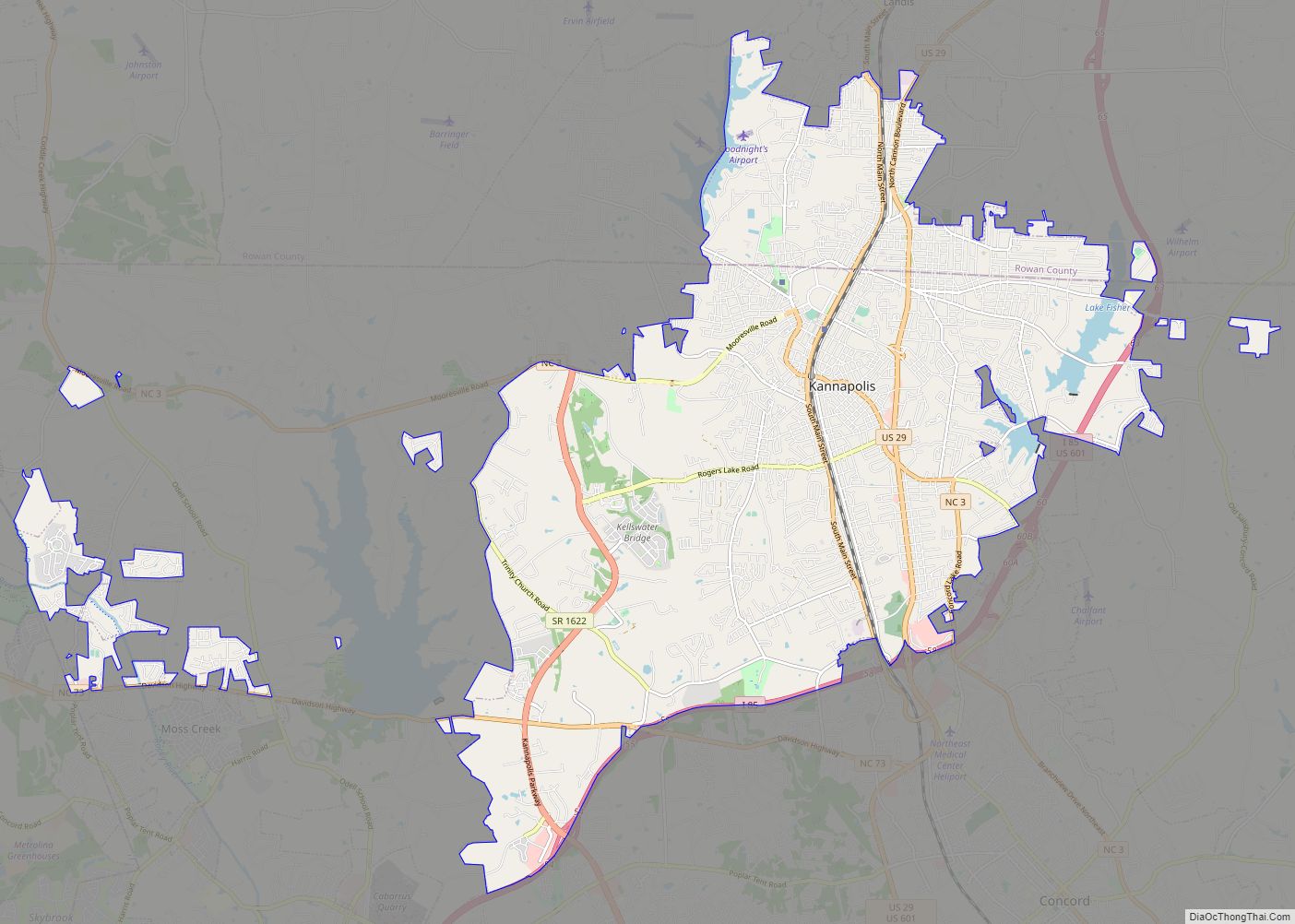
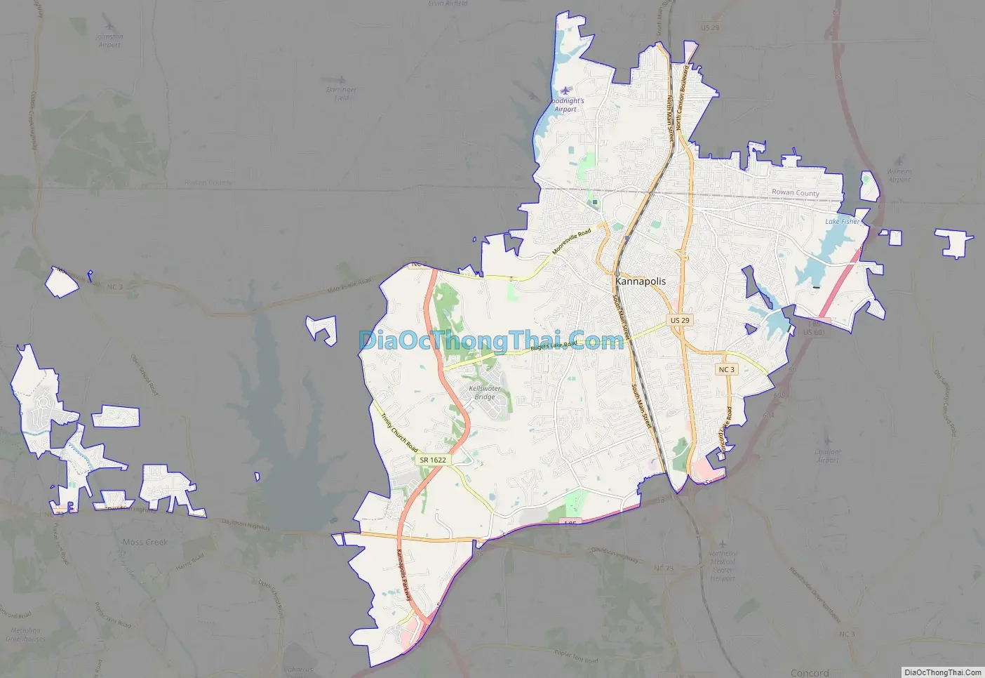
Kannapolis Road Map
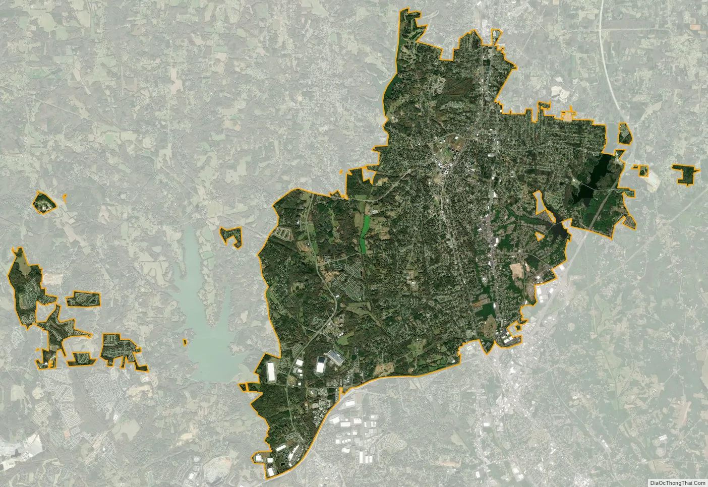
Kannapolis city Satellite Map
Geography
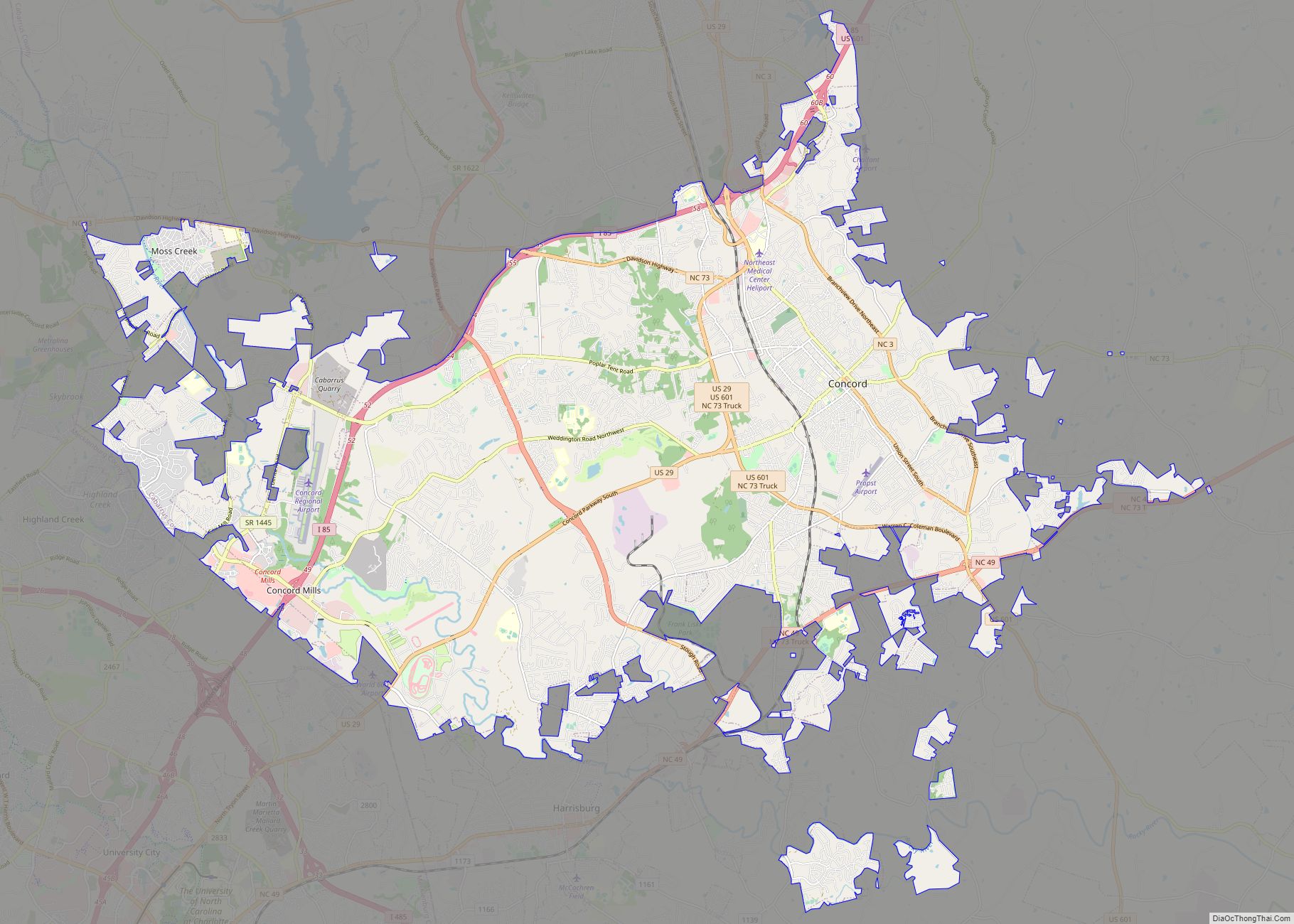
Kannapolis is located on the boundary of Cabarrus and Rowan counties, with a greater portion of its area in Cabarrus County. U.S. Route 29 (Cannon Boulevard) passes through the city east of the downtown area; U.S. 29 leads northeast 15 miles (24 km) to Salisbury and south 7 miles (11 km) to Concord. Interstate 85 bypasses the city on the south and the east, with access from Exits 54 through 63 (five exits total). I-85 leads northeast 65 miles (105 km) to Greensboro and southwest 21 miles (34 km) to Charlotte.
According to the United States Census Bureau, the city has a total area of 32.5 square miles (84.2 km), of which 31.9 square miles (82.7 km) is land and 0.58 square miles (1.5 km), or 1.73%, is water.
See also
Map of North Carolina State and its subdivision:- Alamance
- Alexander
- Alleghany
- Anson
- Ashe
- Avery
- Beaufort
- Bertie
- Bladen
- Brunswick
- Buncombe
- Burke
- Cabarrus
- Caldwell
- Camden
- Carteret
- Caswell
- Catawba
- Chatham
- Cherokee
- Chowan
- Clay
- Cleveland
- Columbus
- Craven
- Cumberland
- Currituck
- Dare
- Davidson
- Davie
- Duplin
- Durham
- Edgecombe
- Forsyth
- Franklin
- Gaston
- Gates
- Graham
- Granville
- Greene
- Guilford
- Halifax
- Harnett
- Haywood
- Henderson
- Hertford
- Hoke
- Hyde
- Iredell
- Jackson
- Johnston
- Jones
- Lee
- Lenoir
- Lincoln
- Macon
- Madison
- Martin
- McDowell
- Mecklenburg
- Mitchell
- Montgomery
- Moore
- Nash
- New Hanover
- Northampton
- Onslow
- Orange
- Pamlico
- Pasquotank
- Pender
- Perquimans
- Person
- Pitt
- Polk
- Randolph
- Richmond
- Robeson
- Rockingham
- Rowan
- Rutherford
- Sampson
- Scotland
- Stanly
- Stokes
- Surry
- Swain
- Transylvania
- Tyrrell
- Union
- Vance
- Wake
- Warren
- Washington
- Watauga
- Wayne
- Wilkes
- Wilson
- Yadkin
- Yancey
- Alabama
- Alaska
- Arizona
- Arkansas
- California
- Colorado
- Connecticut
- Delaware
- District of Columbia
- Florida
- Georgia
- Hawaii
- Idaho
- Illinois
- Indiana
- Iowa
- Kansas
- Kentucky
- Louisiana
- Maine
- Maryland
- Massachusetts
- Michigan
- Minnesota
- Mississippi
- Missouri
- Montana
- Nebraska
- Nevada
- New Hampshire
- New Jersey
- New Mexico
- New York
- North Carolina
- North Dakota
- Ohio
- Oklahoma
- Oregon
- Pennsylvania
- Rhode Island
- South Carolina
- South Dakota
- Tennessee
- Texas
- Utah
- Vermont
- Virginia
- Washington
- West Virginia
- Wisconsin
- Wyoming