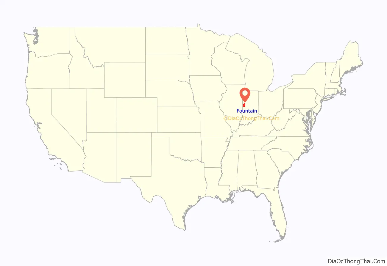
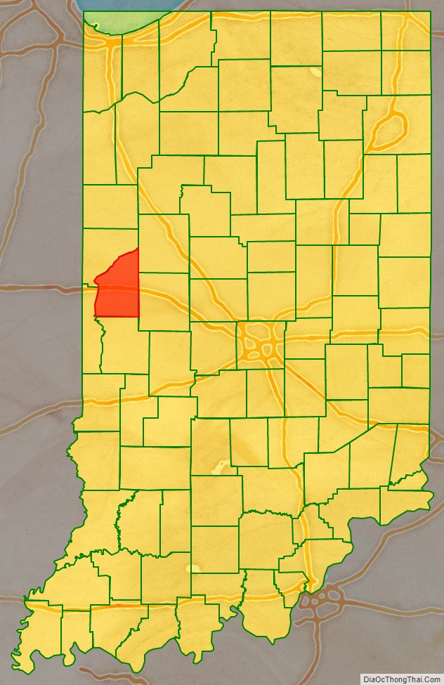
Fountain County lies in the western part of the U.S. state of Indiana on the east side of the Wabash River. The county was officially established in 1826 and was the 53rd in Indiana. The county seat is Covington.
According to the 2000 United States Census, its population was 17,954; the 2010 population was 17,240. The county has two incorporated cities and six incorporated towns with a total population of about 9,700, as well as many small unincorporated communities. It is divided into eleven townships which provide local services. An interstate highway, two U.S. Routes and five Indiana state roads cross the county, as does a major railroad line.
| Name: | Fountain County |
|---|---|
| FIPS code: | 18-045 |
| State: | Indiana |
| Founded: | April 1, 1826 |
| Named for: | James Fontaine |
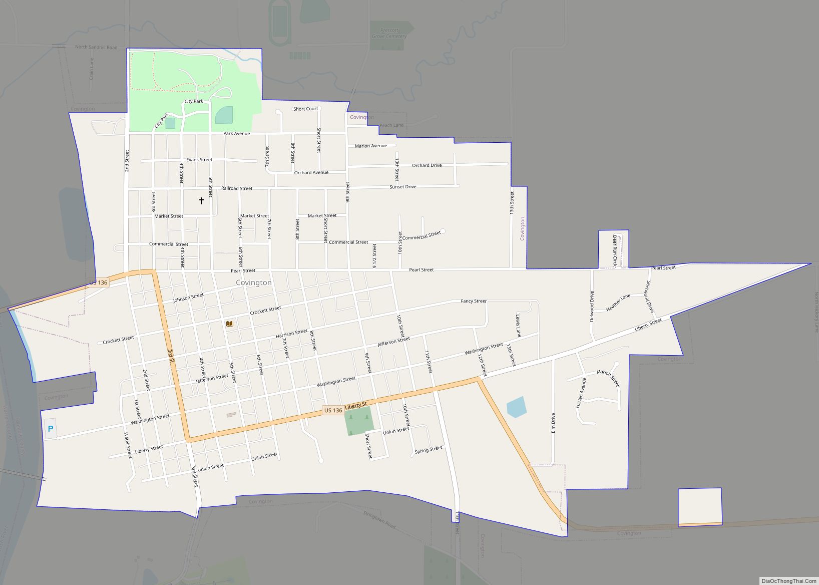
| Seat: | Covington |
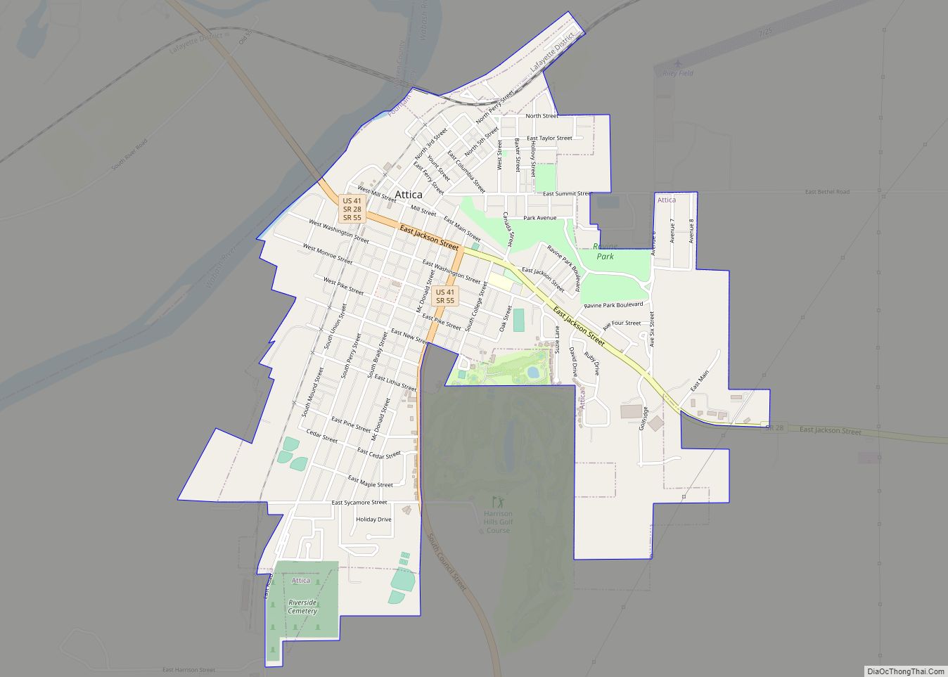
| Largest city: | Attica |
| Total Area: | 397.88 sq mi (1,030.5 km²) |
| Land Area: | 395.66 sq mi (1,024.8 km²) |
| Population Density: | 41.3/sq mi (15.9/km²) |
Fountain County location map. Where is Fountain County?
History
Indiana was granted statehood near the end of 1816. The first non-indigenous settler in the future Fountain County is thought to have been a Mr. Forbes, who arrived in early 1823 and was soon followed by others. The legislative act creating Fountain County was passed on December 30, 1825, setting an effective date of April 1, 1826. The county’s boundaries have remained unchanged since that time. It was named for Major James Fontaine of Kentucky who was killed at Harmar’s Defeat (near modern Fort Wayne, Indiana) on October 22, 1790, during the Northwest Indian War.
The first Fountain County courthouse was a two-story frame building constructed in Covington in 1827; Abraham Griffith submitted the winning bid of $335. In 1829, plans were made for a larger courthouse building, but then an act of the legislature called for the county seat to be moved. In the end it was decided that the county seat should remain in Covington, and the brick courthouse was completed in 1833. A third courthouse was commissioned in 1856, and was completed in 1857 at a cost of $33,500. The circuit court met for the first time in the new building in January 1860, and the building was largely destroyed by fire the same day. Isaac Hodgson was the architect for the rebuilt courthouse, which was first occupied in January 1861; the total cost, including the reconstruction, totaled $54,624.05. The current courthouse was built in 1936–37 at a cost of $246,734; it replaced the previous building which had been declared unsafe. The 1937 building was constructed by the Jacobson Brothers of Chicago; the architects were Louis R. Johnson and Walter Scholar of Lafayette. The courthouse walls display murals painted by Eugene Francis Savage and others from 1937 to 1940, covering 2,500 square feet (232 m) of wall space and depicting the settlement of western Indiana.
Digging on the Wabash and Erie Canal began in 1832 and worked southwest; it reached Lafayette by 1842. In 1846 it reached Covington, and by 1847 traffic was moving through the county via the canal. Completion of the county’s first railroad line in the 1850s heralded an end to the canal’s usefulness, and in 1875 the last canal boat passed through Covington.
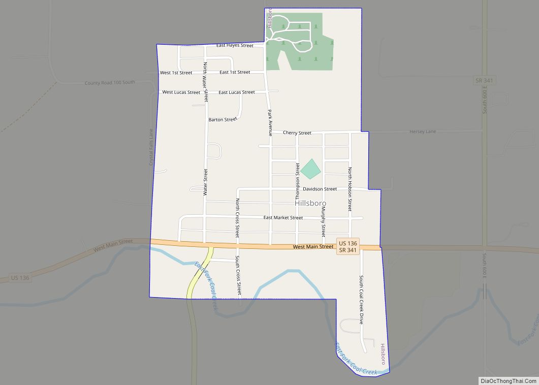
The first railway line through the county was the Toledo, Wabash and Western Railway (later the Wabash Railroad) which was built from the east across the northern part of the county and reached Attica in 1856; it continued west through Warren County and reached the Illinois state line the following year. The Indianapolis, Crawfordsville and Danville Railroad (later the Indiana, Bloomington and Western Railway), was started in 1855, but the general state of the economy halted construction in 1858. It was completed by another owner in 1870, and traffic started in 1871. It passed through Covington, Veedersburg and Hillsboro.
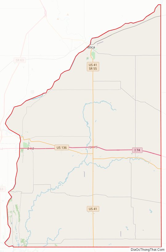
Fountain County Road Map
Geography
Fountain County’s northern and western borders are defined by the Wabash River which flows southwesterly out of Tippecanoe County.
According to the 2010 United States Census, the county has a total area of 397.88 square miles (1,030.5 km), of which 395.66 square miles (1,024.8 km) (or 99.44%) is land and 2.22 square miles (5.7 km) (or 0.56%) is water. Elevations range from 770 feet (230 m) above sea level in the northeastern part of the county to 465 feet (142 m) in the southwest where the Wabash River leaves the county. The county is within the drainage basin of the Wabash River, sloping to the southwest. It is covered with loess ranging in thickness from a few inches to more than 7 feet (2.1 m). Approximately 84 percent of the county’s land is use for agriculture.
The Portland Arch Nature Preserve and the Miller-Campbell Memorial Tract, a 435-acre (176 ha) preserve managed by the Indiana Department of Natural Resources, are located adjacent to the Wabash River.
Adjacent counties
- Warren County – north
- Tippecanoe County – northeast
- Montgomery County – east.
- Parke County – south
- Vermillion County – southwest
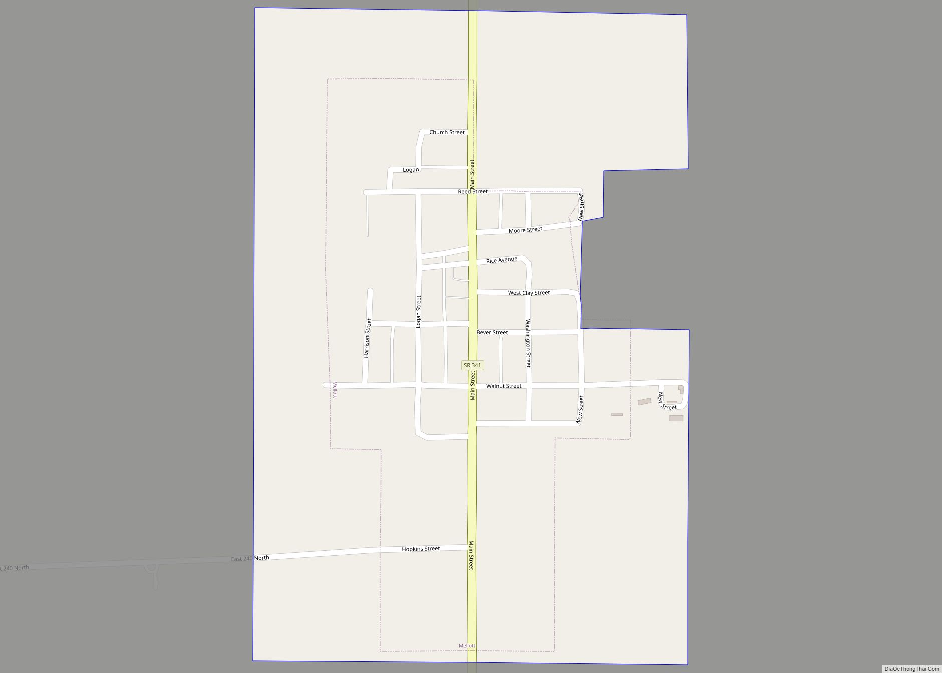
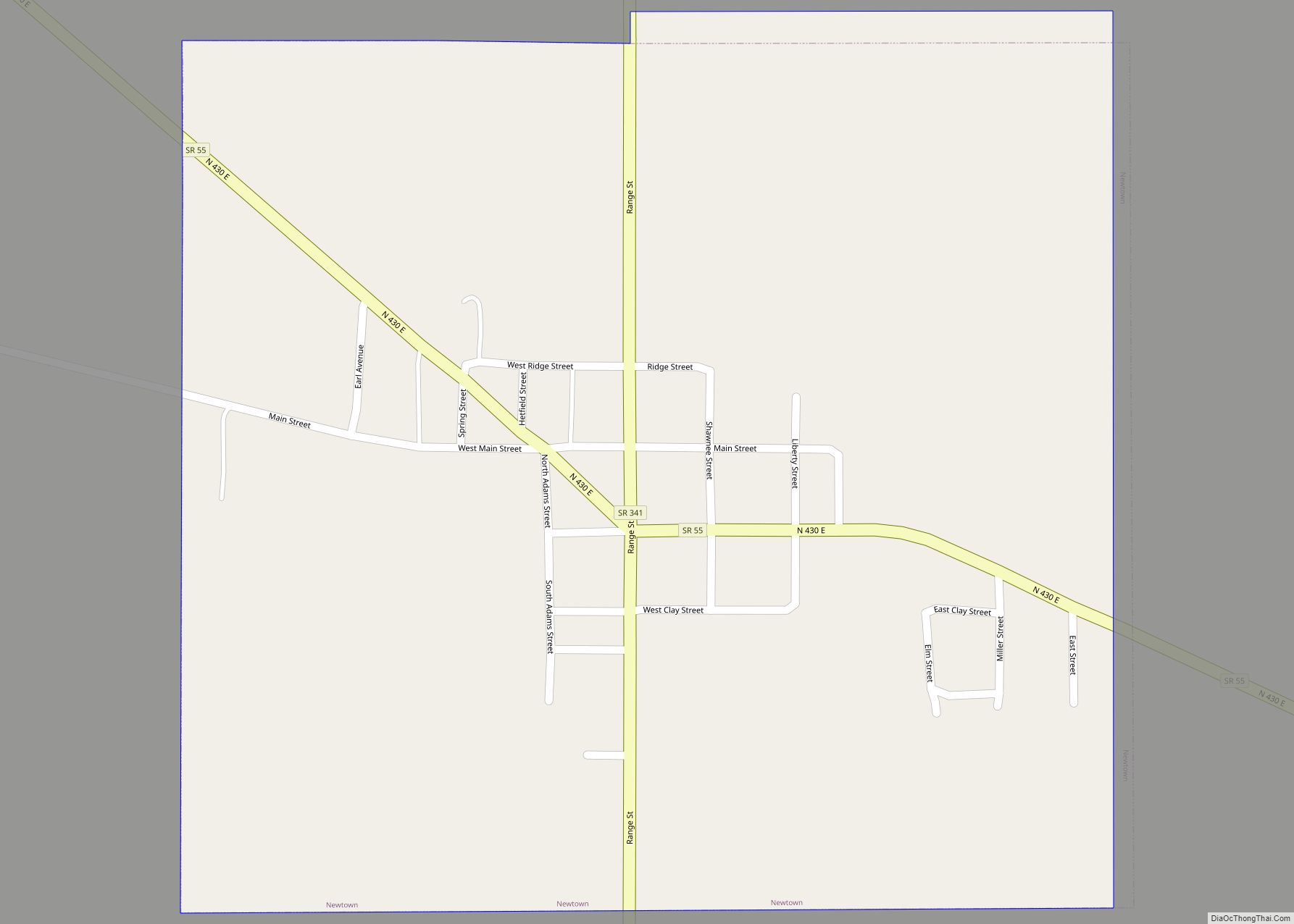
Communities
- Aylesworth
- Cates
- Centennial
- Coal Creek
- Fountain
- Graham
- Harveysburg
- Layton
- Riverside
- Rob Roy
- Roberts
- Silverwood
- Steam Corner
- Stone Bluff
- Vine
- Yeddo
- Stringtown – abandoned mining settlement south of Covington
There are several coal mines in southwest Fountain County.
- Cain (July 24, 1826)
- Davis
- Fulton
- Jackson
- Logan
- Millcreek
- Richland (July 24, 1826)
- Shawnee (July 24, 1826)
- Troy (July 24, 1826)
- Van Buren
- Wabash (July 24, 1826)
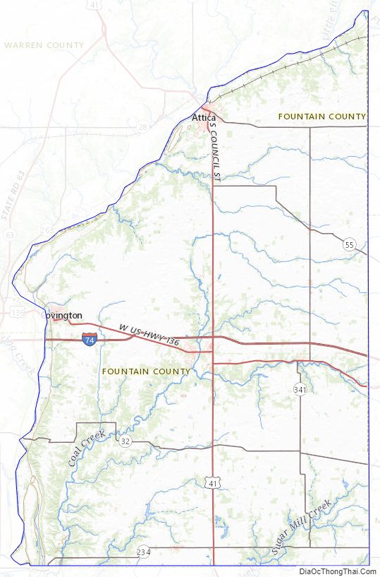
Fountain County Topographic Map
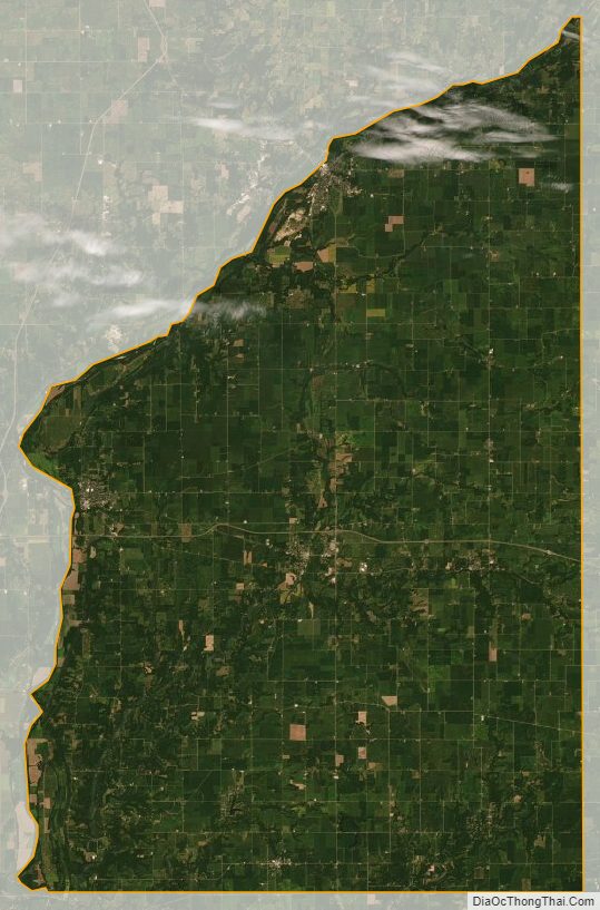
Fountain County Satellite Map
Fountain County Outline Map