Covington is a city in, and the county seat of, Fountain County, Indiana, United States. The population was 2,645 at the 2010 census.
| Name: | Covington city |
|---|---|
| LSAD Code: | 25 |
| LSAD Description: | city (suffix) |
| State: | Indiana |
| County: | Fountain County |
| Elevation: | 564 ft (172 m) |
| Total Area: | 1.29 sq mi (3.34 km²) |
| Land Area: | 1.29 sq mi (3.34 km²) |
| Water Area: | 0.00 sq mi (0.00 km²) |
| Total Population: | 2,668 |
| Population Density: | 2,068.22/sq mi (798.26/km²) |
| ZIP code: | 47932 |
| Area code: | 765 |
| FIPS code: | 1815490 |
| GNISfeature ID: | 0433050 |
| Website: | covingtonin.net |
Online Interactive Map
Click on ![]() to view map in "full screen" mode.
to view map in "full screen" mode.
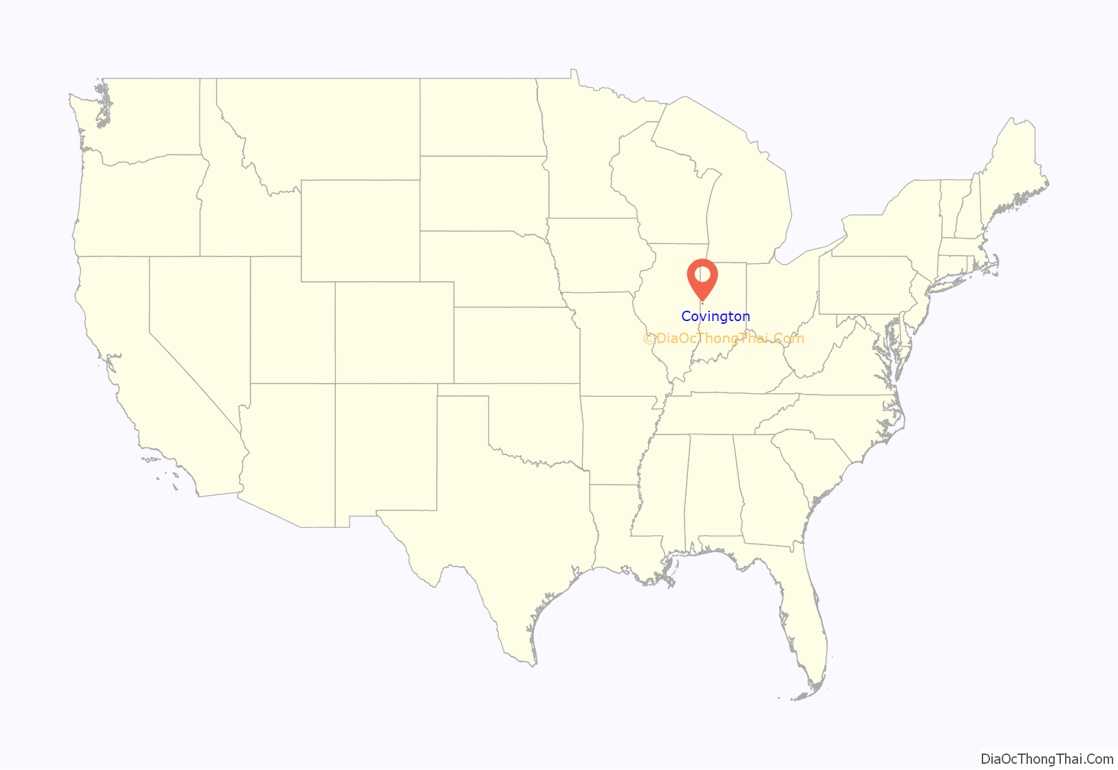
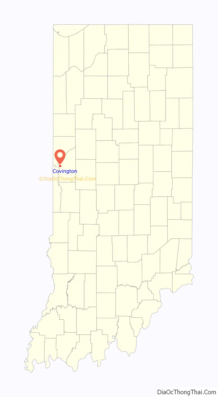
Covington location map. Where is Covington city?
History
Fountain County was formed on April 1, 1826. Later that year, the county seat was established at Covington, and a two-story frame courthouse was built in 1827. The location of the county seat was a point of contention for some years, as Covington was not centrally located in the county. In 1831 an act was passed that called for the relocation of the county seat, but after further discussion it was decided that it should remain where it was. Eventually the coming of the railroads helped to alleviate the geographical concern. A brick courthouse was completed in 1833.
The Carnegie Library of Covington, Covington Courthouse Square Historic District, Covington Residential Historic District, Fountain County Clerk’s Building, Fountain County Courthouse, and William C.B. Sewell House are listed on the National Register of Historic Places.
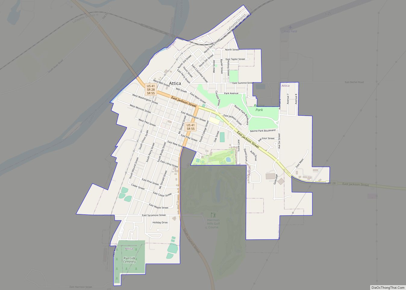
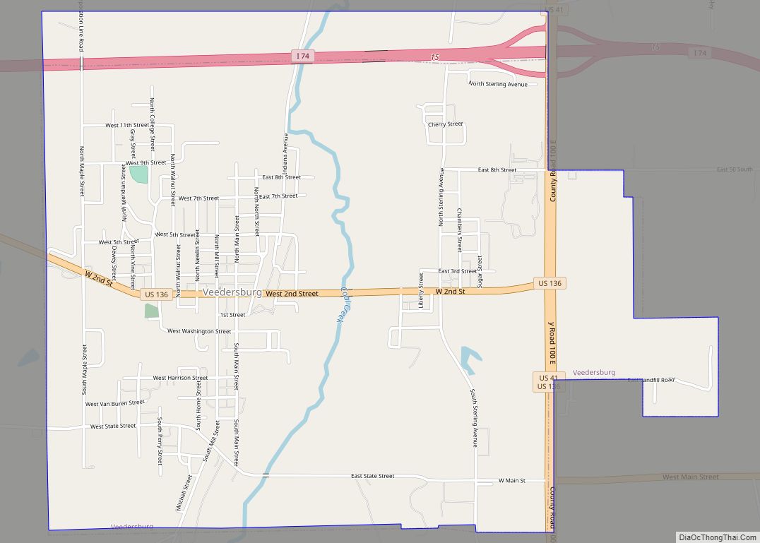
Covington Road Map
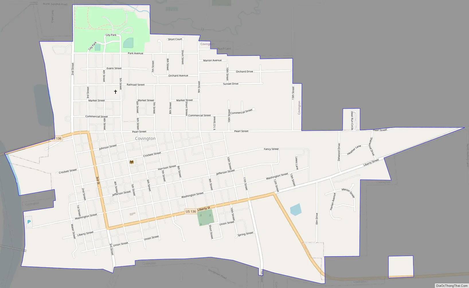
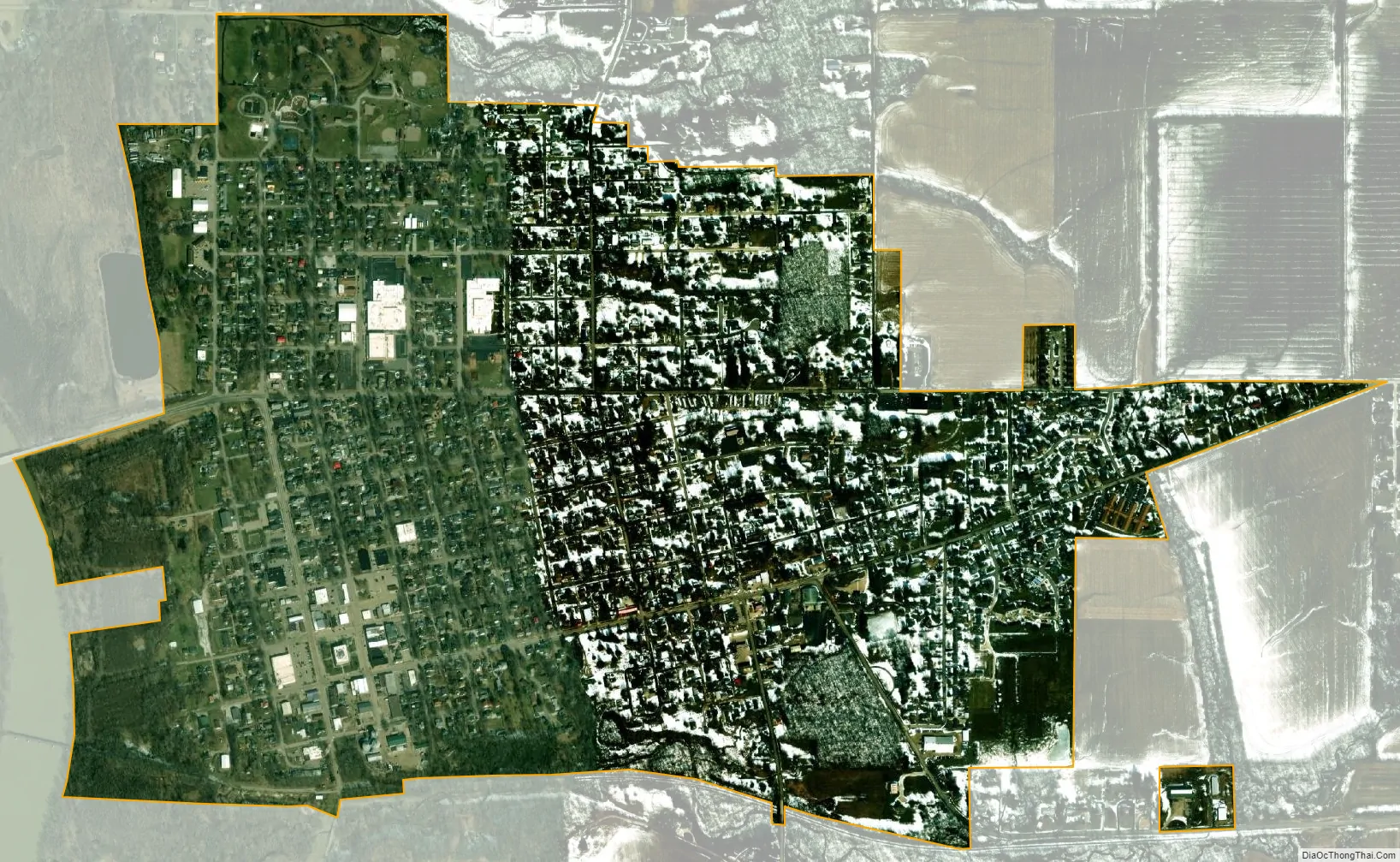
Covington city Satellite Map
Geography
Covington is located at 40°8′26″N 87°23′35″W / 40.14056°N 87.39306°W / 40.14056; -87.39306 (40.140518, -87.393106). It lies in the west part of Fountain County along the Wabash River, where U.S. Route 136 crosses the river. Interstate 74 passes about 0.5 miles (0.80 km) to the south of the city.
According to the 2010 census, Covington has a total area of 1.18 square miles (3.06 km), all land.
See also
Map of Indiana State and its subdivision:- Adams
- Allen
- Bartholomew
- Benton
- Blackford
- Boone
- Brown
- Carroll
- Cass
- Clark
- Clay
- Clinton
- Crawford
- Daviess
- De Kalb
- Dearborn
- Decatur
- Delaware
- Dubois
- Elkhart
- Fayette
- Floyd
- Fountain
- Franklin
- Fulton
- Gibson
- Grant
- Greene
- Hamilton
- Hancock
- Harrison
- Hendricks
- Henry
- Howard
- Huntington
- Jackson
- Jasper
- Jay
- Jefferson
- Jennings
- Johnson
- Knox
- Kosciusko
- LaGrange
- Lake
- Lake Michigan
- LaPorte
- Lawrence
- Madison
- Marion
- Marshall
- Martin
- Miami
- Monroe
- Montgomery
- Morgan
- Newton
- Noble
- Ohio
- Orange
- Owen
- Parke
- Perry
- Pike
- Porter
- Posey
- Pulaski
- Putnam
- Randolph
- Ripley
- Rush
- Saint Joseph
- Scott
- Shelby
- Spencer
- Starke
- Steuben
- Sullivan
- Switzerland
- Tippecanoe
- Tipton
- Union
- Vanderburgh
- Vermillion
- Vigo
- Wabash
- Warren
- Warrick
- Washington
- Wayne
- Wells
- White
- Whitley
- Alabama
- Alaska
- Arizona
- Arkansas
- California
- Colorado
- Connecticut
- Delaware
- District of Columbia
- Florida
- Georgia
- Hawaii
- Idaho
- Illinois
- Indiana
- Iowa
- Kansas
- Kentucky
- Louisiana
- Maine
- Maryland
- Massachusetts
- Michigan
- Minnesota
- Mississippi
- Missouri
- Montana
- Nebraska
- Nevada
- New Hampshire
- New Jersey
- New Mexico
- New York
- North Carolina
- North Dakota
- Ohio
- Oklahoma
- Oregon
- Pennsylvania
- Rhode Island
- South Carolina
- South Dakota
- Tennessee
- Texas
- Utah
- Vermont
- Virginia
- Washington
- West Virginia
- Wisconsin
- Wyoming