Franklin County is a nongovernmental county located in the northwestern part of the U.S. state of Massachusetts. As of the 2020 census, the population was 71,029, which makes it the least-populous county on the Massachusetts mainland, and the third-least populous county in the state. Its traditional county seat and most populous city is Greenfield. Its largest town by area is New Salem. Franklin County comprises the Greenfield Town, MA Micropolitan Statistical Area, which is included in the Springfield-Greenfield Town, MA Combined Statistical Area.
| Name: | Franklin County |
|---|---|
| FIPS code: | 25-011 |
| State: | Massachusetts |
| Founded: | 1811 |
| Named for: | Benjamin Franklin |
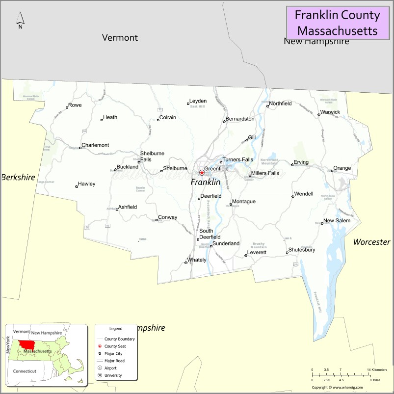
| Seat: | Greenfield |
| Largest city: | Greenfield |
| Total Area: | 725 sq mi (1,880 km²) |
| Land Area: | 699 sq mi (1,810 km²) |
| Total Population: | 71,029 |
| Population Density: | 101.6/sq mi (39.2/km²) |
| Time zone: | UTC−5 (Eastern) |
| Summer Time Zone (DST): | UTC−4 (EDT) |
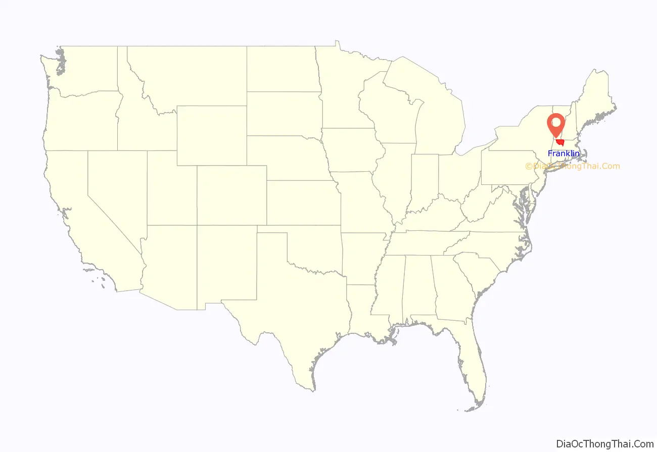
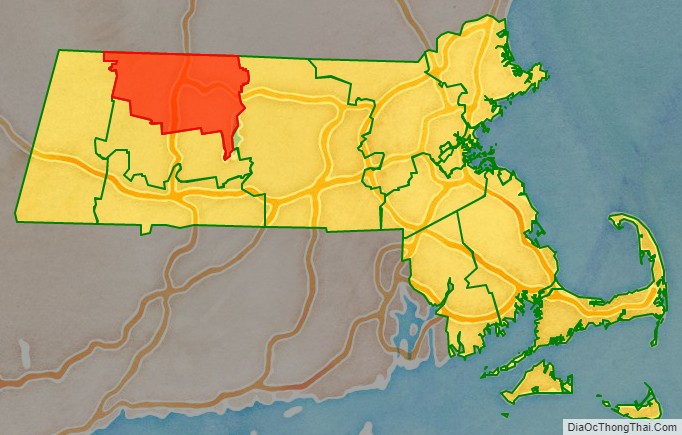
Franklin County location map. Where is Franklin County?
History
Franklin County was created on June 24, 1811, from the northern third of Hampshire County. It was named for Benjamin Franklin. Franklin County’s government was abolished by the state government in 1997, at the county’s request.
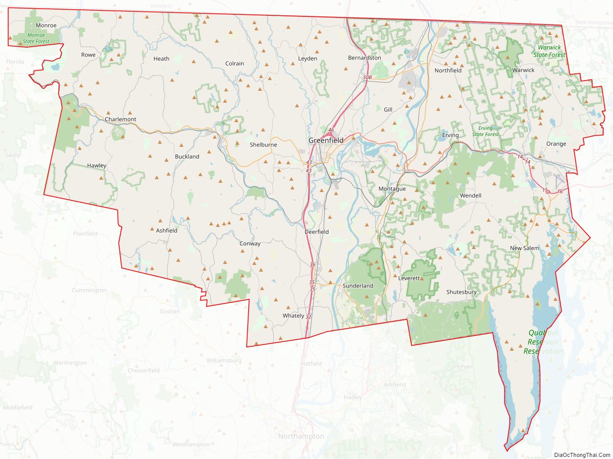
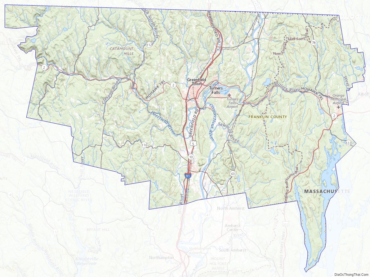
Franklin County Road Map
Geography
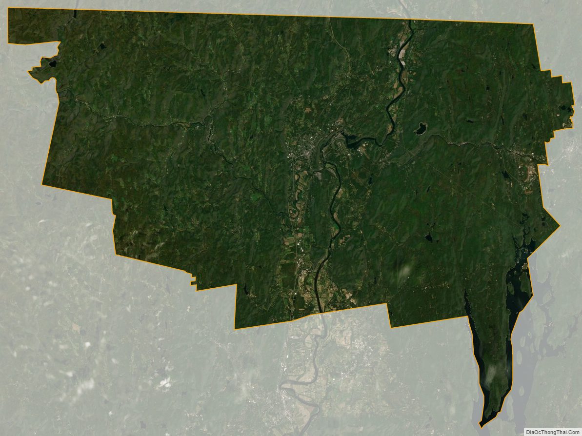
According to the U.S. Census Bureau, the county has a total area of 724.57 square miles (1,876.6 km), of which 699 square miles (1,810 km) is land, 25 square miles (65 km) and (3.5%) is water. Central and southern Franklin County is dominated by the northern end of the Pioneer Valley, with steep hills rising on either side of the Connecticut River.
The high point of Franklin County is Crum Hill, 2,841 feet (866 m), located in the town of Monroe.
Climate
The climate in Franklin County is typically cool temperate. The area is also somewhat maritime, with relatively high year-round precipitation. Summers are warm and humid with frequent evening storms, and winters are cool to cold with frequent snow and subfreezing (below 31F) temperatures.
Protected areas
- Silvio O. Conte National Fish and Wildlife Refuge (part)
- Paul C. Jones Working Forest (privately owned with conservation easement) around Brushy Mountain, Shutesbury
Various Department of Conservation & Recreation properties.
Franklin County Topographic Map
Franklin County Satellite Map
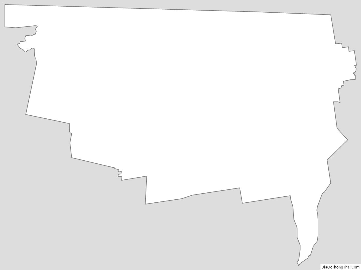
Franklin County Outline Map
See also
Map of Massachusetts State and its subdivision: Map of other states:- Alabama
- Alaska
- Arizona
- Arkansas
- California
- Colorado
- Connecticut
- Delaware
- District of Columbia
- Florida
- Georgia
- Hawaii
- Idaho
- Illinois
- Indiana
- Iowa
- Kansas
- Kentucky
- Louisiana
- Maine
- Maryland
- Massachusetts
- Michigan
- Minnesota
- Mississippi
- Missouri
- Montana
- Nebraska
- Nevada
- New Hampshire
- New Jersey
- New Mexico
- New York
- North Carolina
- North Dakota
- Ohio
- Oklahoma
- Oregon
- Pennsylvania
- Rhode Island
- South Carolina
- South Dakota
- Tennessee
- Texas
- Utah
- Vermont
- Virginia
- Washington
- West Virginia
- Wisconsin
- Wyoming