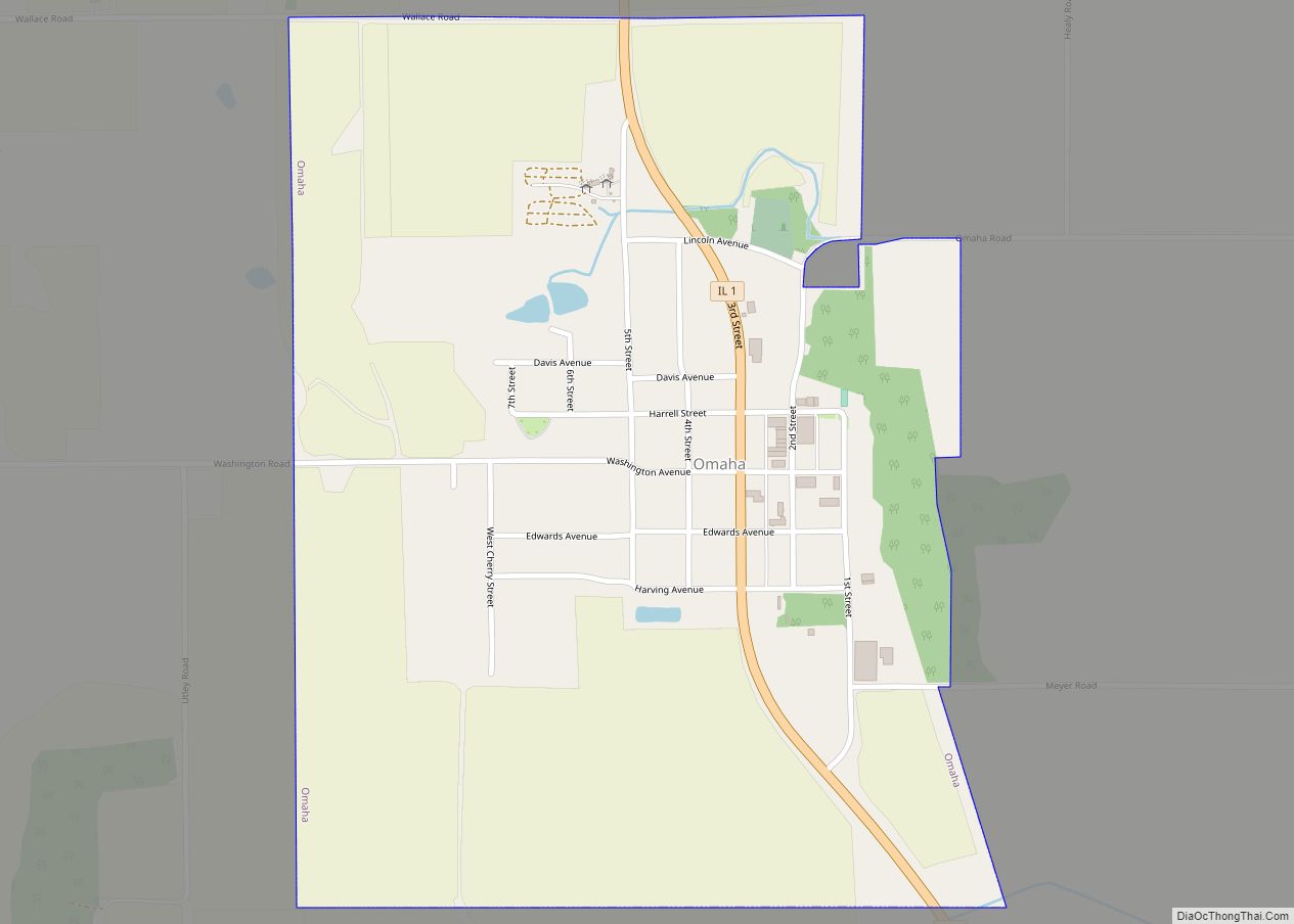
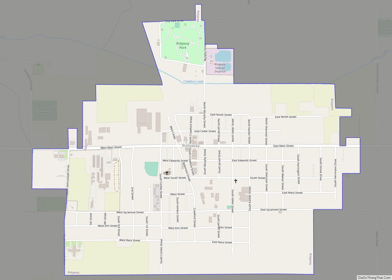
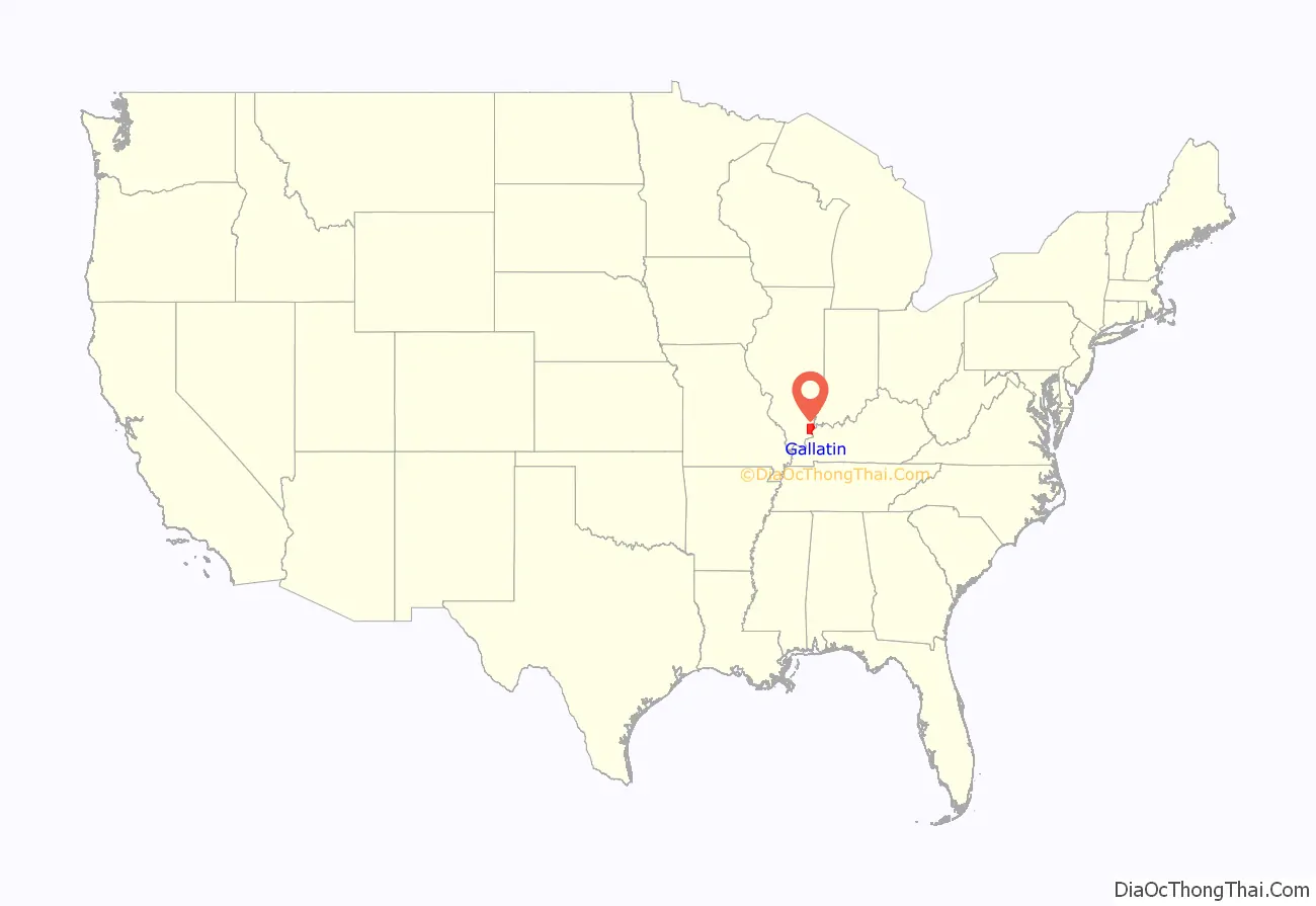
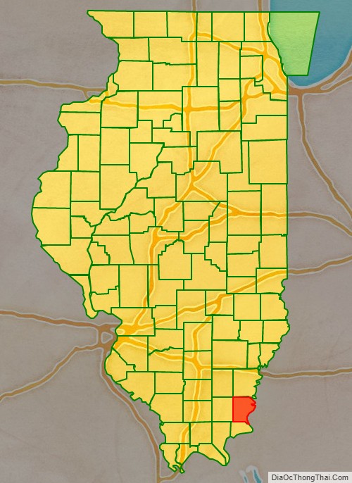
Gallatin County is a county located in the U.S. state of Illinois. According to the 2020 census, it has a population of 4,946, making it the third-least populous county in Illinois. Its county seat is Shawneetown. It is located in the southern portion of Illinois known locally as Little Egypt. Located at the mouth of the Wabash River, Gallatin County, along with neighboring Posey County, Indiana, and Union County, Kentucky form the tri-point of the Illinois-Indiana-Kentucky Tri-State Area.
| Name: | Gallatin County |
|---|---|
| FIPS code: | 17-059 |
| State: | Illinois |
| Founded: | 1812 |
| Named for: | Albert Gallatin |
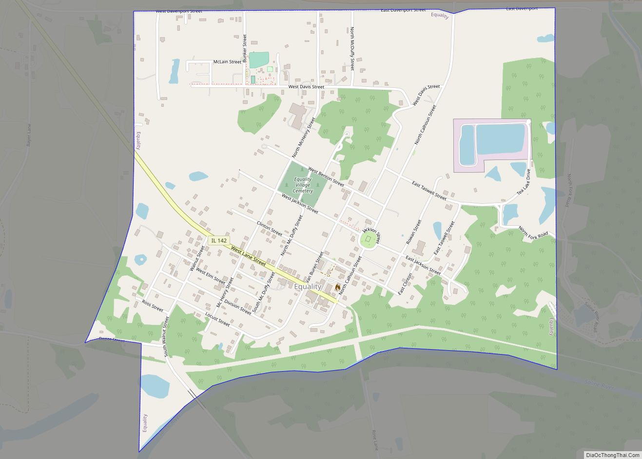
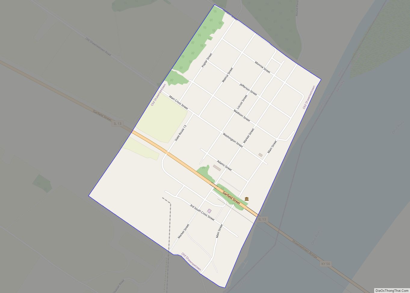
| Seat: | Shawneetown |
| Largest city: | Shawneetown |
| Total Area: | 328 sq mi (850 km²) |
| Land Area: | 323 sq mi (840 km²) |
| Total Population: | 4,946 |
| Population Density: | 15/sq mi (6/km²) |
| Time zone: | UTC−6 (Central) |
| Summer Time Zone (DST): | UTC−5 (CDT) |
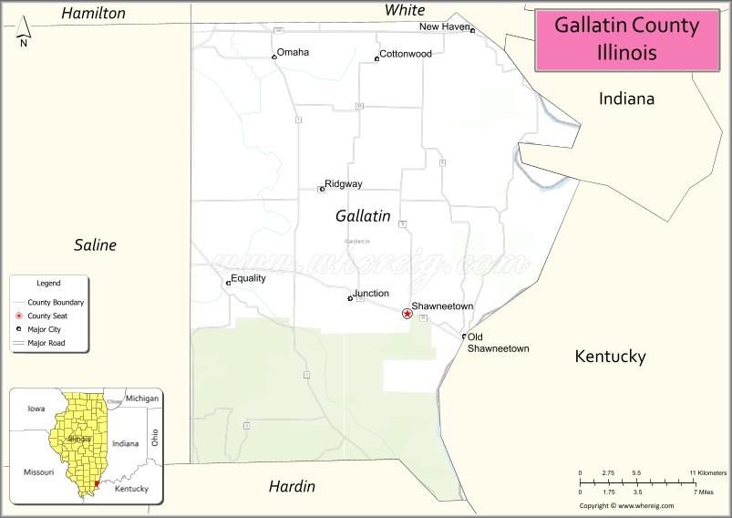
Gallatin County location map. Where is Gallatin County?
History
Salt production served as the state’s first major industry in the early 19th century. Saltworks developed first by Native Americans, and the French had settled at the Great Salt Spring on the south side of the Saline River, about five miles downstream from Equality. Beginning in 1803, salt works were also developed at Half Moon Lick, southwest of Equality on the north side of the Saline River. Half Moon Lick is now on private land, but the Great Salt Springs are on public lands in the Shawnee National Forest, about one mile west of the Saline River bridge across Illinois Route 1 on Salt Well Road.
Gallatin county was organized in 1812 from land formerly in Randolph County. It was named for Albert Gallatin, who was then Secretary of the Treasury. The bank at Shawneetown was the first in Illinois. It was originally in the John Marshall House, which has been rebuilt and serves as the museum of the Gallatin County Historical Society. This should not be confused with the State Bank of Illinois building, which is a state historic site a block away in Old Shawneetown
Gallatin County created in the Illinois Territory period between 1812 and 1815
Gallatin between 1815 and 1816
Gallatin between 1816 and 1818, including unorganized territory (formerly part of Johnson County) temporarily attached to it.
Gallatin between 1818 and 1847
Gallatin in 1847, when a cession to Hardin and the creation of Saline County reduced it to its current territory
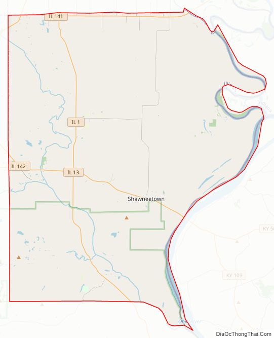
Gallatin County Road Map
Geography
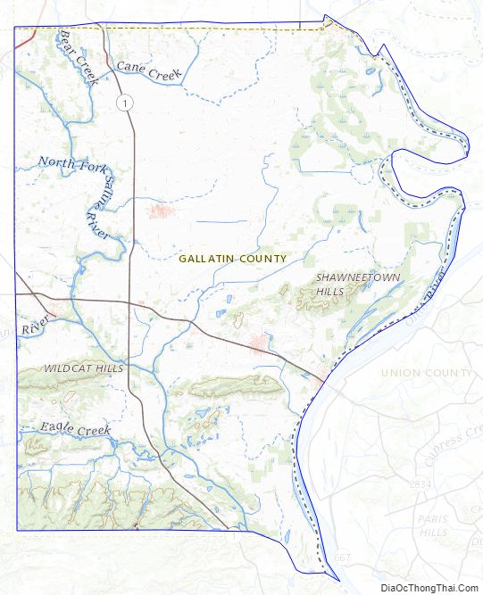
According to the U.S. Census Bureau, the county has a total area of 328 square miles (850 km), of which 323 square miles (840 km) is land and 5.1 square miles (13 km) (1.6%) is water.
The Wabash and Ohio rivers join in the northeastern part of the county. The Saline River is a major drainage in the county, and it feeds into the Ohio River.
Climate and weather
In recent years, average temperatures in the county seat of Shawneetown have ranged from a low of 21 °F (−6 °C) in January to a high of 87 °F (31 °C) in July, although a record low of −22 °F (−30 °C) was recorded in January 1994 and a record high of 104 °F (40 °C) was recorded in August 2007. Average monthly precipitation ranged from 3.22 inches (82 mm) in October to 5.02 inches (128 mm) in May.
Major highways
- U.S. Highway 45
- Illinois Route 1
- Illinois Route 13
- Illinois Route 141
- Illinois Route 142
Adjacent counties
- White County – north
- Posey County, Indiana – northeast
- Union County, Kentucky – east
- Hardin County – south
- Saline County – west
- Hamilton County – northwest
National protected area
- Shawnee National Forest (part)
Gallatin County Topographic Map
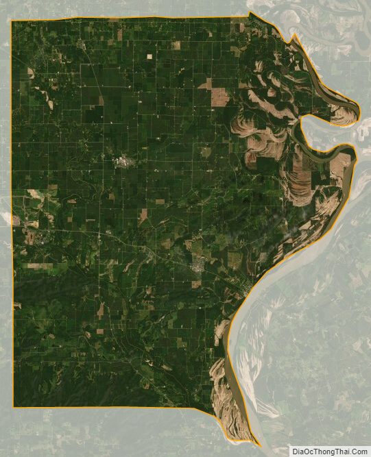
Gallatin County Satellite Map
Gallatin County Outline Map