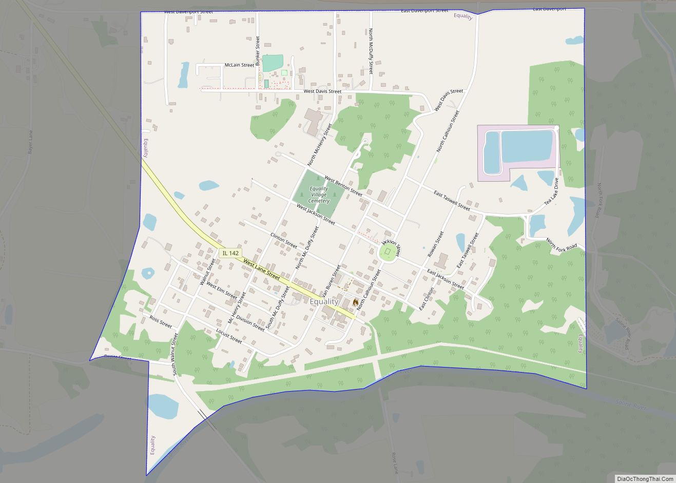
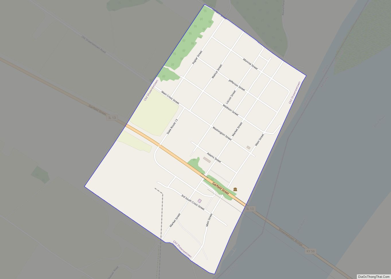
Equality is a village in Gallatin County, Illinois, United States. The population was 595 at the 2010 census, down from 721 at the 2000 census. Near the village are two points of interest, the Crenshaw House and the Garden of the Gods Wilderness. Equality was the county seat of Gallatin County from 1826–1851.
| Name: | Equality village |
|---|---|
| LSAD Code: | 47 |
| LSAD Description: | village (suffix) |
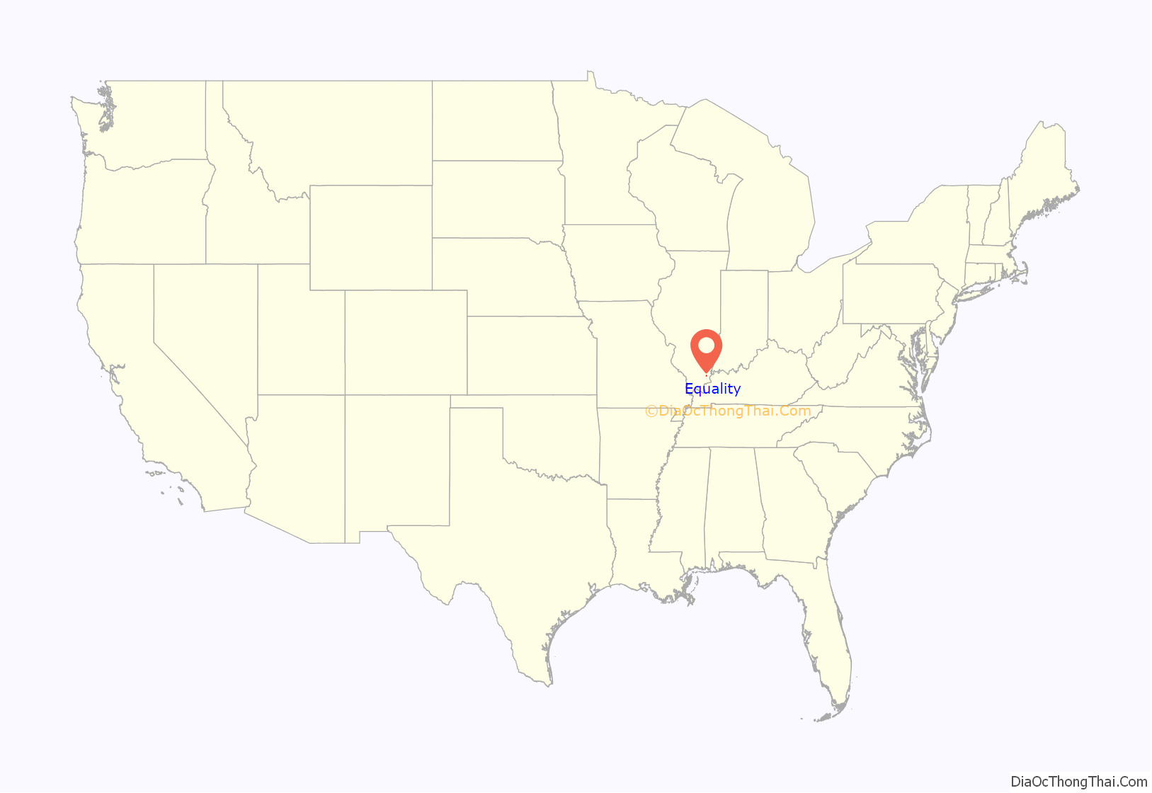
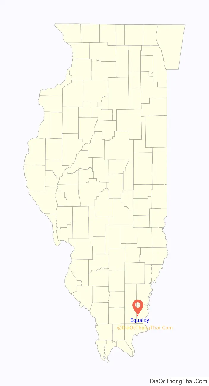
| State: | Illinois |
| County: | Gallatin County |
| Elevation: | 427 ft (130 m) |
| Total Area: | 0.90 sq mi (2.33 km²) |
| Land Area: | 0.88 sq mi (2.27 km²) |
| Water Area: | 0.02 sq mi (0.05 km²) |
| Total Population: | 539 |
| Population Density: | 614.60/sq mi (237.19/km²) |
| Area code: | 618 |
| FIPS code: | 1724348 |
Online Interactive Map
Click on ![]() to view map in "full screen" mode.
to view map in "full screen" mode.
Equality location map. Where is Equality village?
History
On Jan. 26, 1826, Equality was officially established by the General Assembly as the county seat of Gallatin County. The courthouse was built in 1827 for the amount of $1,300.00 dollars. Court was held there until 1851, when all legal documents were removed to Shawneetown, The building was later used as a school, church & local society meetings. It was destroyed by fire Nov. 28, 1894.
Salt Works
French settlers extracted salt near Equality as early as 1735, while Native Americans made salt here long before then. In 1803, the American Indians ceded their “Great Salt Springs” to the US government by treaty. The government then leased the springs, requiring the holder to produce a certain quantity of salt each year or pay a penalty. The salt works is referred to as the “United States Saline” in old documents.
Isaac White was in charge of the salt works in 1811. White volunteered for the Indiana Militia that year, and was killed at the Battle of Tippecanoe.
Special territorial laws permitted exceptions to anti-slavery treaties at these salines, and slaves were used extensively in manufacturing salt. The census of 1820 for Gallatin County listed 239 slaves or servants.
During the 1820s, Gallatin County included what is now Saline County as its western half. In 1826, the county seat was moved from Old Shawneetown, on the eastern edge of the county, to the new village of Equality, near the center of what was then Gallatin County. Equality remained the county seat until the formation of Saline County in 1847.
In 1838, a local salt maker and illegal slave trader kidnapper and illegal slave breeder, John Hart Crenshaw, began building his manor house at Hickory Hill just five miles east of Equality; he used the house for his business of kidnapping free blacks and breeding slaves to sell into slavery as part of the Reverse Underground Railroad.
The Great Salt Springs are located southeast of Equality, on federal land along the south bank of the Saline River, seven-tenths of a mile west of Illinois Route 1 on Salt Well Road. Half Moon Lick, where the saltworks first developed as a large industry, is on private property southwest of Equality.
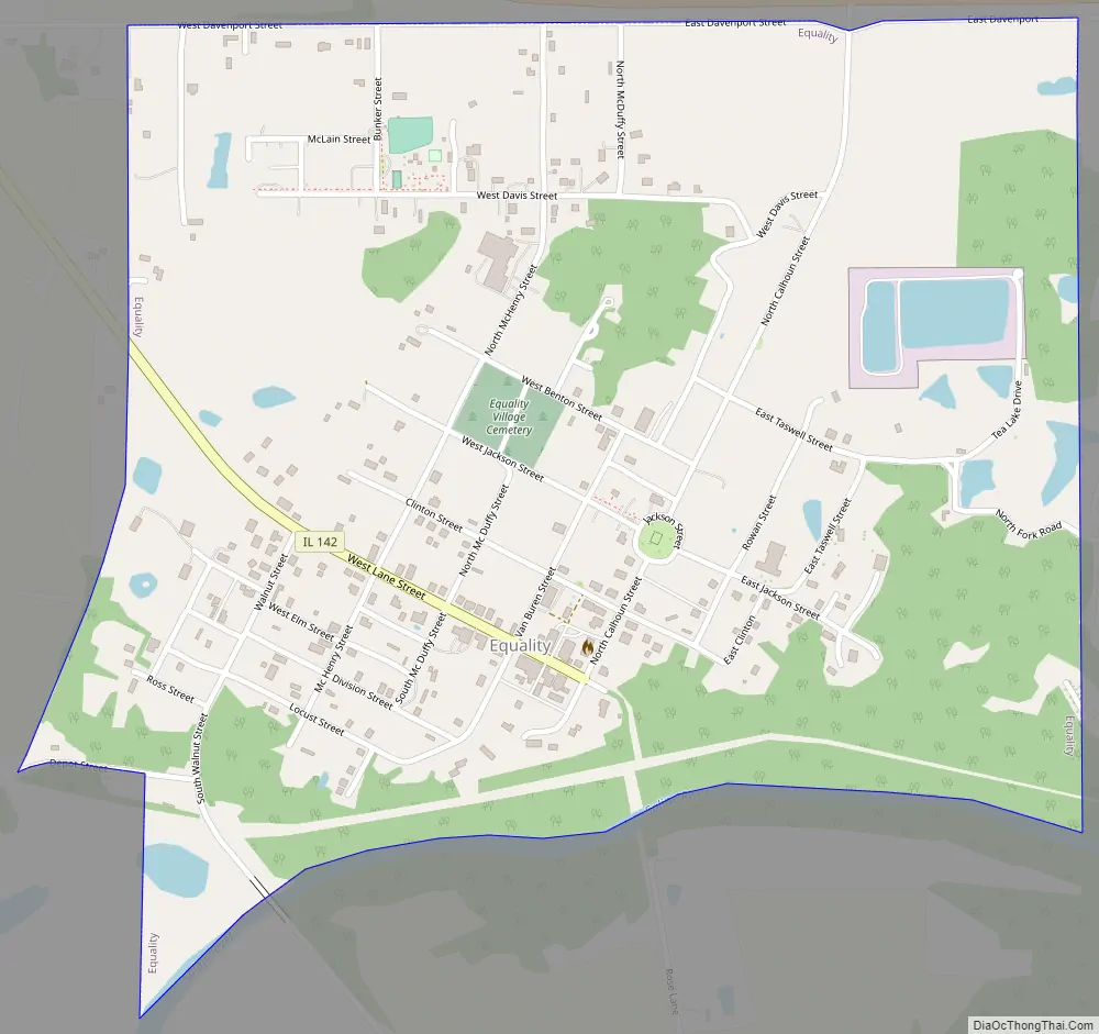
Equality Road Map
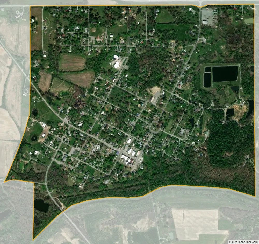
Equality city Satellite Map
Geography
Equality is located in western Gallatin County at 37°44′11″N 88°20′40″W / 37.73639°N 88.34444°W / 37.73639; -88.34444 (37.736472, -88.344473), on the north side of the Saline River, a southeast-flowing tributary of the Ohio River.
According to the 2010 census, Equality has a total area of 0.906 square miles (2.35 km), of which 0.89 square miles (2.31 km) (or 98.23%) is land and 0.016 square miles (0.04 km) (or 1.77%) is water.
See also
Map of Illinois State and its subdivision:- Adams
- Alexander
- Bond
- Boone
- Brown
- Bureau
- Calhoun
- Carroll
- Cass
- Champaign
- Christian
- Clark
- Clay
- Clinton
- Coles
- Cook
- Crawford
- Cumberland
- De Kalb
- De Witt
- Douglas
- Dupage
- Edgar
- Edwards
- Effingham
- Fayette
- Ford
- Franklin
- Fulton
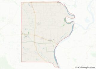
- Gallatin
- Greene
- Grundy
- Hamilton
- Hancock
- Hardin
- Henderson
- Henry
- Iroquois
- Jackson
- Jasper
- Jefferson
- Jersey
- Jo Daviess
- Johnson
- Kane
- Kankakee
- Kendall
- Knox
- La Salle
- Lake
- Lake Michigan
- Lawrence
- Lee
- Livingston
- Logan
- Macon
- Macoupin
- Madison
- Marion
- Marshall
- Mason
- Massac
- McDonough
- McHenry
- McLean
- Menard
- Mercer
- Monroe
- Montgomery
- Morgan
- Moultrie
- Ogle
- Peoria
- Perry
- Piatt
- Pike
- Pope
- Pulaski
- Putnam
- Randolph
- Richland
- Rock Island
- Saint Clair
- Saline
- Sangamon
- Schuyler
- Scott
- Shelby
- Stark
- Stephenson
- Tazewell
- Union
- Vermilion
- Wabash
- Warren
- Washington
- Wayne
- White
- Whiteside
- Will
- Williamson
- Winnebago
- Woodford
- Alabama
- Alaska
- Arizona
- Arkansas
- California
- Colorado
- Connecticut
- Delaware
- District of Columbia
- Florida
- Georgia
- Hawaii
- Idaho
- Illinois
- Indiana
- Iowa
- Kansas
- Kentucky
- Louisiana
- Maine
- Maryland
- Massachusetts
- Michigan
- Minnesota
- Mississippi
- Missouri
- Montana
- Nebraska
- Nevada
- New Hampshire
- New Jersey
- New Mexico
- New York
- North Carolina
- North Dakota
- Ohio
- Oklahoma
- Oregon
- Pennsylvania
- Rhode Island
- South Carolina
- South Dakota
- Tennessee
- Texas
- Utah
- Vermont
- Virginia
- Washington
- West Virginia
- Wisconsin
- Wyoming