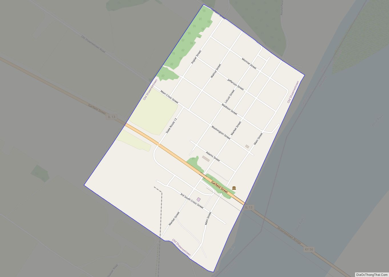
Old Shawneetown is a village in Gallatin County, Illinois, United States. As of the 2010 census, the village had a population of 193, down from 278 at the 2000 census. Located along the Ohio River, Shawneetown served as an important United States government administrative center for the Northwest Territory. The village was devastated by the Ohio River flood of 1937. The village’s population was moved several miles inland to New Shawneetown.
| Name: | Old Shawneetown village |
|---|---|
| LSAD Code: | 47 |
| LSAD Description: | village (suffix) |
| State: | Illinois |
| County: | Gallatin County |
| Elevation: | 348 ft (106 m) |
| Total Area: | 0.51 sq mi (1.32 km²) |
| Land Area: | 0.51 sq mi (1.32 km²) |
| Water Area: | 0.00 sq mi (0.00 km²) |
| Total Population: | 113 |
| Population Density: | 221.57/sq mi (85.51/km²) |
| Area code: | 618 |
| FIPS code: | 1755756 |
Online Interactive Map
Click on ![]() to view map in "full screen" mode.
to view map in "full screen" mode.
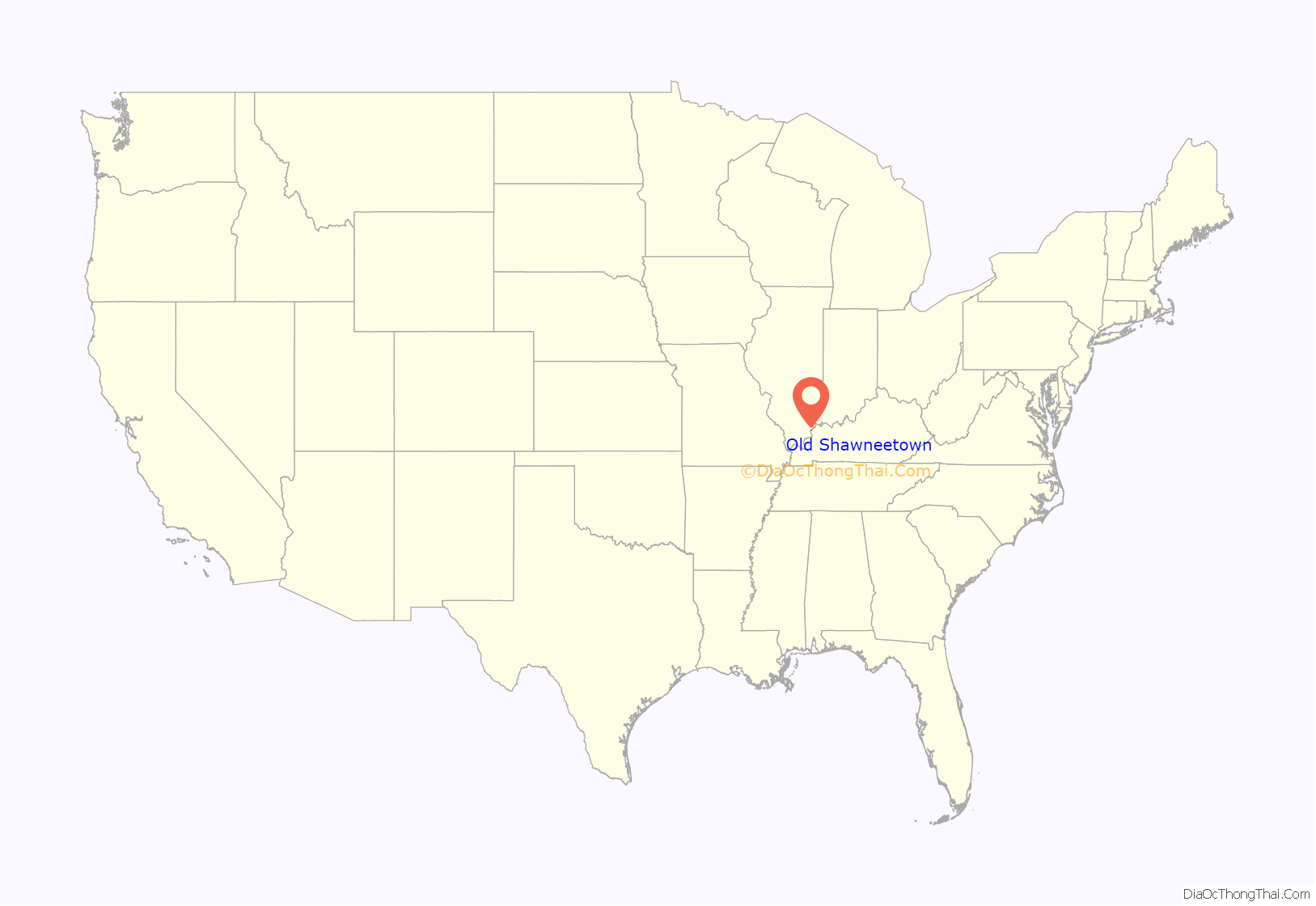
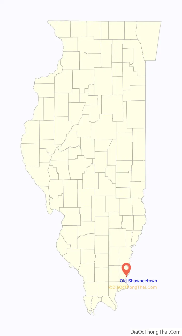
Old Shawneetown location map. Where is Old Shawneetown village?
History
At least one record suggests that a village was established here by the Pekowi Shawnee led by Peter Chartier about 1758. In early November 1803, Lewis and Clark are believed to have stopped at Old Shawneetown on their way to Fort Massac, just down the Ohio River.
After the American Revolution, Shawneetown served as an important United States government administrative center for the Northwest Territory. Shawneetown and Washington, D.C., share the distinction of being the only towns chartered by the United States government.
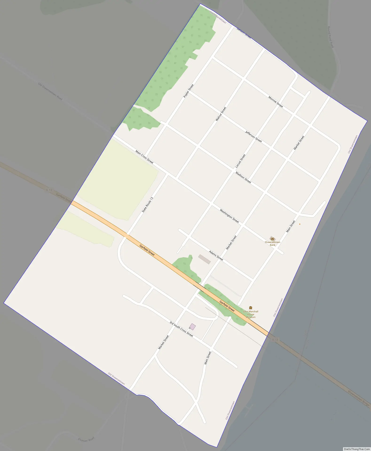
Old Shawneetown is the site of the first bank chartered in Illinois, in 1816. Originally in a log cabin, it was replaced in 1822 with a brick structure (only the second one in the town) now known as the John Marshall House.
Local legend states that the Shawneetown Bank refused to buy the first bonds issued by the city of Chicago on the grounds that no city located that far from a navigable river could survive.
Another historic bank building, the Bank of Illinois, was constructed in 1839-41 to house the offices of the Bank of Illinois at Shawneetown. It later housed numerous other financial institutions before it was closed in the 1930s. This fine example of Greek Revival architecture survives as the Shawneetown Bank State Historic Site.
Residents long remembered the visit by Gilbert du Motier, Marquis de Lafayette of France to the city on May 8, 1825, as a high point for the early community’s social history.
After the Great Flood of 1937, many residents moved to the current location of Shawneetown. The old courthouse was torn down and a new Gallatin County Courthouse was constructed in 1939.
Old Shawneetown Road Map
Old Shawneetown city Satellite Map

Geography
Old Shawneetown is located in southeastern Gallatin County at 37°41′54″N 88°8′13″W / 37.69833°N 88.13694°W / 37.69833; -88.13694 (37.698197, -88.136857), on the northwest bank of the Ohio River. Illinois Route 13 passes through the village. To the east it crosses the Shawneetown Bridge over the Ohio, becoming Kentucky Route 56 and leading 13 miles (21 km) to Morganfield, Kentucky. To the west, IL 13 leads 3 miles (5 km) to Shawneetown, the Gallatin County seat, and 23 miles (37 km) to Harrisburg.
According to the 2010 census, Old Shawneetown has a total area of 0.53 square miles (1.37 km), all land.
In 2019, Old Shawneetown was featured on PBS NewsHour in a segment on communities subjected to repeated flooding. Because of the town’s historically flood-prone location, it is prohibitively difficult to insure, and some researchers have recommended a total relocation of the remaining residents as a preventative policy.
See also
Map of Illinois State and its subdivision:- Adams
- Alexander
- Bond
- Boone
- Brown
- Bureau
- Calhoun
- Carroll
- Cass
- Champaign
- Christian
- Clark
- Clay
- Clinton
- Coles
- Cook
- Crawford
- Cumberland
- De Kalb
- De Witt
- Douglas
- Dupage
- Edgar
- Edwards
- Effingham
- Fayette
- Ford
- Franklin
- Fulton
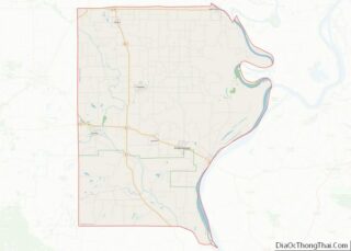
- Gallatin
- Greene
- Grundy
- Hamilton
- Hancock
- Hardin
- Henderson
- Henry
- Iroquois
- Jackson
- Jasper
- Jefferson
- Jersey
- Jo Daviess
- Johnson
- Kane
- Kankakee
- Kendall
- Knox
- La Salle
- Lake
- Lake Michigan
- Lawrence
- Lee
- Livingston
- Logan
- Macon
- Macoupin
- Madison
- Marion
- Marshall
- Mason
- Massac
- McDonough
- McHenry
- McLean
- Menard
- Mercer
- Monroe
- Montgomery
- Morgan
- Moultrie
- Ogle
- Peoria
- Perry
- Piatt
- Pike
- Pope
- Pulaski
- Putnam
- Randolph
- Richland
- Rock Island
- Saint Clair
- Saline
- Sangamon
- Schuyler
- Scott
- Shelby
- Stark
- Stephenson
- Tazewell
- Union
- Vermilion
- Wabash
- Warren
- Washington
- Wayne
- White
- Whiteside
- Will
- Williamson
- Winnebago
- Woodford
- Alabama
- Alaska
- Arizona
- Arkansas
- California
- Colorado
- Connecticut
- Delaware
- District of Columbia
- Florida
- Georgia
- Hawaii
- Idaho
- Illinois
- Indiana
- Iowa
- Kansas
- Kentucky
- Louisiana
- Maine
- Maryland
- Massachusetts
- Michigan
- Minnesota
- Mississippi
- Missouri
- Montana
- Nebraska
- Nevada
- New Hampshire
- New Jersey
- New Mexico
- New York
- North Carolina
- North Dakota
- Ohio
- Oklahoma
- Oregon
- Pennsylvania
- Rhode Island
- South Carolina
- South Dakota
- Tennessee
- Texas
- Utah
- Vermont
- Virginia
- Washington
- West Virginia
- Wisconsin
- Wyoming