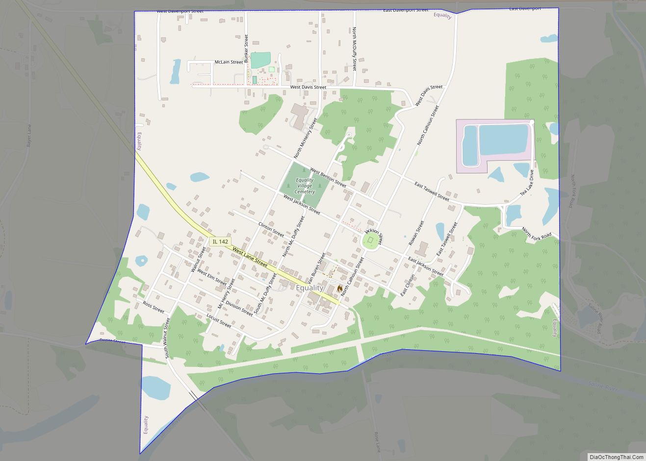
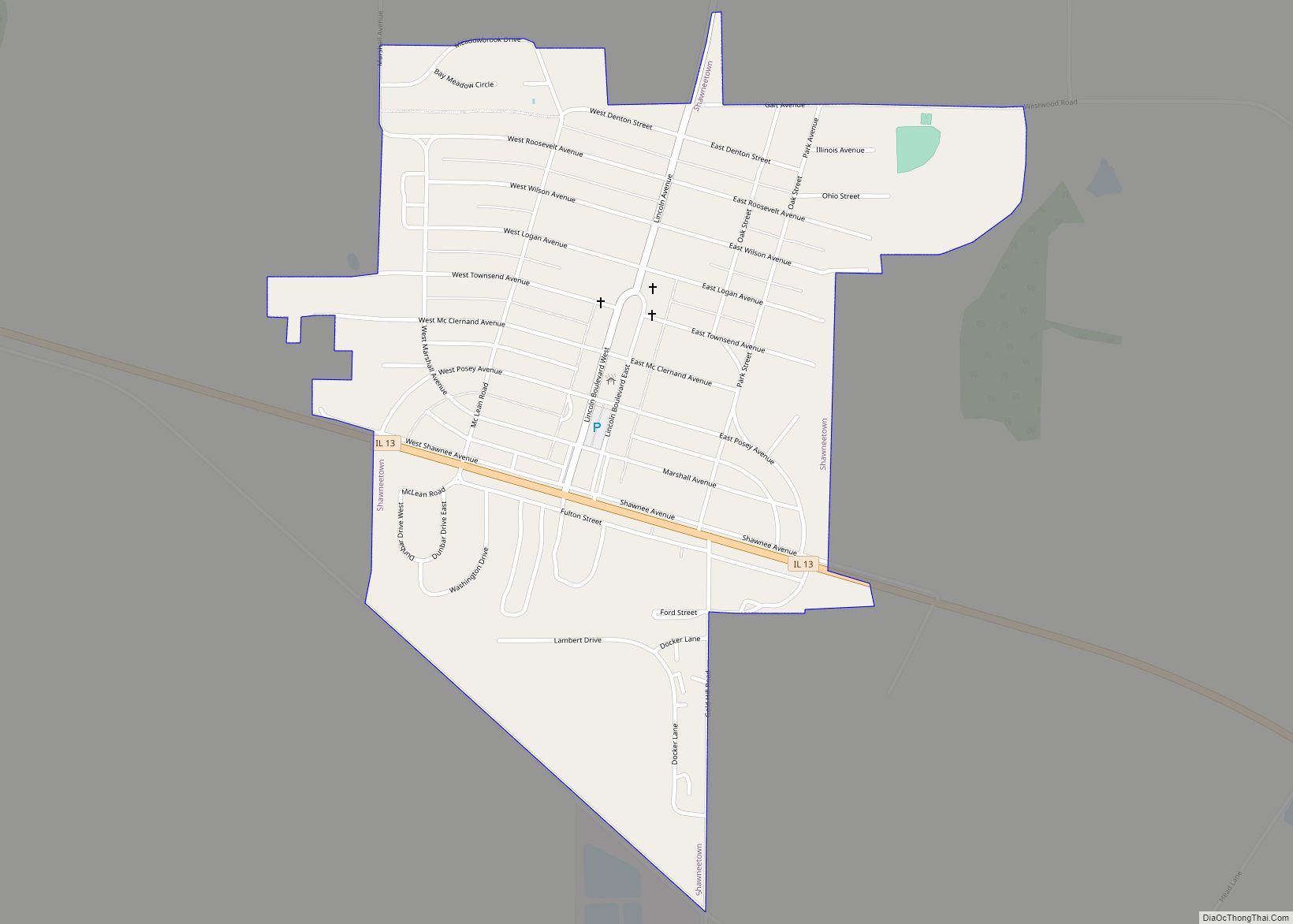
Shawneetown is a city in Gallatin County, Illinois, United States. The population was 1,239 at the 2010 census, down from 1,410 at the 2000 census. It is the county seat of Gallatin County.
| Name: | Shawneetown city |
|---|---|
| LSAD Code: | 25 |
| LSAD Description: | city (suffix) |
| State: | Illinois |
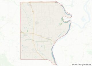
| County: | Gallatin County |
| Elevation: | 407 ft (124 m) |
| Total Area: | 0.74 sq mi (1.92 km²) |
| Land Area: | 0.73 sq mi (1.90 km²) |
| Water Area: | 0.01 sq mi (0.02 km²) |
| Total Population: | 1,054 |
| Population Density: | 1,435.97/sq mi (554.28/km²) |
| Area code: | 618 |
| FIPS code: | 1769082 |
Online Interactive Map
Click on ![]() to view map in "full screen" mode.
to view map in "full screen" mode.
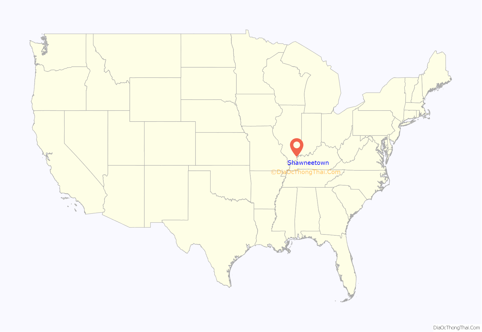
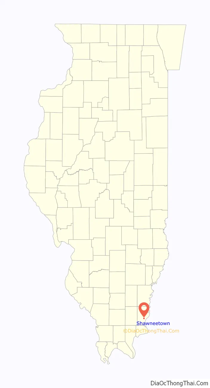
Shawneetown location map. Where is Shawneetown city?
History
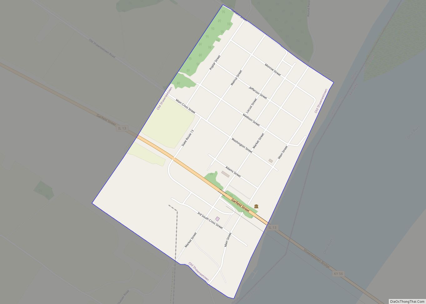
The present town was established in 1937 after the Ohio River flood of 1937 inundated what is now Old Shawneetown, Illinois.
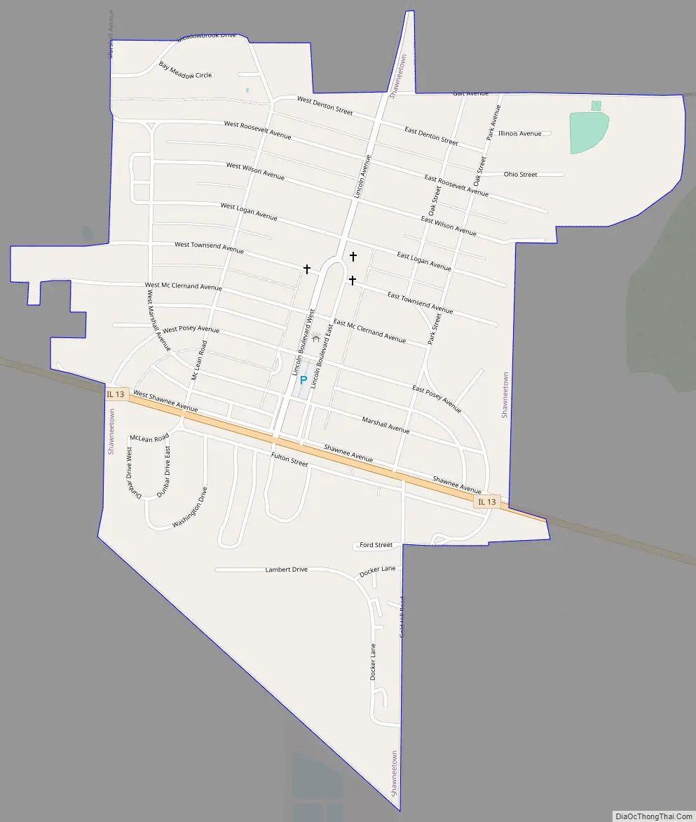
Shawneetown Road Map
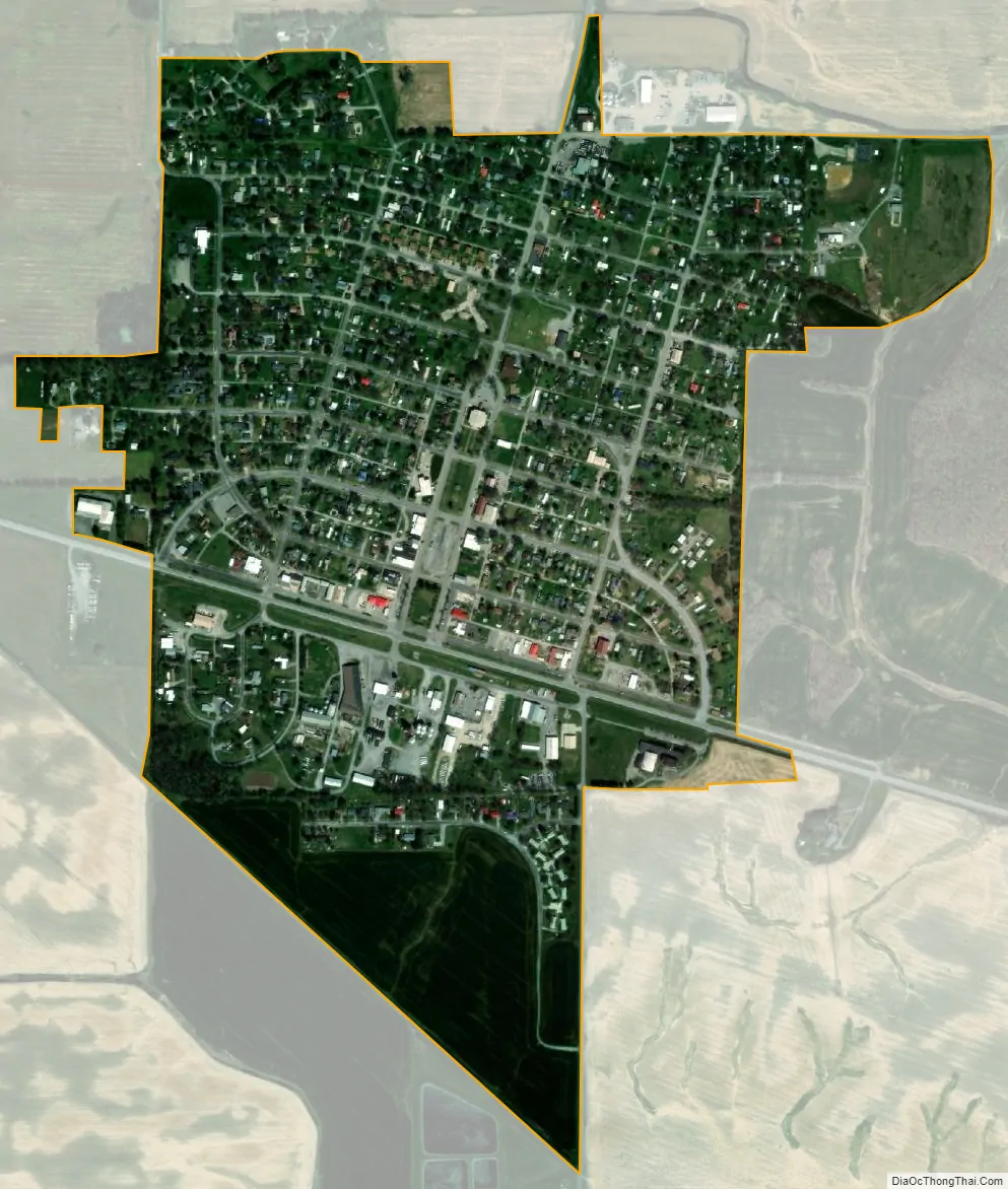
Shawneetown city Satellite Map
Geography
Shawneetown is located southeast of the center of Gallatin County at 37°42′53″N 88°11′00″W / 37.714701°N 88.183465°W / 37.714701; -88.183465. Illinois Route 13 passes through the city, leading southeast 3 miles (5 km) to the Ohio River and the Kentucky border at Old Shawneetown, and west 20 miles (32 km) to Harrisburg. It is located at the northeast edge of Shawnee National Forest.
According to the 2010 census, Shawneetown has a total area of 0.679 square miles (1.76 km), of which 0.67 square miles (1.74 km) (or 98.67%) is land and 0.009 square miles (0.02 km) (or 1.33%) is water.
See also
Map of Illinois State and its subdivision:- Adams
- Alexander
- Bond
- Boone
- Brown
- Bureau
- Calhoun
- Carroll
- Cass
- Champaign
- Christian
- Clark
- Clay
- Clinton
- Coles
- Cook
- Crawford
- Cumberland
- De Kalb
- De Witt
- Douglas
- Dupage
- Edgar
- Edwards
- Effingham
- Fayette
- Ford
- Franklin
- Fulton
- Gallatin
- Greene
- Grundy
- Hamilton
- Hancock
- Hardin
- Henderson
- Henry
- Iroquois
- Jackson
- Jasper
- Jefferson
- Jersey
- Jo Daviess
- Johnson
- Kane
- Kankakee
- Kendall
- Knox
- La Salle
- Lake
- Lake Michigan
- Lawrence
- Lee
- Livingston
- Logan
- Macon
- Macoupin
- Madison
- Marion
- Marshall
- Mason
- Massac
- McDonough
- McHenry
- McLean
- Menard
- Mercer
- Monroe
- Montgomery
- Morgan
- Moultrie
- Ogle
- Peoria
- Perry
- Piatt
- Pike
- Pope
- Pulaski
- Putnam
- Randolph
- Richland
- Rock Island
- Saint Clair
- Saline
- Sangamon
- Schuyler
- Scott
- Shelby
- Stark
- Stephenson
- Tazewell
- Union
- Vermilion
- Wabash
- Warren
- Washington
- Wayne
- White
- Whiteside
- Will
- Williamson
- Winnebago
- Woodford
- Alabama
- Alaska
- Arizona
- Arkansas
- California
- Colorado
- Connecticut
- Delaware
- District of Columbia
- Florida
- Georgia
- Hawaii
- Idaho
- Illinois
- Indiana
- Iowa
- Kansas
- Kentucky
- Louisiana
- Maine
- Maryland
- Massachusetts
- Michigan
- Minnesota
- Mississippi
- Missouri
- Montana
- Nebraska
- Nevada
- New Hampshire
- New Jersey
- New Mexico
- New York
- North Carolina
- North Dakota
- Ohio
- Oklahoma
- Oregon
- Pennsylvania
- Rhode Island
- South Carolina
- South Dakota
- Tennessee
- Texas
- Utah
- Vermont
- Virginia
- Washington
- West Virginia
- Wisconsin
- Wyoming