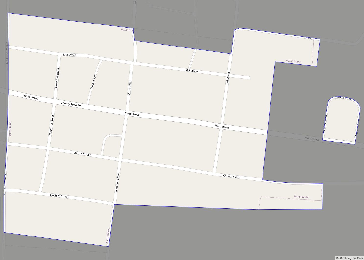
New Haven is a village in Gallatin County, Illinois, United States, along the Little Wabash River near its mouth at the Wabash River. The population was 433 at the 2010 United States Census, down from 477 at the 2000 census.
| Name: | New Haven village |
|---|---|
| LSAD Code: | 47 |
| LSAD Description: | village (suffix) |
| State: | Illinois |
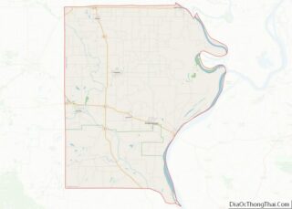
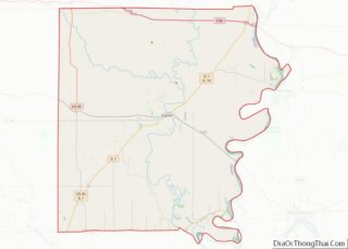
| County: | Gallatin County, White County |
| Elevation: | 436 ft (133 m) |
| Total Area: | 1.27 sq mi (3.30 km²) |
| Land Area: | 1.24 sq mi (3.22 km²) |
| Water Area: | 0.03 sq mi (0.08 km²) |
| Total Population: | 399 |
| Population Density: | 320.74/sq mi (123.80/km²) |
| Area code: | 618 |
| FIPS code: | 1752506 |
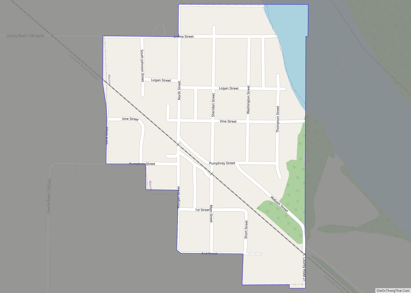
Online Interactive Map
Click on ![]() to view map in "full screen" mode.
to view map in "full screen" mode.
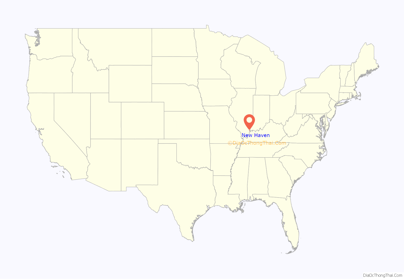
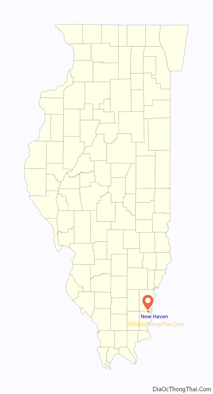
New Haven location map. Where is New Haven village?
History
Before the New Haven vicinity was settled, it was inhabited by multiple indigenous cultures. Some countryside southeast of the village near the Wabash was formerly the location of a village of a Late Woodland people known as the “Duffy Complex”; the location is now an archaeological site known as the Duffy site.
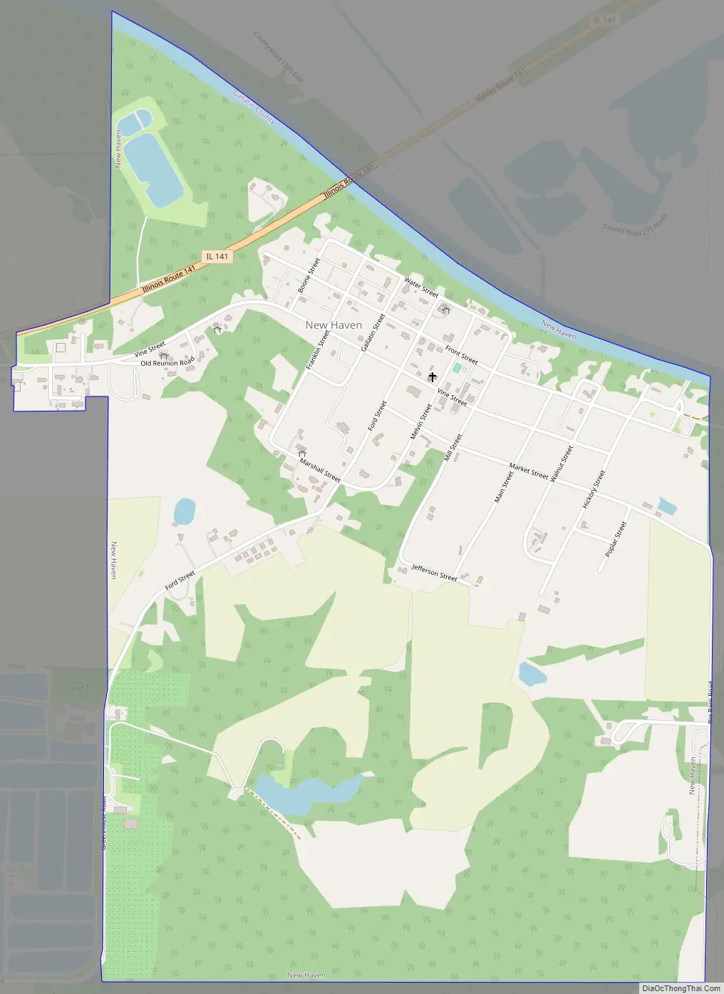
New Haven Road Map
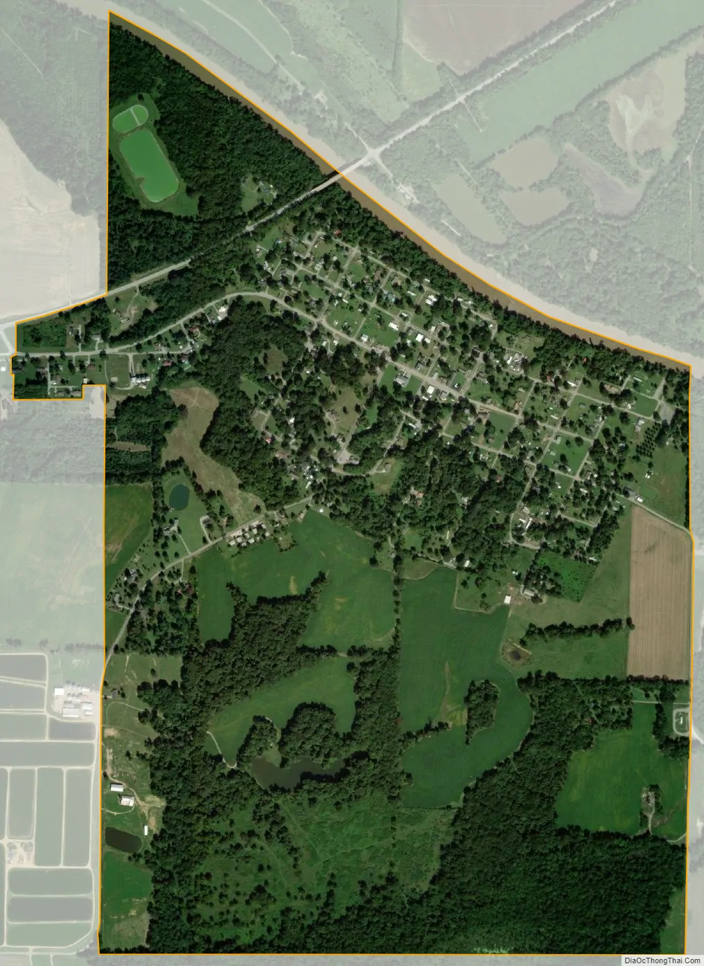
New Haven city Satellite Map
Geography
New Haven is located in the northeast corner of Gallatin County at 37°54′26″N 88°7′37″W / 37.90722°N 88.12694°W / 37.90722; -88.12694 (37.907113, -88.126954). It is bordered to the north by White County, and the Little Wabash River forms part of the northern border. Illinois Route 141 passes through the northern part of the village, leading east 5 miles (8 km) to the Indiana border at the Wabash River and 13 miles (21 km) to Mount Vernon, Indiana, and west 12 miles (19 km) to U.S. Route 45 northwest of Omaha, Illinois. Shawneetown, the Gallatin County seat, is 17 miles (27 km) to the south.
According to the 2010 census, New Haven has a total area of 1.258 square miles (3.26 km), of which 1.23 square miles (3.19 km) (or 97.77%) is land and 0.028 square miles (0.07 km) (or 2.23%) is water.
See also
Map of Illinois State and its subdivision:- Adams
- Alexander
- Bond
- Boone
- Brown
- Bureau
- Calhoun
- Carroll
- Cass
- Champaign
- Christian
- Clark
- Clay
- Clinton
- Coles
- Cook
- Crawford
- Cumberland
- De Kalb
- De Witt
- Douglas
- Dupage
- Edgar
- Edwards
- Effingham
- Fayette
- Ford
- Franklin
- Fulton
- Gallatin
- Greene
- Grundy
- Hamilton
- Hancock
- Hardin
- Henderson
- Henry
- Iroquois
- Jackson
- Jasper
- Jefferson
- Jersey
- Jo Daviess
- Johnson
- Kane
- Kankakee
- Kendall
- Knox
- La Salle
- Lake
- Lake Michigan
- Lawrence
- Lee
- Livingston
- Logan
- Macon
- Macoupin
- Madison
- Marion
- Marshall
- Mason
- Massac
- McDonough
- McHenry
- McLean
- Menard
- Mercer
- Monroe
- Montgomery
- Morgan
- Moultrie
- Ogle
- Peoria
- Perry
- Piatt
- Pike
- Pope
- Pulaski
- Putnam
- Randolph
- Richland
- Rock Island
- Saint Clair
- Saline
- Sangamon
- Schuyler
- Scott
- Shelby
- Stark
- Stephenson
- Tazewell
- Union
- Vermilion
- Wabash
- Warren
- Washington
- Wayne
- White
- Whiteside
- Will
- Williamson
- Winnebago
- Woodford
- Alabama
- Alaska
- Arizona
- Arkansas
- California
- Colorado
- Connecticut
- Delaware
- District of Columbia
- Florida
- Georgia
- Hawaii
- Idaho
- Illinois
- Indiana
- Iowa
- Kansas
- Kentucky
- Louisiana
- Maine
- Maryland
- Massachusetts
- Michigan
- Minnesota
- Mississippi
- Missouri
- Montana
- Nebraska
- Nevada
- New Hampshire
- New Jersey
- New Mexico
- New York
- North Carolina
- North Dakota
- Ohio
- Oklahoma
- Oregon
- Pennsylvania
- Rhode Island
- South Carolina
- South Dakota
- Tennessee
- Texas
- Utah
- Vermont
- Virginia
- Washington
- West Virginia
- Wisconsin
- Wyoming