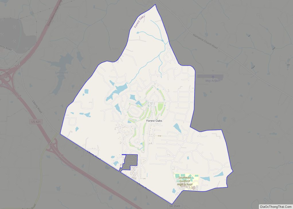
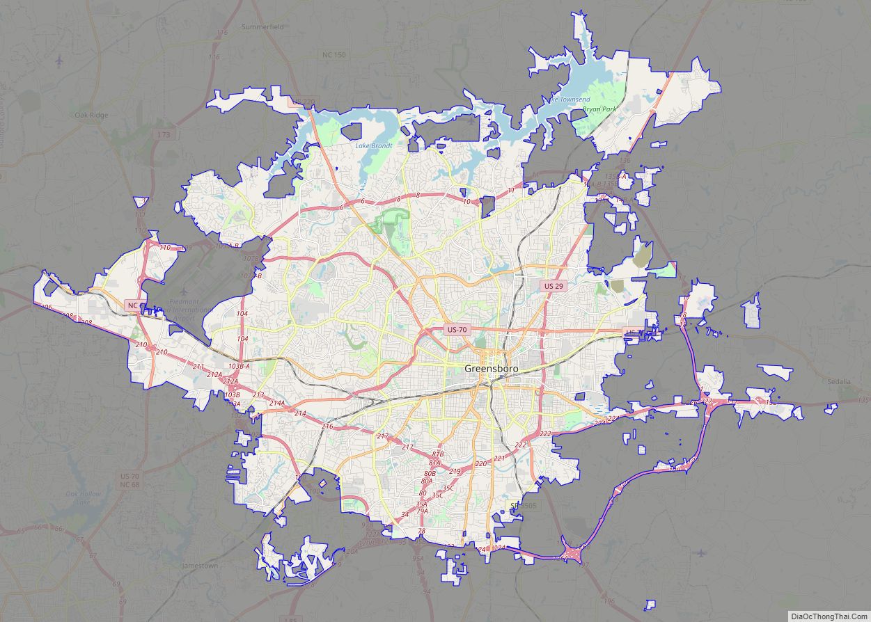
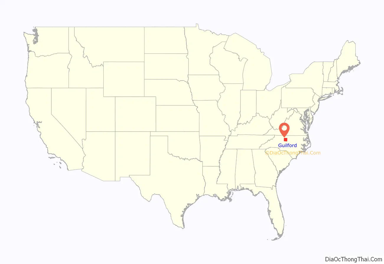
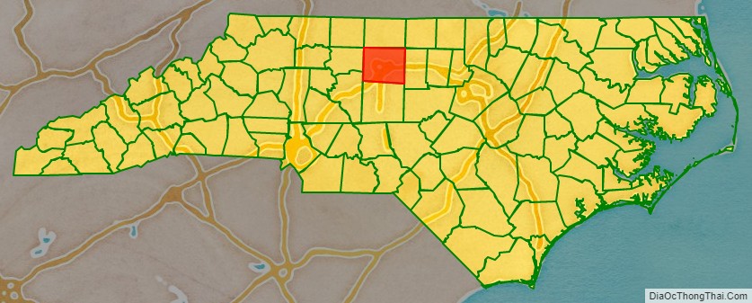
Guilford County is a county located in the U.S. state of North Carolina. As of the 2020 census, the population is 541,299, making it the third-most populous county in North Carolina. The county seat, and largest municipality, is Greensboro. Since 1938, an additional county court has been located in High Point. The county was formed in 1771. Guilford County is included in the Greensboro-High Point, NC Metropolitan Statistical Area, which is also included in the Greensboro-Winston-Salem-High Point, NC Combined Statistical Area.
| Name: | Guilford County |
|---|---|
| FIPS code: | 37-081 |
| State: | North Carolina |
| Founded: | 1771 |
| Named for: | Francis North, 1st Earl of Guilford |
| Seat: | Greensboro (Courthouse also located in High Point) |
| Largest city: | Greensboro |
| Total Area: | 658 sq mi (1,700 km²) |
| Land Area: | 646 sq mi (1,670 km²) |
| Total Population: | 541,299 |
| Population Density: | 792.7/sq mi (306.1/km²) |
| Time zone: | UTC−5 (Eastern) |
| Summer Time Zone (DST): | UTC−4 (EDT) |
| Website: | www.guilfordcountync.gov |
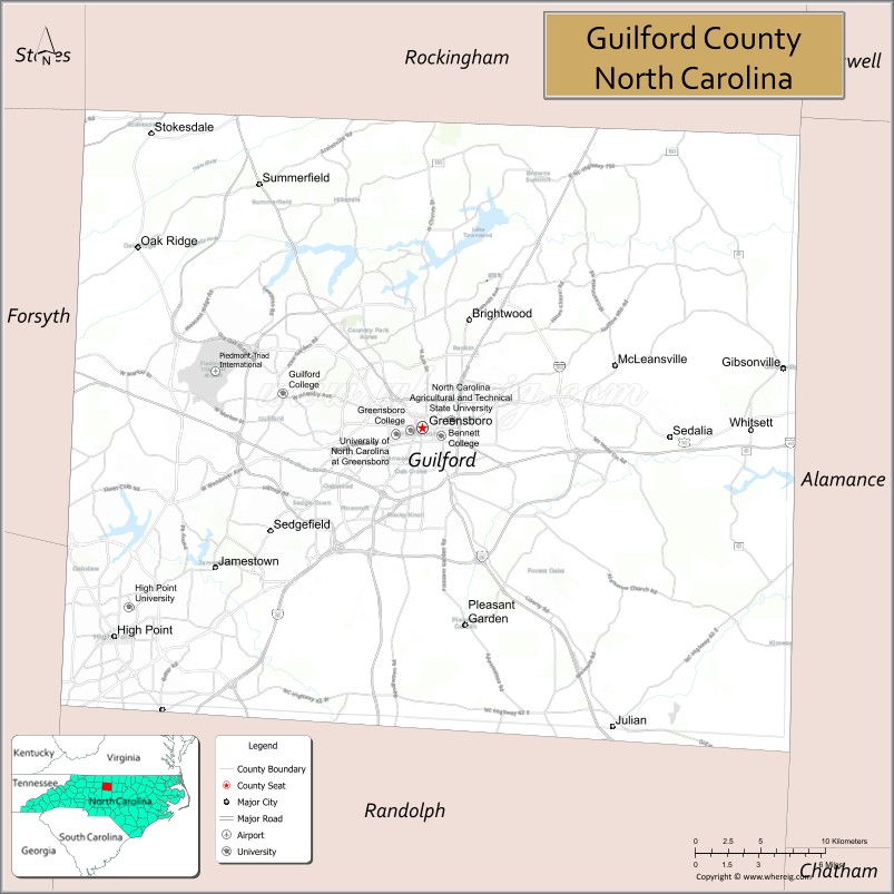
Guilford County location map. Where is Guilford County?
History
At the time of European encounter, the inhabitants of the area that became Guilford County were a Siouan-speaking people called the Cheraw. Beginning in the 1740s, settlers arrived in the region in search of fertile and affordable land. These first settlers included American Quakers from Pennsylvania, Maryland, and New England at what is now Greensboro, as well as German Reformed and Lutherans in the east, British Quakers in the south and west, and Scotch-Irish Presbyterians in the center of today’s Guilford County. As population increased, the North Carolina colonial legislature organized the county in 1771, from parts of Rowan and Orange counties. It was named for Francis North, Earl of Guilford, father of Frederick North, Lord North, British Prime Minister from 1770 to 1782.
Friedens Church, whose name means “peace” in German, is in eastern Guilford County, at 6001 NC Hwy 61 North, northwest of Gibsonville. It is a historic church established by some of the earliest European settlers in this area. According to a church history, Rev. John Ulrich Giesendanner led his Lutheran congregation from Pennsylvania in 1740 into the part of North Carolina around Haw River, Reedy Fork, Eno River, Alamance Creek, Travis Creek, Beaver Creek, and Deep River. Friedens Church built a log structure in 1745, which the congregation used for 25 years. The second building, completed about 1771, was more substantial and was used for a century, being replaced in May 1871. That third building was destroyed by fire on January 8, 1939, with only the front columns surviving destruction. The church was rebuilt and reopened in May 1939.
The Quaker meeting also played a major role in the European settlement of the county. Numerous Quakers still live in the county. New Garden Friends Meeting, established in 1754 and first affiliated with a Pennsylvania meeting, still operates in Greensboro.
Alamance Presbyterian Church, a log structure, was built in 1762. The congregation was not officially organized until 1764 by the Rev. Henry Patillo, pastor of Hawfields Presbyterian Church. It has operated since then on the same site in present-day Greensboro. According to the church history, the congregation has built five churches on that site and now has its eighteenth pastor.
On March 15, 1781, during the American Revolution (1775-1783), for independence from Great Britain, the Battle of Guilford Court House was fought just north of present-day Greensboro between Generals Charles Cornwallis and Nathanael Greene. This battle marked a turning point in the Revolutionary War in the South. Although General Cornwallis, the British commander, held the field at the end of the battle, his losses were so severe that he decided to withdraw to the Carolina coastline, where he could receive reinforcements from the British Royal Navy at the port in Wilmington and his battered army could be protected by the British naval power. His decision ultimately led to his leading his finished ravaged army north into Virginia leading eventually to his defeat and surrender later in October 1781 at Yorktown, Virginia after a long siege, by a combined force of American and French Royal troops and blockading French Navy warships on the Chesapeake Bay.
In 1779, the southern third of Guilford County was separated and erected as Randolph County. In 1785, following the American Revolution, the northern half of its remaining territory was organized as Rockingham County.
In 1808, the town of Greensboro replaced the hamlet of Guilford Court House as the county seat. It was more centrally located, making it a better location for travelers of the time.
The county was the site of early industrial development, namely, the Mt. Hecla Cotton Mill, established in 1818 as one of the earliest cotton mills in the state. First run by water power, the mill was refitted to be powered by steam, and was one of the earliest examples in the state of the use of steam power for manufacturing.
In the antebellum era, many of the county’s residents were opposed to slavery, including Lutherans, Quakers and Methodists. The county was a stop on the Underground Railroad, for which volunteers aided refugee slaves en route to freedom in the North. People gave them safe places to stay and often food and clothing. Levi Coffin, among the founders of the “railroad,” was a Guilford County native. He is credited with personally helping more than 2,000 slaves escape to freedom before the war.
Guilford College was founded in 1837 as the New Garden Boarding School; its name was changed in 1888 when the academic program was expanded considerably. Guilford is the third-oldest coeducational institution in the country and the oldest such institution in the South. Greensboro College, established by the Methodist Church through a charter secured in 1838, was one of the earliest institutions of higher education for women in the United States. It became coeducational in 1954.
In 1873 Bennett College was founded in the basement of the Warnersville Methodist Episcopal Church (now St. Matthew’s Methodist Church) with 70 African American male and female students. In 1926, the school became a women-only college, as it continues to be today.
In 1891, Greensboro was selected as the home of a land-grant institution for African Americans, the Agricultural and Mechanical College for the Colored Race, now known as North Carolina Agricultural and Technical State University. It was the nation’s second college established under the federal Morrill Act of 1890 and was the first state-supported school for people of color in North Carolina.
Also in 1891, the county became home to the state’s first and only publicly supported institution of higher learning for women, the State Normal and Industrial School, established in Greensboro especially to train teachers. In 1932, the school joined with the University of North Carolina at Chapel Hill and North Carolina State University in Raleigh to form the Consolidated University of North Carolina; it was renamed as the Woman’s College of the University of North Carolina. From the 1930s to the 1960s, the Woman’s College was the third-largest women’s university in the world. In 1963, the university was changed to a coed institution, and its curriculum was gradually expanded to include graduate work. It is now known as the University of North Carolina at Greensboro.
Immanuel Lutheran College and Seminary was located on a small campus on East Market Street from 1905 until it closed in 1961. “Lutheran” was founded by white ethnic German Lutherans for black students in 1903 in Concord, at a time when education was racially segregated and blacks had limited access to higher education. When the school moved to the county seat of Greensboro, Lutherans built a large granite main building for it. The school operated a high school, junior college, and seminary under the jurisdiction of the Evangelical Lutheran Synodical Conference of North America.
In 1911, a new county called Piedmont County was proposed, with High Point as its county seat, to be created from Guilford, Davidson and Randolph Counties. Many people appeared at the courthouse to oppose the plan, vowing to go to the state legislature to protest. The state legislature voted down the plan in February 1911.
In 1960 North Carolina still operated by racial segregation laws, and maintained the disenfranchisement of most black voters established at the end of the 19th century to suppress the Republican Party. Following World War II, African-American veterans and young people heightened their activities in the American civil rights movement. Guilford County was the site of an influential protest in 1960 when four black students from the North Carolina A&T State University in Greensboro started an early sit-in. Known afterwards as the Greensboro Four, the four young men sat at a “whites-only” lunch counter at the Woolworth’s store in downtown Greensboro and asked to be served after purchasing items in the store. When refused, they asked why their money was good enough for buying retail items, but not food at the counter. They were arrested, but their action led to many other college students in Greensboro – including white students from Guilford and the Women’s College – to sit at the lunch counter in a show of support. The students carried on a regular sit-in and within two months, the sit-in movement spread to 54 cities in nine states; Woolworth’s eventually agreed to desegregate its lunch counters, and other restaurants in Southern towns and cities followed suit.
A darker racial incident in 1979 was called the Greensboro massacre. In this incident the predominantly African American Communist Workers Party (CWP) led a march protesting the Ku Klux Klan and other white-supremacist groups through a black neighborhood in southeastern Greensboro. They were attacked and shot at by KKK and American Nazi Party members; five of the Communist Party marchers were killed and seven wounded in the attack. In 1980 the case attracted renewed national attention when the six shooter defendants were found “not guilty” by an all-white jury. None of the people involved in this shooting, from either side, was a citizen of Guilford County; they simply chose the county seat of Greensboro as a rallying point. In 1985 families and friends of the victims won a civil case for damages against the city police department and other officials for failure to protect the African Americans; monies were paid to the Greensboro Justice Center.
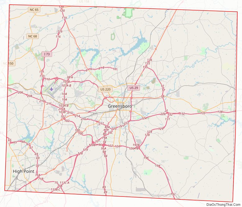
Guilford County Road Map
Geography
According to the U.S. Census Bureau, the county has a total area of 658 square miles (1,700 km), of which 646 square miles (1,670 km) is land and 12 square miles (31 km) (1.8%) is water.
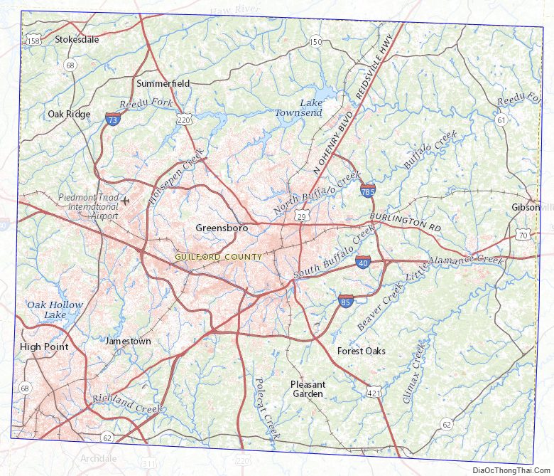
The county is drained, in part, by the Deep and Haw Rivers.
National protected area
- Guilford Courthouse National Military Park
State and local protected areas/sites
- Cascades Preserve (part)
- Charlotte Hawkins Brown Museum
- Company Mill Preserve
- Greensboro Arboretum
- Haw River State Park (part)
- Piedmont Environmental Center
- Rich Fork Preserve (part)
Major water bodies
- Back Creek
- Beaver Creek
- Belews Lake
- Big Alamance Creek
- Buffalo Creek
- Buffalo Lake
- Deep River
- Haw River
- Hickory Creek
- Lake Brandt
- Lake Hggins
- Lake High Point
- Lake Mackintosh
- Lake Townsend
- Little Alamance Creek
- Mears Fork (Haw River tributary)
- Moores Creek (Reedy Fork tributary)
- North Buffalo Creek
- Old Hollow Lake
- Reddicks Creek
- Reedy Fork (Haw River tributary)
- Rock Creek
- South Buffalo Creek
- West Fork Deep River
Adjacent counties
- Rockingham County – north
- Alamance County – east
- Randolph County – south
- Davidson County – southwest
- Forsyth County – west
Major highways
- I-40
- I-85
- I-73
- I-74
- I-85
- I-85 BL
- Future I-685 (Concurrency with US 421)
- I-785 / Future I-785
- I-840 / Future I-840 (To be fully complete by late 2023)
- US 29
- US 70
- US 158
- US 220
- US 421
- NC 22
- NC 61
- NC 62
- NC 65
- NC 68
- NC 100
- NC 150
Major infrastructure
- Amtrak Thruway (High Point Station)
- High Point Station
- J. Douglas Galyon Depot
- Piedmont Triad International Airport
Guilford County Topographic Map
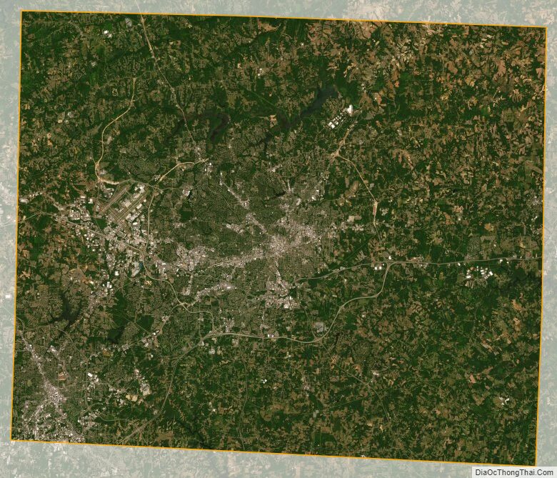
Guilford County Satellite Map
Guilford County Outline Map