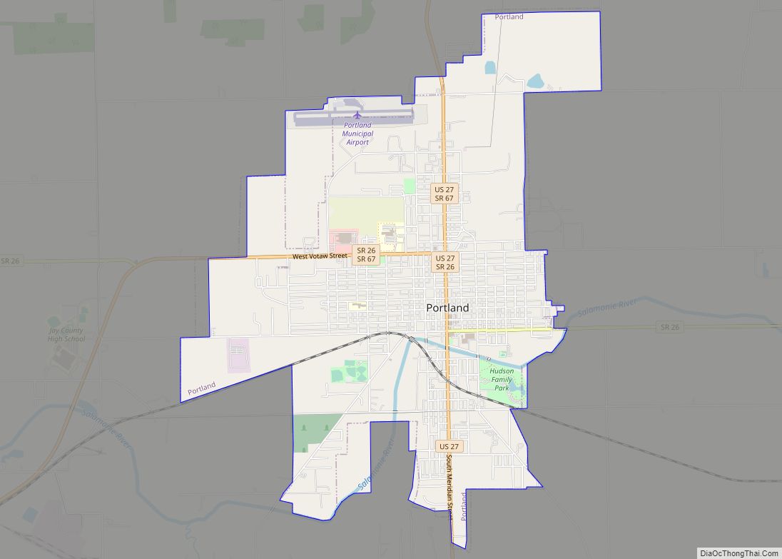
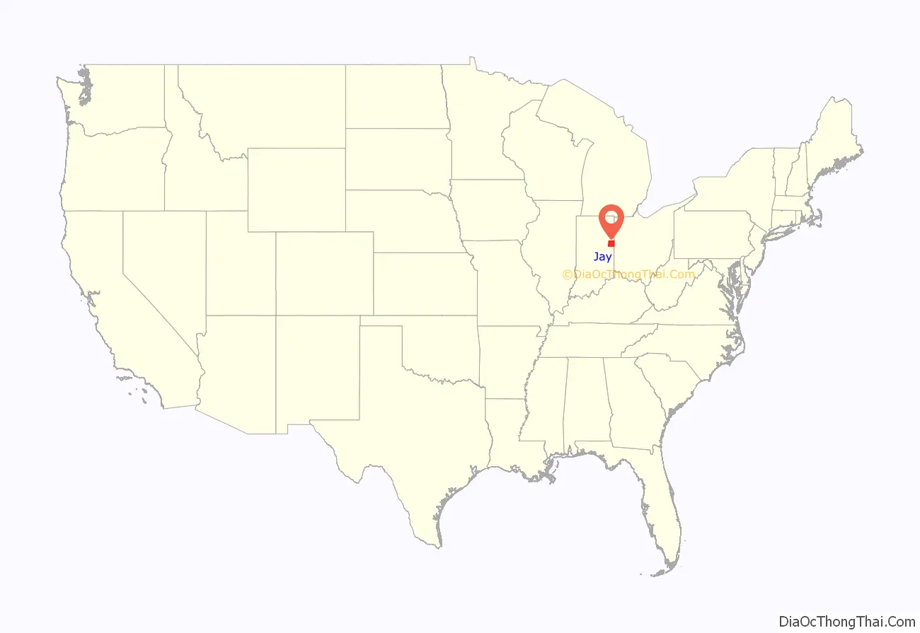
Jay County is a county in the U.S. state of Indiana. As of 2020, the population was 20,478. The county seat is Portland.
| Name: | Jay County |
|---|---|
| FIPS code: | 18-075 |
| State: | Indiana |
| Founded: | 7 February 1835 (authorized) 1836 (organized) |
| Named for: | John Jay |
| Seat: | Portland |
| Largest city: | Portland |
| Total Area: | 384.08 sq mi (994.8 km²) |
| Land Area: | 383.90 sq mi (994.3 km²) |
| Total Population: | 20,478 |
| Population Density: | 54/sq mi (20.9/km²) |
Jay County location map. Where is Jay County?
History
The Indiana State Legislature passed an omnibus county bill on 7 February 1835 that authorized the creation of thirteen counties in northeast Indiana, including Jay – the only county in the United States named for John Jay, co-author of The Federalist Papers, Secretary of Foreign Affairs under the Articles of Confederation, and first Chief Justice of the United States. John Jay had died in 1829.
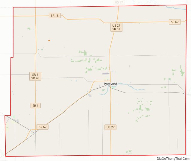
Jay County Road Map
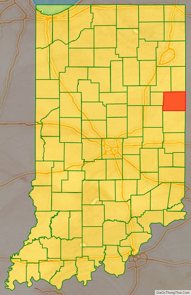
Geography
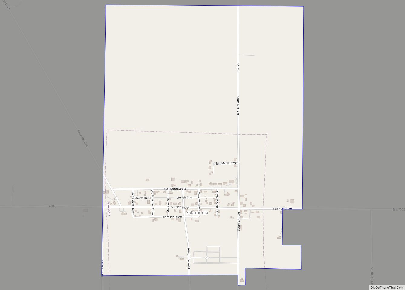
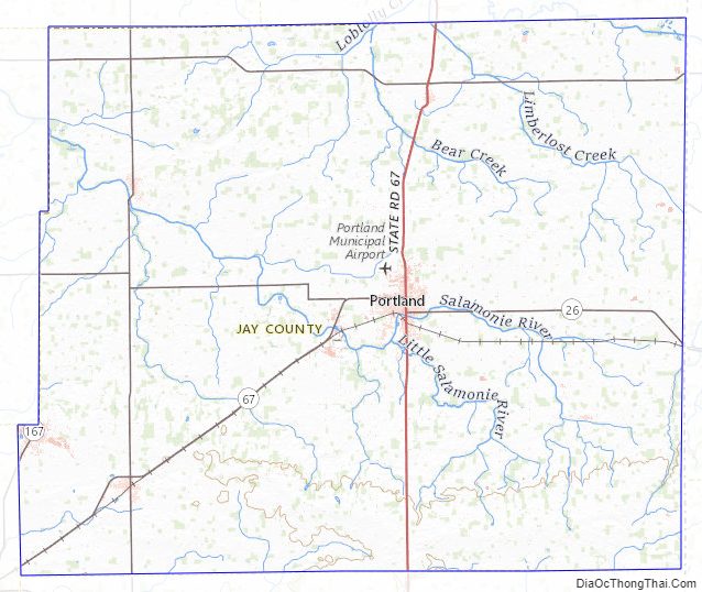
Jay County lies on the east side of Indiana; its east border abuts the western border of Ohio. Its low, rolling terrain is entirely devoted to agriculture or urban development. Its highest point (1,121 feet/342 meters ASL) is a small rise on the east border with Ohio, 2,600 feet north of the county’s SE corner. The Salamonie River originates near Salamonia in southeastern Jay County and flows generally northwestwardly into Blackford County (It joins the Wabash River from the south in Wabash County). According to the 2010 United States Census, the county has a total area of 384.08 square miles (994.8 km), of which 383.90 square miles (994.3 km) (or 99.95%) is land and 0.18 square miles (0.47 km) (or 0.05%) is water.
Adjacent counties
- Adams County – north
- Mercer County, Ohio – east
- Darke County, Ohio – southeast
- Randolph County – south
- Delaware County – southwest
- Blackford County – west
- Wells County – northwest
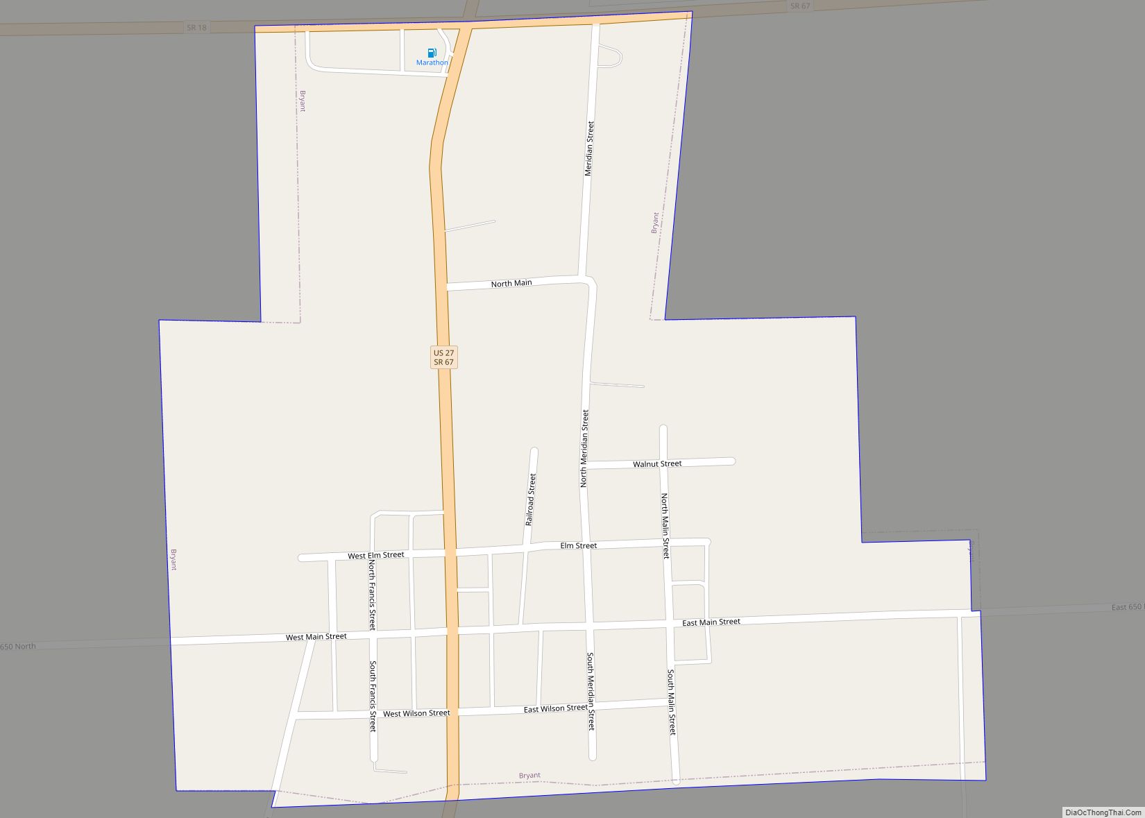
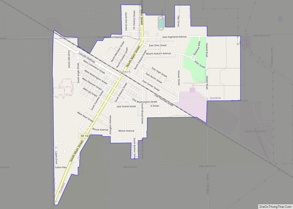
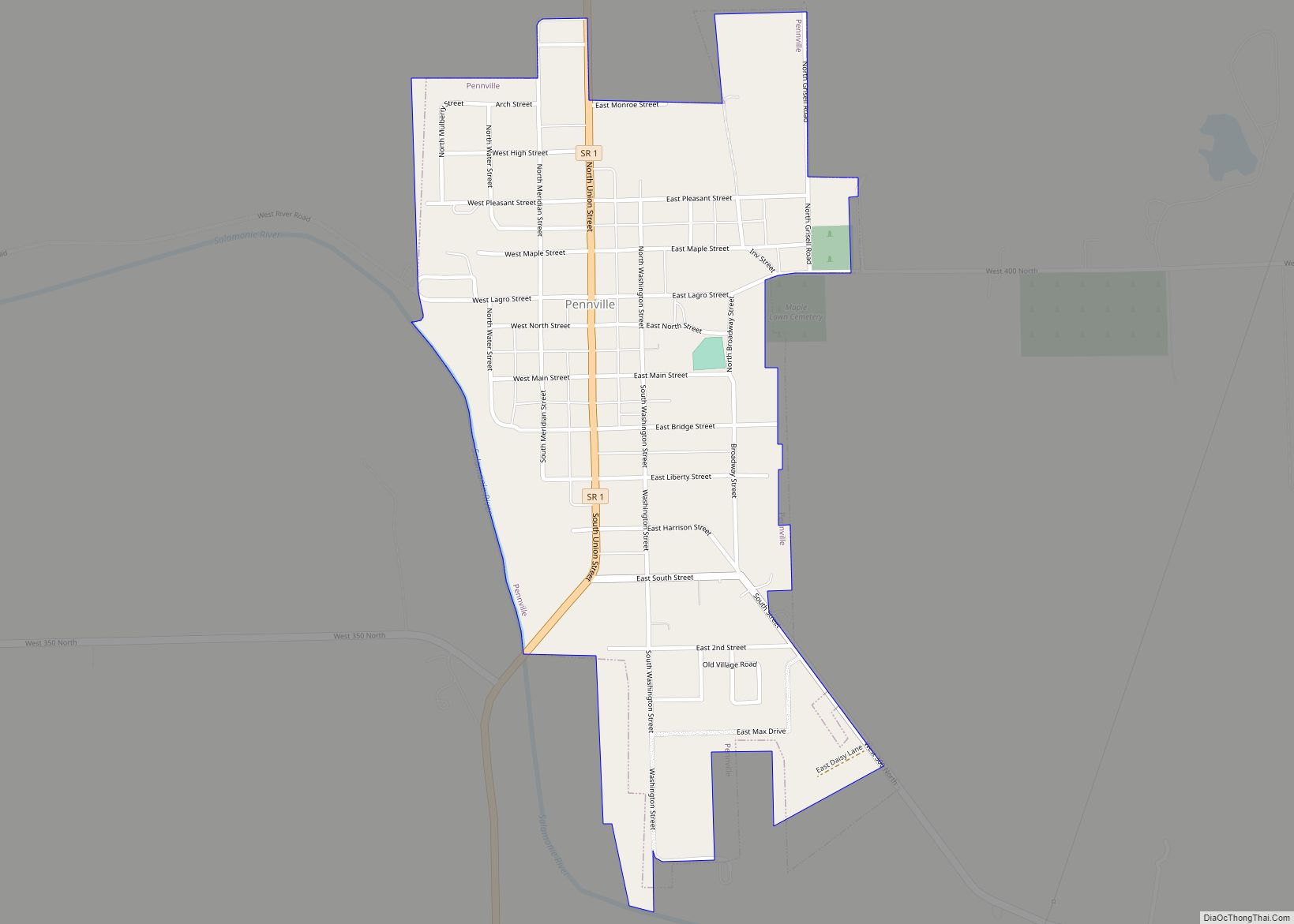
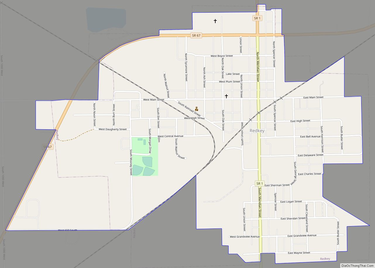
Cities & Towns
Townships
- Bearcreek
- Greene
- Jackson
- Jefferson
- Knox
- Madison
- Noble
- Penn
- Pike
- Richland
- Wabash
- Wayne
Unincorporated communities
- Antioch
- Antiville
- Balbec
- Bellfountain
- Blaine
- Bloomfield
- Bluff Point
- Boundary City
- Brice
- Center
- College Corner
- Collett
- Como
- Fiat
- Greene
- Jay City
- Kitt
- Liber
- New Corydon
- New Mount Pleasant
- Noble
- Pleasant Ridge
- Poling
- Pony
- Powers
- Ridertown
- Salem
- Trinity
- West Liberty
- Westchester
Major highways
Sources: National Atlas, US Census Bureau
- US 27
- SR 1
- SR 18
- SR 26
- SR 67
- SR 167
Jay County Topographic Map
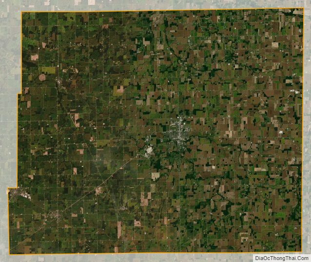
Jay County Satellite Map
Jay County Outline Map