Portland is a city in and the county seat of Jay County, Indiana, United States. The population was 6,223 at the 2010 census, and in 2018 the estimated population was 6,085.
| Name: | Portland city |
|---|---|
| LSAD Code: | 25 |
| LSAD Description: | city (suffix) |
| State: | Indiana |
| County: | Jay County |
| Elevation: | 909 ft (277 m) |
| Total Area: | 4.88 sq mi (12.63 km²) |
| Land Area: | 4.87 sq mi (12.62 km²) |
| Water Area: | 0.00 sq mi (0.01 km²) 0.24%% |
| Total Population: | 6,320 |
| Population Density: | 1,296.94/sq mi (500.79/km²) |
| ZIP code: | 47371 |
| Area code: | 260 |
| FIPS code: | 1861236 |
| GNISfeature ID: | 0441471 |
| Website: | www.thecityofportland.net |
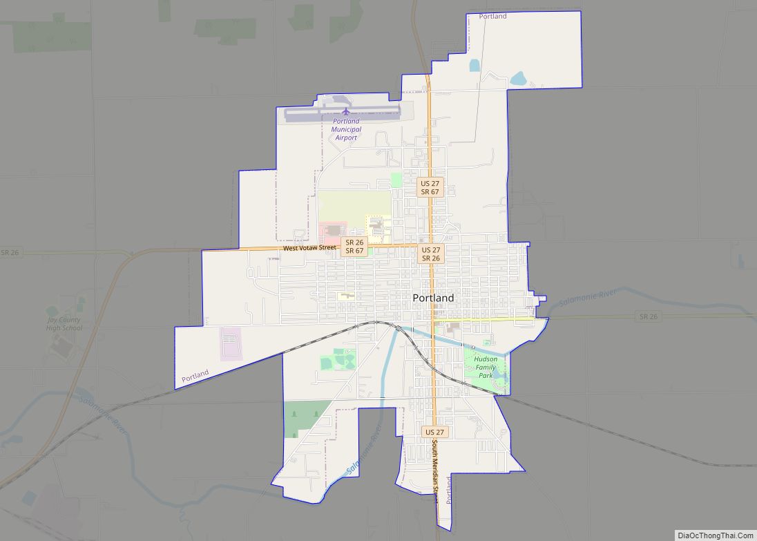
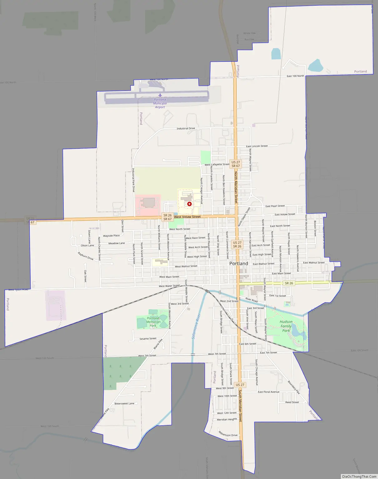
Online Interactive Map
Click on ![]() to view map in "full screen" mode.
to view map in "full screen" mode.
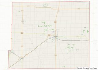
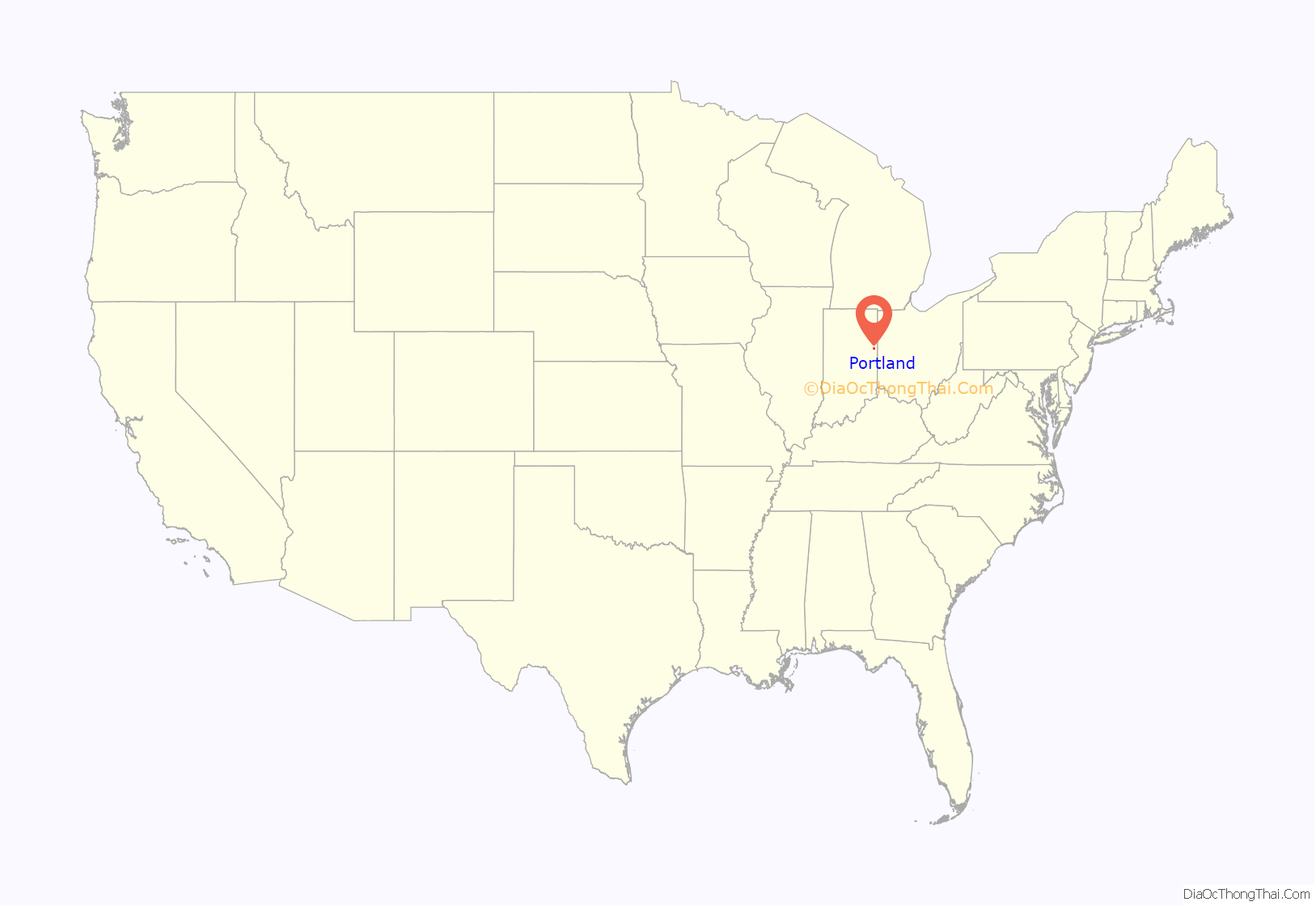
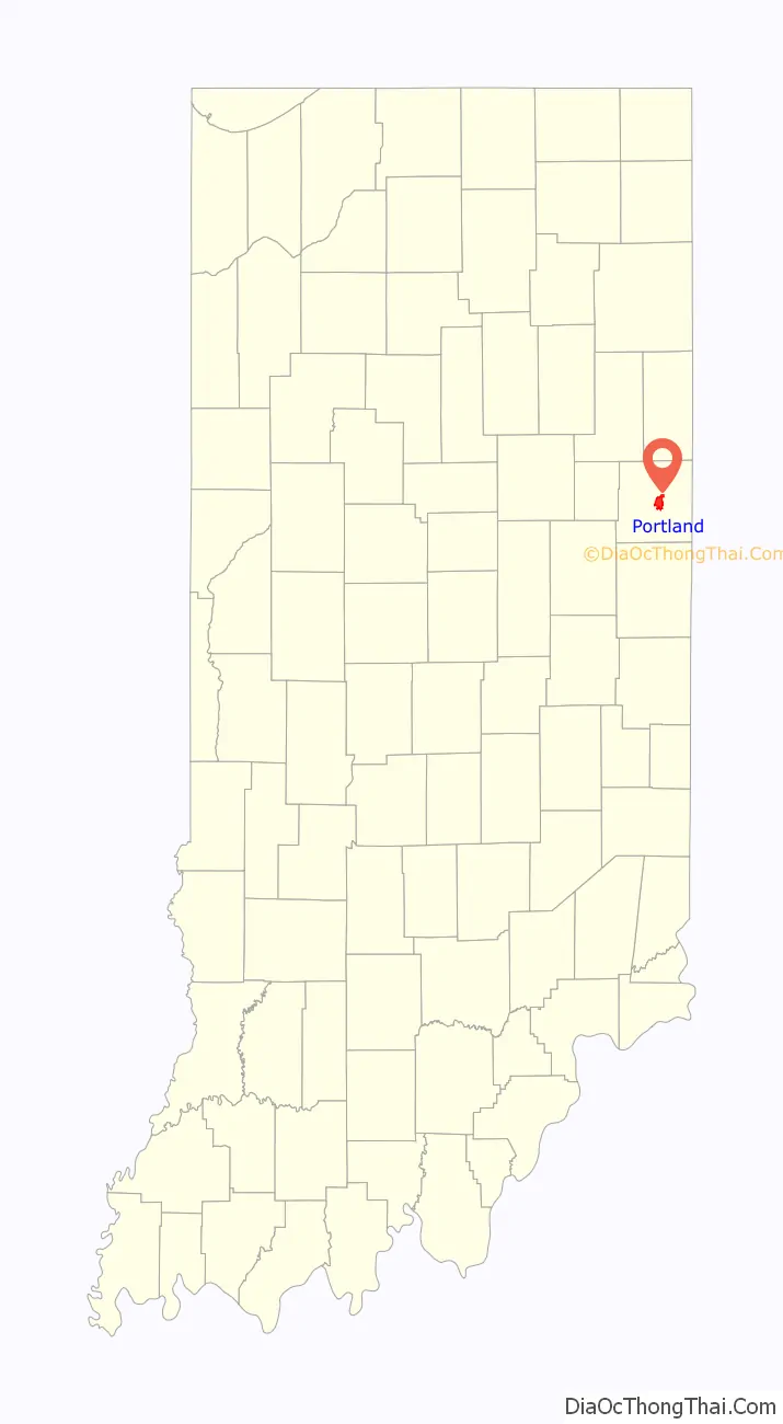
Portland location map. Where is Portland city?
History
Portland was platted in 1837. It was named after Portland, Maine.
The Jay County Courthouse, Portland Commercial Historic District, and Jonas Votaw House are listed on the National Register of Historic Places.
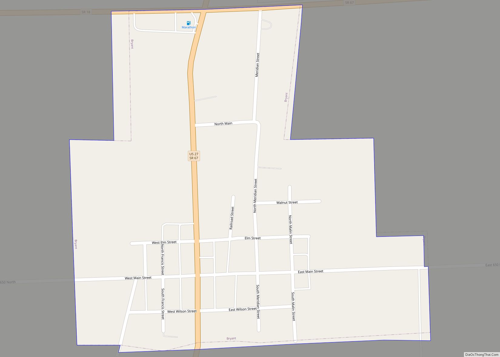
Portland Road Map
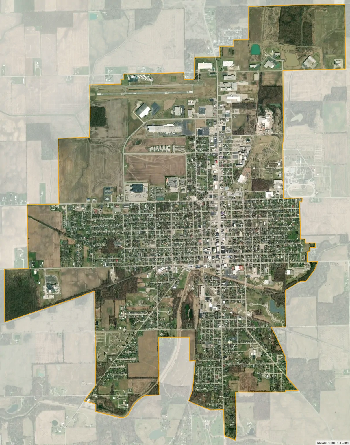
Portland city Satellite Map
Geography
According to the U.S. Census Bureau, Portland has a total area of 4.97 square miles (12.88 km), of which 1.6 acres (6,524 m), or 0.05%, are water. The Salamonie River runs through the city just south of its center. The Salamonie is a west-flowing tributary of the Wabash River.
See also
Map of Indiana State and its subdivision:- Adams
- Allen
- Bartholomew
- Benton
- Blackford
- Boone
- Brown
- Carroll
- Cass
- Clark
- Clay
- Clinton
- Crawford
- Daviess
- De Kalb
- Dearborn
- Decatur
- Delaware
- Dubois
- Elkhart
- Fayette
- Floyd
- Fountain
- Franklin
- Fulton
- Gibson
- Grant
- Greene
- Hamilton
- Hancock
- Harrison
- Hendricks
- Henry
- Howard
- Huntington
- Jackson
- Jasper
- Jay
- Jefferson
- Jennings
- Johnson
- Knox
- Kosciusko
- LaGrange
- Lake
- Lake Michigan
- LaPorte
- Lawrence
- Madison
- Marion
- Marshall
- Martin
- Miami
- Monroe
- Montgomery
- Morgan
- Newton
- Noble
- Ohio
- Orange
- Owen
- Parke
- Perry
- Pike
- Porter
- Posey
- Pulaski
- Putnam
- Randolph
- Ripley
- Rush
- Saint Joseph
- Scott
- Shelby
- Spencer
- Starke
- Steuben
- Sullivan
- Switzerland
- Tippecanoe
- Tipton
- Union
- Vanderburgh
- Vermillion
- Vigo
- Wabash
- Warren
- Warrick
- Washington
- Wayne
- Wells
- White
- Whitley
- Alabama
- Alaska
- Arizona
- Arkansas
- California
- Colorado
- Connecticut
- Delaware
- District of Columbia
- Florida
- Georgia
- Hawaii
- Idaho
- Illinois
- Indiana
- Iowa
- Kansas
- Kentucky
- Louisiana
- Maine
- Maryland
- Massachusetts
- Michigan
- Minnesota
- Mississippi
- Missouri
- Montana
- Nebraska
- Nevada
- New Hampshire
- New Jersey
- New Mexico
- New York
- North Carolina
- North Dakota
- Ohio
- Oklahoma
- Oregon
- Pennsylvania
- Rhode Island
- South Carolina
- South Dakota
- Tennessee
- Texas
- Utah
- Vermont
- Virginia
- Washington
- West Virginia
- Wisconsin
- Wyoming