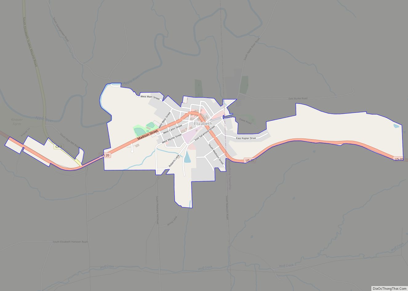
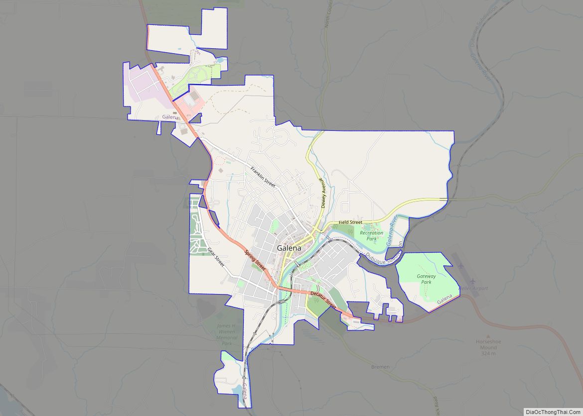
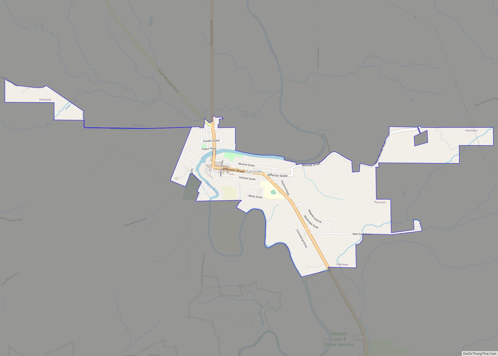
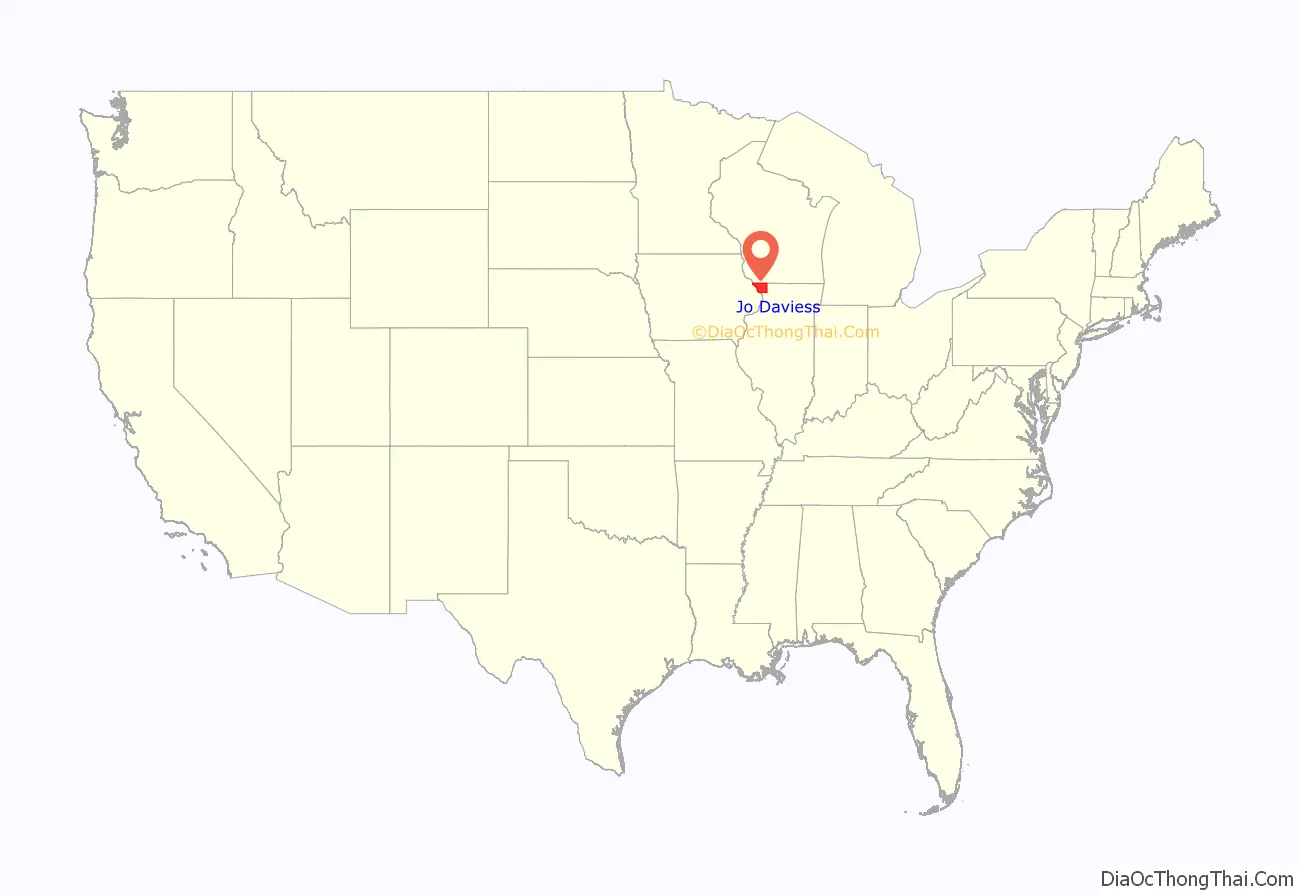
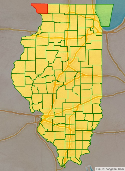
Jo Daviess County (/ˈdeɪvɪs/) is the northwesternmost county in the U.S. state of Illinois. According to the 2010 census, it had a population of 22,678. Its county seat is Galena.
Jo Daviess County is part of the Tri-State Area and is located near Dubuque, Iowa and Platteville, Wisconsin. As part of the Driftless Area, Jo Daviess County is known for its scenic stretches of road, high hills and valley views. Within Jo Daviess County lies Charles Mound, the highest natural point in Illinois, as well as eight of the ten highest points in Illinois.
| Name: | Jo Daviess County |
|---|---|
| FIPS code: | 17-085 |
| State: | Illinois |
| Founded: | 1827 |
| Named for: | Joseph Hamilton Daveiss |
| Seat: | Galena |
| Largest city: | Galena |
| Total Area: | 619 sq mi (1,600 km²) |
| Land Area: | 601 sq mi (1,560 km²) |
| Total Population: | 22,691 |
| Population Density: | 37/sq mi (14/km²) |
| Time zone: | UTC−6 (Central) |
| Summer Time Zone (DST): | UTC−5 (CDT) |
| Website: | www.jodaviesscountyil.gov |
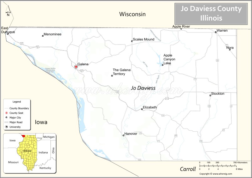
Jo Daviess County location map. Where is Jo Daviess County?
History
Jo Daviess County was formed in 1827 out of Henry and Putnam Counties. It is named for Maj. Joseph Hamilton Daveiss, United States District Attorney for Kentucky, who was killed in 1811 at the Battle of Tippecanoe. The local pronunciation is “Davis”. Jo Daviess County was founded exclusively by immigrants from New England. These were old stock “Yankee” immigrants, meaning they were descended from the English Puritans who settled New England in the 1600s. The completion of the Erie Canal caused a surge in New England immigration to what was then the Northwest Territory.
The end of the Black Hawk War led to an additional surge of immigration, once again coming almost exclusively from the six New England states as a result of overpopulation combined with land shortages in that region. Some of these later settlers were from upstate New York and had parents who had moved to that region from New England shortly after the Revolutionary War. New Englanders and New England transplants from upstate New York were the vast majority of Jo Daviess County’s inhabitants during the first several decades of its history. These settlers were primarily members of the Congregational Church though due to the Second Great Awakening many of them had converted to Methodism and some had become Baptists before coming to what is now Jo Daviess County. The Congregational Church subsequently has gone through many divisions and some factions, including those in Jo Daviess County are now known as the Church of Christ and the United Church of Christ.
As a result of this heritage the vast majority of inhabitants in Jo Daviess County, much like antebellum New England were overwhelmingly in favor of the abolitionist movement during the decades leading up to the Civil War.
In the late 1880s and early 1890s Irish and German migrants began moving into Jo Daviess County, most of these later immigrants did not move directly from Ireland and Germany, but rather from other areas in the Midwest where they had been living, particularly the state of Ohio.
County border changes
- 1830- The northern border of Illinois and Wisconsin was formally established. Until that time, several Wisconsin towns actually were under the jurisdiction of Jo Daviess County.
- 1831- Rock Island County was formed from a part of the county, along with a new northern extension of Henry County and Putnam County.
- 1836- Whiteside, Ogle, and Winnebago counties were formed from the southern and eastern sections of the county.
- 1837- Stephenson County was formed from the eastern section of the county.
- 1839- Carroll County was formed from the southern section of the county.
Jo Daviess County at the time of its creation to 1831 (Wisconsin border adjustment not shown)
Jo Daviess between 1831 and 1836
Jo Daviess between 1836 and 1837. Whiteside and Ogle Counties remained temporarily attached to Jo Daviess until county governments could be organized.
Jo Daviess between 1837 and 1839
Jo Daviess reduced to its current size in 1839 by the creation of Carroll County and the organization of a government in Whiteside County
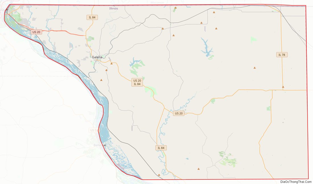
Jo Daviess County Road Map
Geography
According to the U.S. Census Bureau, the county has a total area of 619 square miles (1,600 km), of which 601 square miles (1,560 km) is land and 18 square miles (47 km) (2.9%) is water.
Climate and weather
In recent years, average temperatures in the county seat of Galena have ranged from a low of 9 °F (−13 °C) in January to a high of 84 °F (29 °C) in July, although a record low of −35 °F (−37 °C) was recorded in February 1996 and a record high of 103 °F (39 °C) was recorded in August 1988. Average monthly precipitation ranged from 1.14 inches (29 mm) in January to 4.58 inches (116 mm) in June.
Major highways
In Illinois, US 20 is designated the General Ulysses S. Grant Highway (often abbreviated the U.S. Grant Memorial Highway) and is the longest route in the United States. In eastern Jo Daviess County US 20 is one of the few areas that remain two-lane across the entire stretch of US 20. The road between Dubuque and Stockton was once known as the most dangerous stretch of road because of the hills and curves flanked by cliffs and valleys. Travelers were greeted with signs reminding them to drive carefully as they entered this stretch of road.
- U.S. Route 20
- Illinois Route 35
- Illinois Route 78
- Illinois Route 84
Adjacent counties
- Lafayette County, Wisconsin – north
- Stephenson County – east
- Carroll County – south
- Jackson County, Iowa – southwest
- Dubuque County, Iowa – west
- Grant County, Wisconsin – northwest
National protected area
- Upper Mississippi River National Wildlife and Fish Refuge (part)
State protected area
- Apple River Canyon State Park
Locally protected area
Several areas are protected by the charitable organization Jo Daviess Conservation Foundation:
- Buehler Preserve
- Casper Bluff Land & Water Reserve
- Horseshoe Mound
- Schurmeier Teaching Forest
- Valley of Eden Bird Sanctuary
- Wapello Land & Water Reserve
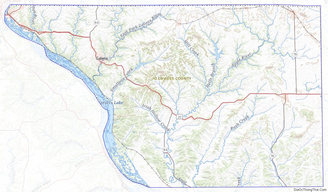
Jo Daviess County Topographic Map
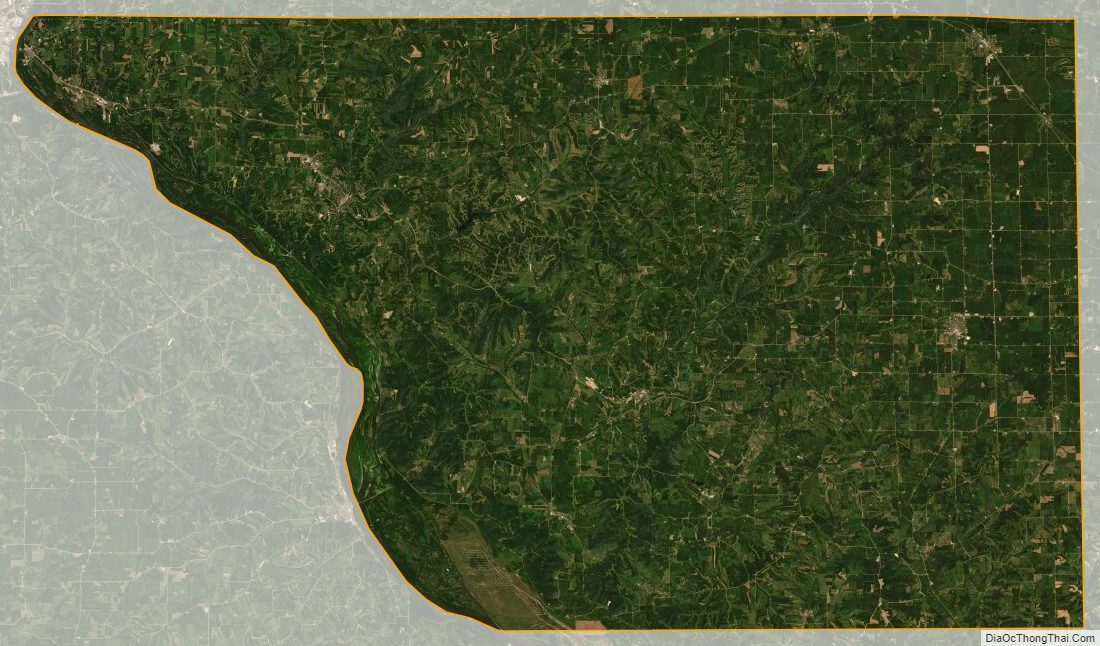
Jo Daviess County Satellite Map
Jo Daviess County Outline Map