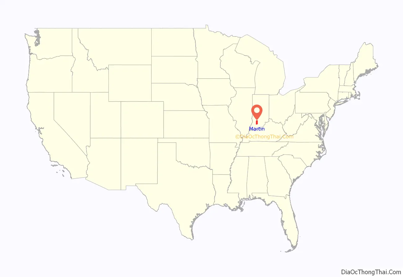
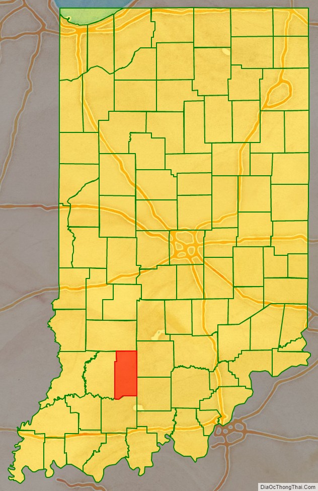
Martin County is a county in the U.S. state of Indiana. As of the 2020 United States Census, the population was 10,327. The county seat is Shoals at the center of the county, and the county’s only incorporated city is Loogootee, on the county’s western border.
| Name: | Martin County |
|---|---|
| FIPS code: | 18-101 |
| State: | Indiana |
| Founded: | 20 January 1820 |
| Named for: | Major John T. Martin |
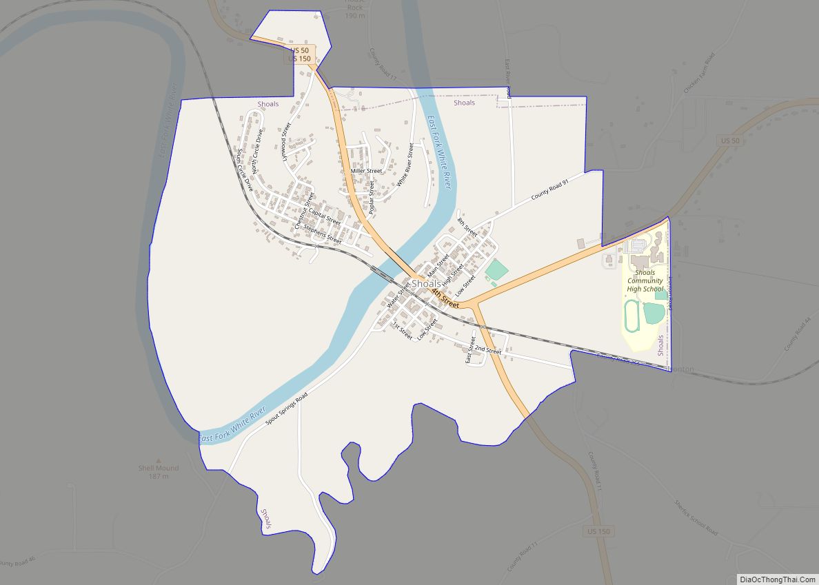
| Seat: | Shoals |
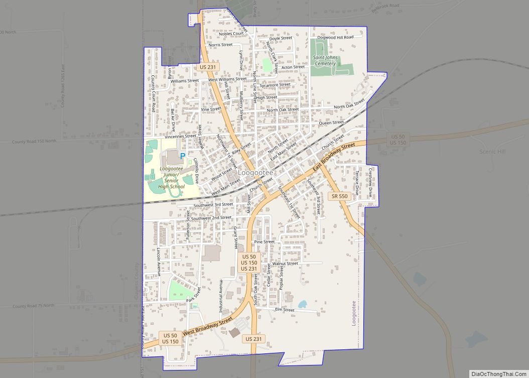
| Largest city: | Loogootee |
| Total Area: | 340.41 sq mi (881.7 km²) |
| Land Area: | 335.74 sq mi (869.6 km²) |
| Total Population: | 10,327 |
| Population Density: | 30/sq mi (12/km²) |
Martin County location map. Where is Martin County?
History
The Indiana Territory achieved statehood near the end of 1816. Shortly thereafter, the new State legislature created Dubois (December 1817) and Daviess (February 1818) counties. Due to the inflow of settlers into southwest Indiana, and the difficulty of accessing the county seats of those counties, Martin County was partitioned off from parts of those counties, being authorized on 20 January 1820. It was named for Maj. John T. Martin of Newport, Kentucky.
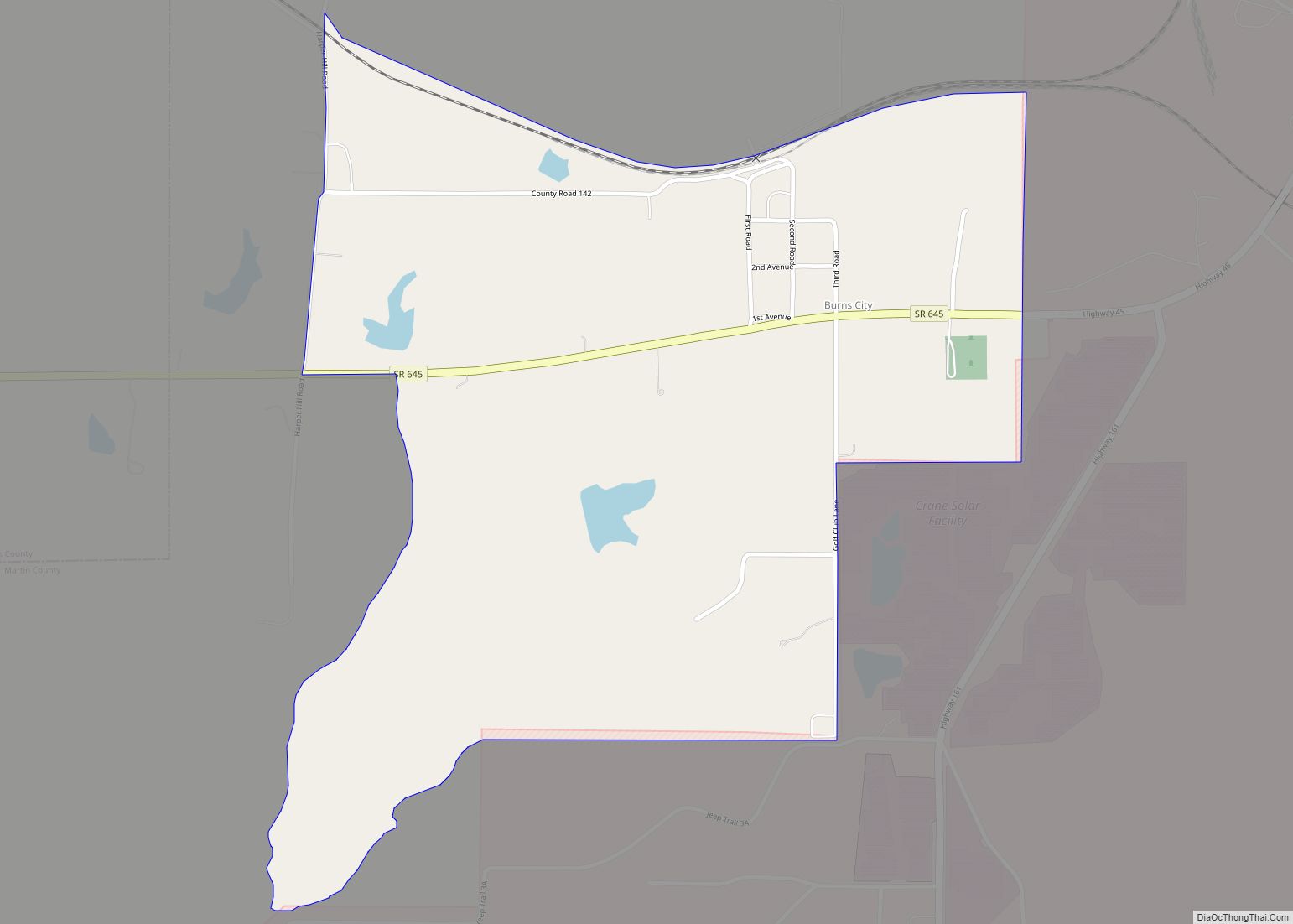
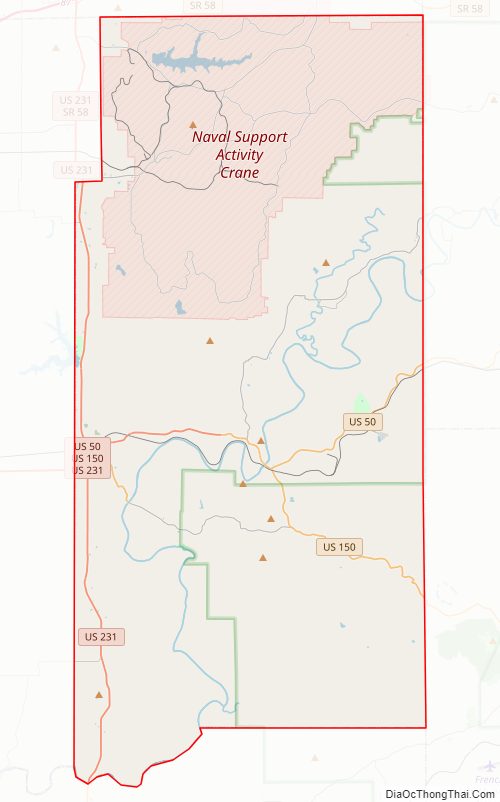
Martin County Road Map
Geography
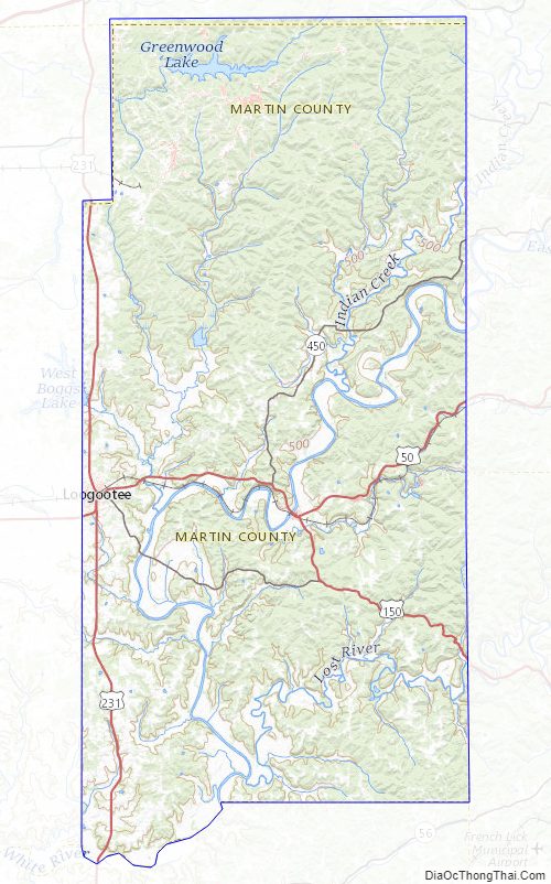
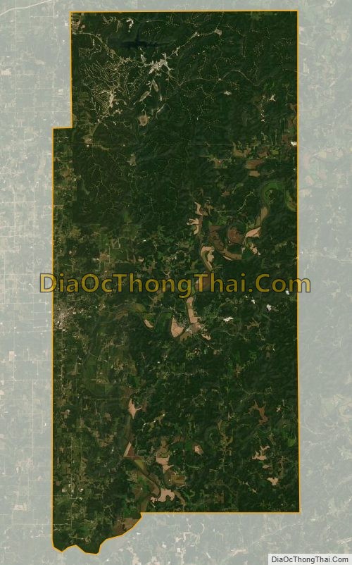
The hills of Martin County are largely wooded and cut with drainages; the available area is devoted to agriculture, development, or is under control of the US Government – about a third of the county belongs to the Naval Surface Warfare Center Crane Division, and about a quarter of the county belongs to Hoosier National Forest. The highest point (870 feet/270 meters ASL) is in Mitcheltree Township, within NSWC Crane.
The East Fork of the White River flows southwestward through the lower part of the county. The central part of the county is drained by Indian Creek, which discharges into White River near the center of the county. The upper part of the county is drained by Boggs Creek, which discharges into White River near the county’s western edge.
According to the 2010 census, the county has a total area of 340.41 square miles (881.7 km), of which 335.74 square miles (869.6 km) (or 98.63%) is land and 4.67 square miles (12.1 km) (or 1.37%) is water.
Adjacent counties
- Greene County – north
- Lawrence County – east
- Orange County – southeast
- Dubois County – south
- Daviess County – west
Protected areas
- Hoosier National Forest (part) in northeast and southeast parts of Martin County. Administered by US Forest Service
- Martin State Forest – in eastern part of Martin County. Administered by Indiana Department of Natural Resources
Lakes
- Greenwood Lake
- Seed Tick Lake
- West Boggs Lake (part)
Martin County Topographic Map
Martin County Satellite Map
Martin County Outline Map