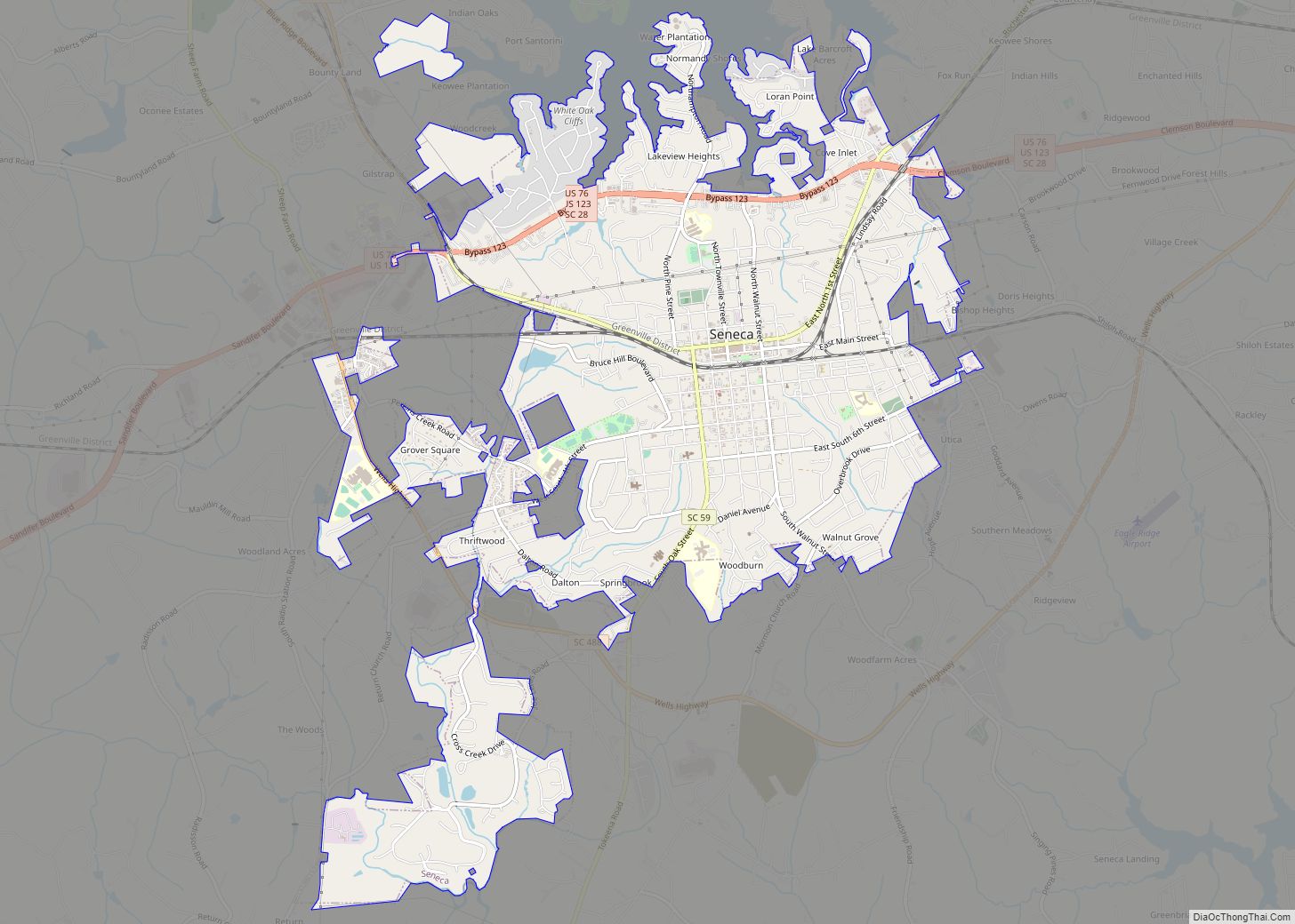
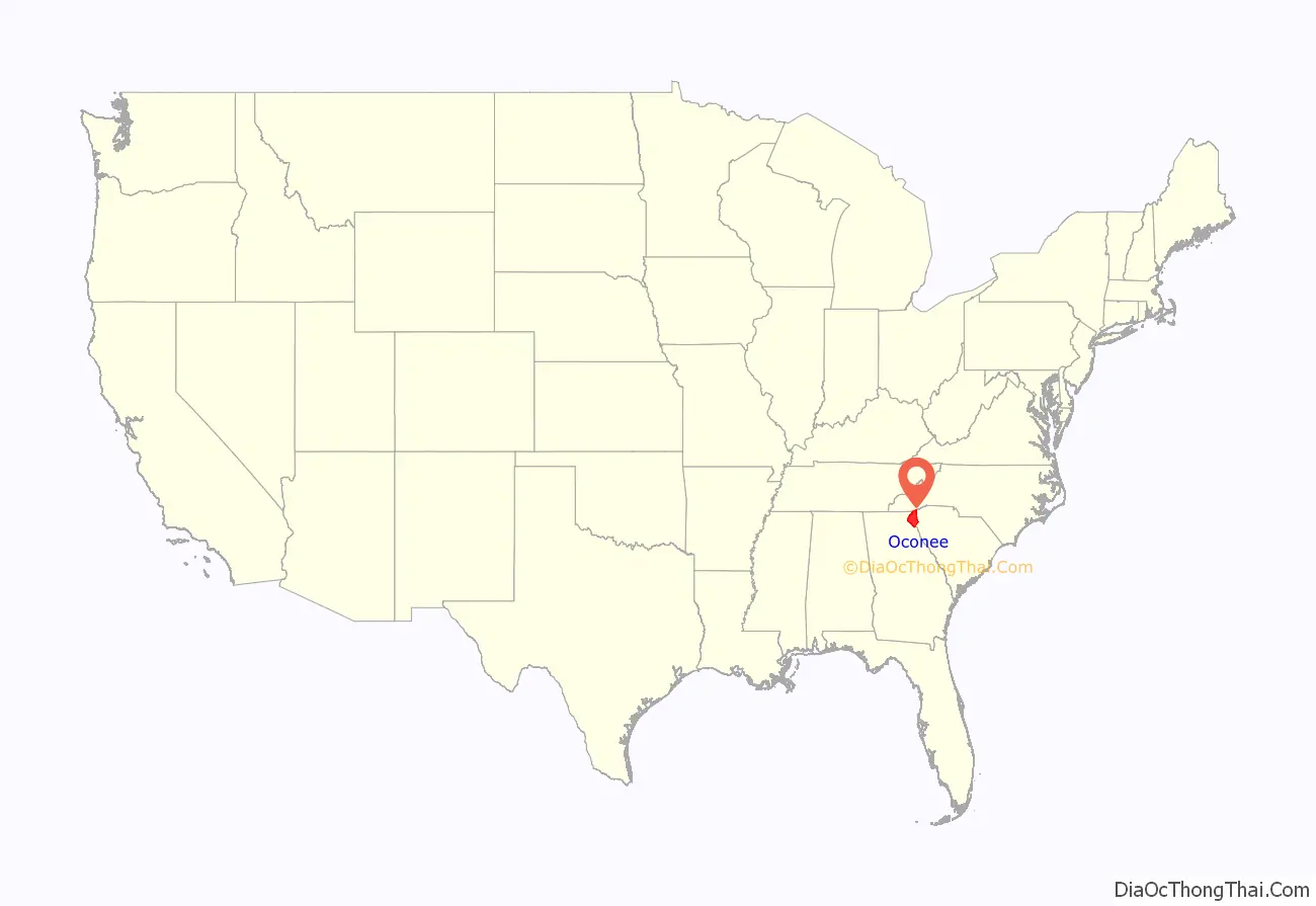
Oconee County is the westernmost county in the U.S. state of South Carolina. As of the 2020 census, the population was 78,607. Its county seat is Walhalla and its largest city is Seneca. Oconee County is included in the Seneca, SC Micropolitan Statistical Area, which is also included in the Greenville–Spartanburg–Anderson, SC Combined Statistical Area. South Carolina Highway 11, the Cherokee Foothills National Scenic Highway, begins in southern Oconee County at Interstate Highway 85 at the Georgia state line.
| Name: | Oconee County |
|---|---|
| FIPS code: | 45-073 |
| State: | South Carolina |
| Founded: | 1868 |
| Named for: | Cherokee word for “land beside the water” |
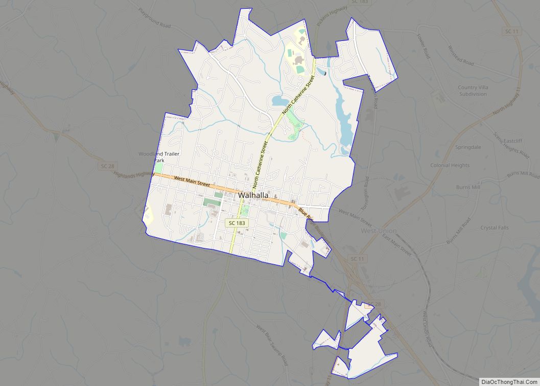
| Seat: | Walhalla |
| Largest city: | Seneca |
| Total Area: | 674 sq mi (1,750 km²) |
| Land Area: | 626 sq mi (1,620 km²) |
| Total Population: | 79,203 |
| Population Density: | 126.5/sq mi (48.8/km²) |
| Time zone: | UTC−5 (Eastern) |
| Summer Time Zone (DST): | UTC−4 (EDT) |
| Website: | www.oconeesc.com |
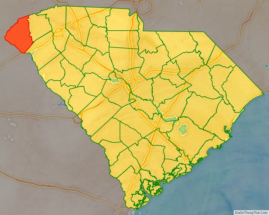
Oconee County location map. Where is Oconee County?
History
Oconee County was named after a historic Cherokee town and the word “Ae-quo-nee”, meaning “land beside the water.” Oconee (Cherokee: ᎤᏊᏄ, romanized: Uquunu) town developed along the Tugaloo River, the border between present-day South Carolina and Georgia. The town was located along the Cherokee trading path of the early 18th century between the English colonial Atlantic port of Charleston and the Mississippi River to the west.
Oconee Town developed around an ancient platform mound built by ancestral peoples during the period of the Southern Appalachian Mississippian culture, approximately 1000CE to 1500CE. In their public architecture, the historic Cherokee built a communal town house on top of the existing earthwork mound. The town house was a meeting place for the larger community and council. Through the centuries of their long occupancy, the Cherokee would replace the town house, and maintain and add to the mound, building in distinctly colored layers of earth that are visible to archeologists.
Due to its geographic position, the town was at the intersection of the trading path and the Cherokee treaty boundary of 1777. In 1792, the newly formed South Carolina State Militia built a frontier outpost near the town site, and named it Oconee Station.
European-American settlement in this far western area of the colony did not begin until the late eighteenth century. Most did not take place until decades after the American Revolutionary War. South Carolina jurisdictions were successively called parishes, counties, judicial districts and counties again. Oconee County was not created until 1868, after the American Civil War and during the Reconstruction era. It was taken from part of the Pickens District and named after Oconee Town.
Post-Revolutionary and nineteenth-century history
- 1780s – The rare American wildflower, Oconee Bell, was first recorded by French botanist André Michaux.
- 1780s – Colonel Benjamin Cleveland and a group of Revolutionary veterans received land grants from the state of Georgia (which then claimed this area according to their colonial charter), in lieu of payment for service, and settled in present-day Oconee County.
- 1787 – Georgia withdrew its claims to the land between the Tugaloo and Keowee rivers by the Treaty of Beaufort with South Carolina.
- 1816 – Under pressure from encroaching European Americans, the Cherokee sold their remaining South Carolina land.
- 1850s – The largest town in the county was Tunnel Hill, located above Stumphouse Mountain Tunnel.
- 1868 – Oconee County was formed by the state legislature dividing Pickens County. Walhalla was designated as the county seat.
- 1870 – Air Line Railroad built a railroad through the county; it stimulated development at stops known as Seneca and Westminster
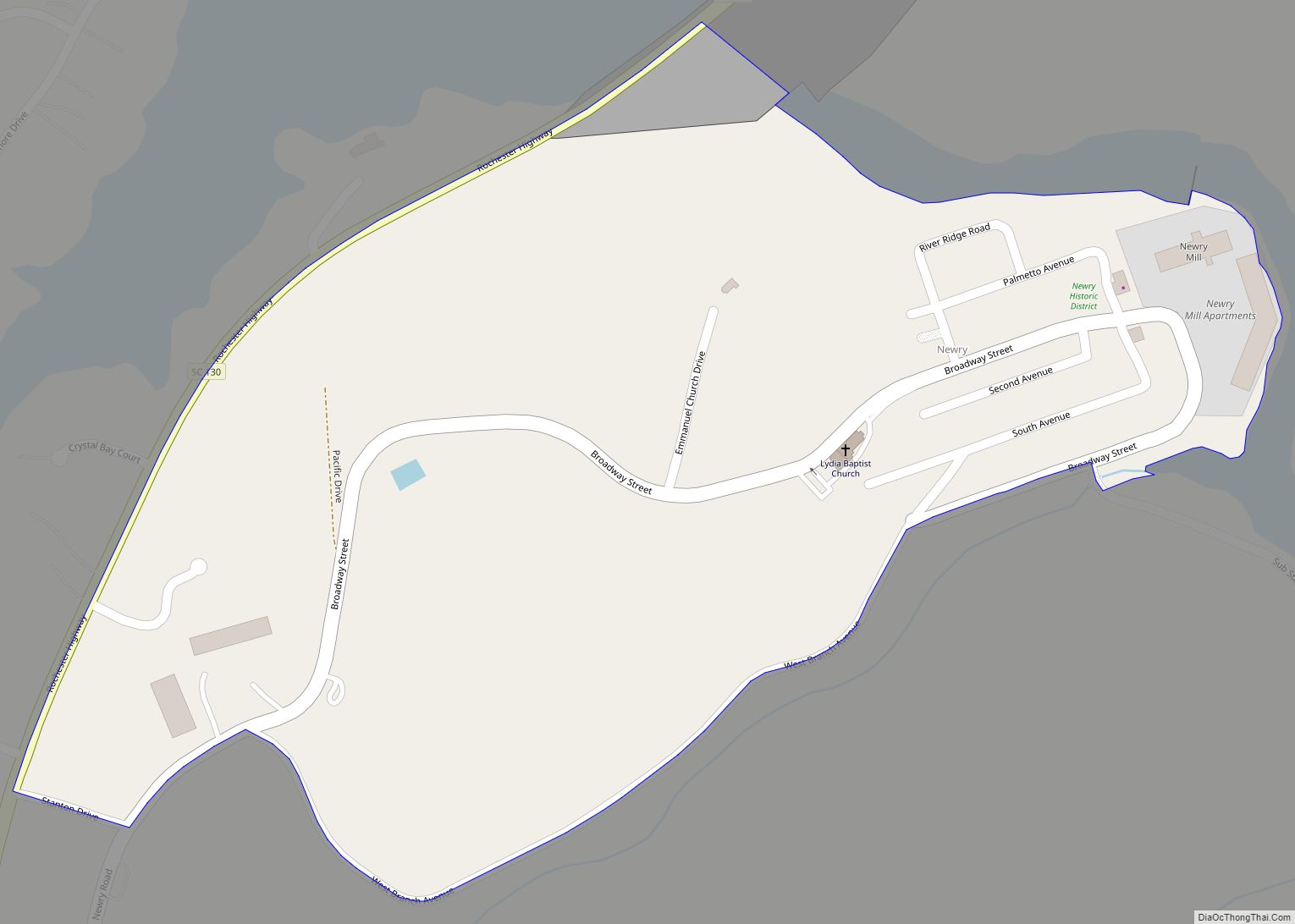
- 1893 – Newry was established as a mill village to house workers of the Courtenay Manufacturing Company, a textile mill that produced cotton, wool, and other textile products.
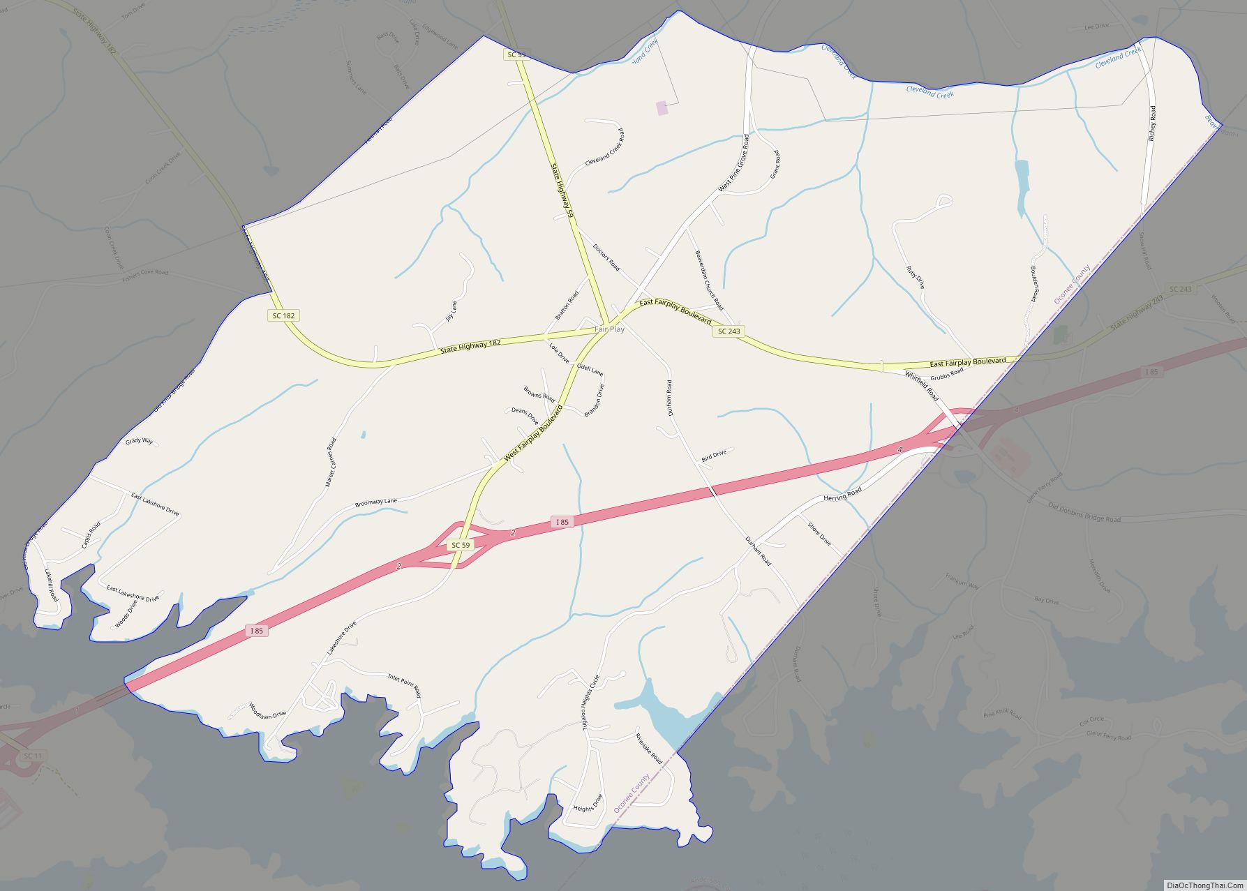
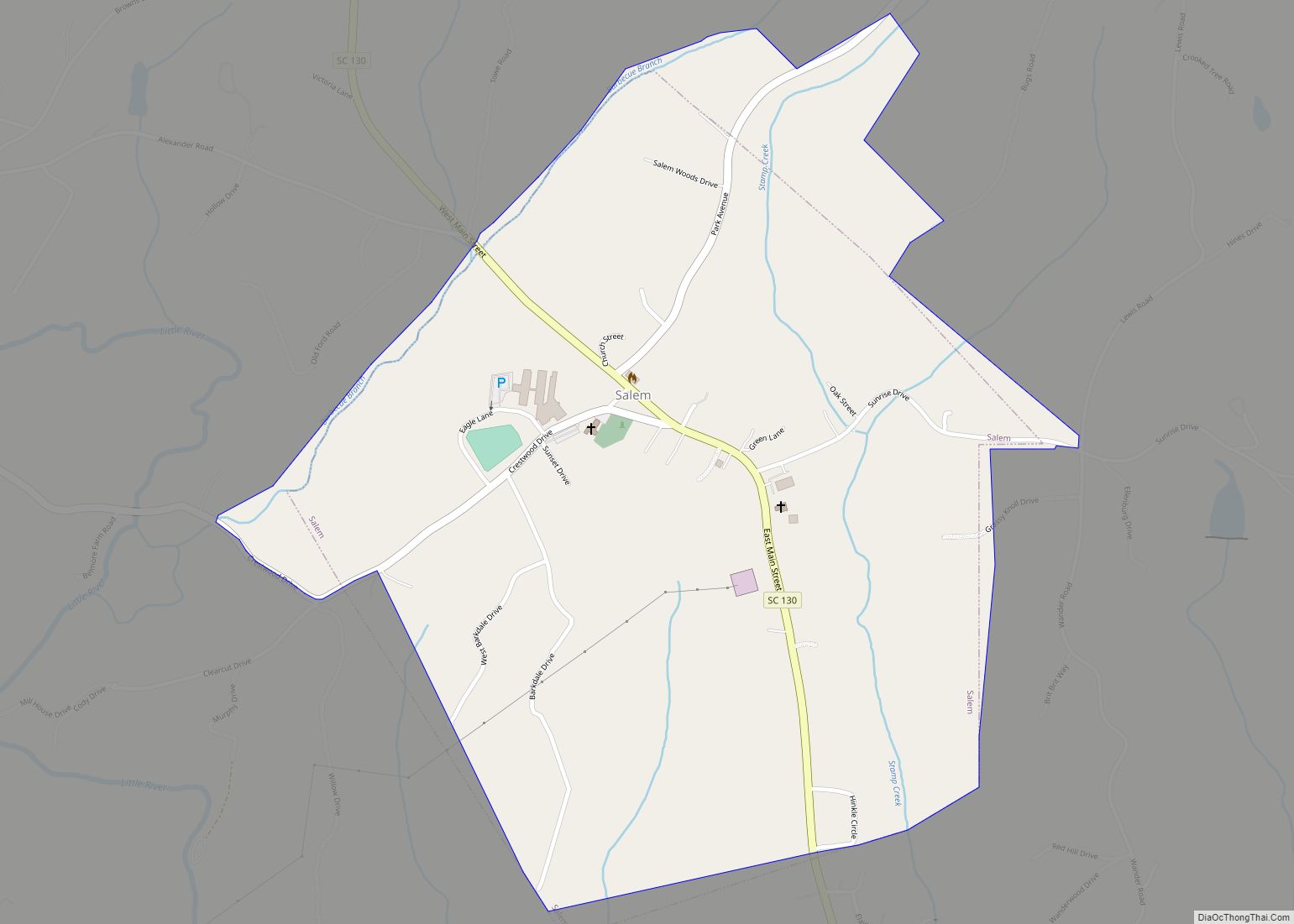
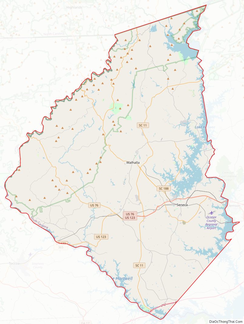
Oconee County Road Map
Geography
According to the U.S. Census Bureau, the county has a total area of 674 square miles (1,750 km), of which 626 square miles (1,620 km) is land and 47 square miles (120 km) (7.0%) is water. Three large man-made lakes provide residents with sport fishing, water skiing, and sailing as well as hydroelectric power. The largest lake is Lake Hartwell, built by the U.S. Army Corps of Engineers between 1955 and 1963. Lake Keowee is the second-largest lake and the Oconee Nuclear Station operates by the lake. Lake Jocassee is the third-largest and is a source of hydroelectric energy, but is also popular for its scenery and numerous waterfalls.
Bad Creek Reservoir, located in the mountains above Jocassee, is lso used for generating electricity during peak hours. The water level can fall by tens of feet per hour and, during off-peak times, water is pumped back into the lake for the next peak period. Because of the dramatic changes in water level due to these uses, boating and swimming are prohibited in this reservoir.
Oconee County is in the Savannah River basin.
National protected area
- Sumter National Forest (part)
State and local protected areas/sites
- Chau Ram County Park
- Devils Fork State Park
- High Falls County Park
- Horsepasture River
- Lake Hartwell State Recreation Area
- Oconee State Park
- Oconee Station State Historic Site
- Piedmont Forestry Center
- South Cove County Park
- W.P. Anderson City Park
- Yellow Branch Falls Recreation Area
Major water bodies
- Chattooga River
- Keowee River
- Lake Hartwell
- Lake Jocassee
- Lake Keowee
- Savannah River
Adjacent counties
- Jackson County, North Carolina – north
- Transylvania County, North Carolina – northeast
- Pickens County – east
- Anderson County – southeast
- Hart County, Georgia – south
- Franklin County, Georgia – south
- Stephens County, Georgia – southwest
- Habersham County, Georgia – west
- Rabun County, Georgia – west
- Macon County, North Carolina – northwest
Major highways
- I-85
- US 76
- US 123
- SC 11
- SC 24
- SC 28
- SC 59
- SC 107
- SC 130
- SC 182
- SC 183
- SC 188
- SC 243
Oconee County Topographic Map
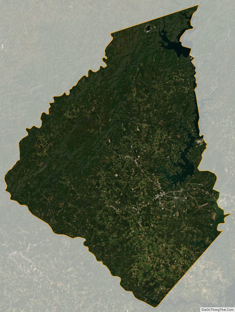
Oconee County Satellite Map
Oconee County Outline Map