Prince William County is located on the Potomac River in the U.S. state of Virginia. As of the 2020 census, the population sits at 482,204, making it Virginia’s second-most populous county. Its county seat is the independent city of Manassas.
A part of Northern Virginia, Prince William County is part of the Washington metropolitan area. In 2019 it had the 20th-highest income of any county in the United States.
| Name: | Prince William County |
|---|---|
| FIPS code: | 51-153 |
| State: | Virginia |
| Founded: | 1731 |
| Named for: | Prince William, Duke of Cumberland |
| Total Area: | 348 sq mi (900 km²) |
| Land Area: | 336 sq mi (870 km²) |
| Total Population: | 482,204 |
| Population Density: | 1,400/sq mi (540/km²) |
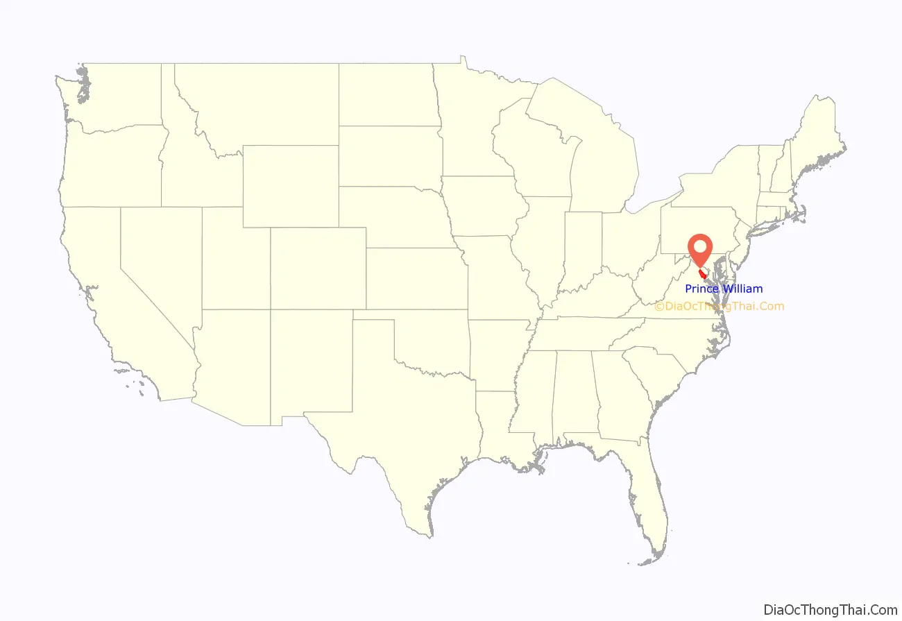
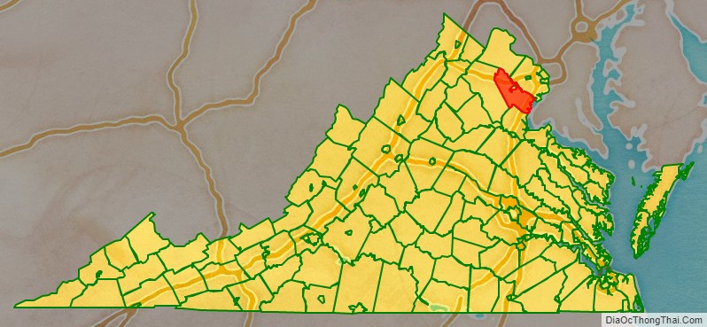
Prince William County location map. Where is Prince William County?
History
At the time of European colonization, the native tribes of the area that would become Prince William County were the Doeg, an Algonquian-speaking sub-group of the Powhatan tribal confederation. When John Smith and other English explorers ventured to the upper Potomac River beginning in 1608, they recorded the name of a village the Doeg inhabited as Pemacocack (meaning “plenty of fish” in their language). It was located on the west bank of the Potomac River about 30 miles south of present-day Alexandria. Unable to deal with European diseases and firepower, the Doeg abandoned their villages in the area by 1700.
Creation and divisions in colonial and early statehood era
As population increased in the area, the General Assembly of the colony of Virginia split Stafford County, Virginia in 1731, and added a section which had previously been part of King George County in order to create Prince William County. The county was named for Prince William, Duke of Cumberland, the third son of King George II. The area encompassed by the 1731 act creating Prince William County originally included all of what later became the counties of Arlington, Fairfax, Fauquier, and Loudoun; and the independent cities of Alexandria, Fairfax, Falls Church, Manassas, and Manassas Park. Fairfax County was split from Prince William County in 1742, and first Loudoun (in 1757) and then the incorporated town of Alexandria (in 1779, part of which later became Arlington County) would later be split from Fairfax County. Fauquier County was created from western Prince William County in 1759.
In 1790 Prince William County’s population was 58% white; most of the remainder were enslaved African Americans. The county had been an area of tobacco plantations, but planters were changing to cultivate mixed crops due to soil exhaustion and changes in the market. In the first two decades after the Revolution, the number and percentage of free blacks increased in Virginia as some whites freed their slaves, based on revolutionary ideals.
Post-Reconstruction era to present
On March 19, 1892, two men, Lee Heflin and Joseph Dye, were lynched in Haymarket. They had been convicted of the murder of a girl and sentenced to death, but the mob did not want to wait for the legal system. The men were hanged from trees at the edge of woods; then the mob shot into their bodies. The Washington Post said, “mob law…is a dangerous thing to encourage. There is too much of it already throughout the country, and it spreads like a contagion so long as public sentiment tacitly approves it.” It was unusual that white men were lynched; in Virginia and the rest of the South, black men were overwhelmingly the victims of lynching, the violence by which whites maintained dominance.
The county was rural and agricultural for decades. Into the early 20th century, the population was concentrated in two areas, one at Manassas (site of a major railroad junction), and the other near Occoquan and Woodbridge along the Potomac River, which was an important transportation route. Beginning in the late 1930s, suburban residential development began and new housing was developed near the existing population centers, particularly in Manassas.
In 1960 the population was 50,164. Continued suburbanization and growth of the Washington, D.C. metropolitan area caused that to increase rapidly in the following decades. There was expansion of federal, military and commercial activities in Northern Virginia in the late 20th century. By 2000, this was the third-most populous local jurisdiction in Virginia. From 2000 to 2010, the population increased by 43.2%. This was the first county in Virginia to be minority-majority: the new majority is composed of Hispanic (of any race, largely of Central and South American ancestry), African American, and Asian. In 2012 it was the seventh-wealthiest county in the country. The estimated population of 2014 is more than 437,000.
In 1994 The Walt Disney Company bought extensive amounts of land in Haymarket for a proposed Disney’s America theme park. Local resistance to the resort, because of its perceived adverse effects on the historic Manassas Battlefield, led to its end as a viable idea. William B. Snyder, a local business man convinced Disney to sell the property to him. Snyder, in turn, sold off most of the land to developers, except for the 405 acres (1.64 km) donated to the National Capital Area Council of the Boy Scouts, who used the land to create Camp Snyder for Cub Scouts.
The Marine Corps Heritage Museum and the Hylton Performing Arts Center opened in the 21st century. The American Wartime Museum is also to be located in this county. During the commemoration of the Sesquicentennial of the Civil War, re-enactment of the famous First and Second Battles of Manassas was planned.
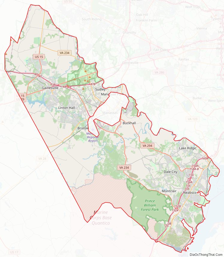
Prince William County Road Map
Geography
According to the U.S. Census Bureau, the county has a total area of 348 square miles (900 km), of which 336 square miles (870 km) is land and 12 square miles (31 km) (3.5%) is water. It is bounded on the north by Loudoun and Fairfax Counties; on the west by Fauquier County; on the south by Stafford County; and on the east by the Potomac River (Charles County, Maryland lies across the river). The western half of the county is occupied by a green belt known as the rural crescent.
The Bureau of Economic Analysis combines the independent cities of Manassas and Manassas Park with Prince William County (within which the two cities are enclaves) for statistical purposes:
Adjacent jurisdictions
- Loudoun County – north
- Fairfax County – northeast
- Charles County, Maryland – southeast
- Stafford County – south
- Fauquier County – west
- Manassas – center (enclave)
- Manassas Park – center (enclave)
National protected areas
- Featherstone National Wildlife Refuge
- Manassas National Battlefield Park
- Occoquan Bay National Wildlife Refuge
- Prince William Forest Park
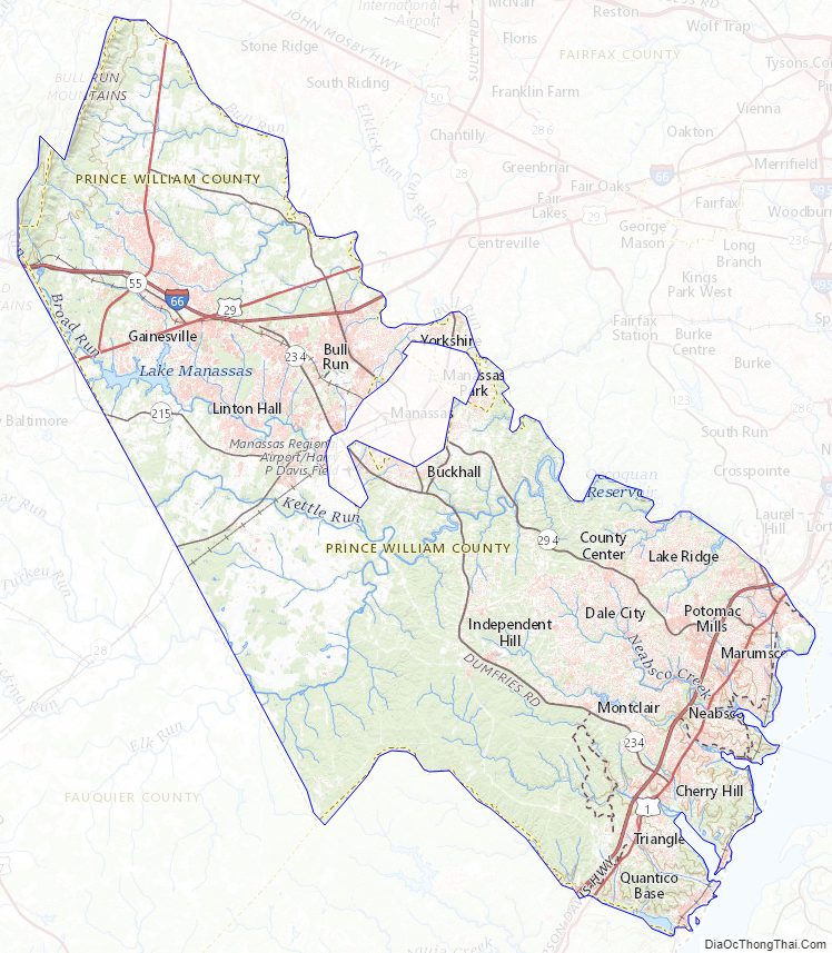
Prince William County Topographic Map
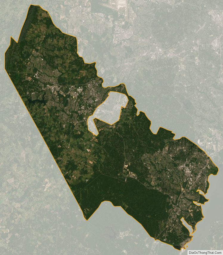
Prince William County Satellite Map
Prince William County Outline Map