Occoquan (/ˈɒkəkwɒn/) is a town in Prince William County, Virginia. The population was 934 at the 2010 United States Census. The town is a suburb of Washington, D.C. and is adjacent to Woodbridge. The current mayor is Earnest W. Porta Jr.
| Name: | Occoquan town |
|---|---|
| LSAD Code: | 43 |
| LSAD Description: | town (suffix) |
| State: | Virginia |
| County: | Fairfax County, Prince William County |
| Elevation: | 7 ft (2 m) |
| Total Area: | 0.22 sq mi (0.57 km²) |
| Land Area: | 0.17 sq mi (0.45 km²) |
| Water Area: | 0.05 sq mi (0.12 km²) |
| Total Population: | 934 |
| Population Density: | 6,277.46/sq mi (2,423.69/km²) |
| ZIP code: | 22125 |
| Area code: | 703, 571 |
| FIPS code: | 5158696 |
| GNISfeature ID: | 1497059 |
| Website: | http://www.occoquanva.gov/ |
Online Interactive Map
Click on ![]() to view map in "full screen" mode.
to view map in "full screen" mode.
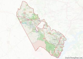
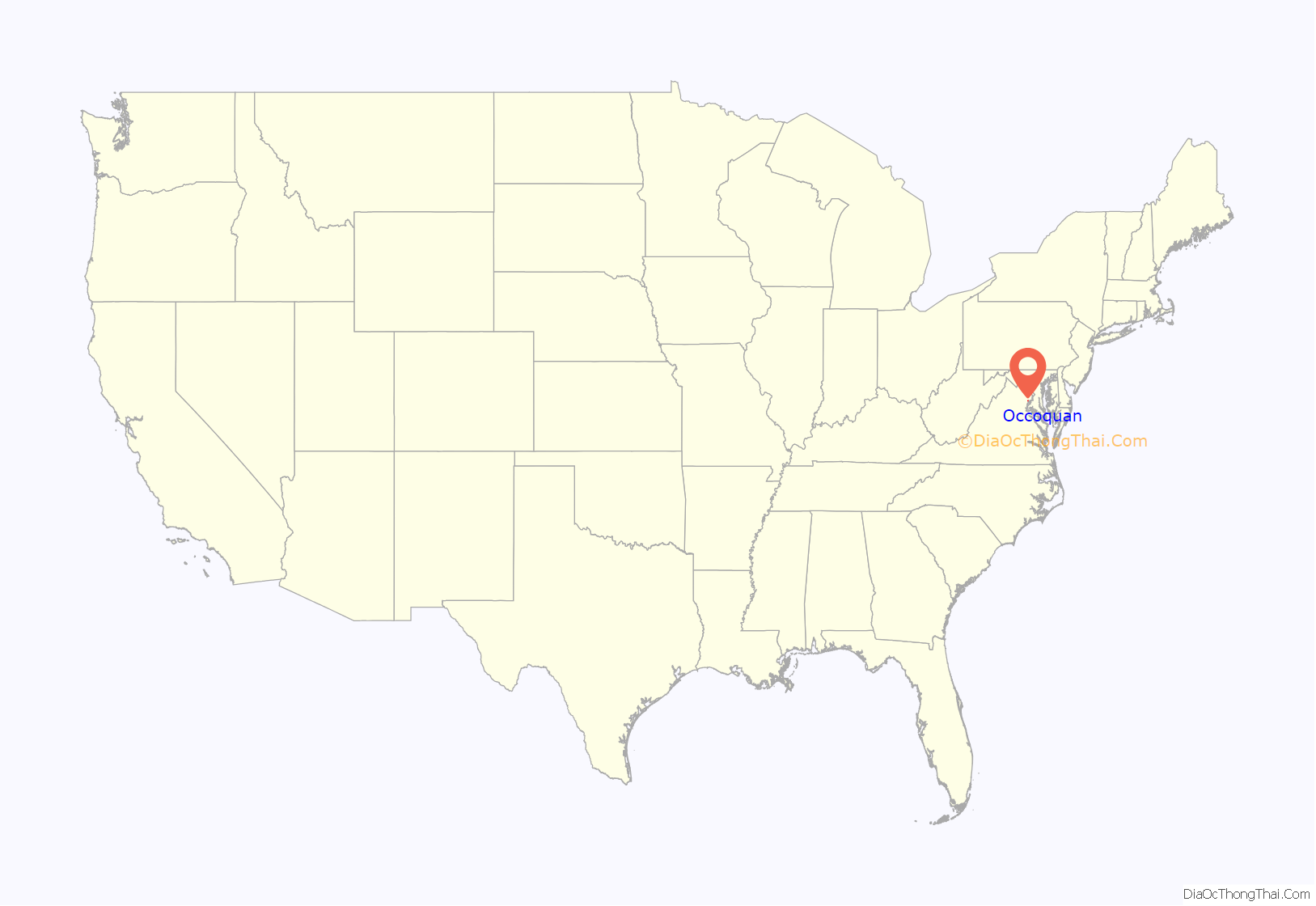
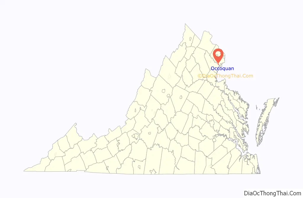
Occoquan location map. Where is Occoquan town?
History
Occoquan is derived from an Algonquian Doeg Indian word, meaning “at the end of the water”. Located on the Occoquan River, Occoquan was long a site of indigenous peoples’ habitation. Like the British colonists after them, they relied on the river for transportation and trade, as well as fish. Early in the 1600s Capt. John Smith sailed and explored the Occoquan River. In 1608, when the first European reached Northern Virginia, the Tauxenent tribe (also known by the English as the “Dogues”) had its main village at the mouth of the Occoquan River. This tribe was more closely associated with neighbors such as the Piscataways (located across the Potomac River in what is now Maryland) than the other Algonquian-speaking tribes to the south. The local chief was called a Tayac, who was subservient to an “emperor” located in Prince Georges County.
By 1765, Anglo-American colonists had established an industrial settlement at Occoquan, with grist mills and tobacco warehouses. The Merchant’s Mill was the first automated grist mill in the nation. It operated for 175 years until destroyed by fire.
During the Civil War, the post office passed letters and packages between North and South. River silting reduced ship traffic to Occoquan and ended its days as a port, as did the shift in traffic to railroads.
The town has survived and thrived. Today, it is a restored artists’ community, with shops, outdoor dining, ghost walks, a town boat dock and more. A number of structures in town, including many in the downtown commercial area, are part of the Occoquan Historic District listed on the National Register of Historic Places (NRHP). Rockledge, the former house of the town’s founder, is also listed as a significant structure on the NRHP.
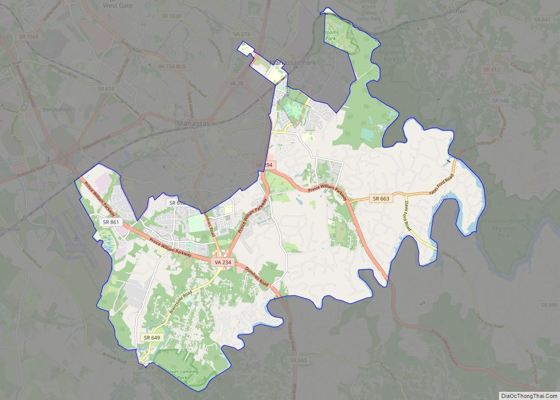
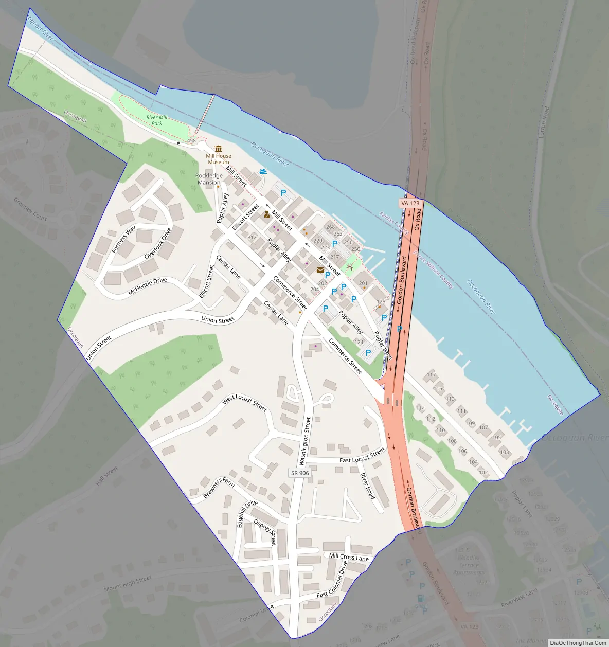
Occoquan Road Map
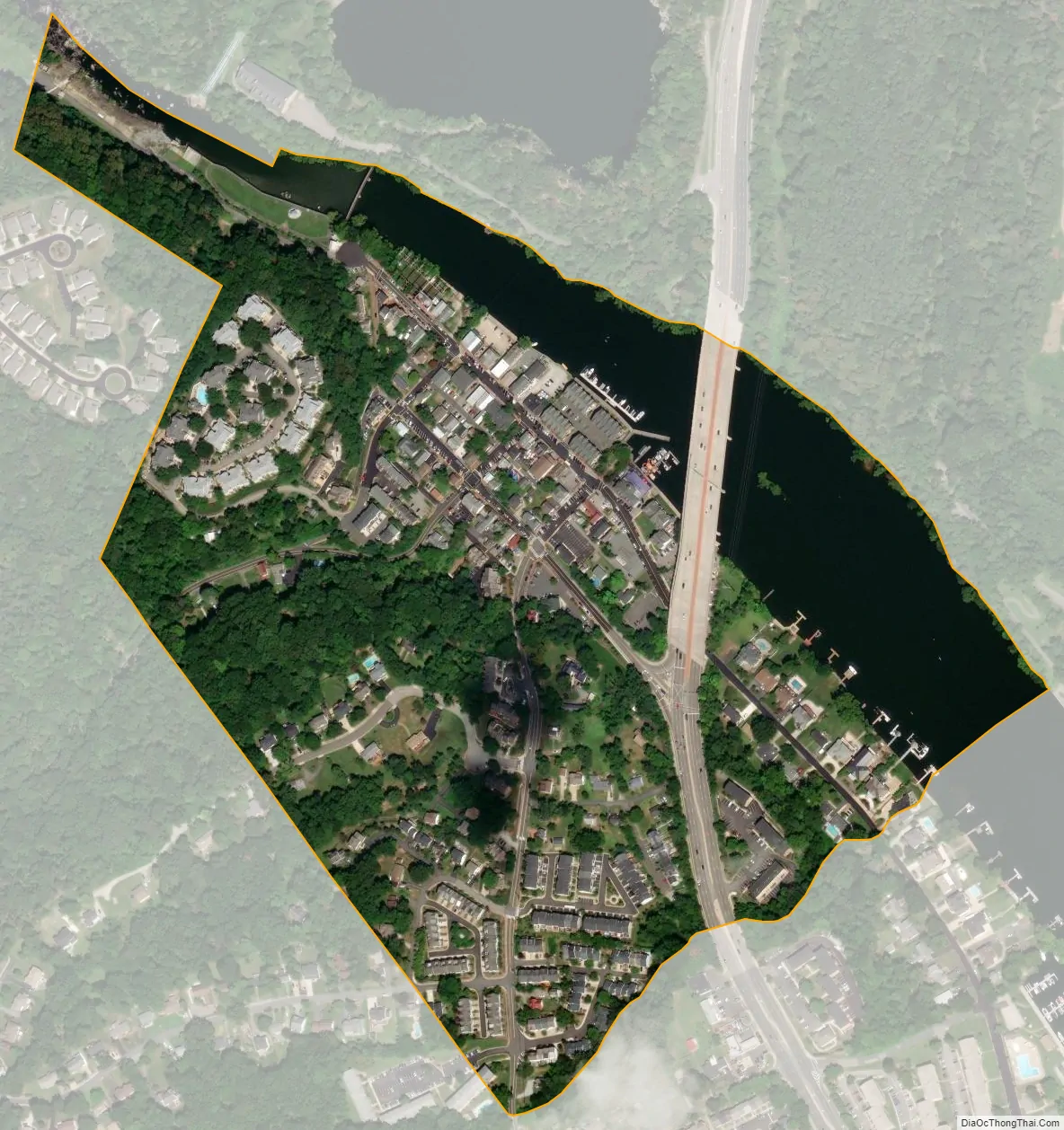
Occoquan city Satellite Map
Geography
Occoquan is located at 38°40′58″N 77°15′39″W / 38.68278°N 77.26083°W / 38.68278; -77.26083 (38.682916, −77.260830) on the north side of the peninsula known as Linton Neck.
According to the United States Census Bureau, the town has a total area of 0.2 square mile (0.5 km) of which, 0.2 square mile (0.4 km) is land and 0.04 square mile (0.1 km) (15.79%) is water.
Occoquan lies on the south bank of the Occoquan River at the Fall Line.
See also
Map of Virginia State and its subdivision:- Accomack
- Albemarle
- Alexandria
- Alleghany
- Amelia
- Amherst
- Appomattox
- Arlington
- Augusta
- Bath
- Bedford
- Bedford City
- Bland
- Botetourt
- Bristol
- Brunswick
- Buchanan
- Buckingham
- Buena Vista
- Campbell
- Caroline
- Carroll
- Charles City
- Charlotte
- Charlottesville
- Chesapeake
- Chesterfield
- Clarke
- Clifton Forge City
- Colonial Heights
- Covington
- Craig
- Culpeper
- Cumberland
- Danville
- Dickenson
- Dinwiddie
- Emporia
- Essex
- Fairfax
- Fairfax City
- Falls Church
- Fauquier
- Floyd
- Fluvanna
- Franklin
- Frederick
- Fredericksburg
- Galax
- Giles
- Gloucester
- Goochland
- Grayson
- Greene
- Greensville
- Halifax
- Hampton
- Hanover
- Harrisonburg
- Henrico
- Henry
- Highland
- Hopewell
- Isle of Wight
- James City
- King and Queen
- King George
- King William
- Lancaster
- Lee
- Lexington
- Loudoun
- Louisa
- Lunenburg
- Lynchburg
- Madison
- Manassas
- Manassas Park
- Martinsville
- Mathews
- Mecklenburg
- Middlesex
- Montgomery
- Nelson
- New Kent
- Newport News
- Norfolk
- Northampton
- Northumberland
- Norton
- Nottoway
- Orange
- Page
- Patrick
- Petersburg
- Pittsylvania
- Poquoson
- Portsmouth
- Powhatan
- Prince Edward
- Prince George
- Prince William
- Pulaski
- Radford
- Rappahannock
- Richmond
- Roanoke
- Roanoke City
- Rockbridge
- Rockingham
- Russell
- Salem
- Scott
- Shenandoah
- Smyth
- Southampton
- Spotsylvania
- Stafford
- Staunton
- Suffolk
- Surry
- Sussex
- Tazewell
- Virginia Beach
- Warren
- Washington
- Waynesboro
- Westmoreland
- Williamsburg
- Winchester
- Wise
- Wythe
- York
- Alabama
- Alaska
- Arizona
- Arkansas
- California
- Colorado
- Connecticut
- Delaware
- District of Columbia
- Florida
- Georgia
- Hawaii
- Idaho
- Illinois
- Indiana
- Iowa
- Kansas
- Kentucky
- Louisiana
- Maine
- Maryland
- Massachusetts
- Michigan
- Minnesota
- Mississippi
- Missouri
- Montana
- Nebraska
- Nevada
- New Hampshire
- New Jersey
- New Mexico
- New York
- North Carolina
- North Dakota
- Ohio
- Oklahoma
- Oregon
- Pennsylvania
- Rhode Island
- South Carolina
- South Dakota
- Tennessee
- Texas
- Utah
- Vermont
- Virginia
- Washington
- West Virginia
- Wisconsin
- Wyoming