Leavenworth (/ˈlɛvənˌwɜːrθ/) is the county seat and largest city of Leavenworth County, Kansas, United States and is part of the Kansas City metropolitan area. As of the 2020 census, the population of the city was 37,351. It is located on the west bank of the Missouri River. The site of Fort Leavenworth, built in 1827, the city became known in American history for its role as a key supply base in the settlement of the American West. During the American Civil War, many volunteers joined the Union Army from Leavenworth. The city has been notable as the location of several prisons, particularly the United States Disciplinary Barracks and United States Penitentiary, Leavenworth.
| Name: | Leavenworth city |
|---|---|
| LSAD Code: | 25 |
| LSAD Description: | city (suffix) |
| State: | Kansas |
| County: | Leavenworth County |
| Founded: | 1854 |
| Incorporated: | 1855 |
| Elevation: | 840 ft (260 m) |
| Total Area: | 24.31 sq mi (62.95 km²) |
| Land Area: | 24.24 sq mi (62.79 km²) |
| Water Area: | 0.06 sq mi (0.16 km²) |
| Total Population: | 37,351 |
| Population Density: | 1,500/sq mi (590/km²) |
| ZIP code: | 66043, 66048 |
| Area code: | 913 |
| FIPS code: | 2039000 |
| Website: | leavenworthks.org |
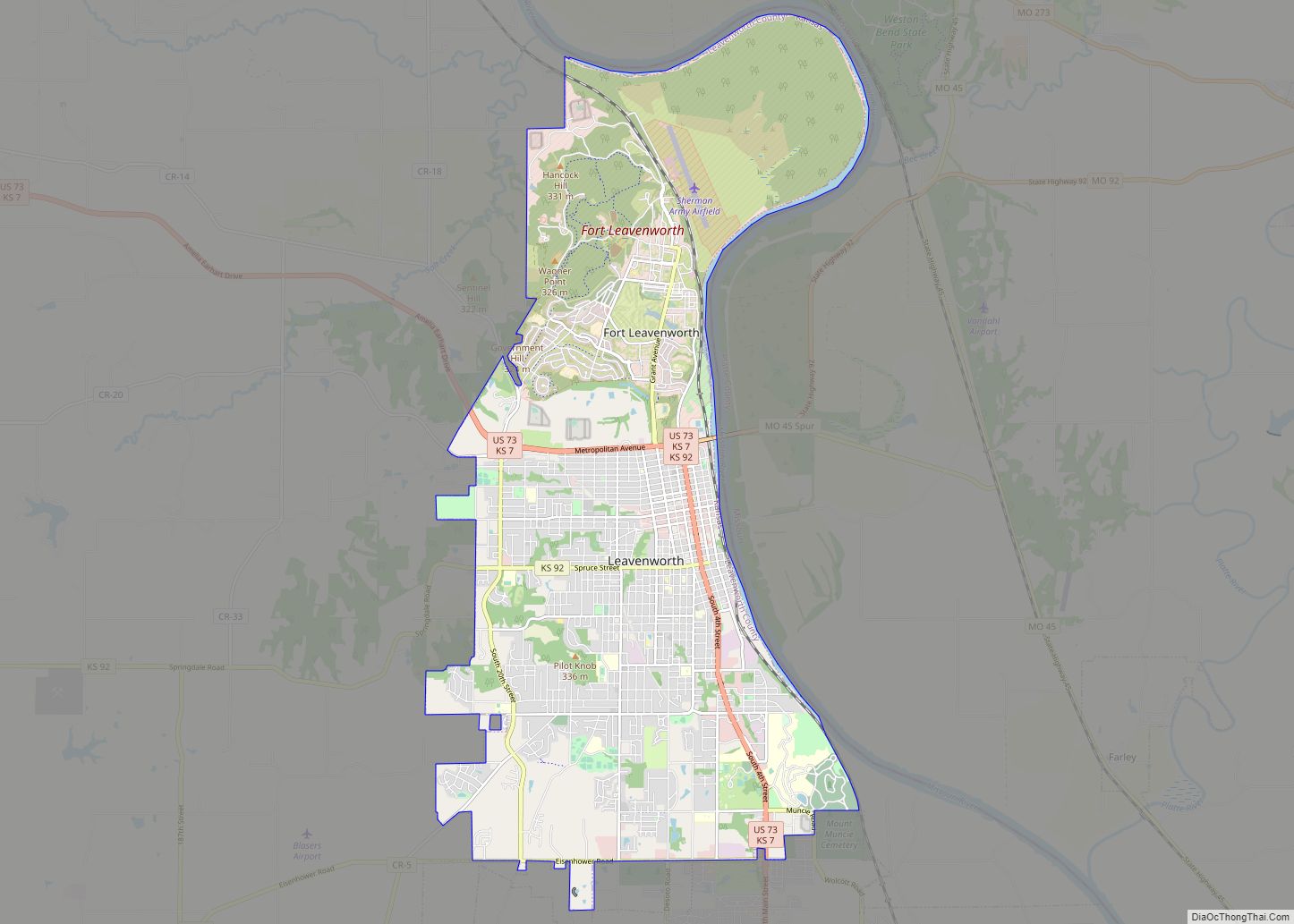
Online Interactive Map
Click on ![]() to view map in "full screen" mode.
to view map in "full screen" mode.
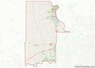
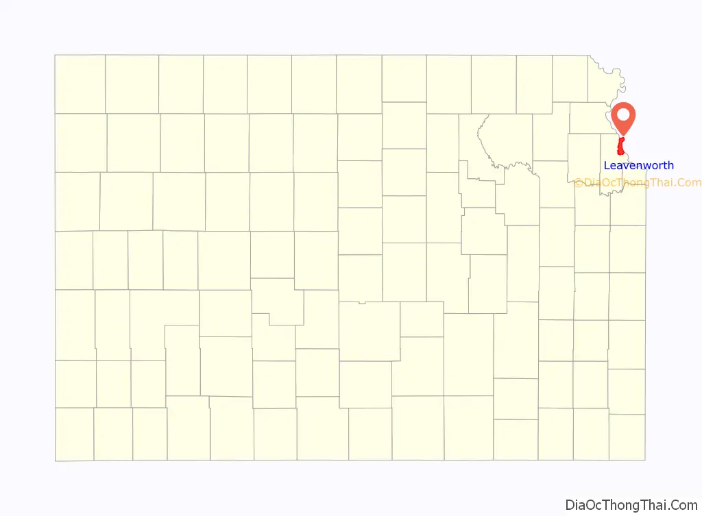
Leavenworth location map. Where is Leavenworth city?

History
Leavenworth, founded in 1854, was the first city incorporated in the territory of Kansas. The city developed south of Fort Leavenworth, which was established as Cantonment Leavenworth in 1827 by Colonel Henry Leavenworth. Its location on the Missouri River attracted refugee African-American slaves in the antebellum years, who were seeking freedom from the slave state of Missouri across the river. Abolition supporters helped them find refuge. In the years before the American Civil War, Leavenworth was a hotbed of anti-slavery and pro-slavery agitation, often leading to open physical confrontations on the street and in public meetings.
On April 3, 1858, the “Leavenworth Constitution” for the state of Kansas was adopted here. Although the federal government never approved this early version of the state constitution, it was considered one of the most radical of the four constitutions drafted for the new territory because it recognized freed blacks as citizens.
Refugee African Americans continued to settle in the city during the war. By 1865 it had attracted nearly one-fifth of the 12,000 blacks in the state. In 1866, the 10th Regiment of Cavalry, an all-black unit within the U.S. Army, was stood up at Fort Leavenworth. Charles Henry Langston was an African-American leader from Boston who worked and lived in Leavenworth and northeast Kansas in the Reconstruction era and afterward. In Kansas, Langston worked for black suffrage and the right of African Americans to sit on juries, testify in court, and have their children educated in common schools. African Americans gained suffrage in 1870 after passage of the federal 15th constitutional amendment, and the legislature voted for their right to sit on juries in 1874.
African Americans continued to migrate to the state of Kansas after the war. There were a total of 17,108 African Americans in Kansas in 1870, with 43,107 in 1880, and 52,003 by 1900. Most lived in urban areas.
20th century to present
Fred Alexander, a 22-year-old black veteran of the Spanish–American War, was arrested on circumstantial evidence following months of assaults on young white women in late 1900. Witnesses had identified a “large white man” and a “slight black man” as having been seen in the vicinity of the attacks, Police moved him to the penitentiary during questioning, but a lynch mob was forming in Leavenworth. The sheriff needed to bring him to Leavenworth for arraignment at the county court. He refused the governor’s offer of state militia, and was unable to protect the prisoner. On January 15, 1901, Alexander was taken from jail by a mob of 5,000 people and to the site of the murder of Pearl Forbes, where he was brutally lynched: burned alive. He protested his innocence to the end. An inquest concluded he had been killed by “persons unknown”.
His family refused to claim his body for burial. His father Alfred Alexander, an exoduster, said “The people have mutilated him, now let them bury him.” The city arranged burial. African Americans in the region were horrified at Alexander’s murder by the mob and created the first state chapter of the Afro-American Council, then the only national organization working for civil rights. (The National Association for the Advancement of Colored People (NAACP) was founded a few years later, and absorbed most members of the AAC.)
In 1972 Benjamin Day became the city’s first African-American mayor. Day had been elected to the City Commission one year earlier. Leavenworth appoints its mayor from among the members of the Commission, and Day was named mayor in 1971. Day was a former educator and principal in Leavenworth.
Fort Leavenworth was located outside the city limits until its territory was annexed by the city on April 12, 1977.
In 2008, an underground series of “vaults” was found in the city, apparently built during the late 19th century.
Leavenworth Road Map

Leavenworth city Satellite Map

Geography
Leavenworth is located at 39°18′40″N 94°55′21″W / 39.31111°N 94.92250°W / 39.31111; -94.92250 (39.3111112, −94.9224637) at an elevation of 840 feet (256 m). Located in northeastern Kansas at the junction of U.S. Route 73 and Kansas Highway 92 (K-92), Leavenworth is 25 mi (40 km) northwest of downtown Kansas City, 145 mi (233 km) south-southeast of Omaha, and 165 mi (266 km) northeast of Wichita.
The city lies on the west bank of the Missouri River in the Dissected Till Plains region of North America’s Central Lowlands. Four small tributaries of the river flow generally east through the city. From north to south, these are Quarry Creek, Corral Creek, Three Mile Creek, and Five Mile Creek.
According to the United States Census Bureau, the city has a total area of 24.06 square miles (62.32 km), of which, 24.04 square miles (62.26 km) is land and 0.02 square miles (0.05 km) is water. Fort Leavenworth occupies the northern half of the city’s area.
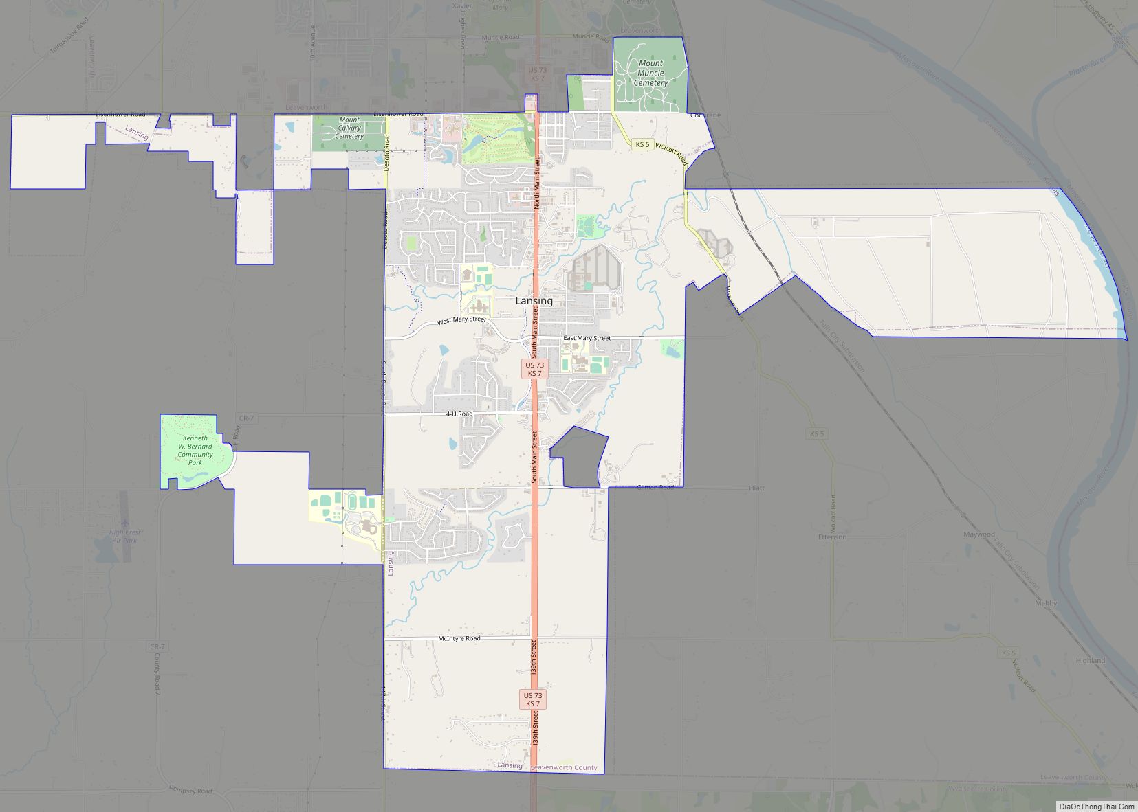
Leavenworth, along with the rest of Leavenworth County, lies within the Kansas City metropolitan area. Lansing, Kansas, is located to the south.
Climate
Leavenworth experiences a humid continental climate (Köppen Dfa), with hot, humid summers and cold, drier winters. On average, January is the coldest month, July is the hottest month, and June is the wettest month.
The average temperature in Leavenworth is 55.2 °F or 12.9 °C. Over the course of a year, temperatures range from an average low of 19 °F or −7.2 °C in January to an average high of 90 °F or 32.2 °C in July. The high temperature reaches or exceeds 90 °F or 32.2 °C an average of 43 afternoons per year and reaches or exceeds 100 °F or 37.8 °C an average of four afternoons per year. The minimum temperature falls below the freezing point of 32 °F or 0 °C an average of 107 mornings per year. The hottest temperature recorded in Leavenworth was 110 °F (43.3 °C) in 1954; the coldest temperature recorded was −27 °F (−32.8 °C) in 1989.
In an average year, Leavenworth experiences 89.7 days with measurable precipitation and receives 42.97 inches or 1,091.4 millimetres of precipitation. Typically, the first fall freeze occurs by the third week of October, and the last spring freeze occurs by the second week of April. Annual snowfall averages 16.1 inches or 0.41 metres. Measurable snowfall occurs an average of eight days per year with at least an inch of snow being received on five of those days. Snow depth of at least an inch occurs an average of 15 days a year. Severe thunderstorms sometimes occur, particularly during the spring months. These produce strong winds and, sometimes, large hail. These storms also bring the risk of tornadoes.
See also
Map of Kansas State and its subdivision:- Allen
- Anderson
- Atchison
- Barber
- Barton
- Bourbon
- Brown
- Butler
- Chase
- Chautauqua
- Cherokee
- Cheyenne
- Clark
- Clay
- Cloud
- Coffey
- Comanche
- Cowley
- Crawford
- Decatur
- Dickinson
- Doniphan
- Douglas
- Edwards
- Elk
- Ellis
- Ellsworth
- Finney
- Ford
- Franklin
- Geary
- Gove
- Graham
- Grant
- Gray
- Greeley
- Greenwood
- Hamilton
- Harper
- Harvey
- Haskell
- Hodgeman
- Jackson
- Jefferson
- Jewell
- Johnson
- Kearny
- Kingman
- Kiowa
- Labette
- Lane
- Leavenworth
- Lincoln
- Linn
- Logan
- Lyon
- Marion
- Marshall
- McPherson
- Meade
- Miami
- Mitchell
- Montgomery
- Morris
- Morton
- Nemaha
- Neosho
- Ness
- Norton
- Osage
- Osborne
- Ottawa
- Pawnee
- Phillips
- Pottawatomie
- Pratt
- Rawlins
- Reno
- Republic
- Rice
- Riley
- Rooks
- Rush
- Russell
- Saline
- Scott
- Sedgwick
- Seward
- Shawnee
- Sheridan
- Sherman
- Smith
- Stafford
- Stanton
- Stevens
- Sumner
- Thomas
- Trego
- Wabaunsee
- Wallace
- Washington
- Wichita
- Wilson
- Woodson
- Wyandotte
- Alabama
- Alaska
- Arizona
- Arkansas
- California
- Colorado
- Connecticut
- Delaware
- District of Columbia
- Florida
- Georgia
- Hawaii
- Idaho
- Illinois
- Indiana
- Iowa
- Kansas
- Kentucky
- Louisiana
- Maine
- Maryland
- Massachusetts
- Michigan
- Minnesota
- Mississippi
- Missouri
- Montana
- Nebraska
- Nevada
- New Hampshire
- New Jersey
- New Mexico
- New York
- North Carolina
- North Dakota
- Ohio
- Oklahoma
- Oregon
- Pennsylvania
- Rhode Island
- South Carolina
- South Dakota
- Tennessee
- Texas
- Utah
- Vermont
- Virginia
- Washington
- West Virginia
- Wisconsin
- Wyoming