Doniphan County (county code DP) is a county located in the U.S. state of Kansas. As of the 2020 census, the county population was 7,510. Its county seat is Troy, and its most populous city is Wathena.
| Name: | Doniphan County |
|---|---|
| FIPS code: | 20-043 |
| State: | Kansas |
| Founded: | August 25, 1855 |
| Named for: | Alexander William Doniphan |
| Seat: | Troy |
| Largest city: | Wathena |
| Total Area: | 398 sq mi (1,030 km²) |
| Land Area: | 393 sq mi (1,020 km²) |
| Total Population: | 7,510 |
| Population Density: | 19.1/sq mi (7.4/km²) |
| Time zone: | UTC−6 (Central) |
| Summer Time Zone (DST): | UTC−5 (CDT) |
| Website: | DpCountyKS.com |
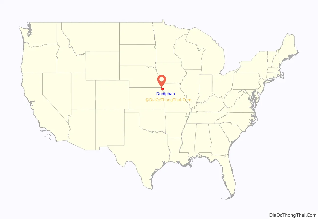
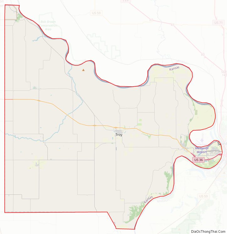
Doniphan County location map. Where is Doniphan County?
History
Early history
For many millennia, the Great Plains of North America was inhabited by nomadic Native Americans. From the 16th century to 18th century, the Kingdom of France claimed ownership of large parts of North America. In 1762, after the French and Indian War, France secretly ceded New France to Spain, per the Treaty of Fontainebleau.
19th century
In 1802, Spain returned most of the land to France, but keeping title to about 7,500 square miles. In 1803, most of the land for modern day Kansas was acquired by the United States from France as part of the 828,000 square mile Louisiana Purchase for 2.83 cents per acre.
In 1854, the Kansas Territory was organized, then in 1861 Kansas became the 34th U.S. state. Doniphan County was established on August 25, 1855, then organized on September 18, 1855. It is named for the U.S. cavalry commander Colonel Alexander W. Doniphan (1808–1887) of Liberty, Missouri, who played an important part in the Mexican–American War. He was a zealous partisan in the failed effort made to extend slavery into Kansas.
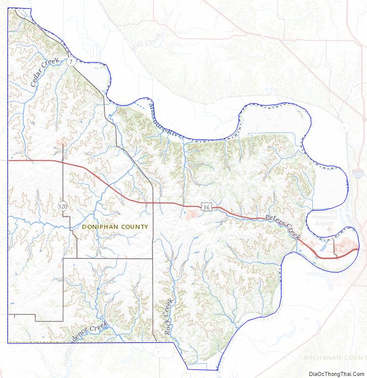
Doniphan County Road Map

Geography
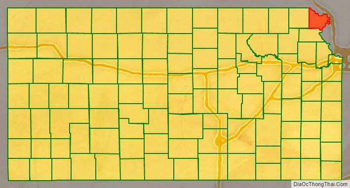
Doniphan County is located in the northeastern corner of the state—it is bordered by Nebraska to the north and Missouri to the east. According to the U.S. Census Bureau, the county has a total area of 398 square miles (1,030 km), of which 393 square miles (1,020 km) is land and 4.9 square miles (13 km) (1.2%) is water. It is the third-smallest county in Kansas by land area and second-smallest by total area.
Geographic features
The Missouri River defines the border in the north and east. Eight barge lines travel the river, and a Port Authority is located across the river in Saint Joseph, Missouri. The river provides much of the water for the eastern part of the county. Interior cities, such as Troy and Highland, receive their water from underground wells. The Wolf River flows through western portions of the county and north into the Missouri River.
Major highways
The only major highway serving the county is U.S. Highway 36, an east–west route traveling through St. Joseph. Troy, Elwood, and Wathena lie along this route. Kansas state highways K-7, K-20, K-120, K-136, K-137, and K-238 serve other areas of the county. K-7 has been designated a scenic byway. (See the map below.)
Adjacent counties
- Holt County, Missouri (north)
- Andrew County, Missouri (northeast)
- Buchanan County, Missouri (southeast)
- Atchison County (southwest)
- Brown County (west)
- Richardson County, Nebraska (northwest)
Doniphan County Topographic Map
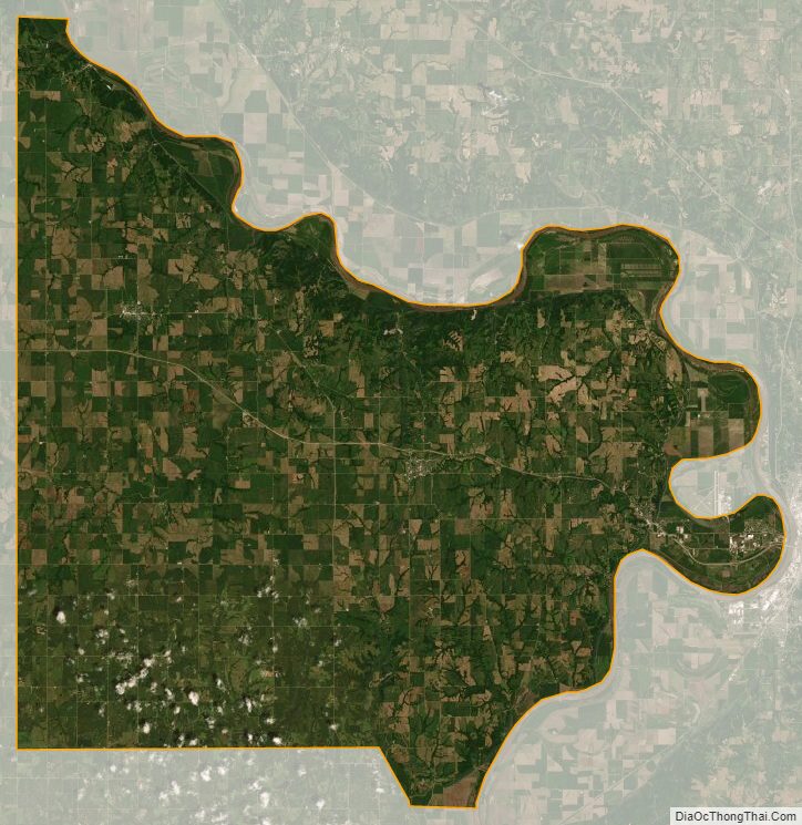
Doniphan County Satellite Map
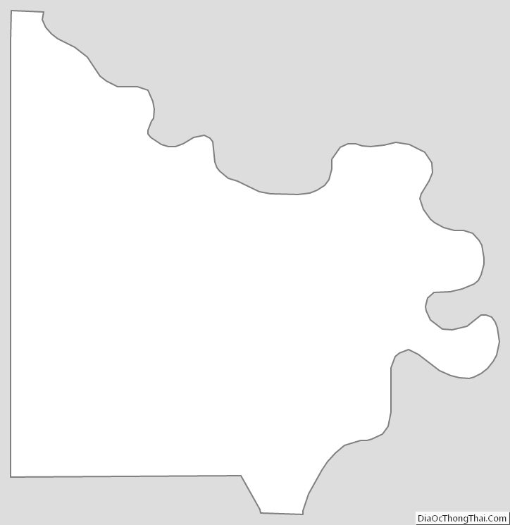
Doniphan County Outline Map