Highland is a city in Doniphan County, Kansas, United States. As of the 2020 census, the population of the city was 903. It is home to Highland Community College.
| Name: | Highland city |
|---|---|
| LSAD Code: | 25 |
| LSAD Description: | city (suffix) |
| State: | Kansas |
| County: | Doniphan County |
| Founded: | 1854 |
| Incorporated: | 1857 |
| Elevation: | 1,050 ft (320 m) |
| Total Area: | 0.53 sq mi (1.36 km²) |
| Land Area: | 0.53 sq mi (1.36 km²) |
| Water Area: | 0.00 sq mi (0.00 km²) |
| Total Population: | 903 |
| Population Density: | 1,700/sq mi (660/km²) |
| ZIP code: | 66035 |
| Area code: | 785 |
| FIPS code: | 2031850 |
| Website: | highlandks.com |
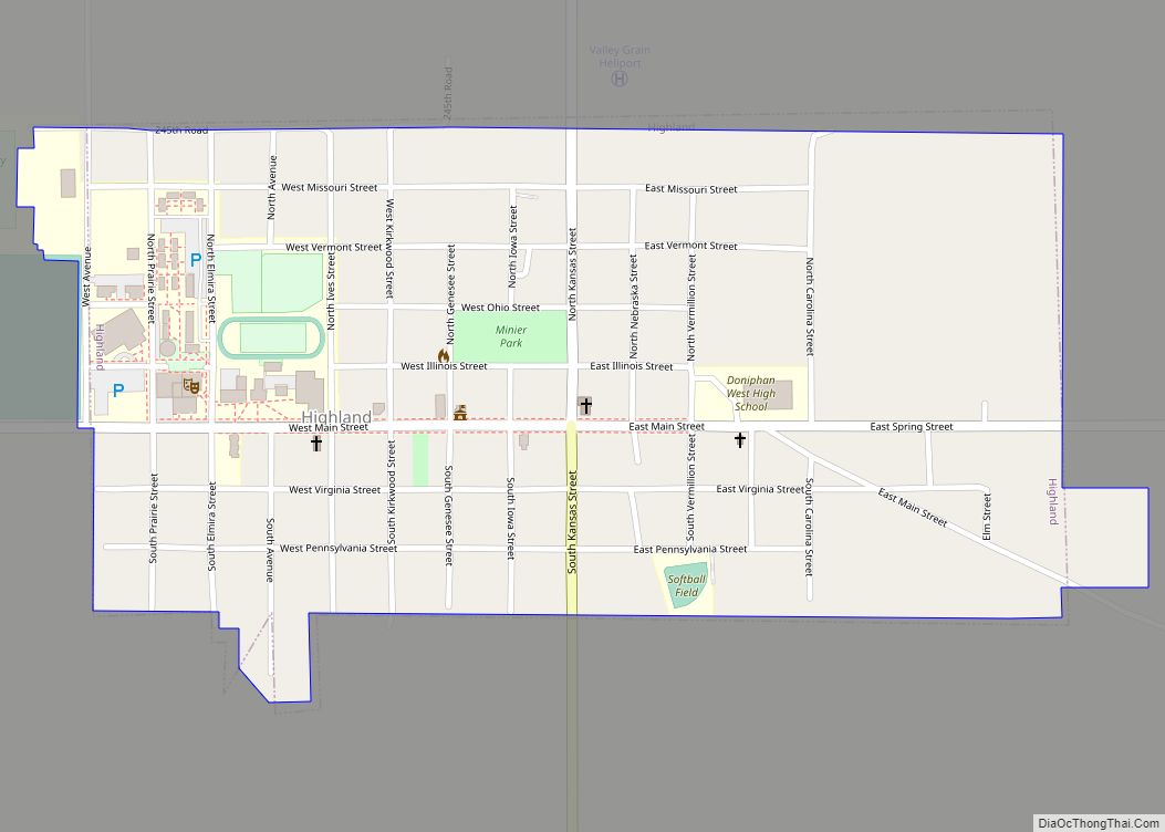
Online Interactive Map
Click on ![]() to view map in "full screen" mode.
to view map in "full screen" mode.
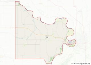
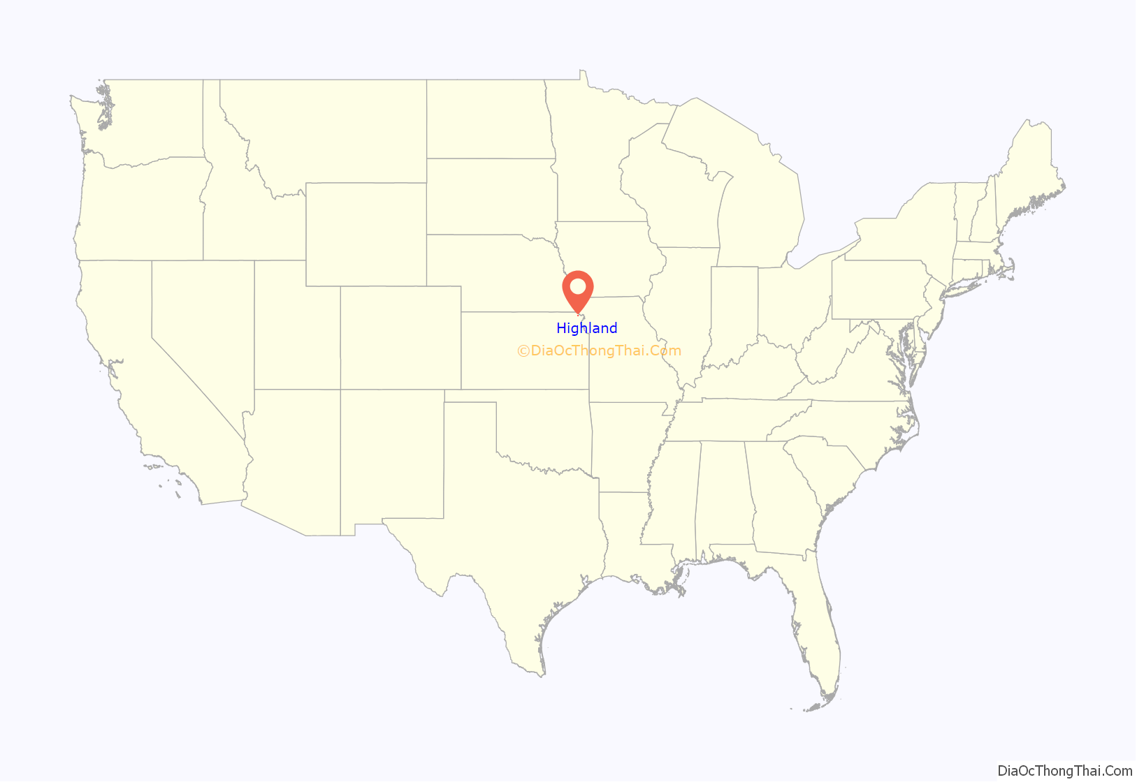
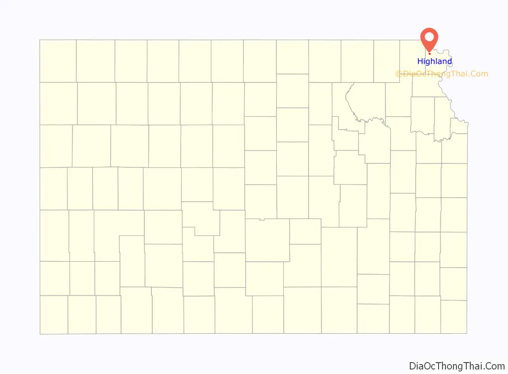
Highland location map. Where is Highland city?
History
Short summary
The Highland Township was started with the founding of the Iowa and Sac & Fox Mission State Historic Site by Reverend Samuel Irvin and Reverend William Hamilton in 1837. The mission was sponsored and funded by the Presbyterians. The Founders plan behind the town was to make it an educational town and in 1857 when the town was laid out a spot was chosen for the future university. Samuel Irvin established the first Highland Community College Building Irvin Hall with the building being built in 1858. The college was chartered and founded in 1858 and has gone through eight name changes over the course of its history.
In 2011 Highland became the self proclaimed Snowflake City of Kansas
Early history
Reverend Samuel Irvin and Reverend William Hamilton found the Ioway Presbtaryian Church in 1843 with Rev. Hamilton acting as Minister. The church was moved from the Mission to Highland in 1860. John Powers Johnson builds a log home 2 miles west of the mission in 1854 due to land unavailability along the Missouri River. The Cabin was the first Building in Highland sitting on the site of the current Senior Citizen Center. Johnson left Kansas for two years as he didn’t have to live in the home he only had to make improvements to the land in order to purchase it under the Preemption Act of 1841 he however could not purchase the land until after the Iowa tribe members had been removed and the land had been surveyed. John Bayless preempted the land just west of Johnson and founded the Susquehanna western Immigration Company to promote anti-slavery people moving to Kansas. Samuel Irvin looked over the claims till the land could properly be purchased in 1857.
The Highland Town Company
On May 16, 1857, the Highland Town Company was formed buying town lots to resell to what they had hoped to be a bustling town. Bayless was the Company’s president with Johnson acting as Secretary and Irvin as the treasurer. The town company had built some amenities such as a large hotel despite slow growth. The town struggled to gain population but despite its small size the town had a newspaper called The Highlander and the first bank arrived by 1862 being opened by Johnson. These three founding fathers hoped that Highland would become not only an educational center but also a religious center for Kansas and surrounding territories. In November of 1857 the Highland Presbytery was organized as part of the Missouri Synod and eventually came to encompass all 21 old school presbyteries in the Kansas and Nebraska territories.
Highland University
At the first meeting of the presbytery, it was decided by the members that a Presbyterian academy would be established in highland. On December 26, 1857, the board had decided that the academy which could be compared to a private high school was not sufficient and voted to established Highland University instead with James Cambell as president and Samuel Irvin as Secretary. The board of trustees prepared a charter that was taken to Lecompton the Territorial capital of Kansas and was passed and signed by Governor Denver on February 9, 1858. Highland Town Company then reserved 4 blocks on the west side of town for the University. Elementary classes were held at the college until a Grade school was opened in the mid 1870s.
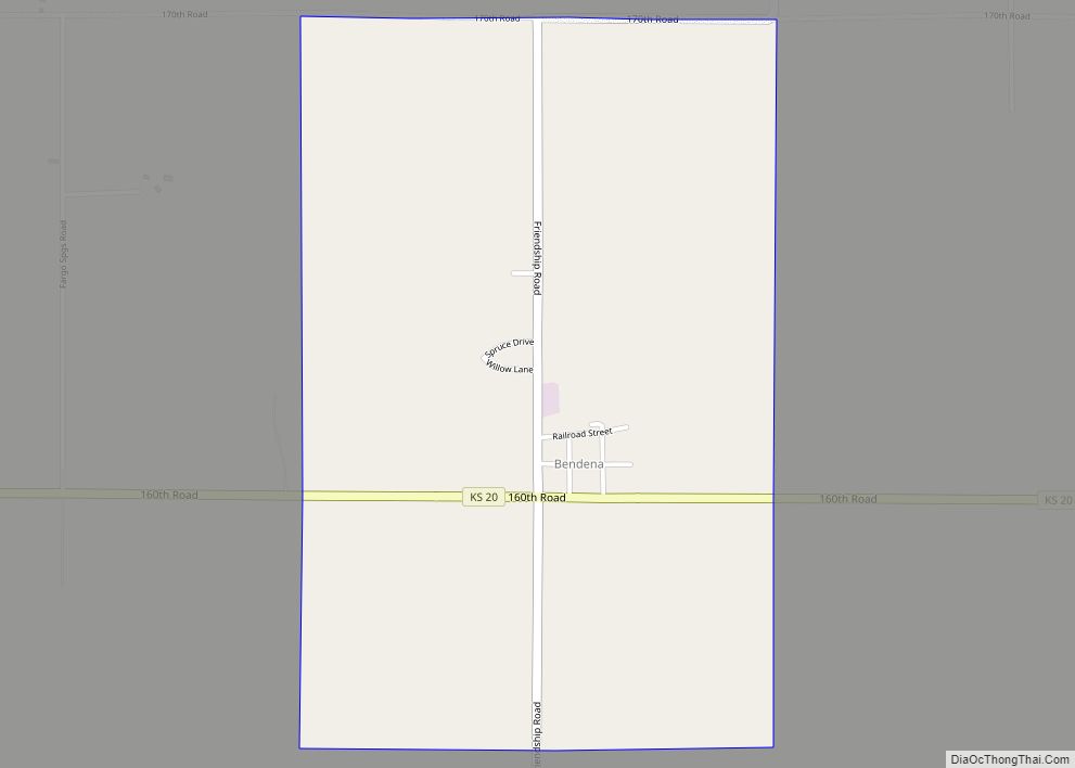
Highland Road Map
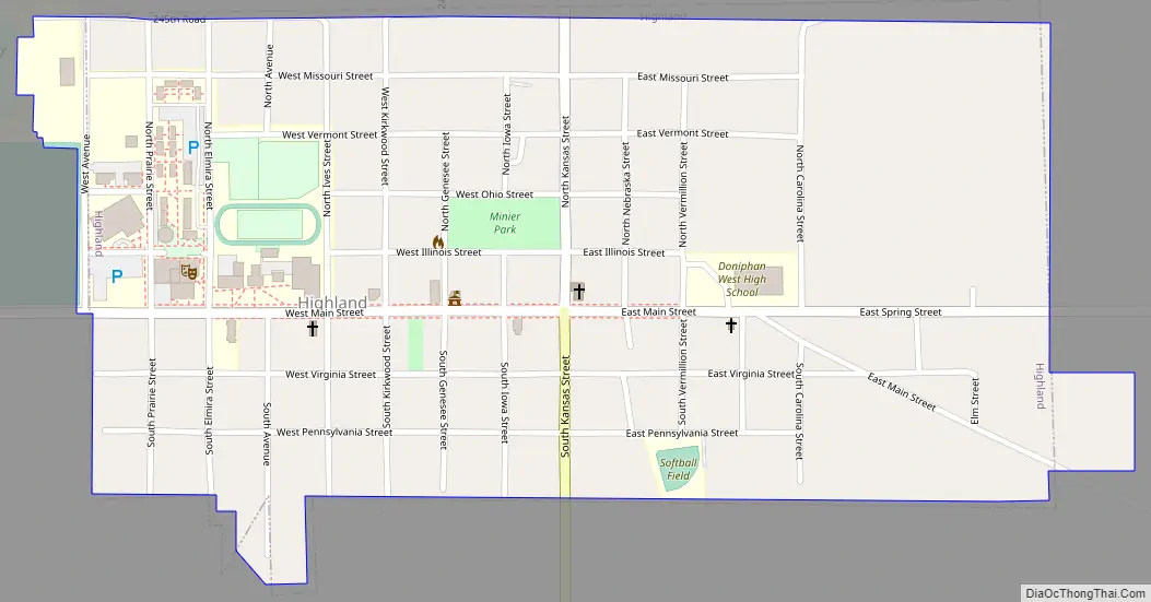
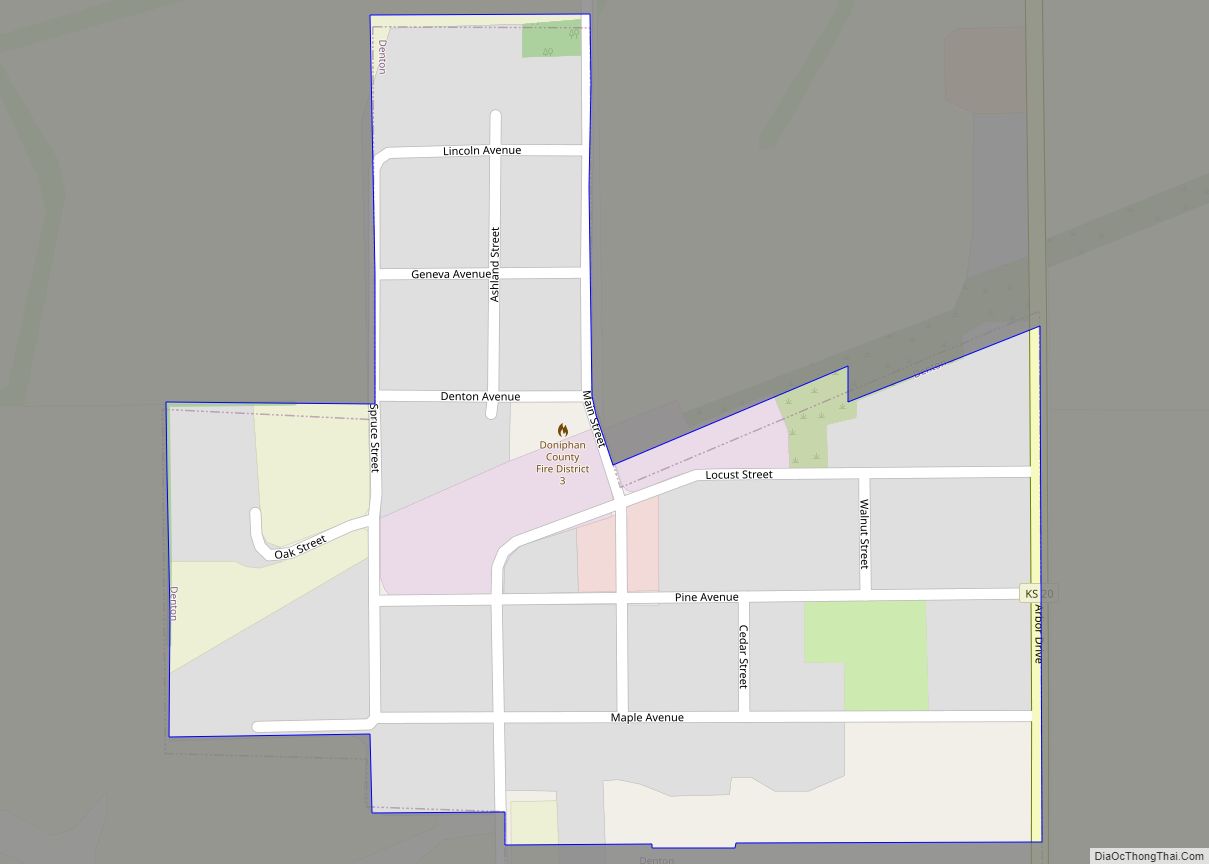
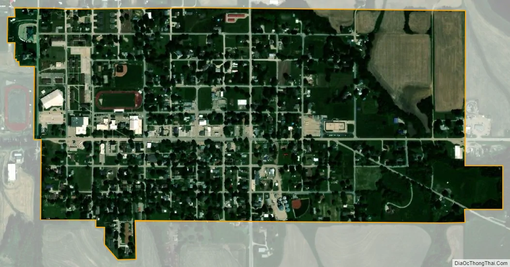
Highland city Satellite Map
Geography
Highland is located at 39°51′36″N 95°16′1″W / 39.86000°N 95.26694°W / 39.86000; -95.26694 (39.860042, -95.266816). According to the United States Census Bureau, the city has a total area of 0.53 square miles (1.37 km), all land.
See also
Map of Kansas State and its subdivision:- Allen
- Anderson
- Atchison
- Barber
- Barton
- Bourbon
- Brown
- Butler
- Chase
- Chautauqua
- Cherokee
- Cheyenne
- Clark
- Clay
- Cloud
- Coffey
- Comanche
- Cowley
- Crawford
- Decatur
- Dickinson
- Doniphan
- Douglas
- Edwards
- Elk
- Ellis
- Ellsworth
- Finney
- Ford
- Franklin
- Geary
- Gove
- Graham
- Grant
- Gray
- Greeley
- Greenwood
- Hamilton
- Harper
- Harvey
- Haskell
- Hodgeman
- Jackson
- Jefferson
- Jewell
- Johnson
- Kearny
- Kingman
- Kiowa
- Labette
- Lane
- Leavenworth
- Lincoln
- Linn
- Logan
- Lyon
- Marion
- Marshall
- McPherson
- Meade
- Miami
- Mitchell
- Montgomery
- Morris
- Morton
- Nemaha
- Neosho
- Ness
- Norton
- Osage
- Osborne
- Ottawa
- Pawnee
- Phillips
- Pottawatomie
- Pratt
- Rawlins
- Reno
- Republic
- Rice
- Riley
- Rooks
- Rush
- Russell
- Saline
- Scott
- Sedgwick
- Seward
- Shawnee
- Sheridan
- Sherman
- Smith
- Stafford
- Stanton
- Stevens
- Sumner
- Thomas
- Trego
- Wabaunsee
- Wallace
- Washington
- Wichita
- Wilson
- Woodson
- Wyandotte
- Alabama
- Alaska
- Arizona
- Arkansas
- California
- Colorado
- Connecticut
- Delaware
- District of Columbia
- Florida
- Georgia
- Hawaii
- Idaho
- Illinois
- Indiana
- Iowa
- Kansas
- Kentucky
- Louisiana
- Maine
- Maryland
- Massachusetts
- Michigan
- Minnesota
- Mississippi
- Missouri
- Montana
- Nebraska
- Nevada
- New Hampshire
- New Jersey
- New Mexico
- New York
- North Carolina
- North Dakota
- Ohio
- Oklahoma
- Oregon
- Pennsylvania
- Rhode Island
- South Carolina
- South Dakota
- Tennessee
- Texas
- Utah
- Vermont
- Virginia
- Washington
- West Virginia
- Wisconsin
- Wyoming