Fresno County (/ˈfrɛznoʊ/ (listen)), officially the County of Fresno, is a county located in the central portion of the U.S. state of California. As of the 2020 Census, the population was 1,008,654. The county seat is Fresno, the fifth-most populous city in California.
Fresno County comprises the Fresno, CA Metropolitan Statistical Area, which is part of the Fresno-Madera, CA Combined Statistical Area. It is located in the Central Valley, south of Stockton and north of Bakersfield. Since 2010, statewide droughts in California have further strained both Fresno County’s and the entire Central Valley’s water security.
| Name: | Fresno County |
|---|---|
| FIPS code: | 06-019 |
| State: | California |
| Founded: | 1856 |
| Named for: | The city of Fresno (Spanish for “ash tree”) |
| Seat: | Fresno |
| Largest city: | Fresno |
| Total Area: | 6,011 sq mi (15,570 km²) |
| Land Area: | 5,958 sq mi (15,430 km²) |
| Total Population: | 1,008,654 |
| Population Density: | 170/sq mi (65/km²) |
| Time zone: | UTC−8 (Pacific) |
| Summer Time Zone (DST): | UTC−7 (Pacific Daylight Time) |
| Website: | www.co.fresno.ca.us |
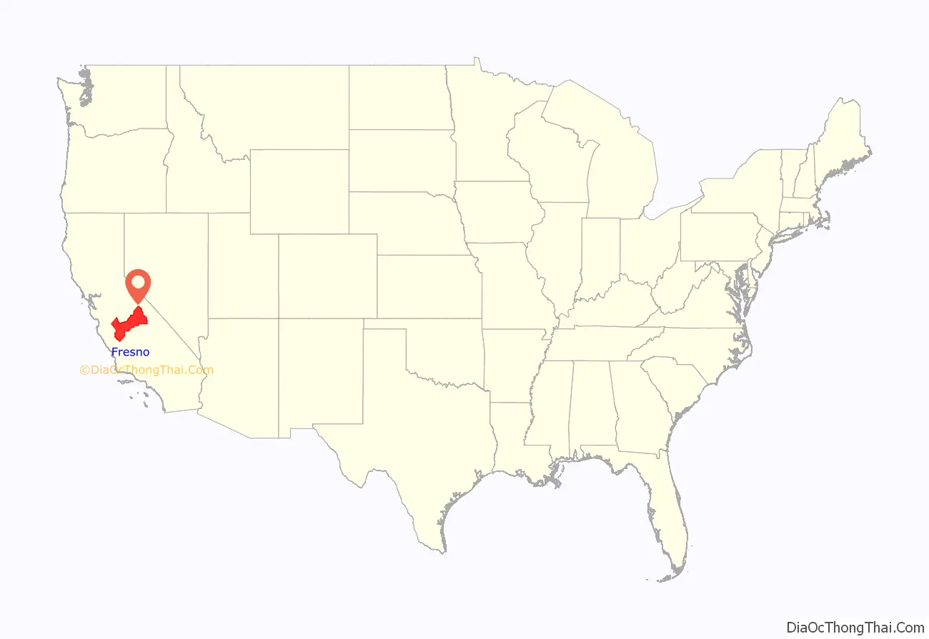
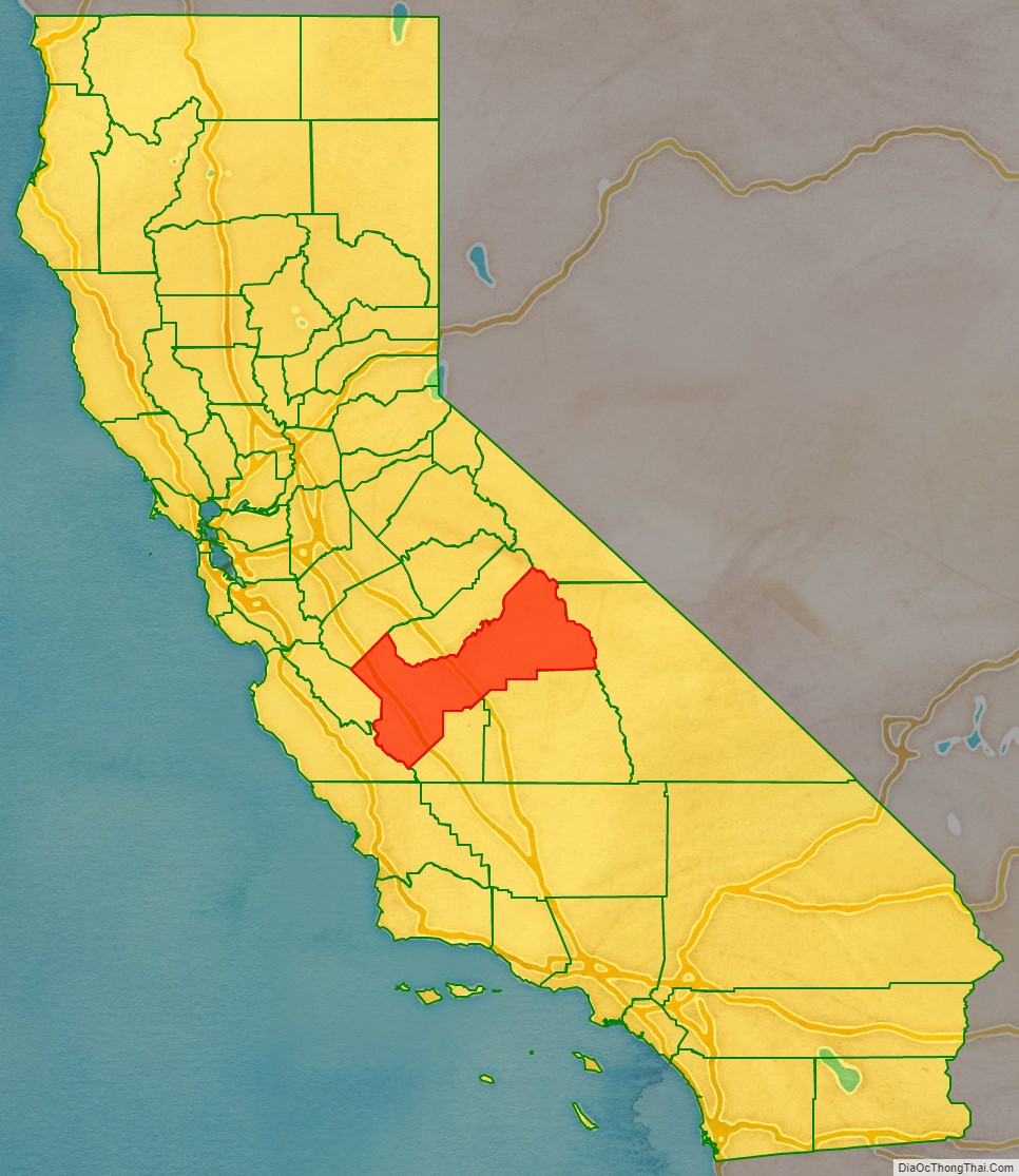
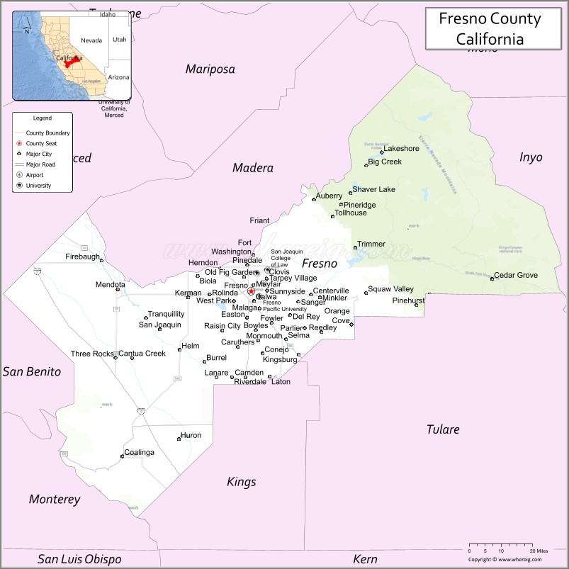
Fresno County location map. Where is Fresno County?
History
The area now known as Fresno County was the traditional homeland of Yokuts and Mono peoples, and was later settled by Spaniards during a search for suitable mission sites. In 1846, this area became part of the United States as a result of the Mexican War.
Fresno County was formed in 1856 from parts of Mariposa, Merced and Tulare counties. Fresno is Spanish for “ash tree” and it was in recognition of the abundance of the shrubby local Ash, Fraxinus dipetala, growing along the San Joaquin River that it received its name. Parts of Fresno County’s territory were given to Mono County in 1861 and to Madera County in 1893. The original county seat was along the San Joaquin River in Millerton, but was moved to the rapidly growing town of Fresno on the newly built Southern Pacific Railroad line after a flood destroyed much of the town.
The settling of Fresno County was not without its conflicts, land disputes, and other natural disasters. Floods caused immeasurable damage elsewhere and fires also plagued the settlers of Fresno County. In 1882, the greatest of the early day fires wiped out an entire block of the city of Fresno, and was followed by another devastating blaze in 1883.
At the same time residents brought irrigation, electricity, and extensive agriculture to the area. In 1865, William Helm brought his sheep to Fresno county, which was then a vast space of open land. Helm was the largest individual sheep grower in Fresno County. Moses Church developed the first canals, called “Church Ditches,” for irrigation. These canals allowed extensive cultivation of wheat. Francis Eisen, leader of the wine industry in Fresno County, also began the raisin industry in 1875, when he accidentally let some of his grapes dry on the vine. Anthony Easterby and Clovis Cole developed extensive grain and cattle ranches. These and other citizens laid the groundwork for the cultivation of Fresno County – now one of the nation’s leading agricultural regions. In more recent times cotton became a major crop in Fresno and the southern San Joaquin Valley, but recent drought and lower demand have lessened cotton’s importance to the local economy.
The discovery of oil in the western part of the county, near the town of Coalinga at the foot of the Coast Ranges, brought about an economic boom in the 1900s (decade), even though the field itself was known at least as early as the 1860s. By 1910, Coalinga Oil Field, the largest field in Fresno County, was the most richly productive oil field in California; a dramatic oil gusher in 1909, the biggest in California up until that time, was an event of sufficient excitement to cause the Los Angeles Stock Exchange to close for a day so that its members could come by train to view it. The Coalinga field continues to produce oil, and is currently the eighth-largest field in the state.
More than thirty structures in Fresno County are on the National Register of Historic Places, including the Fresno Water Tower, which once held over 250,000 US gallons (950 m) of water for the city of Fresno, the Meux Home, and Kearney Mansion Museum.
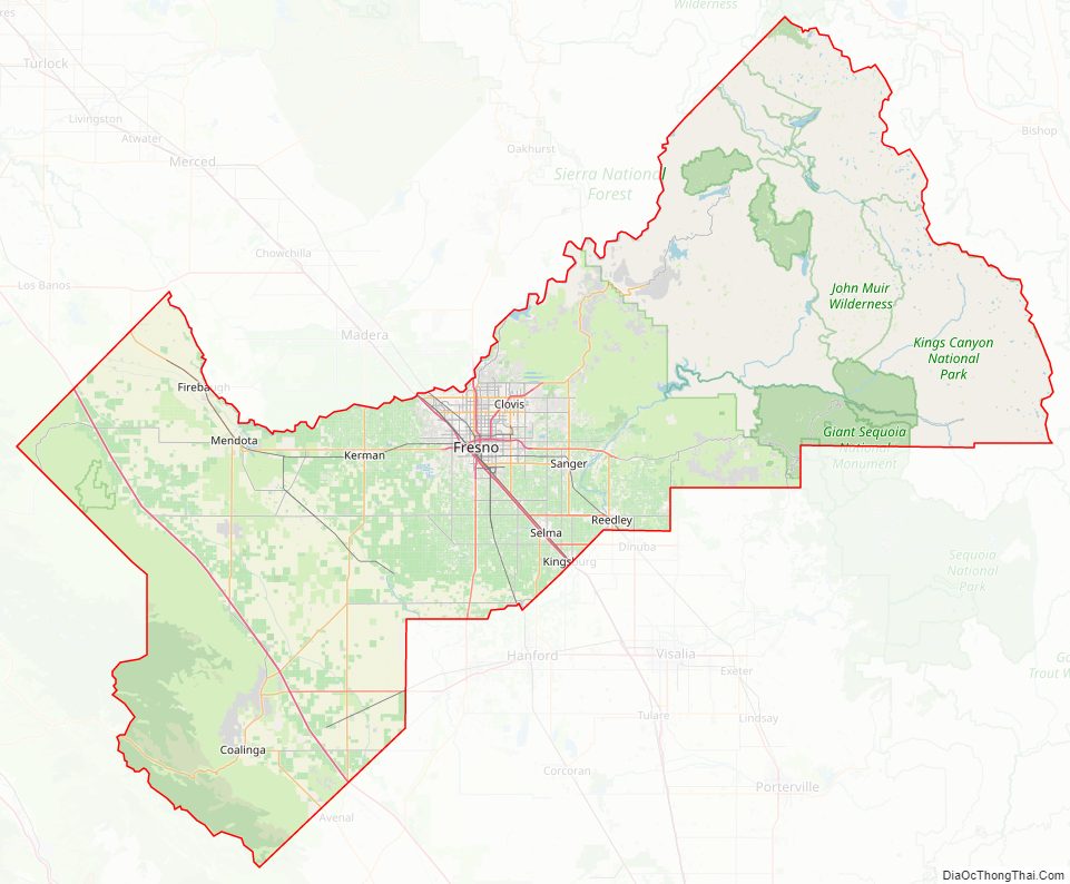
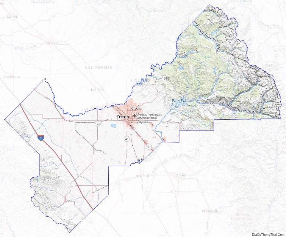
Fresno County Road Map
Geography
According to the U.S. Census Bureau, the county has a total area of 6,011 square miles (15,570 km), of which 5,958 square miles (15,430 km) is land and 53 square miles (140 km) (0.9%) is water.
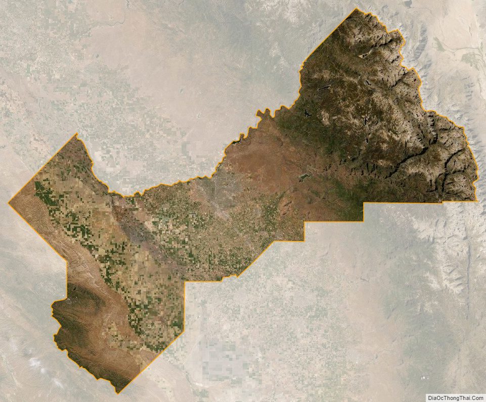
Major watercourses are the San Joaquin River, Kings River, Delta-Mendota Canal, Big Creek, Friant Kern Canal, Helm Canal and Madera Canal. It is bordered on the west by the Coast Range and on the east by the Sierra Nevada. It is the center of a large agricultural area, known as the most agriculturally rich county in the United States. The county withdrew 3.7 billion US gallons (14,000,000 m) of fresh water per day in 2000, more than any other county in the United States. In recent years, statewide droughts in California have further strained both Fresno’s and the entire Central Valley’s water security.
Fresno County is part of the Madera AVA wine region. However, Fresno was named after two particular ash trees that grew near the town of Minkler on the Kings River, one of which is still alive and standing.
National protected areas
- Giant Sequoia National Monument (part)
- Kings Canyon National Park (part)
- Sequoia National Forest (part)
- Sierra National Forest (part)
Geology
A number of minerals have been discovered in the county, including macdonaldite, krauskopfite, walstromite, fresnoite, verplanckite, muirite, traskite, and kampfite.
In October 2019, the Bureau of Land Management ended a five-year moratorium on leasing federal land in California to fossil fuel companies, opening 725,000 acres (1100 sq. miles; 29,000 ha) to drilling in San Benito, Monterey, and Fresno counties.
Fresno County Topographic Map
Fresno County Satellite Map
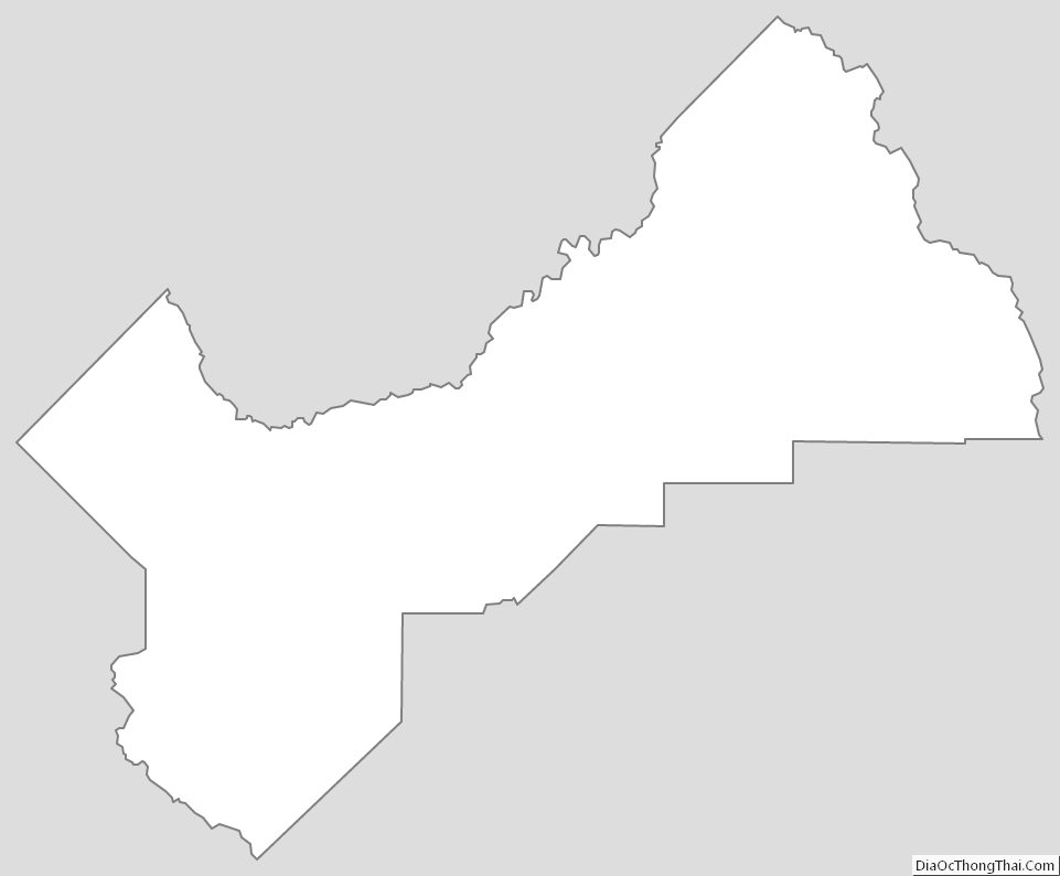
Fresno County Outline Map