Madera (Spanish for “Wood”) is a city and county seat of Madera County, California. As of the 2020 United States census, the city’s population was 66,224.
Located in the San Joaquin Valley, Madera is the principal city of the Madera Metropolitan Statistical Area, which is part of the Fresno-Madera-Hanford Combined Statistical Area. The city is home to the Madera Unified School District.
| Name: | Madera city |
|---|---|
| LSAD Code: | 25 |
| LSAD Description: | city (suffix) |
| State: | California |
| County: | Madera County |
| Incorporated: | March 27, 1907 |
| Elevation: | 272 ft (83 m) |
| Land Area: | 16.48 sq mi (42.67 km²) |
| Water Area: | 0.00 sq mi (0.00 km²) 0% |
| Population Density: | 4,000/sq mi (1,600/km²) |
| ZIP code: | 93636–93639 |
| Area code: | 559 |
| FIPS code: | 0645022 |
| Website: | www.madera.gov |
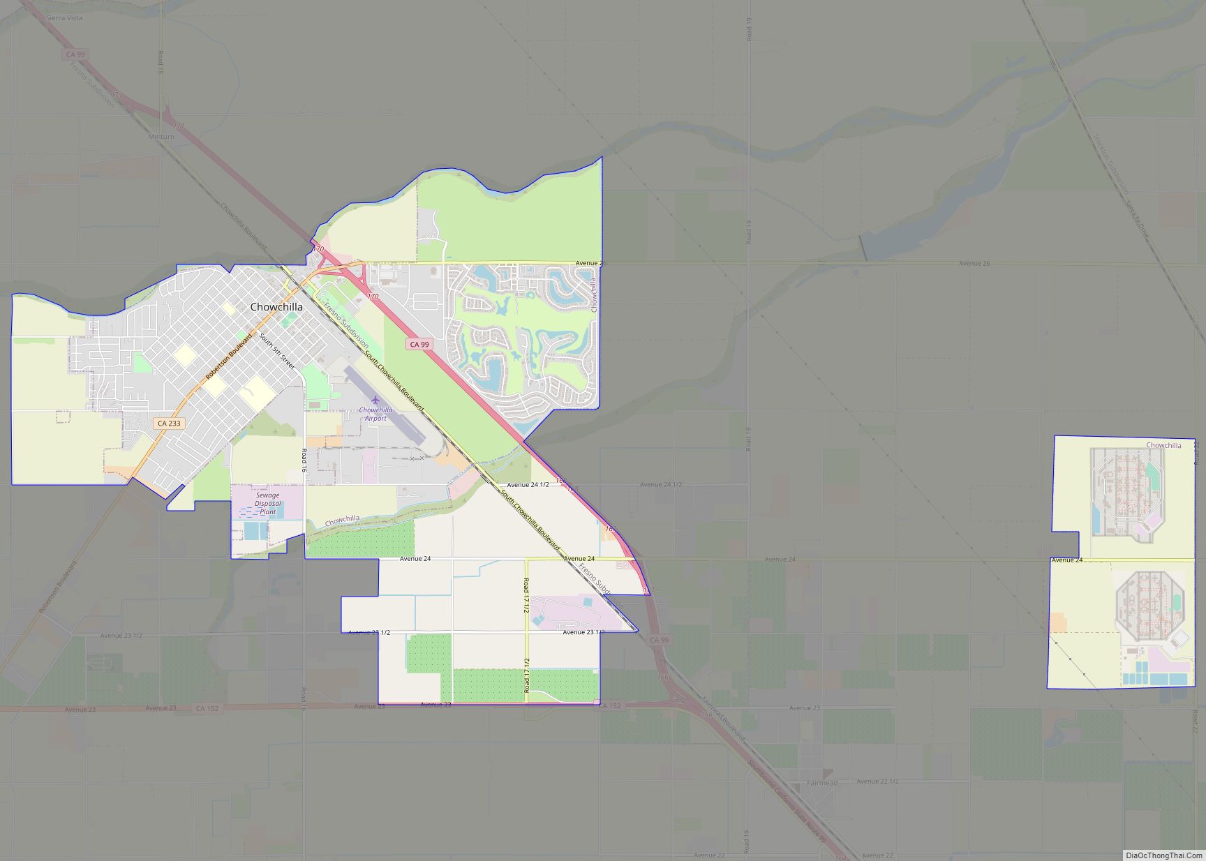
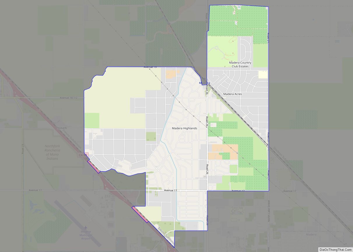
Online Interactive Map
Click on ![]() to view map in "full screen" mode.
to view map in "full screen" mode.
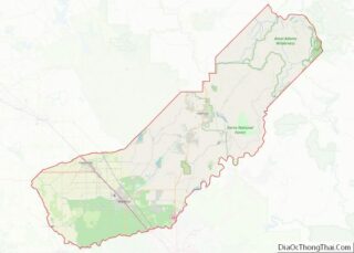
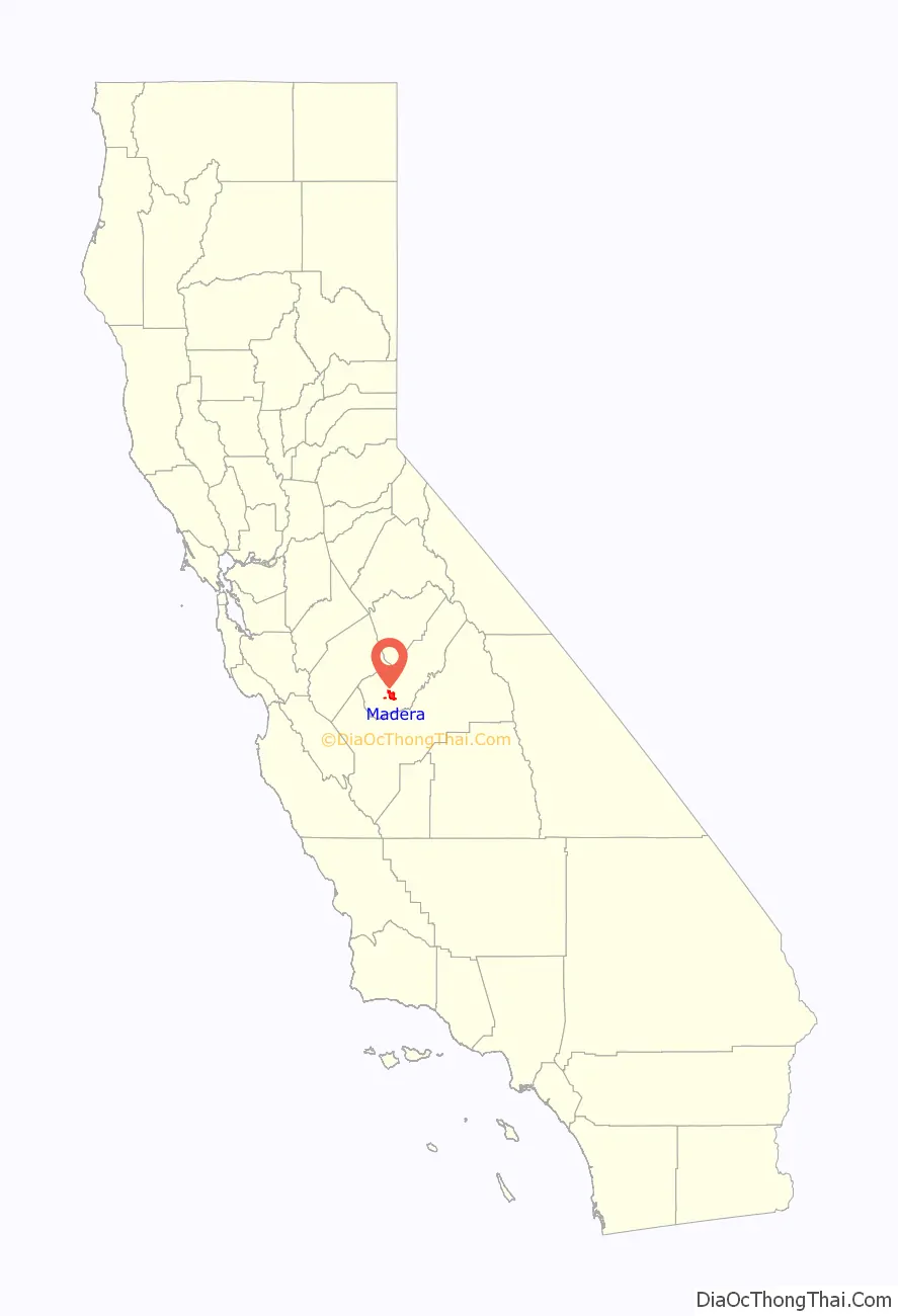
Madera location map. Where is Madera city?

History
The town was named after the Spanish term for lumber. The town was laid out by the California Lumber Company in 1876. From 1876 to 1931, a 63-mile (101 km) water flume carried lumber from the mountains to Madera where the lumber was shipped by train.
The first post office at Madera opened in 1877. On May 16, 1893, Madera County officially became a county of the state of California and the town incorporated as the City of Madera on March 27, 1907. One of the city’s first African Americans to hold an elected office was Rev. Naaman N. Haynes, who was voted in as a Madera Unified School District school board trustee in the 1960s.
Landmarks include the historic Madera County Courthouse, the notable Madera water tower, and a fully operational drive-in movie theater.
Madera celebrates the completion of the “world’s longest lumber flume” on October 27, 1900.
The Madera flume terminus around 1901
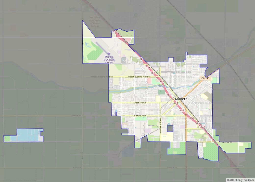
Madera Road Map
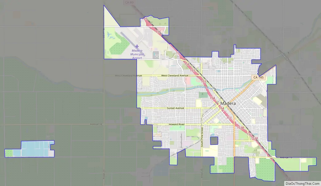
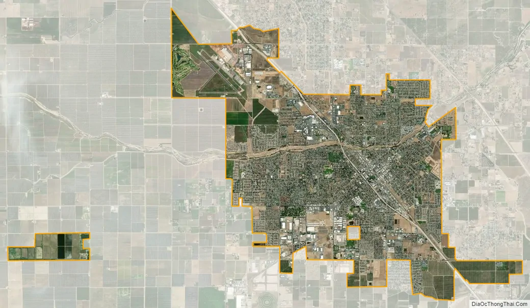
Madera city Satellite Map
Geography
Madera is located at 36°57′41″N 120°03′39″W / 36.96139°N 120.06083°W / 36.96139; -120.06083. The geographic center of California is 38 mi (61 km) east of Madera. Via California Route 99, the city is 23 miles (37 km) northwest of Fresno and 72 miles (116 km) southeast of Modesto. According to the United States Census Bureau, Madera has a total area of 16.5 square miles (43 km), all of it recorded as land. The Fresno River, a tributary of the San Joaquin River, passes through the city north of downtown.
Madera is the location of the Madera AVA wine region.
Climate
Madera has a steppe climate (Köppen: BSk), in the central zone of this climatic subtype. Average January temperatures are a maximum of 54.2 °F (12.3 °C) and a minimum of 36.8 °F (2.7 °C). Average July temperatures are a maximum of 96.6 °F (35.9 °C) and a minimum of 62.3 °F (16.8 °C). Annually, there are an average of 103.9 afternoons with highs of 90 °F (32 °C) or higher, 26.1 afternoons reaching or exceeding 100 °F (38 °C), and an average of 24.6 mornings with lows of 32 °F (0 °C) or lower. The record high temperature was 116 °F (47 °C), recorded on July 13, 1961. The record low temperature was 15 °F (−9 °C), recorded on January 10, 1949.
The average annual rainfall is 11.87 inches (301.5 mm) and there are an average of 59.3 days with measurable precipitation. The wettest year was 1983 with 22.13 inches (562.1 mm) and the driest was 2013 with 4.49 inches (114.0 mm). The most rainfall in one month was 7.11 inches (180.6 mm), in March 1991. The most rainfall in 24 hours was 1.98 inches (50.3 mm), on November 21, 1978. Although snowfall is rare, 4.0 inches (10 cm) fell in January 1962.
See also
Map of California State and its subdivision:- Alameda
- Alpine
- Amador
- Butte
- Calaveras
- Colusa
- Contra Costa
- Del Norte
- El Dorado
- Fresno
- Glenn
- Humboldt
- Imperial
- Inyo
- Kern
- Kings
- Lake
- Lassen
- Los Angeles
- Madera
- Marin
- Mariposa
- Mendocino
- Merced
- Modoc
- Mono
- Monterey
- Napa
- Nevada
- Orange
- Placer
- Plumas
- Riverside
- Sacramento
- San Benito
- San Bernardino
- San Diego
- San Francisco
- San Joaquin
- San Luis Obispo
- San Mateo
- Santa Barbara
- Santa Clara
- Santa Cruz
- Shasta
- Sierra
- Siskiyou
- Solano
- Sonoma
- Stanislaus
- Sutter
- Tehama
- Trinity
- Tulare
- Tuolumne
- Ventura
- Yolo
- Yuba
- Alabama
- Alaska
- Arizona
- Arkansas
- California
- Colorado
- Connecticut
- Delaware
- District of Columbia
- Florida
- Georgia
- Hawaii
- Idaho
- Illinois
- Indiana
- Iowa
- Kansas
- Kentucky
- Louisiana
- Maine
- Maryland
- Massachusetts
- Michigan
- Minnesota
- Mississippi
- Missouri
- Montana
- Nebraska
- Nevada
- New Hampshire
- New Jersey
- New Mexico
- New York
- North Carolina
- North Dakota
- Ohio
- Oklahoma
- Oregon
- Pennsylvania
- Rhode Island
- South Carolina
- South Dakota
- Tennessee
- Texas
- Utah
- Vermont
- Virginia
- Washington
- West Virginia
- Wisconsin
- Wyoming