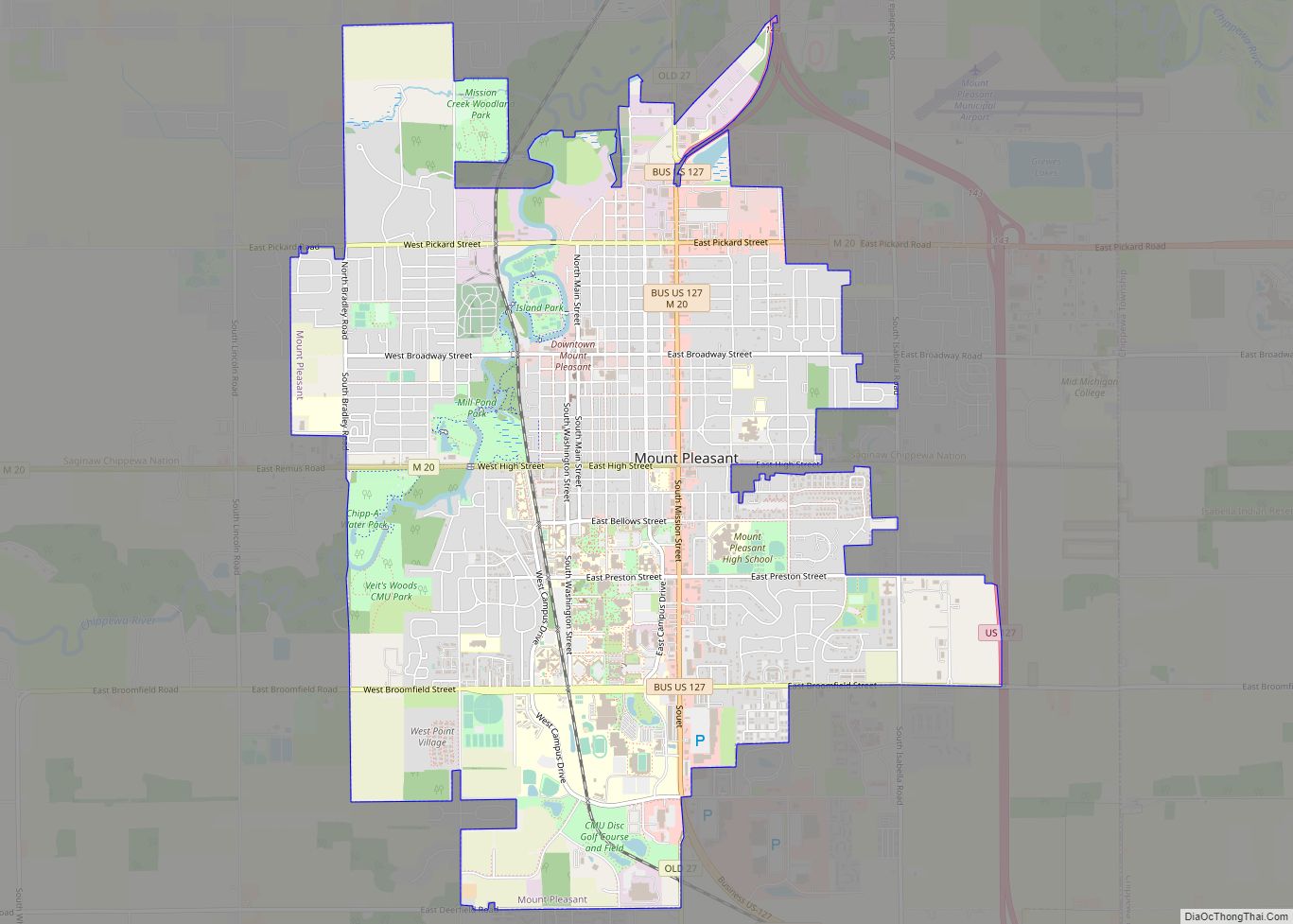
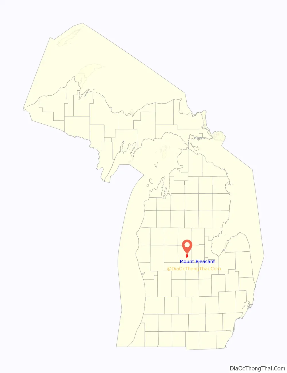
Mount Pleasant is a city in the U.S. state of Michigan. The city is the county seat of Isabella County, which is part of Central Michigan. The population of Mount Pleasant was 21,688 as of the 2020 census. The city is surrounded by Union Charter Township, but is politically independent.
Part of the city (with a population of 8,741) is located within the Isabella Indian Reservation, the base of the federally recognized Saginaw Chippewa Tribal Nation. The tribe’s Soaring Eagle Casino & Resort in nearby Chippewa Township is also within the reservation boundaries.
Mount Pleasant is home to the main campuses of Central Michigan University, one of the largest universities in the state with 20,000 students at Mount Pleasant, and Mid Michigan Community College. The student population nearly doubles the population of the city during the academic year, making it a college town. Despite its name, the surrounding area is mostly flat and does not feature any mountains or hills.
| Name: | Mount Pleasant city |
|---|---|
| LSAD Code: | 25 |
| LSAD Description: | city (suffix) |
| State: | Michigan |
| County: | Isabella County |
| Incorporated: | 1889 |
| Elevation: | 771 ft (235 m) |
| Total Area: | 7.81 sq mi (20.23 km²) |
| Land Area: | 7.72 sq mi (20.00 km²) |
| Water Area: | 0.09 sq mi (0.23 km²) 1.15% |
| Total Population: | 21,688 |
| Population Density: | 2,808.60/sq mi (1,084.39/km²) |
| Area code: | 989 |
| FIPS code: | 2656020 |
| GNISfeature ID: | 0632832 |
Online Interactive Map
Click on ![]() to view map in "full screen" mode.
to view map in "full screen" mode.
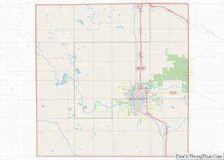
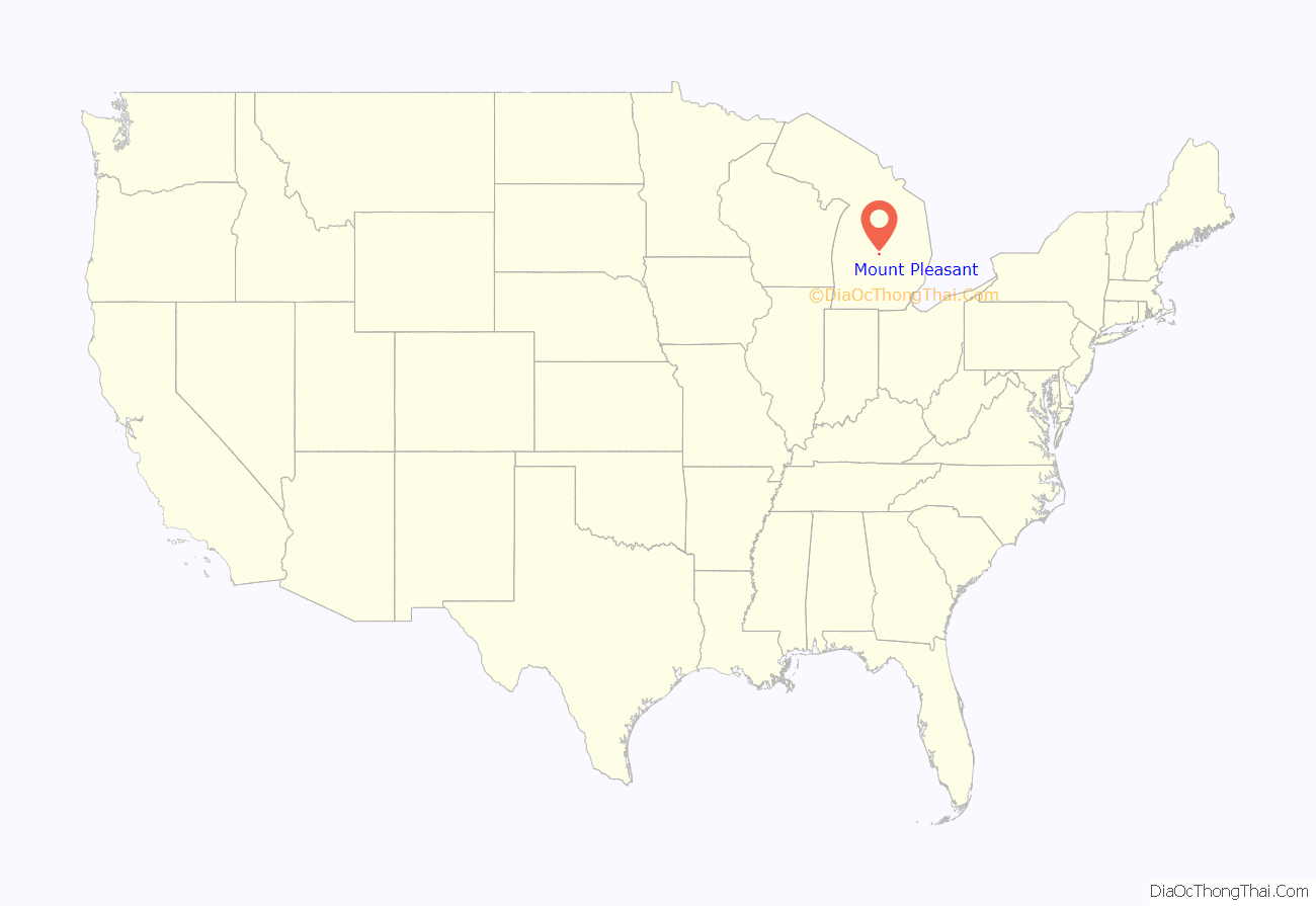
Mount Pleasant location map. Where is Mount Pleasant city?
History
Until the mid-19th century, this area was occupied by historical bands of the Ojibwa people, known by English speakers as the Chippewa. In the early decades of the century, they ceded vast amounts of land to the United States government, which wanted to enable settlement by European Americans.
The federal Graduation Act of 1854 allowed settlers to purchase land from the government at discount rates, and the first white settlers began to arrive in what became Mount Pleasant. Under the Treaty of 1855, the Ojibwa bands (Saginaw Chippewa Tribal Nation) from the Saginaw, Swan Creek, and Black rivers were relocated to land in Isabella County (Isabella Indian Reservation).
Many non-natives soon moved to Mount Pleasant, predicting prosperous relations with the natives. The Homestead Act of 1862 also attracted many new settlers to Mount Pleasant, including new European immigrants, They worked to develop their stake on free lands offered by the US government in exchange for their labor in developing it for residence and agriculture.
The village and future city developed. In 1875, a devastating fire started at the Fancher Building on the north corner of Broadway and Main streets. It moved east down Broadway, destroying several buildings. Seven years later another fire would damage buildings on the south side of Broadway.
In 1879 the first library was established in Mt. Pleasant. Known as “The Library, Literary, and Musical Association of Mount Pleasant,” its first books were made up of the personal book collections of the board members.
In 1890, W.A. Jordan started Mount Pleasant Business College. Expanding in 1892, the school changed its name to Central Michigan Normal School and Business Institute, as it incorporated a curriculum of teacher training. It was the origin of what is now Central Michigan University. This is the largest campus of the state system, with 20,000 students in the 21st century.
On January 3, 1893, the U.S. government opened an Indian boarding school called the Mount Pleasant Indian Industrial Boarding School. Indian children were encouraged to give up their cultural ways and assimilate to using the English language and adopting European-American culture. The school operated for 40 years, closing in 1933.
Since the late 20th and early 21st centuries, the role of such schools has been re-evaluated and the damage done to children by such efforts has been acknowledged. Various Native American groups have taken action to help people reconcile their experiences. On July 17, 2009, the White Bison Wellbriety Journey for Forgiveness made a stop in the Mount Pleasant community to recognize this part of the city’s history. The boarding school building was abandoned, but the Saginaw Chippewa Tribal Nation purchased it from the state of Michigan.
In 1928, large quantities of oil were discovered in the Mt. Pleasant area. A farm owned by the Lilly family was the first to strike, producing hundreds of barrels a day. Although oil resources eventually diminished, this legacy is represented in the Mt. Pleasant city seal, which includes an image of an oil drill. Mt. Pleasant High School’s mascot, the Oiler, also refers to the city’s history of oil production. The city eventually became known as the “Oil Capital of Michigan”.
Mount Pleasant Road Map
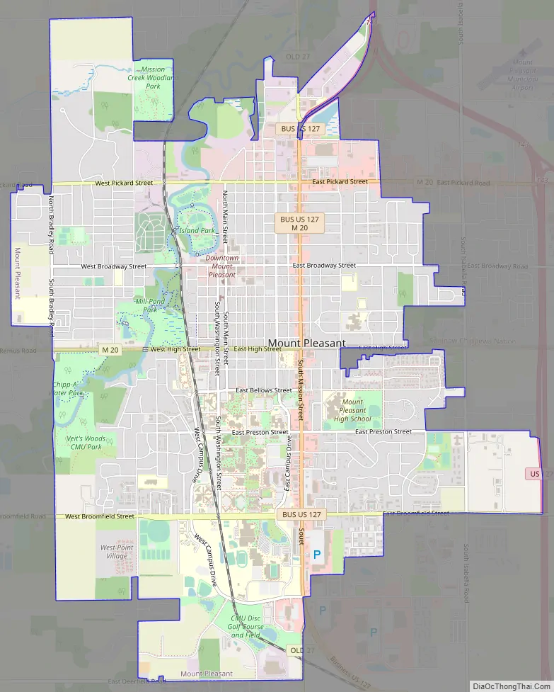
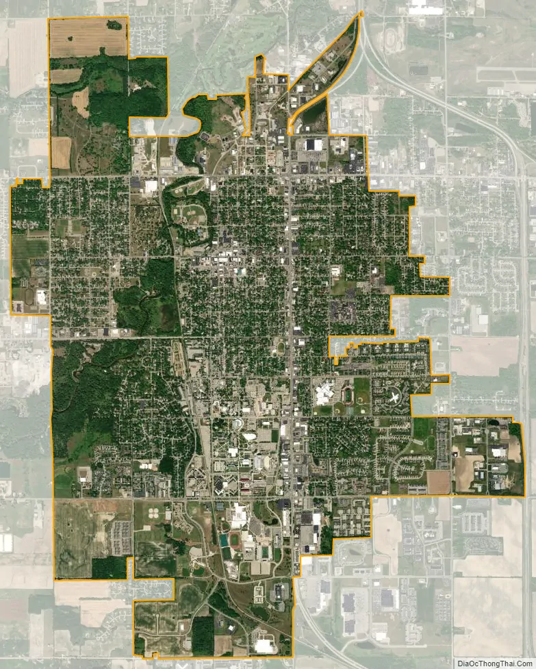
Mount Pleasant city Satellite Map
Geography
According to the United States Census Bureau, the city has a total area of 7.83 square miles (20.28 km), of which 7.74 square miles (20.05 km) is land and 0.09 square miles (0.23 km) is water. The Chippewa River runs through the city. Mount Pleasant is located approximately 61 miles (98 km) north of Lansing, Michigan’s state capital, along US 127.
Climate
See also
Map of Michigan State and its subdivision:- Alcona
- Alger
- Allegan
- Alpena
- Antrim
- Arenac
- Baraga
- Barry
- Bay
- Benzie
- Berrien
- Branch
- Calhoun
- Cass
- Charlevoix
- Cheboygan
- Chippewa
- Clare
- Clinton
- Crawford
- Delta
- Dickinson
- Eaton
- Emmet
- Genesee
- Gladwin
- Gogebic
- Grand Traverse
- Gratiot
- Hillsdale
- Houghton
- Huron
- Ingham
- Ionia
- Iosco
- Iron
- Isabella
- Jackson
- Kalamazoo
- Kalkaska
- Kent
- Keweenaw
- Lake
- Lake Hurron
- Lake Michigan
- Lake St. Clair
- Lake Superior
- Lapeer
- Leelanau
- Lenawee
- Livingston
- Luce
- Mackinac
- Macomb
- Manistee
- Marquette
- Mason
- Mecosta
- Menominee
- Midland
- Missaukee
- Monroe
- Montcalm
- Montmorency
- Muskegon
- Newaygo
- Oakland
- Oceana
- Ogemaw
- Ontonagon
- Osceola
- Oscoda
- Otsego
- Ottawa
- Presque Isle
- Roscommon
- Saginaw
- Saint Clair
- Saint Joseph
- Sanilac
- Schoolcraft
- Shiawassee
- Tuscola
- Van Buren
- Washtenaw
- Wayne
- Wexford
- Alabama
- Alaska
- Arizona
- Arkansas
- California
- Colorado
- Connecticut
- Delaware
- District of Columbia
- Florida
- Georgia
- Hawaii
- Idaho
- Illinois
- Indiana
- Iowa
- Kansas
- Kentucky
- Louisiana
- Maine
- Maryland
- Massachusetts
- Michigan
- Minnesota
- Mississippi
- Missouri
- Montana
- Nebraska
- Nevada
- New Hampshire
- New Jersey
- New Mexico
- New York
- North Carolina
- North Dakota
- Ohio
- Oklahoma
- Oregon
- Pennsylvania
- Rhode Island
- South Carolina
- South Dakota
- Tennessee
- Texas
- Utah
- Vermont
- Virginia
- Washington
- West Virginia
- Wisconsin
- Wyoming