Humboldt County (/ˈhʌmboʊlt/ (listen)) is a county located in the U.S. state of California. As of the 2020 census, the population was 136,463. The county seat is Eureka.
Humboldt County comprises the Eureka–Arcata–Fortuna, California, Micropolitan Statistical Area. It is located on the far North Coast of California, about 270 miles (435 km) north of San Francisco. It has among the most diverse climates of United States counties, with very mild coastal summers and hot interior days. Similar to the greater region, summers are extremely dry and winters have substantial rainfall.
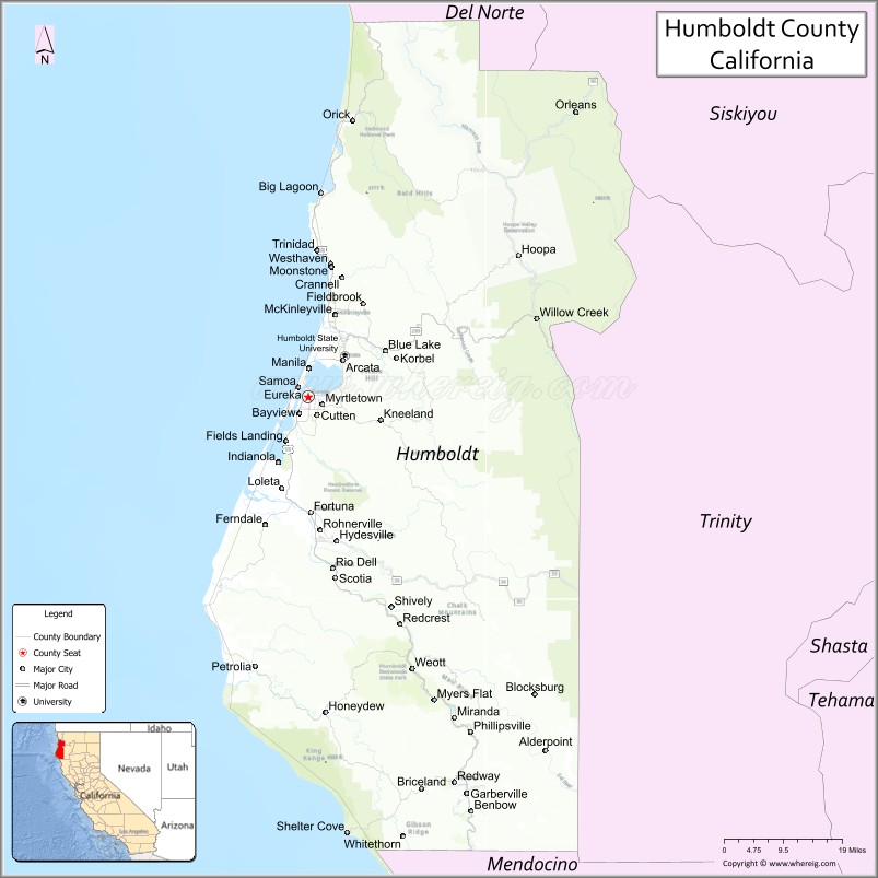
Its primary population centers of Eureka, the site of College of the Redwoods main campus, and the smaller college town of Arcata, site of California State Polytechnic University, Humboldt, are located adjacent to Humboldt Bay, California’s second largest natural bay. Area cities and towns are known for hundreds of ornate examples of Victorian architecture.
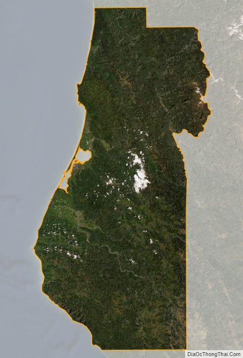
Humboldt County is a densely forested mountainous and rural county with about 110 miles (177 km) of coastline (more than any other county in the state), situated along the Pacific coast in Northern California’s rugged Coast (Mountain) Ranges. With nearly 1,500,000 acres (6,100 km) of combined public and private forest in production, Humboldt County alone produces twenty percent of the total volume and thirty percent of the total value of all forest products produced in California. The county contains over forty percent of all remaining old growth Coast Redwood forests, the vast majority of which are protected or strictly conserved within dozens of national, state, and local forests and parks, totaling approximately 680,000 acres (1,060 sq mi).
| Name: | Humboldt County |
|---|---|
| FIPS code: | 06-023 |
| State: | California |
| Founded: | 1853 |
| Named for: | Humboldt Bay, which was named after Alexander von Humboldt |
| Seat: | Eureka |
| Largest city: | Eureka |
| Total Area: | 4,052 sq mi (10,490 km²) |
| Land Area: | 3,568 sq mi (9,240 km²) |
| Total Population: | 136,463 |
| Population Density: | 38/sq mi (15/km²) |
| Time zone: | UTC−8 (Pacific Time Zone) |
| Summer Time Zone (DST): | UTC−7 (Pacific Daylight Time) |
| Website: | humboldtgov.org |
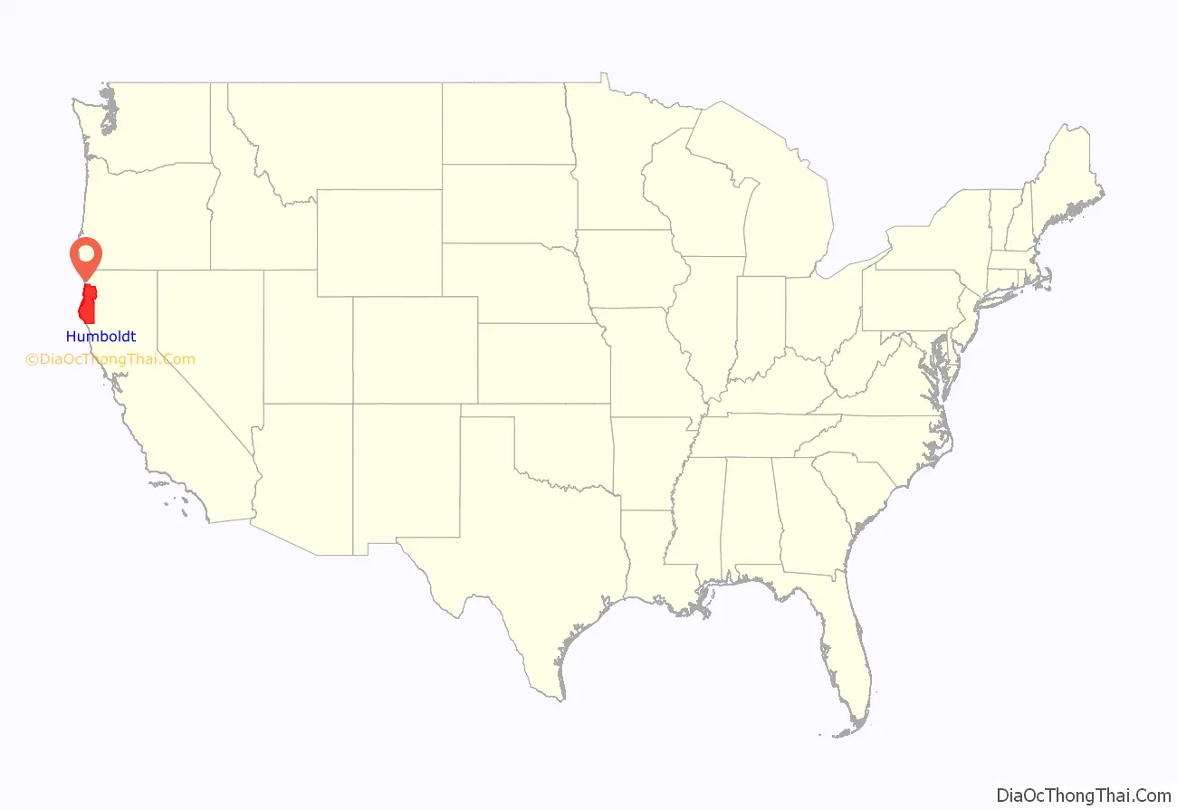
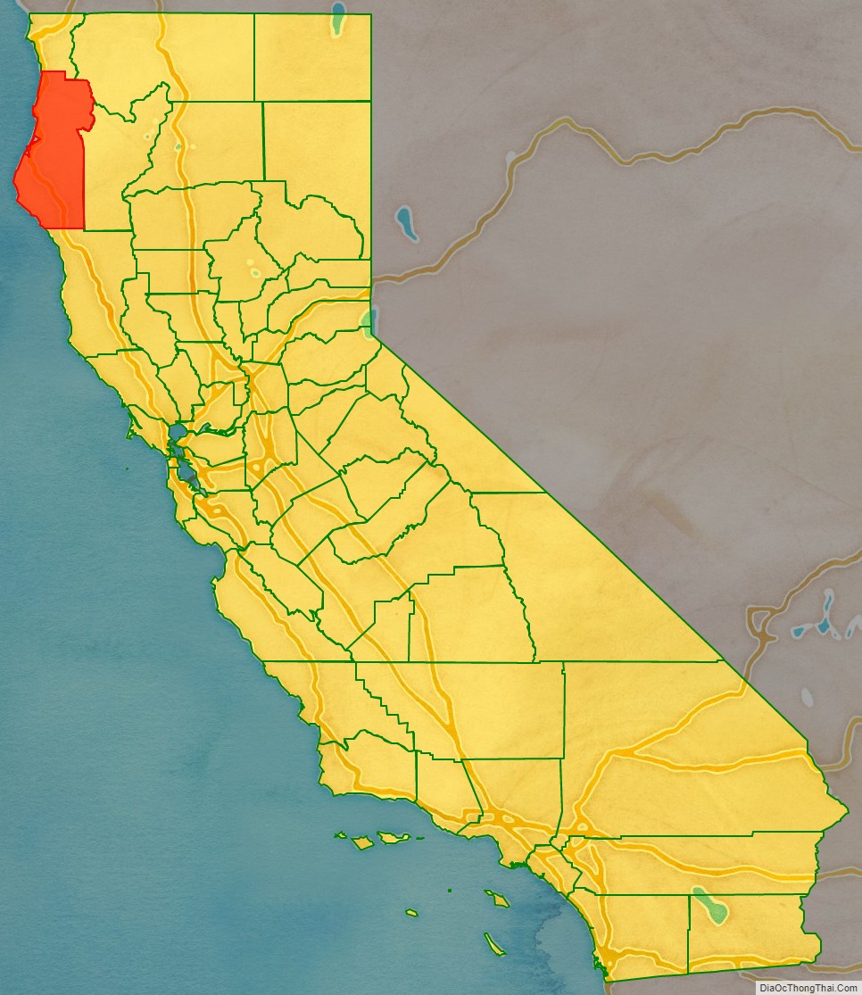
Humboldt County location map. Where is Humboldt County?
History
The original inhabitants of the area now known as Humboldt County include the Algic Wiyot, Yurok; the Hokan Karuk; and the Athapaskan Hupa, Chilula, Whilkut, Tsnungwe as well as the Eel River Athapaskan peoples, including the Wailaki, Mattole and Nongatl.
Spanish traders made unintended visits to California with the Manila Galleons on their return trips from the Philippines beginning in 1565. The first recorded entry by people of European origin was a landing by the Spanish in 1775 in Trinidad.
The first recorded entry of Humboldt Bay by non-natives was an 1806 visit from a sea otter hunting party from Sitka employed by the Russian American Company. The hunting party included Captain Jonathan Winship, an American, and some Aleut hunters. The bay was not visited again by people of European origin until 1849 when Josiah Gregg’s party visited. In 1850, Douglas Ottinger and Hans Buhne entered the bay, naming it Humboldt in honor of the great naturalist and explorer, Alexander von Humboldt, and the name was later applied to the county as a whole.
The area around Humboldt Bay was once solely inhabited by the Wiyot Indian tribe. One of the largest Wiyot villages, Tolowot, was located on Indian Island in Humboldt Bay. Founded around 900 BC, it contains a shell midden 6 acres (2.4 ha) in size and 14 feet (4.3 m) deep. It was the site of the February 26, 1860 massacre of the Wiyot people that was recorded by Bret Harte, then living in Union, now called Arcata. Between 60 and 200 Wiyot men, women, and children were murdered that night in the midst of a religious ceremony. Tolowot is now a restricted site and a National Historic Landmark. In 2019, the island was restored to the Wiyot tribe, and is now known as Tuluwat or Duluwat island.
Humboldt County was formed in 1853 from parts of Trinity County.
State historic landmarks in Humboldt County include Arcata and Mad River Railroad, California’s First Drilled Oil Wells in Petrolia, Camp Curtis, Centerville Beach Cross, the city of Eureka, the victorian town of Ferndale, Fort Humboldt, Humboldt Harbor Historical District, the Jacoby Building, The Old Arrow Tree, Old Indian Village of Tsurai, the Town of Trinidad, and Trinidad Head.
On February 5 and 6, 1885, Eureka’s entire Chinese population of 300 men and 20 women were expelled after a gunfight between rival Chinese gangs (tongs) resulted in the wounding of a 12-year-old boy and the death of 56-year-old David Kendall, a Eureka City Councilman. After the shooting, an angry mob of 600 Eureka residents met and informed the Chinese that they were no longer wanted in Eureka and would be hanged if they were to stay in town longer than 3 p.m. the next day. They were put on two steamships and shipped to San Francisco. No one was killed in the expulsion. Another Chinese expulsion occurred during 1906 in a cannery on the Eel River, in which 23 Chinese cannery workers were expelled after objections to their presence. However, some Chinese remained in the Orleans area, where some white landowners sheltered and purchased food for the Chinese mineworkers until after racial tension passed. Chinese did not return to the coastal cities until the 1950s.
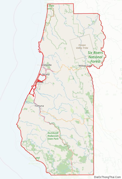
Humboldt County Road Map
Geography
According to the United States Census Bureau, Humboldt County encompasses 4,052 square miles (10,490 km), of which 3,568 square miles (9,240 km) is land and 484 square miles (1,250 km) is water.
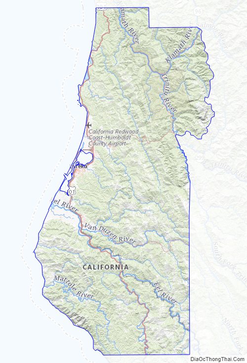
Cape Mendocino is the westernmost point in California (longitude 124 degrees, 24 minutes, 30 seconds). Humboldt Bay, the only deepwater port between San Francisco and Coos Bay, Oregon, is located on the coast at the midpoint of the county.
Humboldt County contains a diversity of plant and animal species, with significant forest and coastal habitats. In coastal areas there are extensive redwood forests. A prominent understory shrub is the toyon, whose northern range limit is in Humboldt County.
Rivers
Humboldt County’s major rivers include (in order of flow – cubic meters per second – from largest to smallest):
- Klamath River
- Eel River
- Trinity River
- Mad River
The smaller rivers include Redwood Creek, significant due to amount of its flow; the Van Duzen; the Eel River syncline group composed of the South Fork, the North Fork, and the Salt River; the Mattole, Salmon, Elk, Bear, and Little rivers.
Seismic activity
Historically, Humboldt County and the entire far north coast have had many earthquakes over 6.0 magnitude.
The 1992 Cape Mendocino earthquakes were a series of three major earthquakes that occurred off the coast of Cape Mendocino, California on April 25 and 26, 1992, the largest being a 7.2. Ninety-five people were injured and property in the county sustained considerable damage.
In 2010, a 6.5 magnitude earthquake struck offshore, 33 mi (53 km) west of Eureka, resulting in only minor injuries and some structural damage to houses and utilities, and no fatalities reported.
In 2022, a 6.4 magnitude earthquake centered approximately 10 miles (16 km) from Ferndale caused damage, especially in Rio Dell.
The town of Arcata is built on top of an accretionary wedge. This was formed by the subduction of the Gorda plate under the North American plate.
Climate
The coastal zone of the county experiences very wet, cool winters and dry, mild foggy summers. In the winter, temperatures range from highs of 40–59 °F (4–15 °C) to lows of 32–49 °F (0–9 °C). Coastal summers are cool to mild, with average highs of 60–69 °F (16–21 °C) and frequent fogs. Coastal summer temperatures range from highs of 64–70 °F (18–21 °C) to lows of 46–55 °F (8–13 °C). In the populated areas and cities near the coast, the highest temperatures tend to occur at locations just a few miles inland from Eureka and Arcata, in towns like Fortuna, Rio Dell, and smaller unincorporated communities located somewhat further away from Humboldt Bay. In these locations summer highs are 70–75 °F (21–24 °C). The coastal zone experiences a number of frosty nights in winter and early spring, though snowfall and hard freezes are rare. Coastal winters are cool and wet. Winter rainstorms are frequent, with averages from 30 to 100 inches (760 to 2,500 mm) a year, depending upon elevation.
Inland areas of the county also experience wet, cool winters. Snowfall is common at elevations over 3,000 ft (910 m) throughout the winter months, and is deep enough at higher elevations to have inspired the opening of a small ski lift operation (now defunct) on Horse Mountain, near Willow Creek, for several decades in the late 20th century. Summer displays the sharpest difference between the coastal and inland climates. Inland regions of Humboldt County experience highs of 80–99 °F (27–37 °C) depending on the elevation and distance from the ocean. Occasional summer highs of 100 °F (38 °C) are common in eastern and southern parts of the county including Orleans, Hoopa, Willow Creek, Garberville, Honeydew, and inland river valleys.
Humboldt County Topographic Map
Humboldt County Satellite Map
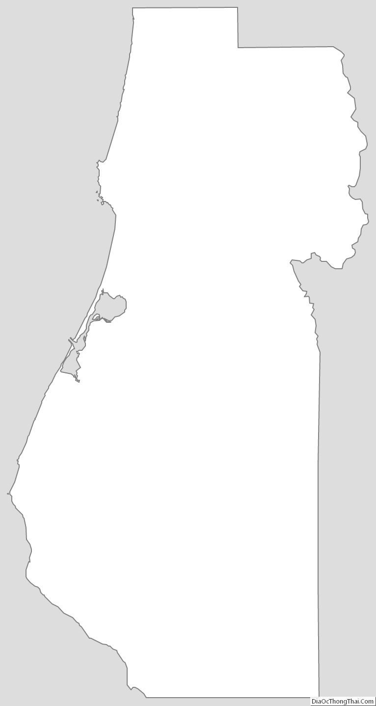
Humboldt County Outline Map