Ferndale is a city in Humboldt County, California, United States. Its population was 1,371 at the 2010 census, down from 1,382 at the 2000 census. The city contains dozens of well-preserved Victorian storefronts and homes. Ferndale is the northern gateway to California’s Lost Coast and the city, which is sited on the edge of a wide plain near the mouth of the Eel River, is also located near the extensive preserves of coast redwood forests.
| Name: | Ferndale city |
|---|---|
| LSAD Code: | 25 |
| LSAD Description: | city (suffix) |
| State: | California |
| County: | Humboldt County |
| Incorporated: | August 28, 1893 |
| Elevation: | 56 ft (17 m) |
| Total Area: | 1.03 sq mi (2.66 km²) |
| Land Area: | 1.03 sq mi (2.66 km²) |
| Water Area: | 0.00 sq mi (0.00 km²) 0% |
| Total Population: | 1,398 |
| Population Density: | 1,316.46/sq mi (508.29/km²) |
| ZIP code: | 95536 |
| Area code: | 707 |
| FIPS code: | 0623910 |
| Website: | ci.ferndale.ca.us |
Online Interactive Map
Click on ![]() to view map in "full screen" mode.
to view map in "full screen" mode.
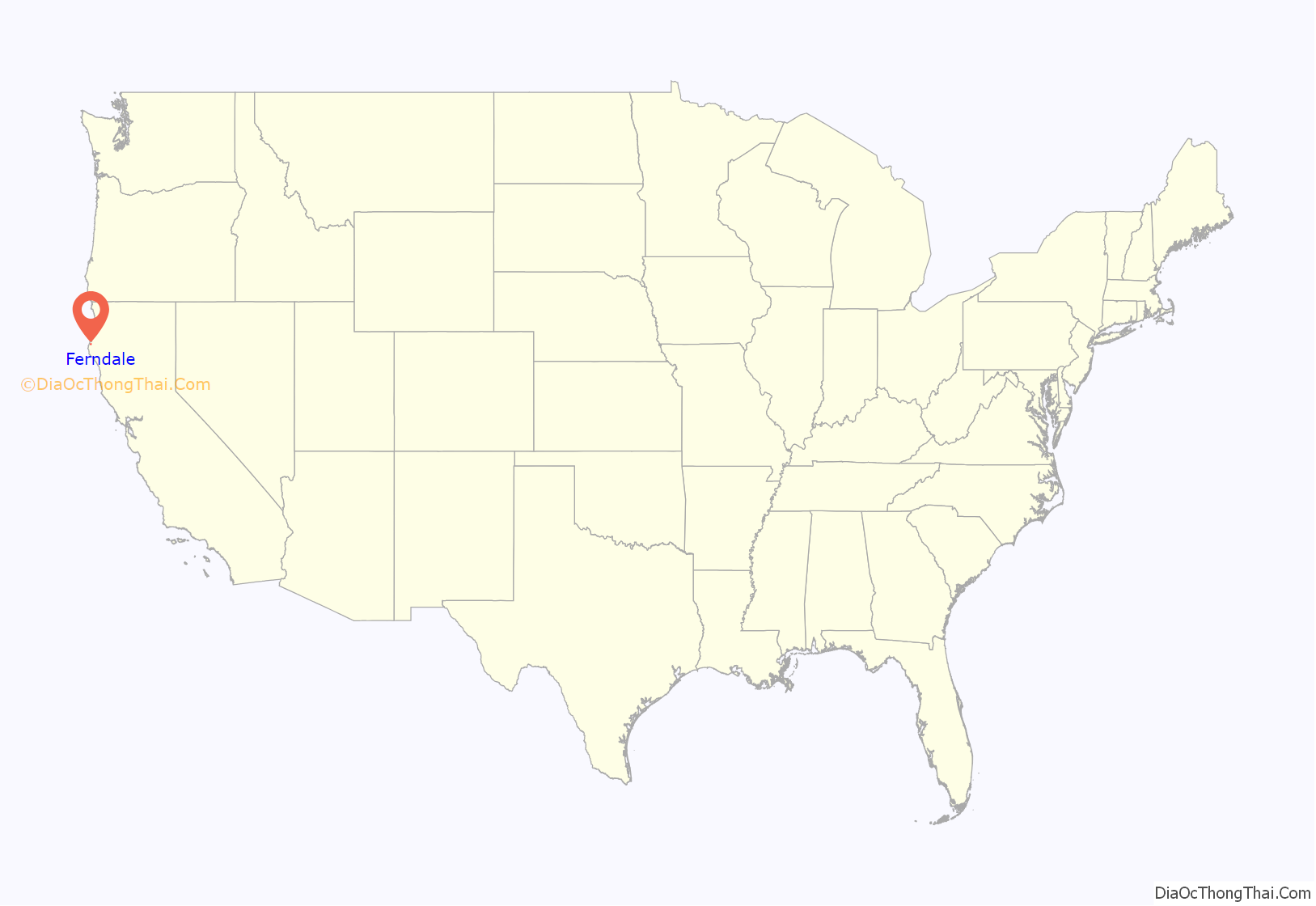
Ferndale location map. Where is Ferndale city?

History
Before American settlement, Ferndale was a glade of giant ferns reaching more than six feet (1.8 m), surrounded by alder, willow, Sitka spruce, Douglas fir, coast redwood, swampy land, and windswept prairies. The area was populated by the southern Wiyot people, and centered along the Eel River, where they caught lamprey eels, salmon and sturgeon in iris leaf fish nets, collected shellfish along the river and at its mouth, while cultivating only a California species of tobacco. The town was established in 1852 from settlement by Willard Allard, Seth Louis Shaw, and his brother, noted American painter Stephen W. Shaw.
Ferndale was incorporated in 1893.
Early settlers
In August 1852, Allard and the Shaw brothers borrowed a canoe from the Wiyots in the Table Bluff area and paddled it across the Eel and up Francis Creek to arrive with their supplies in the approximate vicinity of what is now Main and Shaw streets. In September 1852, they cleared a five-acre area of ferns and began building a cabin near the base of the Wildcat Road even though Allard was sick with ague. By January 1853, 12 men were living in the Shaws’ cabin including Seth Kinman, who provided the group with meat, and Joseph Russ (1825–1886), whose later holdings included the Fern Cottage Historic District. About this time, Stephen Shaw painted the portrait of Wiyot elder Kiwelattah (or Ki-we-lah-tah) and kept a detailed journal of two years of trying to grow plants in cold coastal fog.
Seth Shaw settled in the area now marked by Main and Lewis streets where he began construction of the Gothic Revival style Shaw House on his property in 1854. The Shaw House served as the area’s first polling place in 1854, post office in 1860 and courthouse in 1863. The voting registers for Humboldt County and Ferndale are on file for viewing in the Andrew Genzoli Collection at Humboldt State University, starting in 1888. Seth Shaw was justice of the peace and postmaster, and his home served for many gatherings although it was not finished until 1866. After having been away from the area for two years, Stephen Shaw sold his holdings in 1856 to Welsh-born Francis Francis (1818–1877) who later established the city’s water system through pipes laid initially in 1875.
Other small towns were established around Ferndale, including Centerville, Port Kenyon, Waddington, Grizzly Bluff, and Arlynda Corners. Produce from Ferndale was shipped out via Centerville and transferred to ships at anchor offshore prior to the opening of docks at Port Kenyon in 1876. In 1865 the first shipment of coal oil from the Union Mattole Oil Company was shipped through Ferndale to San Francisco.
While the earliest settlers were English speaking from Great Britain, New England, Canada, or Ireland, waves of immigrants arrived in Ferndale from Denmark, Switzerland, Germany, Italy, Portugal, and China.
European immigrants
Danish settlers founded and built Our Savior’s Lutheran Church in 1899 and dedicated Danish Hall, which had been built as a warehouse by Arnold Berding in the late 1880s, on October 10, 1929. The Swiss who settled in Ferndale from Italian- and German-speaking families included the Oeschgers who moved to Ferndale in time for Joe Oeschger to play baseball at Ferndale High School before going to a career in Major League Baseball. A later influx of Romansh Swiss included the ancestors of College Football Hall of Fame coach Len Casanova. Sausage, salami-making and wine-making can be traced to Italians who arrived later than the Danish and Swiss, beginning around 1897. The Germans arrived earlier; the first was businessman Arnold Berding in 1857. Most Germans worked on ranches or were dairymen, but at least one owned the Milwaukee Brewery Depot Saloon. United States Congressman Don Clausen is descended from German settlers of Ferndale. German settlers organized St. Mark’s Lutheran Church in 1906. Except for three Portuguese brothers who arrived in the 1870s and a few from mainland Portugal, most came from the Azores islands between 1900 and 1915. Ferndale Portuguese have celebrated their traditional Festival of the Holy Ghost since 1924.
Chinese settlement and expulsions
Chinese immigrants arrived in California in the earliest gold-rush days, and were settled in all parts of Humboldt County almost as soon as English-speaking whites. They worked in gold mining on the Klamath and Trinity Rivers, before settling mostly in Eureka, with a few in outlying towns like Ferndale where two Chinese owned clothes washing businesses. Chinese laborers built parts of the Wildcat Road between Ferndale and Petrolia, dug out the water reservoirs for the Francis Water Company and worked at two fish canneries on the Eel River, although – as in the rest of California – they were not truly welcome.
In 1885, after a city councilman of Eureka was shot dead in the crossfire from two warring Chinese tong gangs, 480 Chinese residents were rounded up in two days and forced to relocate to San Francisco. A year later, the Cutting Packing Company brought in a crew of Chinese for the season. Following a heated meeting at Roberts Hall in Ferndale between local residents and an upset delegation from Eureka, the company guaranteed the workers would come nowhere near town and they were allowed to stay until the fishing season was over in December. Chinese crews were used again at the same cannery in 1887 and 1889.
In 1906 Eureka and Fortuna citizens were again up in arms at Ferndale’s violation of the unwritten law of the county when the Starbuck–Talent Canning Company of Port Kenyon brought in 23 Chinese and four Japanese to work at the cannery. After threats of mass action, the Chinese were taken to an old cookhouse on Indian Island from which all whites were barred and where they were held until they left by sea. The Japanese were permitted to keep working for Starbuck–Talent.
Business and communications
Dairies were founded from the Bear River Ridge to the south side of the Eel River starting in the late 1860s. Filled kegs of butter were transported along the beach river by four-horse teams from the Mattole to Centerville or Port Kenyon and the teams returned supplies from Ferndale. The 81 dairies from the southern area faded as the land along the Eel River Valley was settled for dairying, first by the Danes and later by other settlers. In the 1880s, multiple cooperative creameries in the Eel River valley began to process milk into butter; by 1904, the Central Creamery on Main Street Ferndale had combined the smaller operations into a more modern production facility.
The use of paper wrapping on butter to reduce air oxidation was pioneered in Ferndale at the suggestion of Chester E. Gray (1881–1944) from the U.S. Department of Agriculture who studied the problem of unrefrigerated fine butter turning white within hours of production. Gray patented a new spray-drying process (U.S. Patent #858,868 – 1907 and #1,157,935 – 1915) and went into business with Central Creamery owner Aage Jensen in a new dry-milk manufacturing process that used non-fat milk solids which had formerly been waste of the process. Their new plant processed 75,000 pounds of milk a day, shipping to San Francisco and filling contracts for the U.S. Navy. The first motorized milk truck was used here.
In 1916, Grey and Jensen moved to San Francisco and changed the company name to Golden State Creamery. Local Ferndale resident Andrew Genzoli began recording the history of the Ferndale dairies during this time, culminating in scrapbooks of newspaper clippings from 1910 to 1954, which are on file for viewing at Humboldt State University Special Collections.
Ferndale was a crossroads village and provided lodging, horses, blacksmithing and other services both to individual travelers and the Overland Stage and Express line which ran from Eureka to Cloverdale with connections to San Francisco; over 80 hours of traveling for a cost of $20. The first stage line was founded in 1862 with daily trips from Eureka, Centerville, and Petrolia. In 1868, twice weekly stages ran to San Francisco and by 1871 daily service was available. The first automobiles were used for the stage runs in 1911, the same year as Fernbridge (bridge) was built, eliminating the need for ferry boat service.
In 1878, regular service on steamships carried produce, cargo and passengers from Port Kenyon, where, by 1897, 188,652 pounds of wool and 965,010 pounds of butter were shipped out along with grains, chickens, potatoes, lumber, eggs, hides, vegetables, and salmon. The steamer trade declined as the Salt River silted up and the transport hub shifted to Eureka. The completion of the Northwestern Pacific Railroad in 1914 allowed for speedier transportation to Eureka and the San Francisco area. The track was built about five miles to the northwest of Ferndale in Fernbridge.
Main Street businesses supplied the needs of not only the Ferndale area, but for the inland Mattole Valley as well. They included banks, hotels, stables, variety and merchandise stores, hardware and grocery stores, farm and machine implements, butchers, blacksmiths shoemakers, barbers, tailors, milliners, saloons and gambling halls, billiard parlors, coopers, doctors, dentists, drug stores, lawyers, engineers, surveyors, real estate agents, several photographers, furniture makers, undertakers, a telegraph office, and a Wells–Fargo office.
Telephone and telegraph wires were run into the valley by private companies in the 1890s; by 1899, it was said that the telephone was in “almost universal use in this valley.” In 1900, the telephone line was extended to the Mattole Oil fields in Petrolia. In 1911, the Eel River and Southern Telephone company consolidated operations around Ferndale, and, on February 6, 1960, dial telephones were introduced; the old switchboard and crank phones are on display at the Ferndale Museum.
The Ferndale Enterprise newspaper was founded on 11 May 1878 by three sons of the local Methodist minister and has published continuously since then, while moving offices and shifting from semi-weekly to weekly publication.
Incorporation and services
Ferndale incorporated with a vote of 89 in favor and 47 against on 17 August 1893 primarily to organize drainage and prevent dogs and other animals from running loose, according to the earliest ordinances enacted. In 1915, the current firehouse was built as combined firehouse and city hall.
After the 1875 fire which nearly destroyed south Main street was put out by volunteer bucket brigades, and after other smaller conflagrations, the City purchased a used Hunneman hand pumper fire engine on April 14, 1883. The end-stroke torrent pumper had been built in the 1850s and been shipped west in the 1860s. The name on the side of this engine was “Franklin” because the city bought it from the Franklin Fire Company of San Jose, California. The engine was transferred to the newly formed Ferndale Fire Department when they organized in February 1897. In November 1923, after 41 years in service, the hand pumper was shipped to the American LaFrance Company, “as part payment on the fine new pumper recently purchased by this town.” Other sources say the engine was sold to a Hollywood film company.
Modern equipment arrived in 1905 with a motorized pumper engine, in 1917 with a Model T truck with chemical tanks and in 1948 the Hook and Ladder Company formed. In 1883, water supplies were consolidated in local cisterns under present-day State Route 211 which were later filled in and water from the hill reservoirs was used to supply the hydrants.
In 1902, the fire alarm was placed in a wooden structure at the corner of Brown and Main which fell over in the 1906 earthquake (see below) which led to the bell being hung at the firehouse, and a steam-whistle at the Creamery used for the fire alarm from 1906 until electric sirens came into use in 1931.
Electrical lighting was installed in May 1896, supplied by a wood-burning steam electric-generating plant that worked between dusk and midnight only; it was replaced in 1903 by a distillate-burning steam electric generator a few blocks east of Main Street. In 1911, the earlier generation and distribution systems were merged into Western States Gas and Electric acquired in 1927 by the Pacific Gas and Electric Company.
The national landmark Ferndale Public Library was completed in 1910 with local funds and an $8,000 Carnegie grant. In 1876, the Ferndale Cemetery Association was established which manages the 5.03 acre burial ground.
Ferndale Road Map

Ferndale city Satellite Map

Geography
Ferndale is located at 40°34.6′N 124°15.8′W / 40.5767°N 124.2633°W / 40.5767; -124.2633. Its location south of US 101, is very close to the mouth of the Eel River as it enters the Pacific Ocean. By car, Ferndale is 265 miles (426 km) north of San Francisco and 12 miles (19 km) south of Eureka. California State Route 211 is the major road connecting the city with US 101. Directly to the south of Ferndale is the Lost Coast region, whose geology and terrain has made it difficult to establish routes through the area. It has thus made that area only accessible by land via small county mountain roads, such as Mattole Road, running from Ferndale south to Petrolia.
According to the United States Census Bureau, Ferndale has a total area of 1.0 square mile (2.6 km), all of it land.
Earthquakes
Ferndale’s location near the Mendocino Triple Junction, a subduction fault associated with the offshore interaction of the Pacific, North American, and Gorda techtonic plates, makes it extremely susceptible to earthquakes. Earthquakes affected Ferndale in the 19th century, but the first to receive widespread news coverage was the 1906 San Francisco earthquake, which damaged more than 40 structures in the downtown, with severe damages to the two brick buildings, and 98 percent of chimneys thrown down. The earthquake was estimated at a Mercalli intensity of VII (Very strong) at Ferndale.
On January 22, 1923, a 7.2 magnitude earthquake centered off Cape Mendocino was said to be nearly as great a shock in Ferndale as the 1906 earthquake. Chimneys fell, water mains and plate glass windows broke, and the recently repaired Odd Fellows building fell off its new foundation. The earthquake arrived with a ground rumble and a flash of light.
On August 20, 1927, an earthquake centered about 60 kilometres (37 mi) west of Arcata caused considerable damage around Humboldt Bay, and damage reports from Ferndale included broken chimneys, merchandise tossed from shelves and china and glassware broken.
Smaller earthquakes were recorded from the 1920s through the 1980s, but the next big earthquake to strike Ferndale was actually a group of three in 1992. The first of these struck on April 25 during the first “Best of the West” festival parade, shattering the glass windows of the stores on Main Street. The brick facade of Valley Grocery collapsed, and police estimated damage to 80 percent of the downtown buildings. Between 30 and 40 houses were knocked off their foundations from the first shock, which was centered about 35 miles (56 km) south of Eureka and had a magnitude of 7.2. The other two large earthquakes hit within 18 hours of the first and were of magnitude 6.5 and 6.7. Both a large landslide and several small landslides occurred on the Mattole Road, which also cracked due to downhill slumping and soil compaction of the road shoulders. Damages in Ferndale were estimated at $10.4 million.
On January 9, 2010, the 6.5 magnitude 2010 Eureka earthquake’s epicenter was about 25 miles (40 km) offshore from Ferndale. It was the largest local earthquake since the 1992 Cape Mendocino earthquakes.
On December 20, 2022, an earthquake with a magnitude of 6.4 centered approximately 10 miles (16 km) from Ferndale impacted the city.
See also
Map of California State and its subdivision:- Alameda
- Alpine
- Amador
- Butte
- Calaveras
- Colusa
- Contra Costa
- Del Norte
- El Dorado
- Fresno
- Glenn
- Humboldt
- Imperial
- Inyo
- Kern
- Kings
- Lake
- Lassen
- Los Angeles
- Madera
- Marin
- Mariposa
- Mendocino
- Merced
- Modoc
- Mono
- Monterey
- Napa
- Nevada
- Orange
- Placer
- Plumas
- Riverside
- Sacramento
- San Benito
- San Bernardino
- San Diego
- San Francisco
- San Joaquin
- San Luis Obispo
- San Mateo
- Santa Barbara
- Santa Clara
- Santa Cruz
- Shasta
- Sierra
- Siskiyou
- Solano
- Sonoma
- Stanislaus
- Sutter
- Tehama
- Trinity
- Tulare
- Tuolumne
- Ventura
- Yolo
- Yuba
- Alabama
- Alaska
- Arizona
- Arkansas
- California
- Colorado
- Connecticut
- Delaware
- District of Columbia
- Florida
- Georgia
- Hawaii
- Idaho
- Illinois
- Indiana
- Iowa
- Kansas
- Kentucky
- Louisiana
- Maine
- Maryland
- Massachusetts
- Michigan
- Minnesota
- Mississippi
- Missouri
- Montana
- Nebraska
- Nevada
- New Hampshire
- New Jersey
- New Mexico
- New York
- North Carolina
- North Dakota
- Ohio
- Oklahoma
- Oregon
- Pennsylvania
- Rhode Island
- South Carolina
- South Dakota
- Tennessee
- Texas
- Utah
- Vermont
- Virginia
- Washington
- West Virginia
- Wisconsin
- Wyoming


