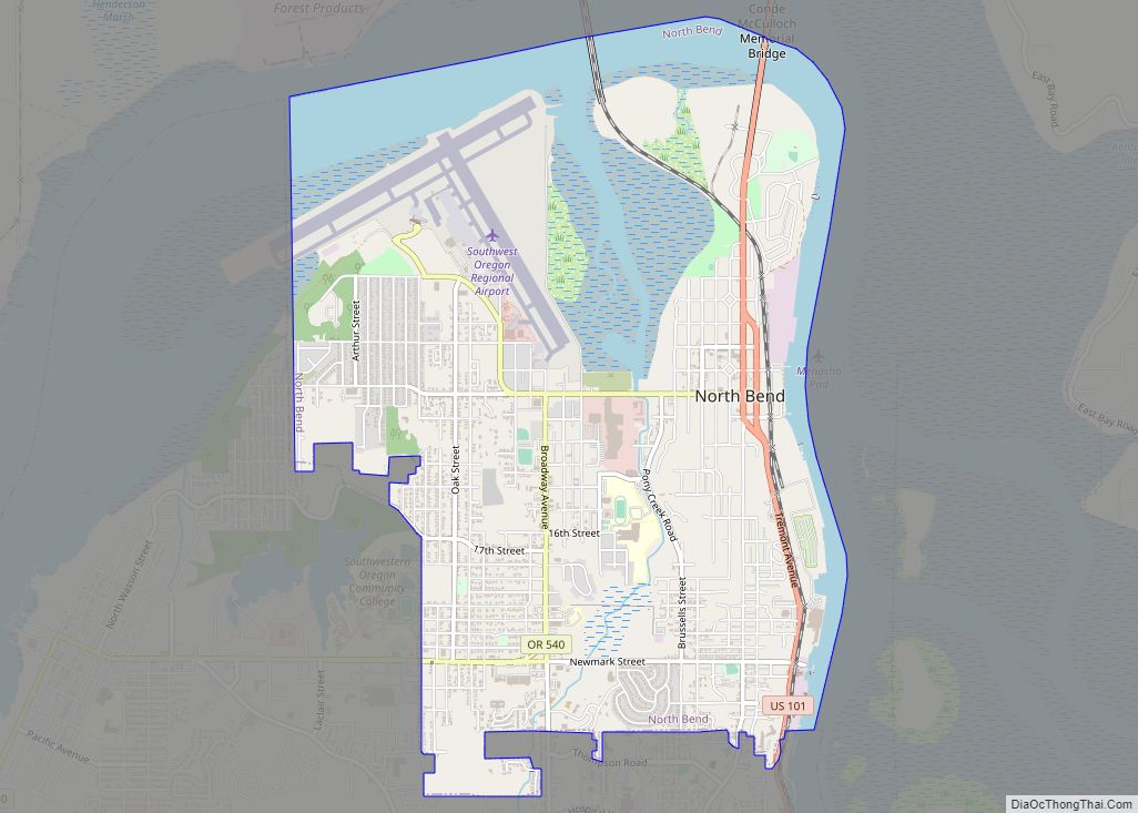
Coos Bay (Coos language: Atsixiis) is a city located in Coos County, Oregon, United States, where the Coos River enters Coos Bay on the Pacific Ocean. The city borders the city of North Bend, and together they are often referred to as one entity called either Coos Bay-North Bend or Oregon’s Bay Area. Coos Bay’s population as of the 2020 census was 15,985 residents, making it the most populous city on the Oregon Coast. Oregon’s Bay Area is estimated to be home to 32,308 (Coos Bay Census County Division).
| Name: | Coos Bay city |
|---|---|
| LSAD Code: | 25 |
| LSAD Description: | city (suffix) |
| State: | Oregon |
| County: | Coos County |
| Elevation: | 138 ft (42 m) |
| Land Area: | 10.63 sq mi (27.53 km²) |
| Water Area: | 5.28 sq mi (13.66 km²) |
| Population Density: | 1,503.90/sq mi (580.67/km²) |
| ZIP code: | 97420 |
| Area code: | 458 and 541 |
| FIPS code: | 4115250 |
| GNISfeature ID: | 2410223 |
| Website: | www.coosbayor.gov |
Online Interactive Map
Click on ![]() to view map in "full screen" mode.
to view map in "full screen" mode.
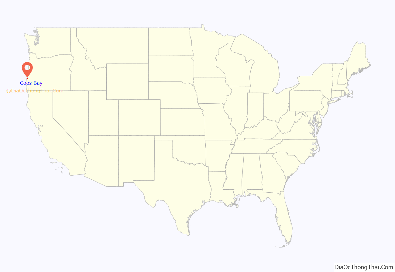
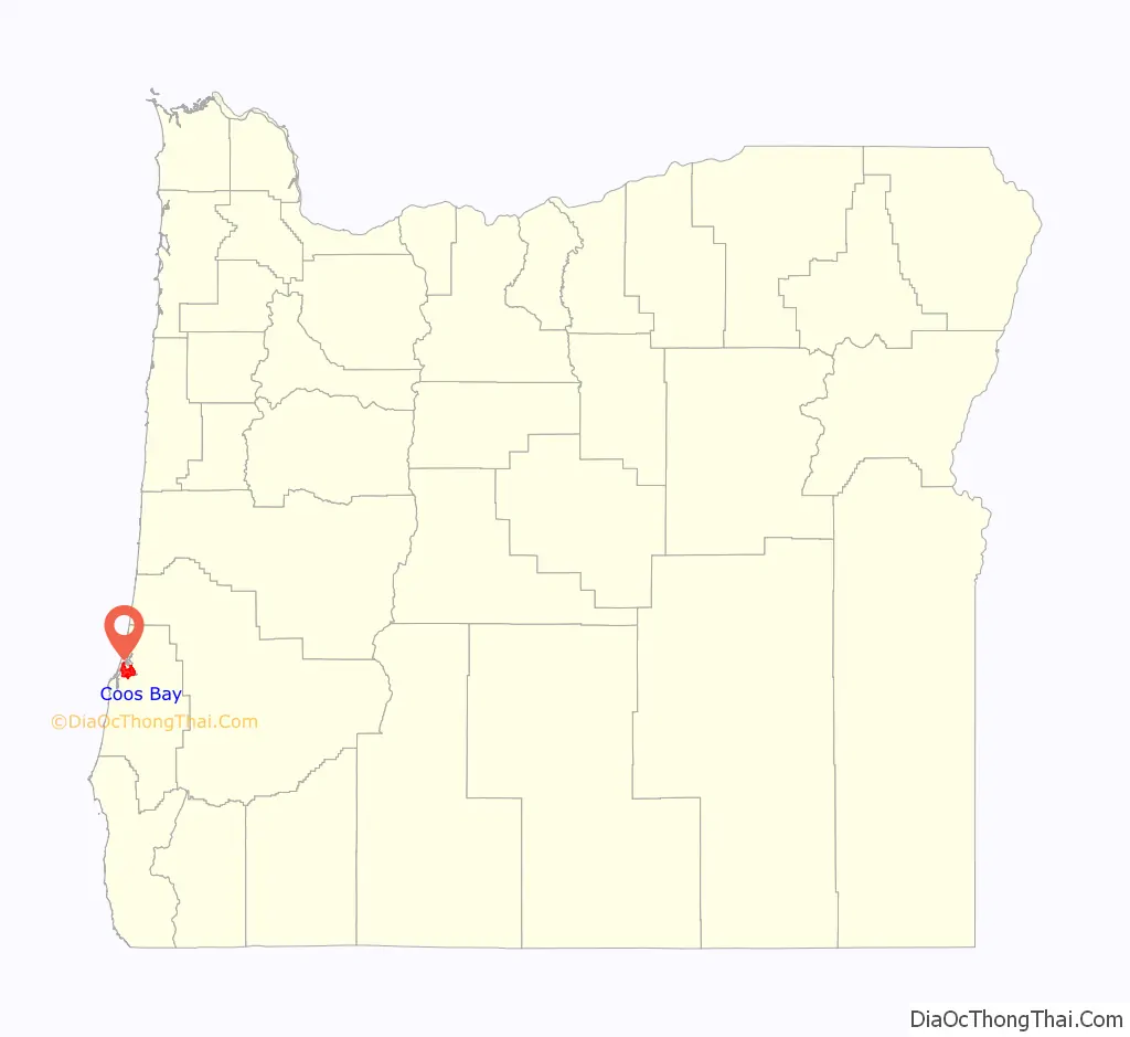
Coos Bay location map. Where is Coos Bay city?
History
Prior to Europeans first visiting the Oregon coast, Native American tribes claimed the Coos Bay region as their homeland for thousands of years. Members of the Coos, Lower Umpqua, Siuslaw and Coquille tribes lived, fished, hunted and gathered along Coos Bay and its estuaries, along rivers, and in meadows and forests. Approximately 400 years ago, British and Spanish explorers first approached the South Coast. In 1579, Sir Francis Drake was purported to have sought shelter for his ship, the Golden Hinde, around Cape Arago. Trader and explorer Jedediah Smith was in the region seeking furs, and the Hudson’s Bay Company sent Alexander Roderick McLeod to search for an inland passage.
19th century
The earliest settlement of European Americans in the area was in January 1852 when survivors of the Captain Lincoln shipwreck established Camp Castaway until they and their cargo could be fully rescued. There has been a permanent settlement on Coos Bay since 1853, when the town of Marshfield was founded there and named after the Massachusetts hometown of its founder, J. C. Tolman. The first Methodist church in the area was established in 1857. By 1866 the inhabitants, who were reliant on the sea for their income, had built the Cape Arago Light. The setting up of a post office in 1871 and the arrival of the Coos Bay Wagon Road in the town a year later connected Coos County with the Umpqua River valley in neighboring Douglas County, on the other side of the Coast Range of mountains. This wagon road, although long gone in its original form, is still partially in existence since the route of Oregon Route 42 roughly follows the original right of way.
1870 saw Coos Bay set up its first, and the state’s 48th, chartered Masonic Lodge. Named Blanco Lodge, this brotherhood was set up by several of the town’s founding fathers. With this development, the incorporation of Marshfield came in 1874. One of the nation’s oldest still-operating machine shops, the Nelson Machine Works-Coos Bay Iron Works, was founded in 1888.
20th century
On September 18, 1902, the only lynching ever to be documented in Oregon occurred in Coos Bay, of Alonzo Tucker, an African-American man. He was accused of raping a white woman and escaping from jail. However, there is no record of his escape from jail. According to newspaper accounts, Tucker was discovered by two young boys who began shooting him with airguns. After a brief pursuit, local miners apprehended Tucker who was hiding inside a store. The mob considering hanging him inside the store but decided to return him to the site of the alleged rape at a nearby bridge. Tucker was shot twice and then hanged from the 7th Street bridge, which spanned present-day Golden Field, where high school soccer games are now held. No charges were ever brought against the mob as officials determined “the deceased came to his death at the hands of parties unknown while resisting arrest for a felony, and that no crime was committed thereby.” Despite this claim that those in the mob were unknown, the participation of multiple people, including the husband of the alleged rape victim, was noted in local newspapers. One newspaper at that time reported the mob was “quiet and orderly” and another paper wrote, “‘Well done’ is the consensus of public opinion.” Alonzo Tucker’s cause of death was asphyxiation. According to the coroner’s report, cause of death was blood loss from the gunshot wound in Tucker’s right thigh, in which case he died before being hanged on the Marshfield bridge.
Prior to around 1915, the Coos region was largely isolated from the rest of Oregon due to difficulties in crossing the Coast Range and fording rivers, and the Pacific Ocean was used to link people to other areas, including San Francisco, which was an easier two-day trip compared to traveling inland over rugged terrain. In 1916 a rail line was completed that linked the region to other interior settlements and towns, which increased commercial trade and tourism Significant urban growth occurred in the 1920s, and during the 1930s to 1950s large-scale growth occurred. Per the Oregon Bay Area Chamber of Commerce, during the 1930s to 1950s:
What now makes up the central district of Coos Bay was called Marshfield until November 10, 1944. The name change, long advocated by residents, had been voted for and became effective on November 11, thus matching the name of the Bay itself. The City of Marshfield was named after the Massachusetts hometown of the Cityʼs founder, J.C. Tolman, and incorporated in 1874.
On February 4, 1999, a Japanese ship named the New Carissa ran aground on a beach 2.75 miles (4.3 km) north of the entrance to Coos Bay, drawing international attention to the area. The New Carissa was empty of cargo at the time, heading for the Port of Coos Bay to pick up wood chips. When the captain was told that the weather was too severe for the ship to enter port, he anchored his ship close by. The crew put out only one anchor, and it appears that this was probably on too short a chain to be effective. The subsequent US Coast Guard investigation found several other aspects of the ship’s company’s handling of the situation to have been poor, leading to the conclusion that human error caused the grounding. 70,000 US gallons (260 m3) of fuel oil were spilled by the vessel, with a further 165,000 to 255,000 gallons (625 to 965 m3) being deliberately set alight and burnt off later. The stern of the ship remained on the beach; the bow was towed out to sea and sunk after structural damage caused by the fire split the ship in two. In 2008, the stern of the New Carissa was cut into pieces and removed from the beach.
21st century
The worst loss of life for a fire department in modern Oregon history occurred in Coos Bay on November 25, 2002, when three firefighters were killed by a structural failure of the roof in an auto parts store. The accidental blaze paralyzed the city for several hours, with fire departments from several neighboring towns assisting in the effort to stop the blaze. Captain Randy Carpenter, Firefighter/Engineer Robert “Chuck” Hanners and Firefighter/Engineer Jeff Common, all from Coos Bay, died when an explosion caused the roof of the building to cave in; they were inside the structure when the roof collapsed, killing the three firefighters.
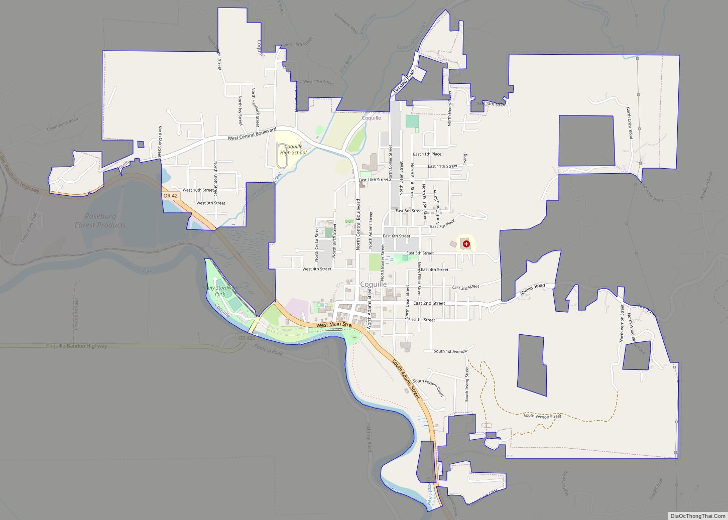
Coos Bay Road Map
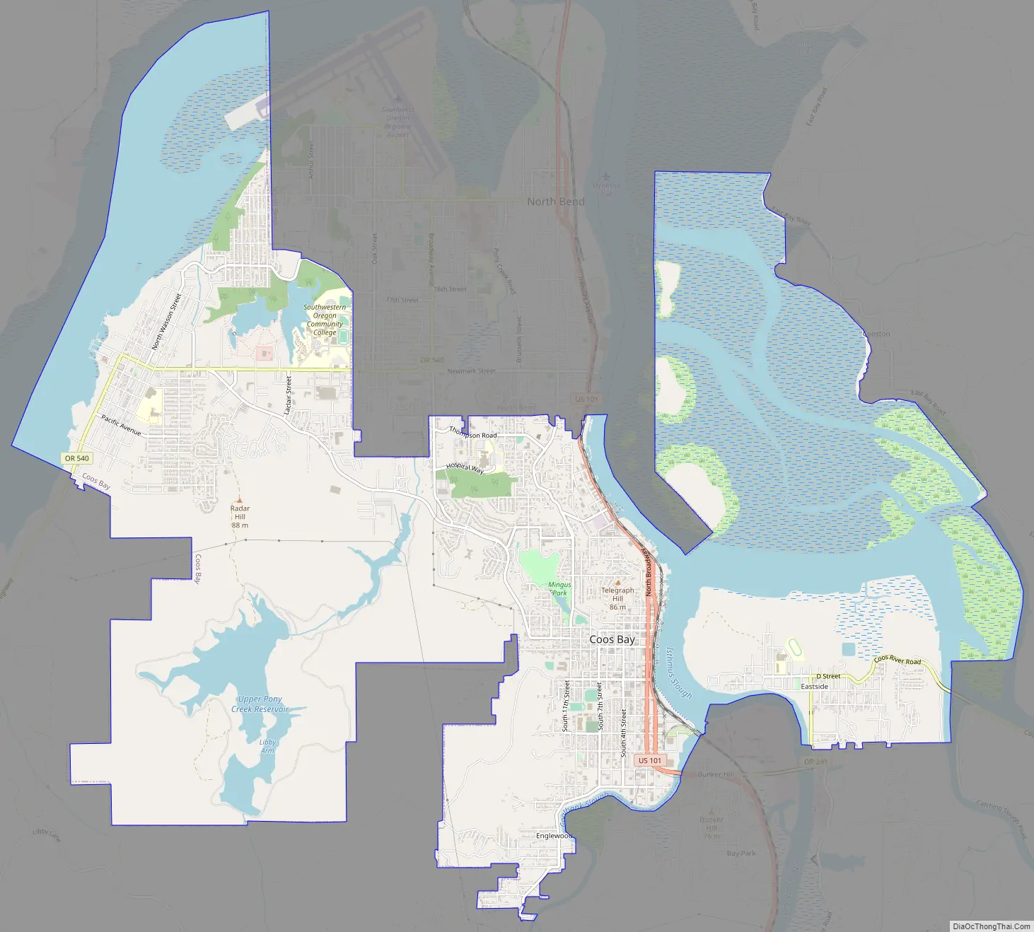
Coos Bay city Satellite Map

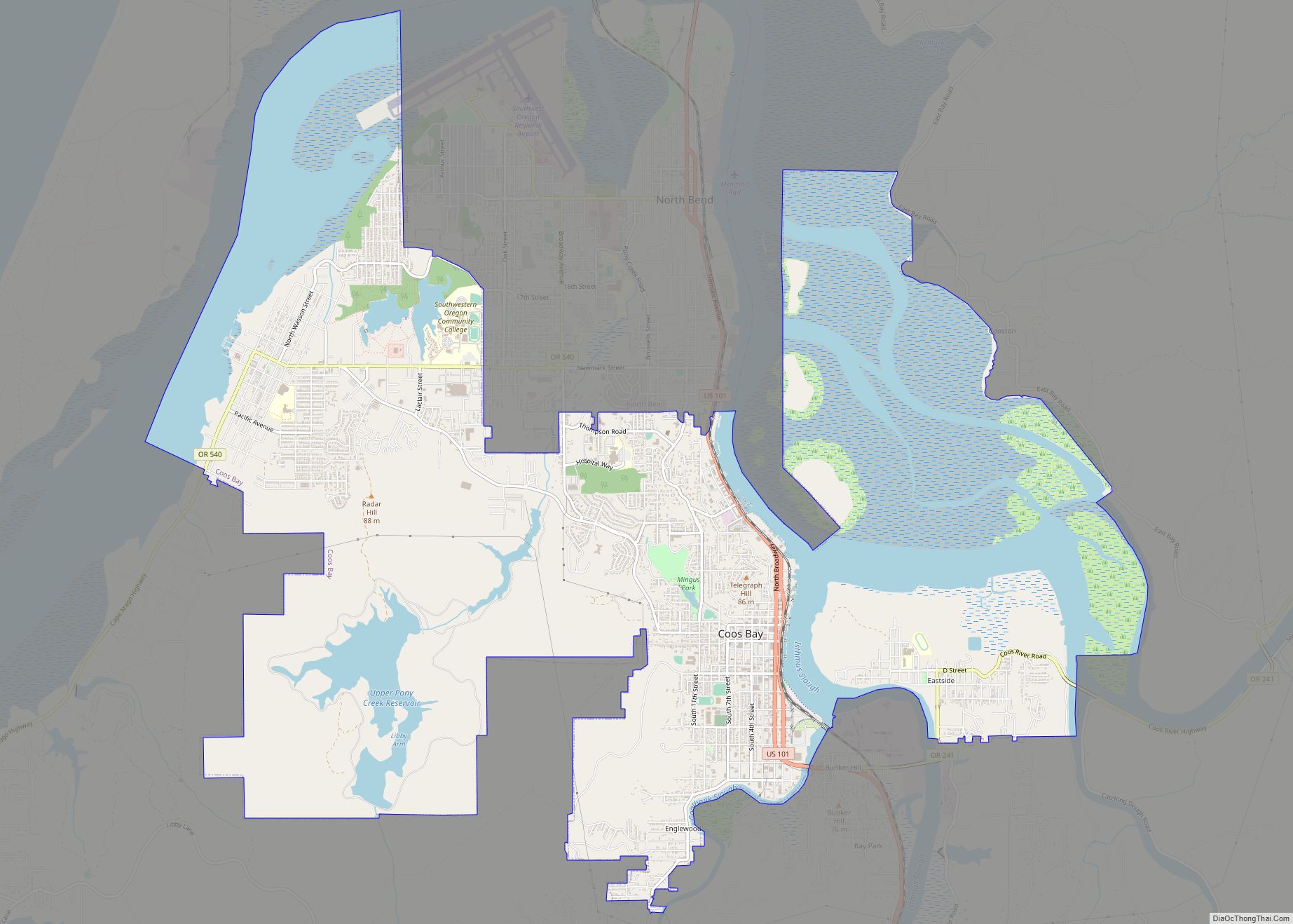
Geography
According to the United States Census Bureau, the city has a total area of 15.90 square miles (41.18 km), of which, 10.60 square miles (27.45 km) is land and 5.30 square miles (13.73 km) is water. The city is quite hilly, with elevations ranging from between sea level to over 500 feet (150 m). Bodies of water within the city limits include Upper Pony Creek Reservoir, Lake Merritt, Empire Lakes and numerous streams.
Districts
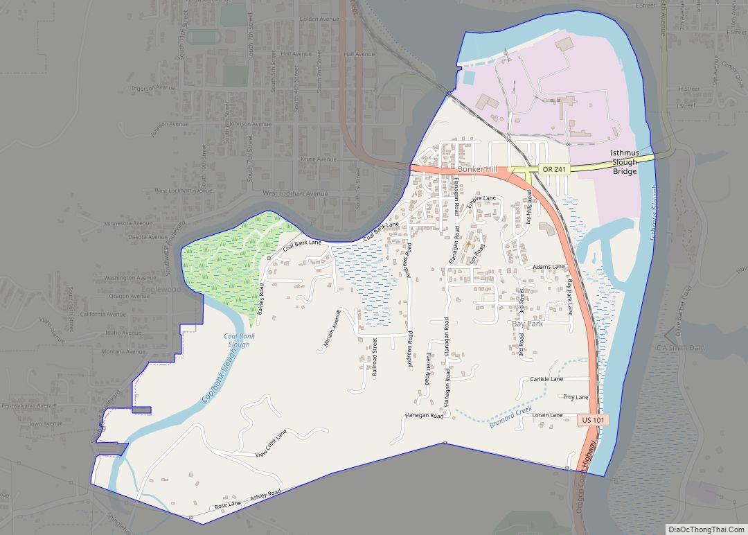
The City of Coos Bay comprises four districts, two of which (Eastside and Empire) were formerly independent cities.
The Marshfield District of Coos Bay is the historic central downtown and business district of the city. Old Marshfield and its surrounding neighborhoods were what comprised the original Coos Bay before the annexations of Empire and Eastside during the 20th century. The Marshfield District contains many buildings listed on the National Register of Historic Places, such as the Carnegie Library, Chandler Hotel, Egyptian Theatre and Tioga Hotel. The waterfront area of the Marshfield District has a boardwalk with a city dock, bicycling trail and pavilions featuring historical and interpretive displays.
The Milner Crest district is a residential neighborhood developed in the mid-20th century, located at the crest of a hill overlooking the bay, north of Mingus Park and the Marshfield District. The majority of the Coos Bay area’s medical facilities are located in this district.
The Eastside district of Coos Bay was originally called East Marshfield for its situation on the east side of the bay. East Marshfield post office was established in 1891 and it operated intermittently until 1908, when the name was changed to Eastside. The community of Eastside merged with the city of Coos Bay in 1983. Eastside is primarily a residential neighborhood and is home to Eastside Elementary, Millicoma Middle School, walking trails at Millicoma Marsh and a public boat launch.
A trail established by Coquille people ran from the original site of Randolph to Empire.
The Empire district (Coos language: Hanisich) was founded as Empire City in 1853 by members of the Coos Bay Company from Jacksonville, Oregon, and at the time it was assumed that the area would be center of the region. The company was formed after the discovery of gold in northern California and southwestern Oregon. For a time Empire City was the county seat of Coos County. The first post office in the location was called Elkhorn, which ran from 1853 until 1854. It was the first post office in what is now Coos County, though at the time it was part of Umpqua County. Empire City post office was established in 1858 and ran until 1894, when it was renamed Empire. In 1965, the city of Empire voted to consolidate with Coos Bay. Today, Empire is the location of Madison Elementary School, Sunset Intermediate School and a business district along Cape Arago Highway.
Climate
This region experiences cool-to-warm summers typical of the Oregon coast, with no average monthly temperatures above 71.6 °F (22.0 °C) which means mild weather usually in the lower 40s to upper 60s Fahrenheit. According to the Köppen Climate Classification system, Coos Bay has a warm-summer Mediterranean climate, abbreviated Csb on climate maps, but that borders on an oceanic climate, due to the cool year-round temperatures and sheer volume of annual rainfall, nearly 65 inches (1,651.0 mm) annually. Severe coastal storms (or gales) with hurricane-force winds occur frequently during the winter months, while summers can be foggy. Snowfall is uncommon, with just around an inch (2.54 cm) of snow annually.
The record high temperature of 102 °F (38.9 °C) was recorded on September 22, 2009, and the record low of 12 °F (−11.1 °C) was recorded on December 21, 1990. The wettest “rain year” at Southwest Oregon Regional Airport in nearby North Bend was from July 1994 to June 1995 with 89.13 inches (2,263.9 mm) and the driest from July 1976 to June 1977 with 30.87 inches (784.1 mm); the greatest monthly rainfall was 22.69 inches (576.3 mm) in November 1973, and the highest 24-hour rainfall 6.67 inches (169.4 mm) on November 18, 1996.
The Coos Bay—North Bend area is in USDA plant hardiness zone 9A, with a frost-free growing season around nine months long.
See also
Map of Oregon State and its subdivision: Map of other states:- Alabama
- Alaska
- Arizona
- Arkansas
- California
- Colorado
- Connecticut
- Delaware
- District of Columbia
- Florida
- Georgia
- Hawaii
- Idaho
- Illinois
- Indiana
- Iowa
- Kansas
- Kentucky
- Louisiana
- Maine
- Maryland
- Massachusetts
- Michigan
- Minnesota
- Mississippi
- Missouri
- Montana
- Nebraska
- Nevada
- New Hampshire
- New Jersey
- New Mexico
- New York
- North Carolina
- North Dakota
- Ohio
- Oklahoma
- Oregon
- Pennsylvania
- Rhode Island
- South Carolina
- South Dakota
- Tennessee
- Texas
- Utah
- Vermont
- Virginia
- Washington
- West Virginia
- Wisconsin
- Wyoming