Farmington is a city in St. Francois County located about 75 miles (121 km) southwest of St. Louis in the Lead Belt region in Missouri. As of the 2020 census, the population was 18,217. It is the county seat of St. Francois County. Farmington was established in 1822 as Murphy’s Settlement, named for William Murphy of Kentucky, who first visited the site in 1798. When St. Francois County was organized, the town was briefly called St. Francois Court House and later renamed to Farmington.
| Name: | Farmington city |
|---|---|
| LSAD Code: | 25 |
| LSAD Description: | city (suffix) |
| State: | Missouri |
| County: | St. Francois County |
| Elevation: | 948 ft (289 m) |
| Total Area: | 9.55 sq mi (24.74 km²) |
| Land Area: | 9.49 sq mi (24.59 km²) |
| Water Area: | 0.06 sq mi (0.15 km²) |
| Total Population: | 18,217 |
| Population Density: | 1,918.79/sq mi (740.85/km²) |
| Area code: | 573 |
| FIPS code: | 2923752 |
| GNISfeature ID: | 2394749 |
| Website: | http://farmington-mo.gov |
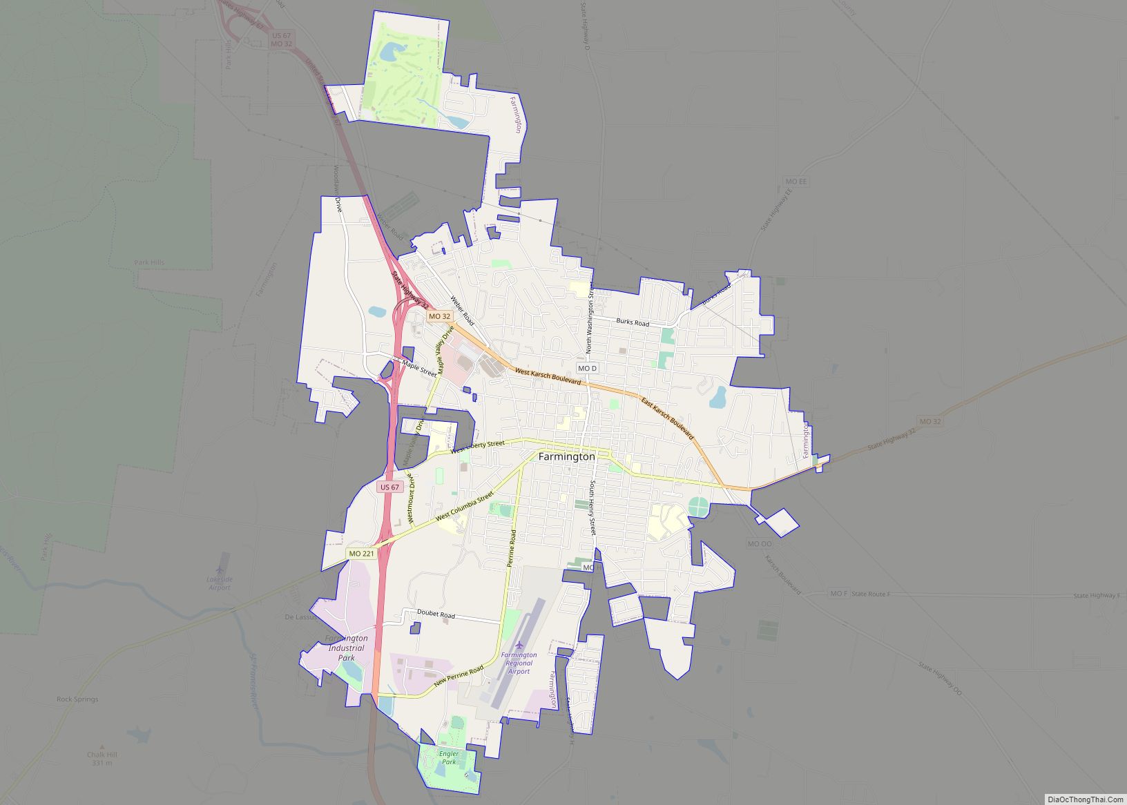
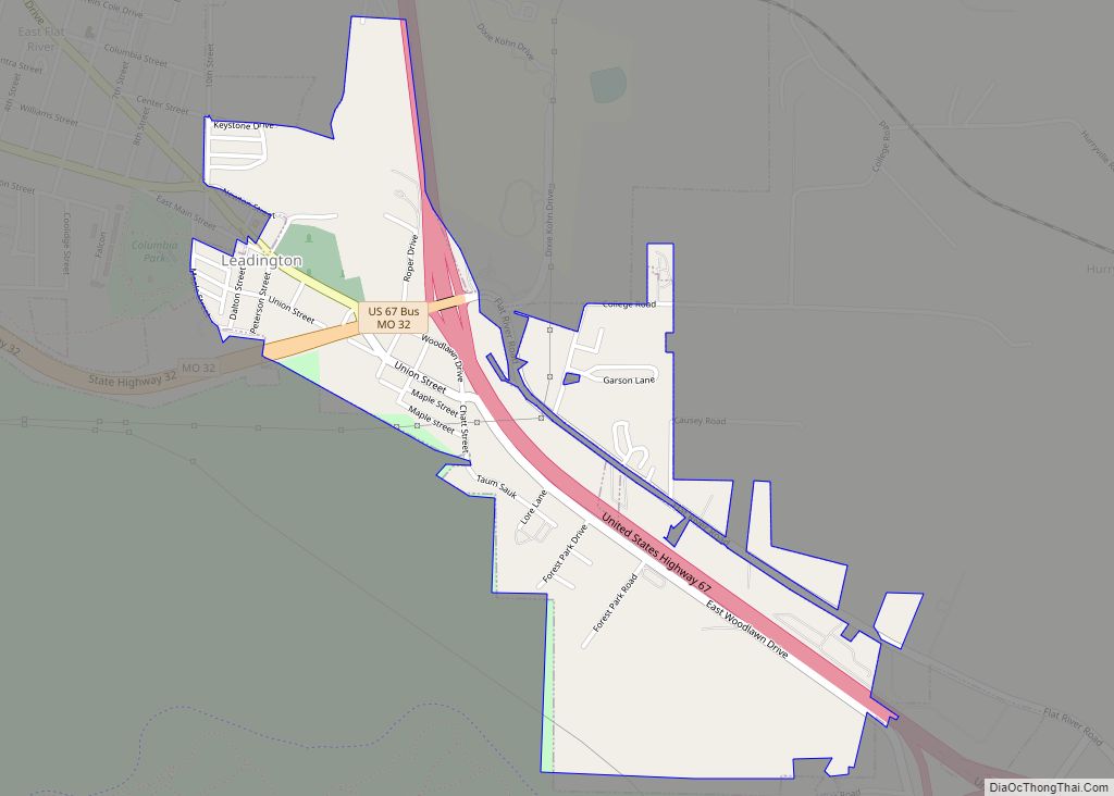
Online Interactive Map
Click on ![]() to view map in "full screen" mode.
to view map in "full screen" mode.
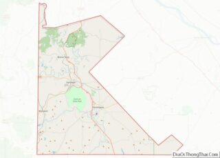
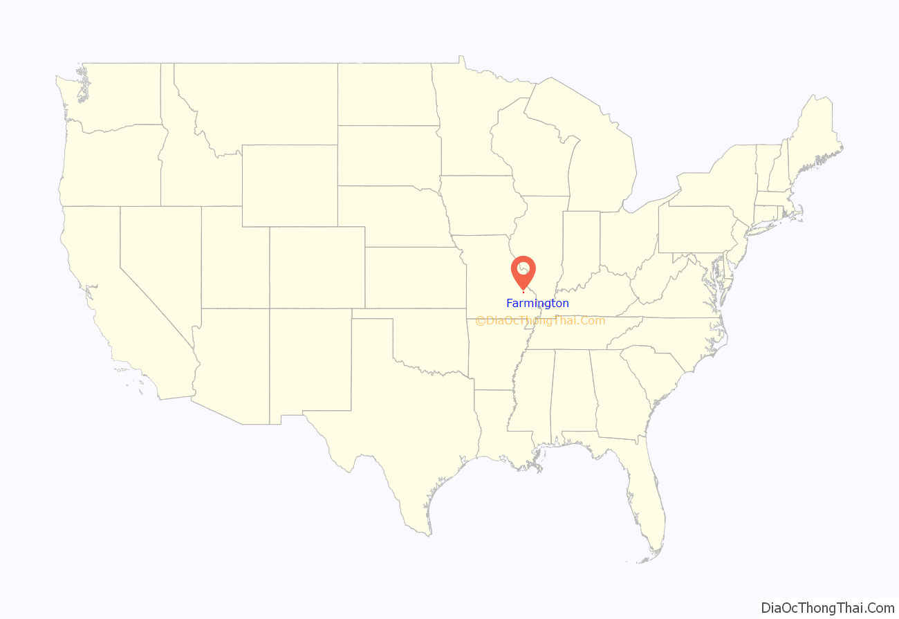
Farmington location map. Where is Farmington city?
History
William Murphy migrated from Kentucky to this former area of La Louisiane west of the Mississippi River in 1798, when it was under Spanish rule. Calderon <—?–> was searching for the ideal site to relocate his family. Tradition holds that he was aided by a local Native American, likely Osage, in finding a spring near here.
Deciding that this was an excellent place to settle, Murphy acquired a Spanish Land Grant, allowing him and his family to found a community along the St. Francois River.
In his travels back to Kentucky, Murphy died. His wife Sarah and their grown sons carried out establishing the settlement around 1800. They named it Murphy’s Settlement. Sarah is known to have founded the first Protestant Sunday School west of the Mississippi River. Because Spanish law barred any religious services that were not Roman Catholic, Sarah and her students conducted classes in secret.
The United States acquired this area as part of the Louisiana Purchase in 1803. It was later designated as part of the Missouri Territory. A post office in Murphy’s Settlement was opened in 1817.
Missouri was admitted as a state in 1821 as part of the Missouri Compromise. In 1822, William Crawford Murphy contributed 52 acres (210,000 m) of land here for the county seat of what was soon to be St. Francois County.
Murphy’s Settlement was renamed Farmington in 1825, taking the name from the area’s rich farm land. Farmington was granted incorporation as a town in 1836 and became a village 20 years later in 1856.
In the mid-19th century, Farmington enjoyed growth from construction of the historic Plank Road, which stretched from Pilot Knob to Ste. Genevieve. It improved the village’s access to supplies and markets slong the river.
The road was built both to transport supplies from the shipping facilities located along the river to the mines and to move the mines’ iron ore to the shipping facilities. This route was soon taken over by the St. Louis, Iron Mountain and Southern Railway.
The first public school was constructed in 1870 and in 1879. Farmington gained recognition as a fourth-class city. In 1981 Farmington became a third-class city.
The Courthouse Square Historic District, East Columbia Historic District, Farmington State Hospital No. 4 Cemetery, James Robinson McCormick House, Presbyterian Orphanage of Missouri, and St. Francois County Jail and Sheriff’s Residence are listed on the National Register of Historic Places.
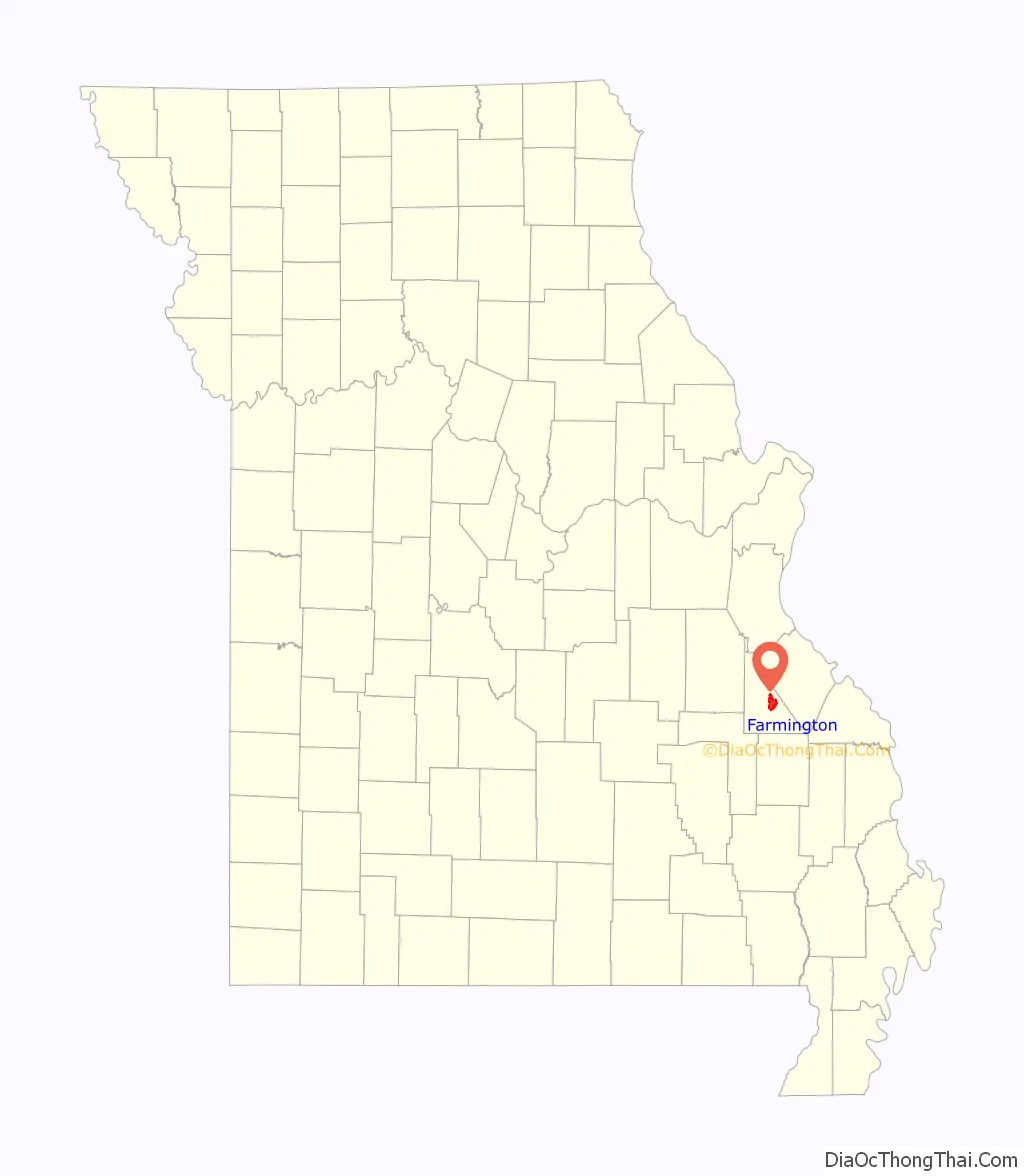
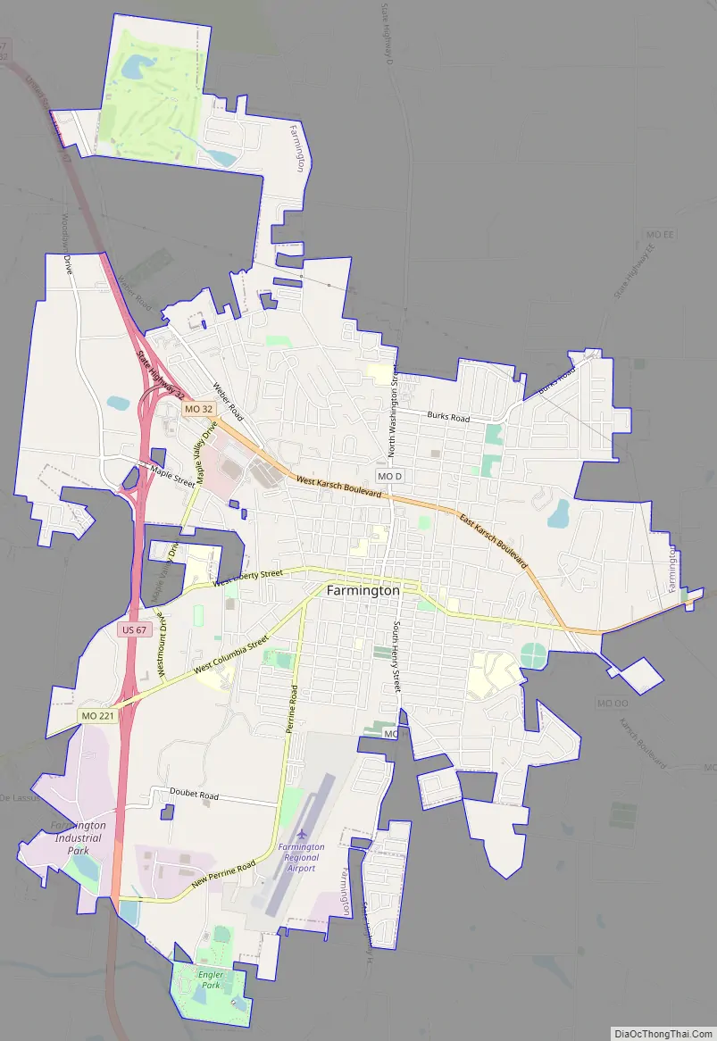
Farmington Road Map
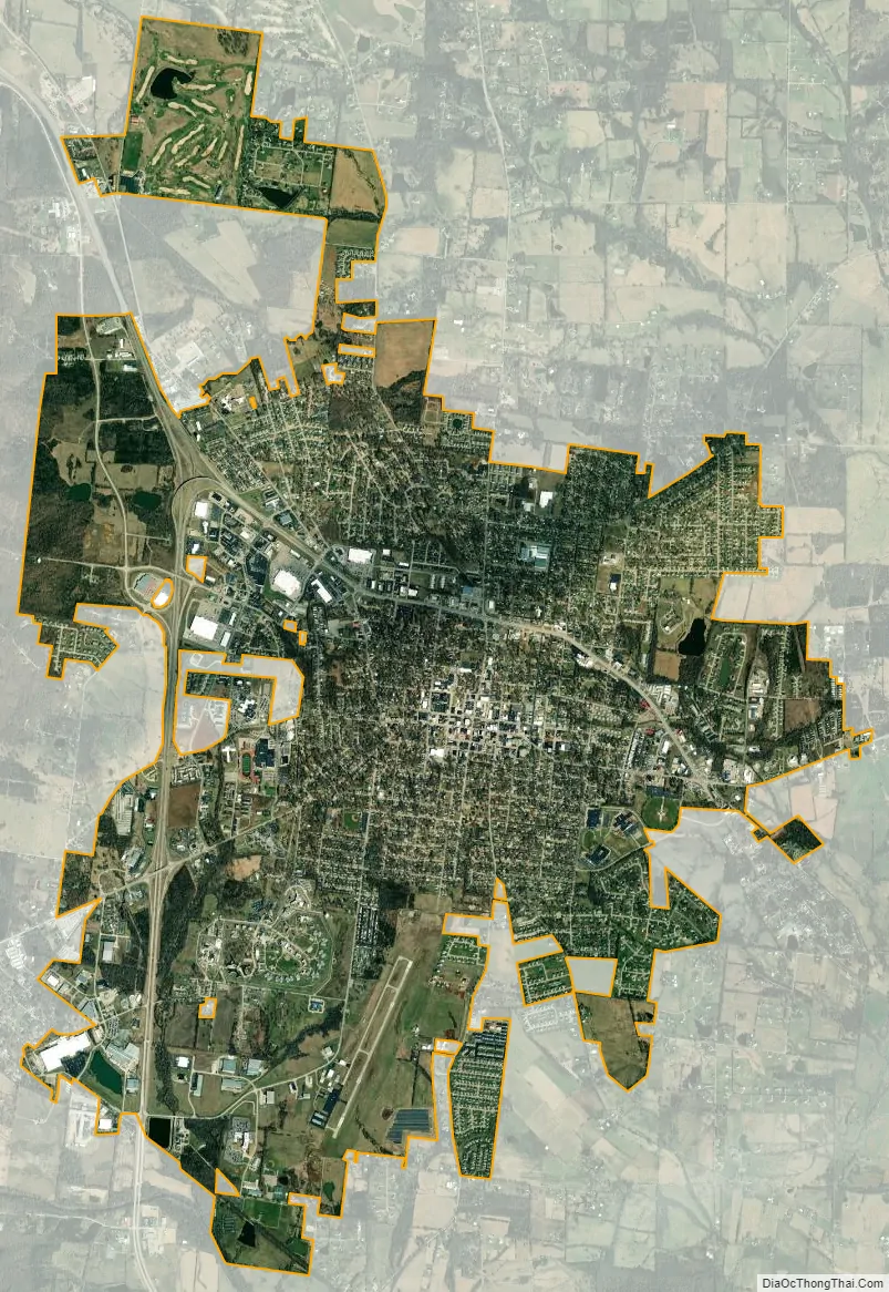
Farmington city Satellite Map
Geography
Farmington is located at 37°46′55″N 90°25′20″W / 37.78194°N 90.42222°W / 37.78194; -90.42222 (37.781932, −90.422145). According to the United States Census Bureau, the city has a total area of 9.39 square miles (24.32 km), of which 9.35 square miles (24.22 km) is land and 0.04 square miles (0.10 km) is water.
Climate
Average temperatures in the following chart are taken from National Weather Service averages from 1991 to 2020.
See also
Map of Missouri State and its subdivision:- Adair
- Andrew
- Atchison
- Audrain
- Barry
- Barton
- Bates
- Benton
- Bollinger
- Boone
- Buchanan
- Butler
- Caldwell
- Callaway
- Camden
- Cape Girardeau
- Carroll
- Carter
- Cass
- Cedar
- Chariton
- Christian
- Clark
- Clay
- Clinton
- Cole
- Cooper
- Crawford
- Dade
- Dallas
- Daviess
- De Kalb
- Dent
- Douglas
- Dunklin
- Franklin
- Gasconade
- Gentry
- Greene
- Grundy
- Harrison
- Henry
- Hickory
- Holt
- Howard
- Howell
- Iron
- Jackson
- Jasper
- Jefferson
- Johnson
- Knox
- Laclede
- Lafayette
- Lawrence
- Lewis
- Lincoln
- Linn
- Livingston
- Macon
- Madison
- Maries
- Marion
- McDonald
- Mercer
- Miller
- Mississippi
- Moniteau
- Monroe
- Montgomery
- Morgan
- New Madrid
- Newton
- Nodaway
- Oregon
- Osage
- Ozark
- Pemiscot
- Perry
- Pettis
- Phelps
- Pike
- Platte
- Polk
- Pulaski
- Putnam
- Ralls
- Randolph
- Ray
- Reynolds
- Ripley
- Saint Charles
- Saint Clair
- Saint Francois
- Saint Louis
- Sainte Genevieve
- Saline
- Schuyler
- Scotland
- Scott
- Shannon
- Shelby
- Stoddard
- Stone
- Sullivan
- Taney
- Texas
- Vernon
- Warren
- Washington
- Wayne
- Webster
- Worth
- Wright
- Alabama
- Alaska
- Arizona
- Arkansas
- California
- Colorado
- Connecticut
- Delaware
- District of Columbia
- Florida
- Georgia
- Hawaii
- Idaho
- Illinois
- Indiana
- Iowa
- Kansas
- Kentucky
- Louisiana
- Maine
- Maryland
- Massachusetts
- Michigan
- Minnesota
- Mississippi
- Missouri
- Montana
- Nebraska
- Nevada
- New Hampshire
- New Jersey
- New Mexico
- New York
- North Carolina
- North Dakota
- Ohio
- Oklahoma
- Oregon
- Pennsylvania
- Rhode Island
- South Carolina
- South Dakota
- Tennessee
- Texas
- Utah
- Vermont
- Virginia
- Washington
- West Virginia
- Wisconsin
- Wyoming