Rockingham County is a county located in the U.S. state of Virginia. As of the 2020 census, the population was 83,757. Its county seat is the independent city of Harrisonburg.
Along with Harrisonburg, Rockingham County forms the Harrisonburg, VA, Metropolitan Statistical Area. It is also home of the Rockingham County Baseball League.
| Name: | Rockingham County |
|---|---|
| FIPS code: | 51-165 |
| State: | Virginia |
| Founded: | 1778 |
| Named for: | Charles Watson-Wentworth |
| Seat: | Harrisonburg |
| Largest town: | Harrisonburg |
| Total Area: | 853 sq mi (2,210 km²) |
| Land Area: | 849 sq mi (2,200 km²) |
| Total Population: | 83,757 |
| Population Density: | 98/sq mi (38/km²) |
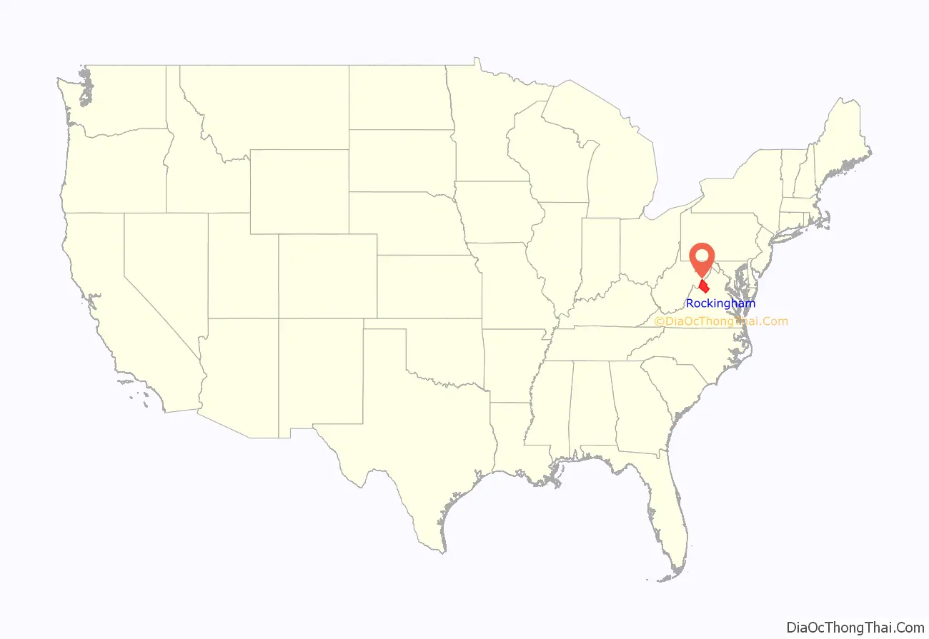
Rockingham County location map. Where is Rockingham County?

History
Settlement of the county began in 1727, when Adam Miller (Mueller) staked out a claim on the south fork of the Shenandoah River, near the line that now divides Rockingham County from Page County. On a trip through eastern Virginia, the German-born Miller had heard reports about a lush valley to the west which had been discovered by Governor Alexander Spotswood’s legendary Knights of the Golden Horseshoe Expedition, and then moved his family down from Lancaster County, Pennsylvania. In 1741, Miller purchased 820 acres (3.3 km), including a large lithia spring, near Elkton, Virginia, and lived on this property for the remainder of his life.
Much-increased settlement of this portion of the Colony of Virginia by Europeans began in the 1740s and 1750s. Standing between the Tidewater and Piedmont regions to the east in Virginia and the Shenandoah Valley and the area beyond (known in old Virginia as the “Transmountaine”) were the Blue Ridge Mountains. Rather than cross such a formidable physical barrier, most early settlers came southerly up the valley across the Potomac River from Maryland and Pennsylvania. Many followed the Great Wagon Trail, also known as the Valley Pike (U.S. Route 11 in modern times).
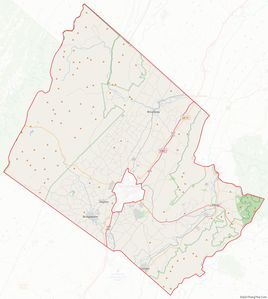
Rockingham County was established in 1778 from Augusta County. Harrisonburg was named as the county seat and incorporated as a town in 1780. Harrisonburg was incorporated as a city in 1916 and separated from Rockingham County (all cities in Virginia are independent of any county), but it remains the county seat.
The county is named for Charles Watson-Wentworth, 2nd Marquess of Rockingham, a British statesman (1730–1782). He was Prime Minister of Great Britain twice, and a keen supporter of constitutional rights for the colonists. During his first term, he brought about the repeal of the Stamp Act of 1765, reducing the tax burden on the colonies. Appointed again in 1782, upon taking office, he backed the claim for the independence of the Thirteen Colonies, initiating an end to British involvement in the American Revolutionary War. However, he died after only 14 weeks in office. By 1778, it was unusual to honor British officials in Virginia, fighting for its independence. The same year, immediately to the north of Rockingham County, Dunmore County, named for Virginia’s last Royal Governor, John Murray, 4th Earl of Dunmore, an unpopular figure, was renamed. The new name, Shenandoah County, used a Native American name. However, long their political supporter in the British Parliament, the Marquess of Rockingham was a popular figure with the citizens of the new United States. Also named in his honor were Rockingham County, New Hampshire, Rockingham County, North Carolina, and the City of Rockingham in Richmond County, North Carolina.
Rockingham County is the birthplace of Thomas Lincoln, Abraham Lincoln’s father. In 1979 when the Adolf Coors Brewing Company came to Rockingham County it caused an uproar; some citizens thought it would corrupt the morals of the area while others wanted the new jobs.
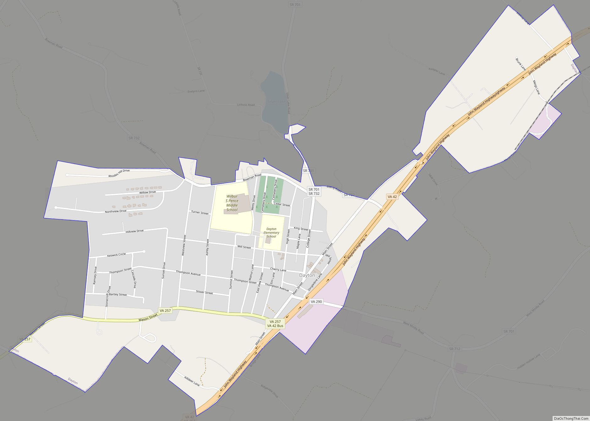
In 2018, a series of strikes and protests were held in Dayton‘s Cargill plant.
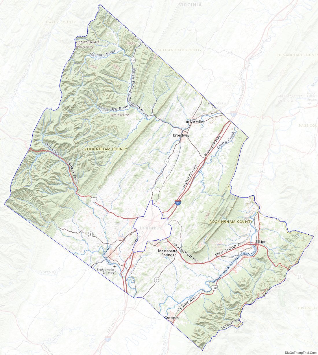
Rockingham County Road Map
Geography
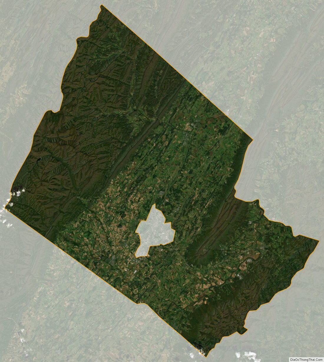
According to the U.S. Census Bureau, the county has a total area of 853 square miles (2,210 km), of which 849 square miles (2,200 km) is land and 4.3 square miles (11 km) (0.5%) is water. It is the third-largest county in Virginia by land area. Large portions of the county fall within the Shenandoah National Park to the east and George Washington National Forest to the west, and therefore are subject to development restrictions. The county stretches west to east from the peaks of easternmost Alleghany mountains to the peaks of the Blue Ridge mountains, encompassing the entire width of the Shenandoah Valley. Rockingham is bisected by another geographic formation, Massanutten Mountain stretching from just east of Harrisonburg, VA to a few miles southwest of Front Royal, VA in Warren County, VA. Massanutten Mountain splits the central Shenandoah Valley as the German River and the North Fork Shenandoah River flow on its western side and the South Fork flows on the eastern.
Adjacent counties
- Pendleton County, West Virginia – west
- Hardy County, West Virginia – north
- Shenandoah County, Virginia – northeast
- Page County, Virginia – east
- Greene County, Virginia – southeast
- Albemarle County, Virginia – southeast
- Augusta County, Virginia – southwest
- Harrisonburg, Virginia – center (enclave)
National protected areas
- George Washington National Forest (part)
- Shenandoah National Park (part)
Rockingham County Topographic Map
Rockingham County Satellite Map
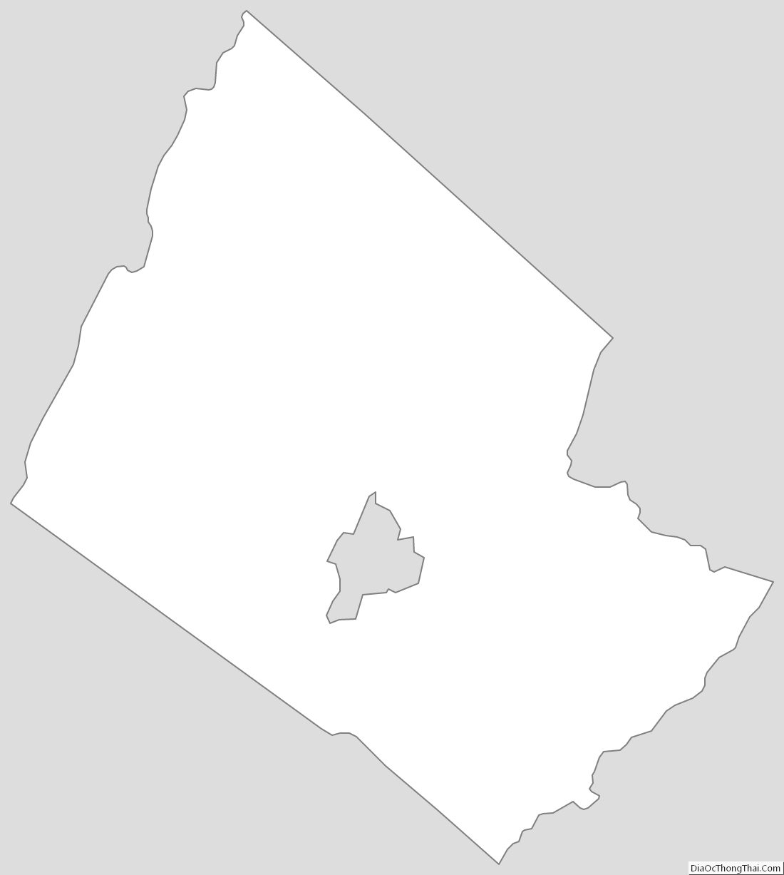
Rockingham County Outline Map