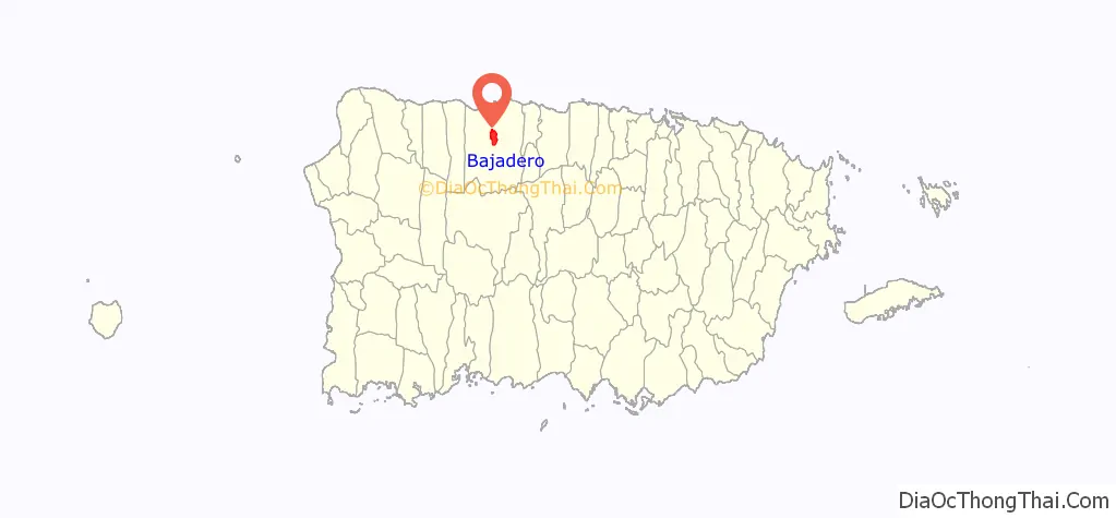
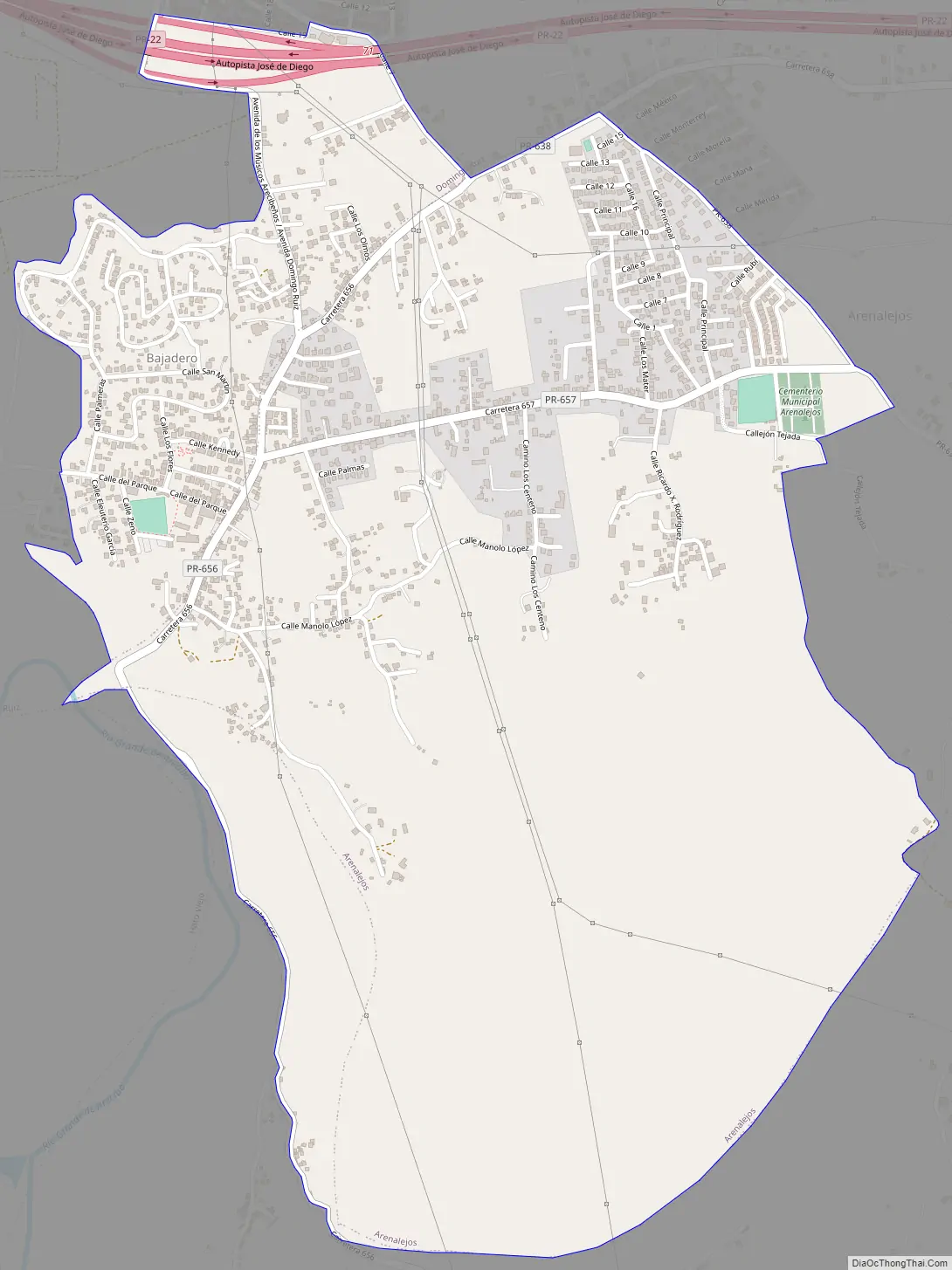
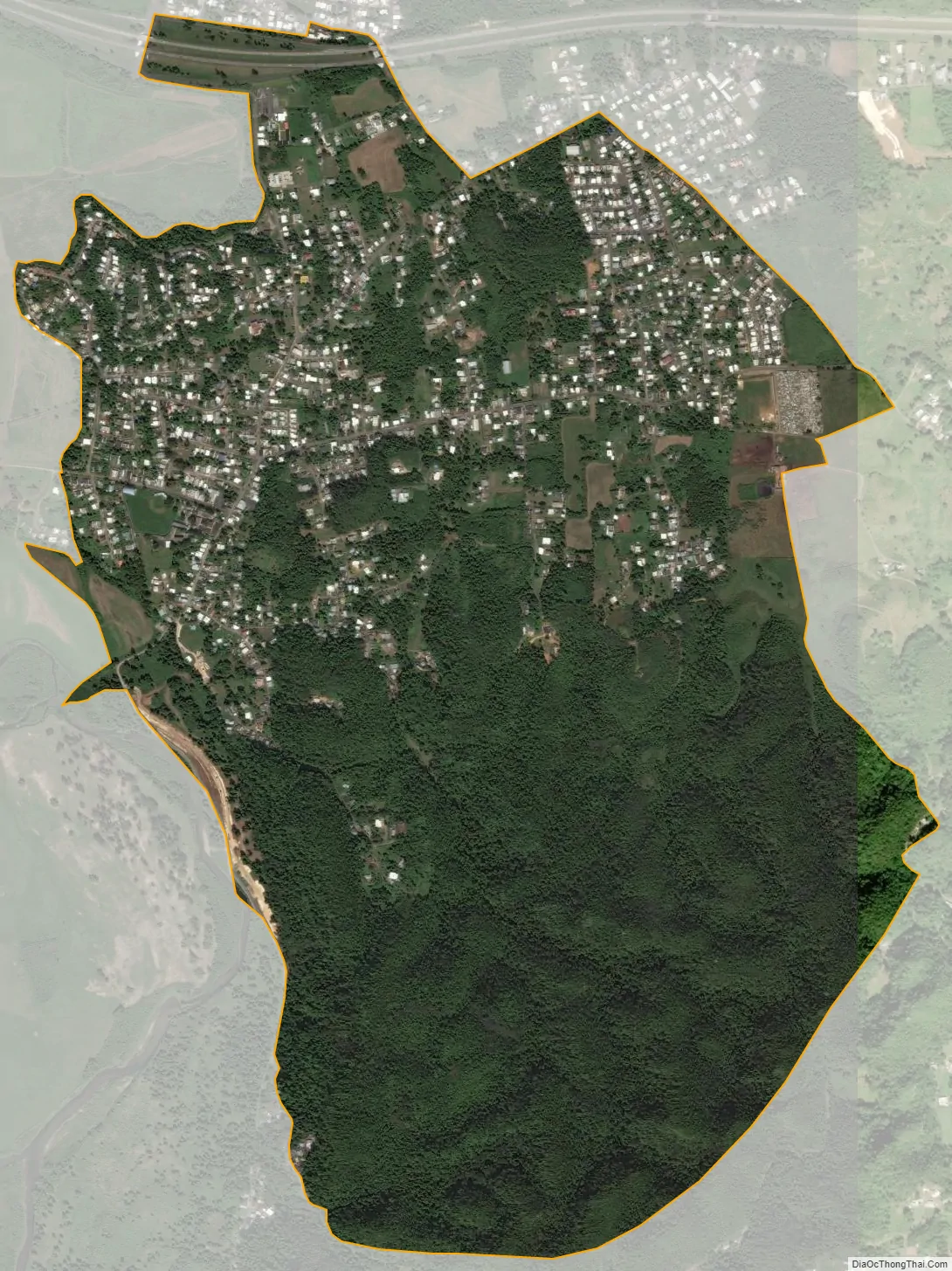
Bajadero is a community in the municipality of Arecibo, Puerto Rico. Its population in 2010 was 3,710. Three barrios border each other and each contains a section of the community. The Bajadero community in the barrio of Arenalejos had a population of 2,380 in 2010. The Bajadero community in the barrio of Carreras had a population of 64 in 2010 and the Bajadero community in the barrio of Domingo Ruíz had a population of 1,266 in 2010. There is a U.S. Post office in the community of Bajadero and its zip code is 00616.
| Name: | Bajadero comunidad |
|---|---|
| LSAD Code: | 55 |
| LSAD Description: | comunidad (suffix) |
| State: | Puerto Rico |
| County: | Arecibo Municipio |
| Elevation: | 259 ft (79 m) |
| Total Area: | 3,710 |
| FIPS code: | 7204658 |
Online Interactive Map
Click on ![]() to view map in "full screen" mode.
to view map in "full screen" mode.
Bajadero location map. Where is Bajadero comunidad?
Bajadero Road Map
Bajadero city Satellite Map
See also
Map of other states:- Alabama
- Alaska
- Arizona
- Arkansas
- California
- Colorado
- Connecticut
- Delaware
- District of Columbia
- Florida
- Georgia
- Hawaii
- Idaho
- Illinois
- Indiana
- Iowa
- Kansas
- Kentucky
- Louisiana
- Maine
- Maryland
- Massachusetts
- Michigan
- Minnesota
- Mississippi
- Missouri
- Montana
- Nebraska
- Nevada
- New Hampshire
- New Jersey
- New Mexico
- New York
- North Carolina
- North Dakota
- Ohio
- Oklahoma
- Oregon
- Pennsylvania
- Rhode Island
- South Carolina
- South Dakota
- Tennessee
- Texas
- Utah
- Vermont
- Virginia
- Washington
- West Virginia
- Wisconsin
- Wyoming