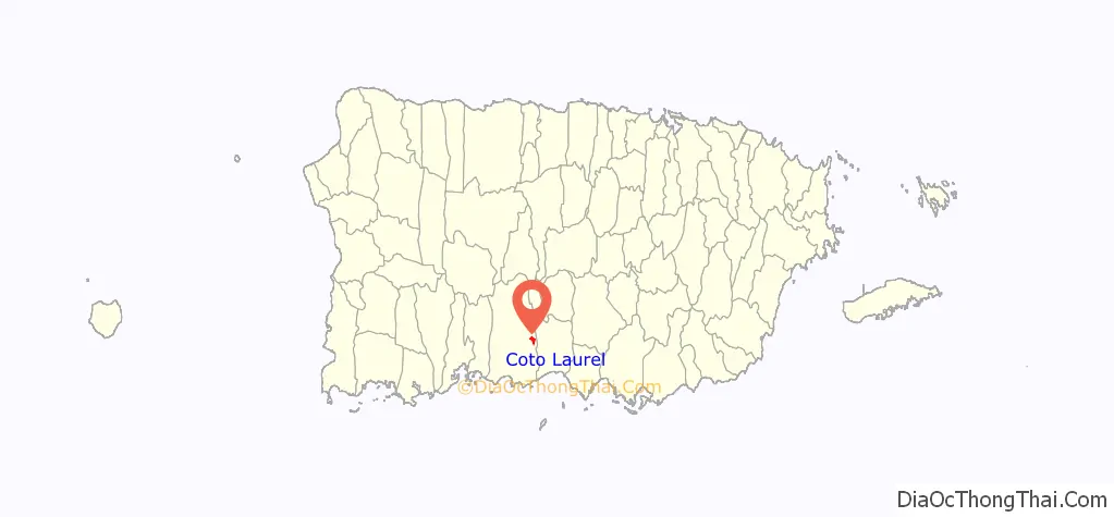
Coto Laurel (Barrio Coto Laurel) is one of the 31 barrios of the municipality of Ponce, Puerto Rico. Along with Anón, Marueño, Guaraguao, Quebrada Limon, Real, and San Patricio, and the coastal barrios of Canas and Capitanejo, Coto Laurel is one of the municipality’s nine bordering barrios. It borders the municipality of Juana Diaz. It was founded in 1831.
| Name: | Coto Laurel comunidad |
|---|---|
| LSAD Code: | 55 |
| LSAD Description: | comunidad (suffix) |
| State: | Puerto Rico |
| County: | Ponce Municipio |
| Elevation: | 335 ft (102 m) |
| Total Area: | 3.59 sq mi (9.3 km²) |
| Land Area: | 3.54 sq mi (9.2 km²) |
| Water Area: | 0.05 sq mi (0.1 km²) |
| Total Population: | 7,123 |
| Population Density: | 2,023.6/sq mi (781.3/km²) |
| FIPS code: | 7221213 |
Online Interactive Map
Click on ![]() to view map in "full screen" mode.
to view map in "full screen" mode.
Coto Laurel location map. Where is Coto Laurel comunidad?
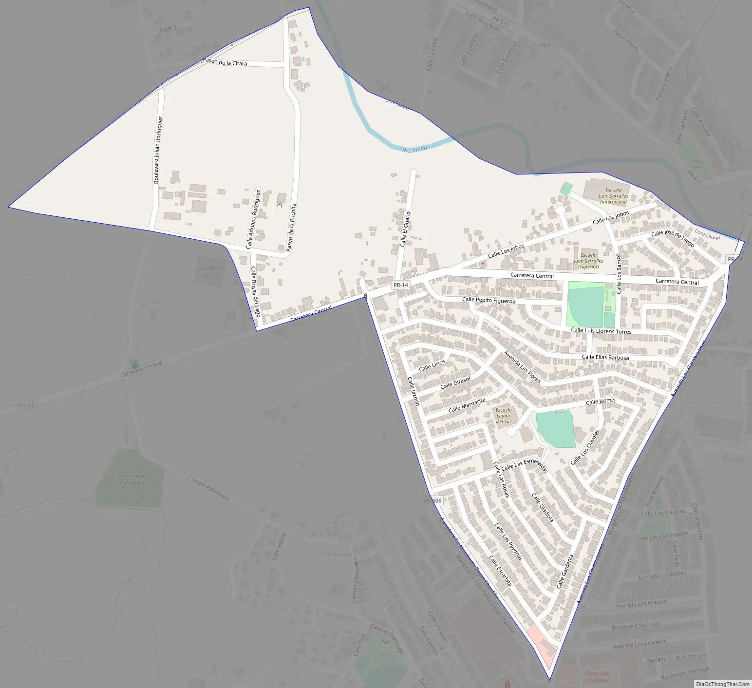
Coto Laurel Road Map
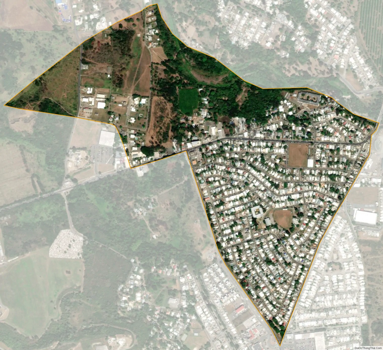
Coto Laurel city Satellite Map
See also
Map of other states:- Alabama
- Alaska
- Arizona
- Arkansas
- California
- Colorado
- Connecticut
- Delaware
- District of Columbia
- Florida
- Georgia
- Hawaii
- Idaho
- Illinois
- Indiana
- Iowa
- Kansas
- Kentucky
- Louisiana
- Maine
- Maryland
- Massachusetts
- Michigan
- Minnesota
- Mississippi
- Missouri
- Montana
- Nebraska
- Nevada
- New Hampshire
- New Jersey
- New Mexico
- New York
- North Carolina
- North Dakota
- Ohio
- Oklahoma
- Oregon
- Pennsylvania
- Rhode Island
- South Carolina
- South Dakota
- Tennessee
- Texas
- Utah
- Vermont
- Virginia
- Washington
- West Virginia
- Wisconsin
- Wyoming