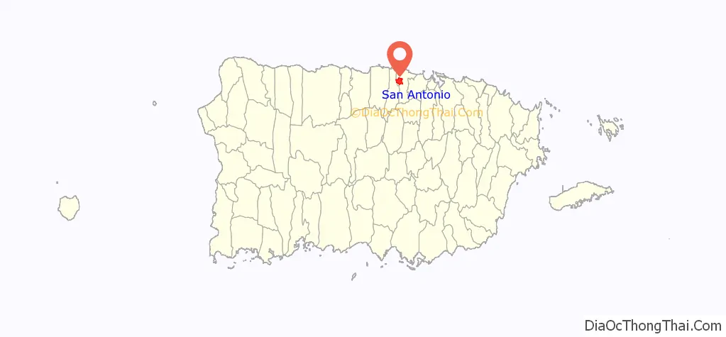
San Antonio is a comunidad (community) in Higuillar which is one of the 6 barrios of Dorado, Puerto Rico.
| Name: | San Antonio comunidad |
|---|---|
| LSAD Code: | 55 |
| LSAD Description: | comunidad (suffix) |
| State: | Puerto Rico |
| County: | Dorado Municipio |
| Elevation: | 184 ft (56 m) |
| Total Area: | 1.75 sq mi (4.5 km²) |
| Land Area: | 1.74 sq mi (4.5 km²) |
| Water Area: | .01 sq mi (0.03 km²) |
| Total Population: | 7,574 |
| Population Density: | 4,352.9/sq mi (1,680.7/km²) |
| FIPS code: | 7275694 |
Online Interactive Map
Click on ![]() to view map in "full screen" mode.
to view map in "full screen" mode.
San Antonio location map. Where is San Antonio comunidad?
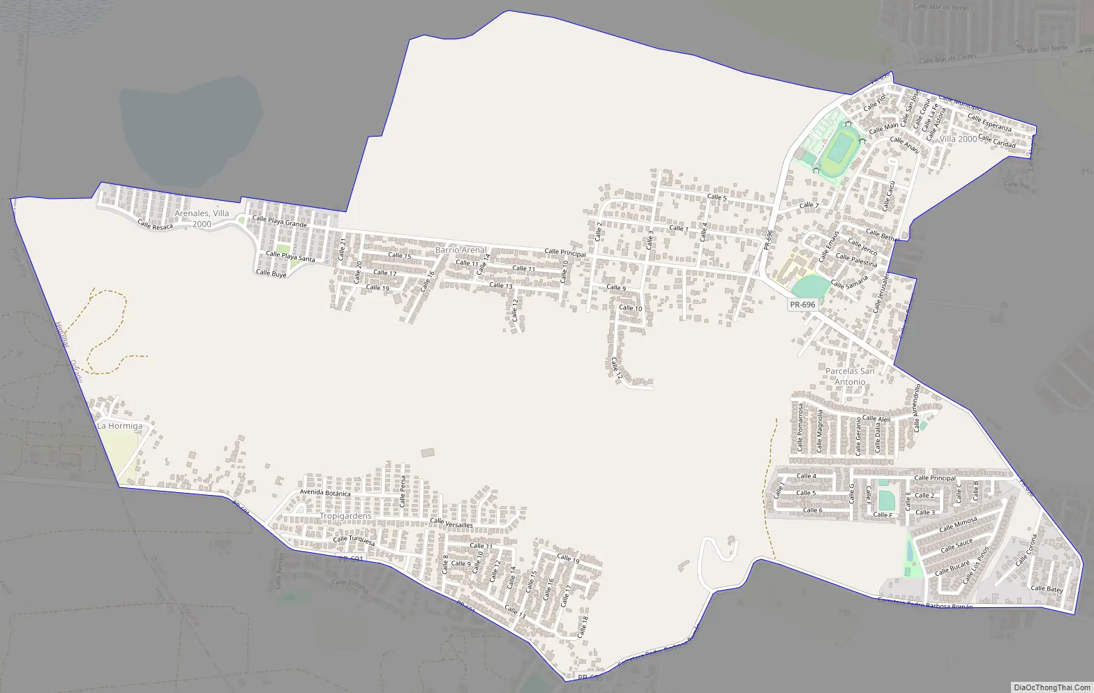
San Antonio Road Map
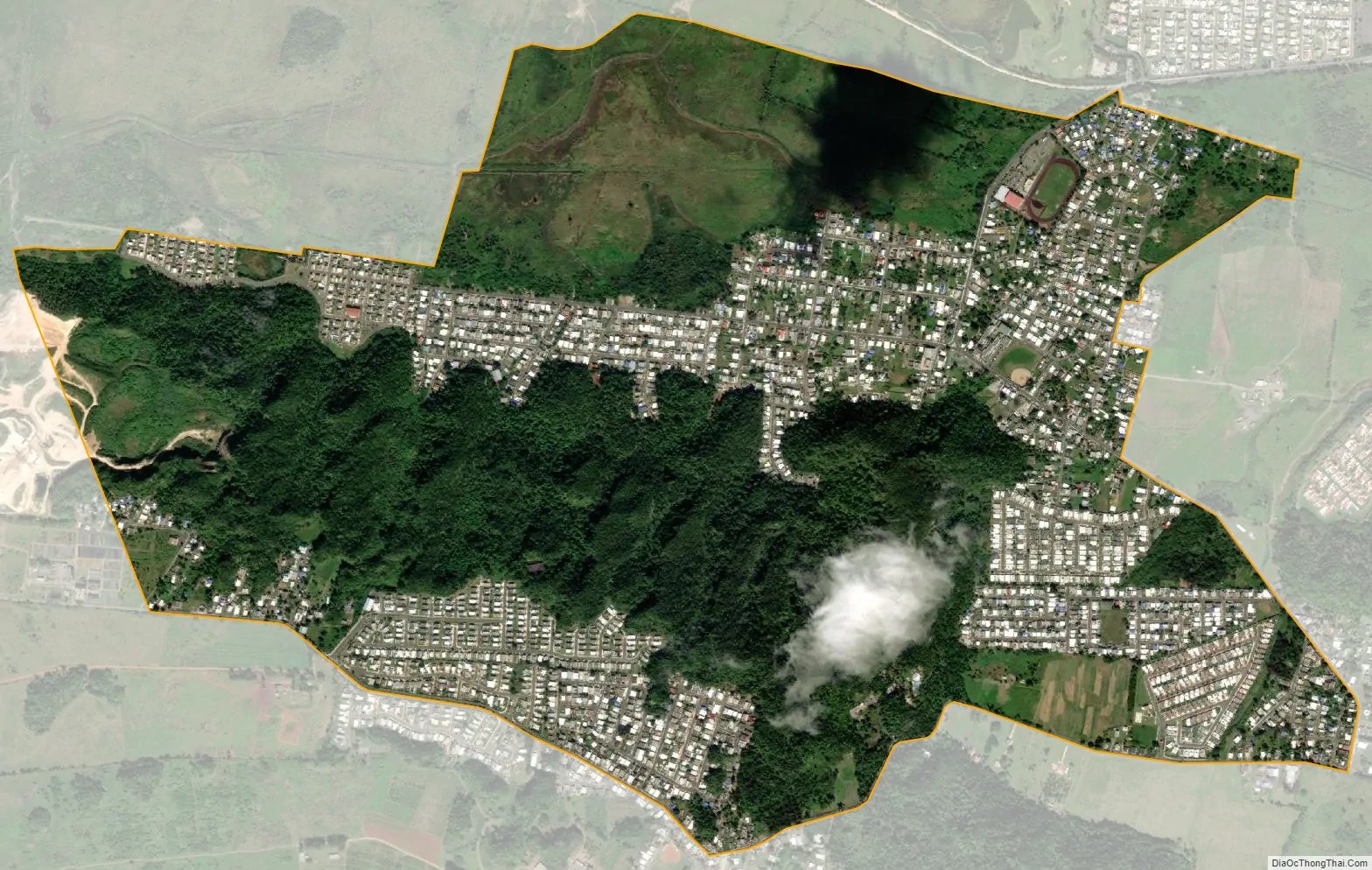
San Antonio city Satellite Map
See also
Map of other states:- Alabama
- Alaska
- Arizona
- Arkansas
- California
- Colorado
- Connecticut
- Delaware
- District of Columbia
- Florida
- Georgia
- Hawaii
- Idaho
- Illinois
- Indiana
- Iowa
- Kansas
- Kentucky
- Louisiana
- Maine
- Maryland
- Massachusetts
- Michigan
- Minnesota
- Mississippi
- Missouri
- Montana
- Nebraska
- Nevada
- New Hampshire
- New Jersey
- New Mexico
- New York
- North Carolina
- North Dakota
- Ohio
- Oklahoma
- Oregon
- Pennsylvania
- Rhode Island
- South Carolina
- South Dakota
- Tennessee
- Texas
- Utah
- Vermont
- Virginia
- Washington
- West Virginia
- Wisconsin
- Wyoming