Vayas is one of the 31 barrios of the municipality of Ponce, Puerto Rico. Along with Playa, Bucana, Canas and Capitanejo, Vayas is also one of Ponce’s five coastal barrios. Together with Capitanejo, Vayas is also one of two rural coastal barrios in the municipality. It was organized in 1831, at which time it was divided into Vayas Norte and Vayas Sur; in 1878 the two were subsequently merged into today’s Vayas.
| Name: | Vayas comunidad |
|---|---|
| LSAD Code: | 55 |
| LSAD Description: | comunidad (suffix) |
| State: | Puerto Rico |
| County: | Ponce Municipio |
| Elevation: | 0 ft (0 m) |
| Total Area: | 10.44 sq mi (27.0 km²) |
| Land Area: | 7.09 sq mi (18.4 km²) |
| Water Area: | 3.35 sq mi (8.7 km²) |
| Total Population: | 901 |
| Population Density: | 127.1/sq mi (49.1/km²) |
| FIPS code: | 7285025 |
Online Interactive Map
Click on ![]() to view map in "full screen" mode.
to view map in "full screen" mode.
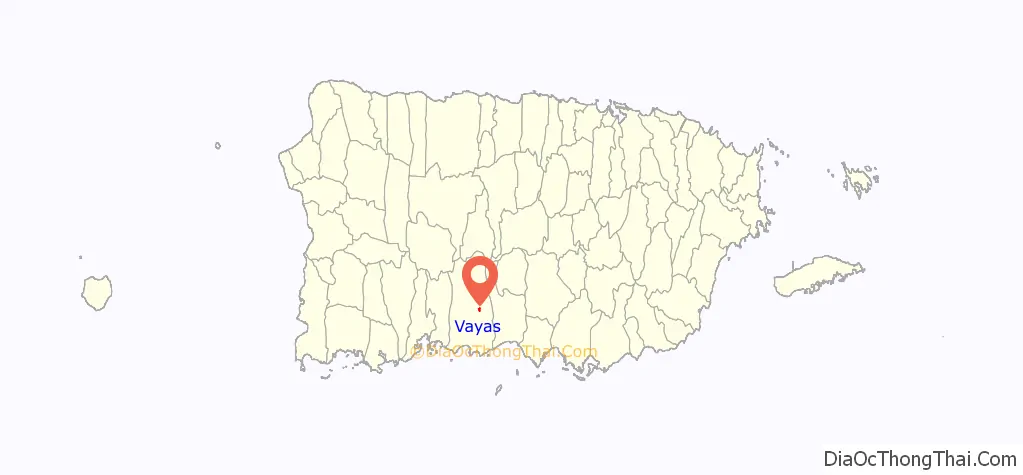
Vayas location map. Where is Vayas comunidad?
History
Barrio Vayas is one of the oldest barrios in Ponce, dating from the 1780s. Its name can be seen spelled as “Bayas”, “Vallas, and even “Ballas”, but the official name is nowadays spelled “Vayas”. It is believed that name came from the stakes used by farmers to mark the extension of their lands, in the times when those lands were used for pasturing herds.
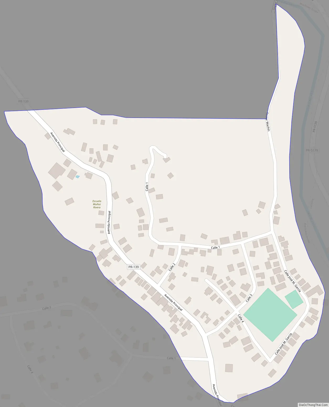
Vayas Road Map
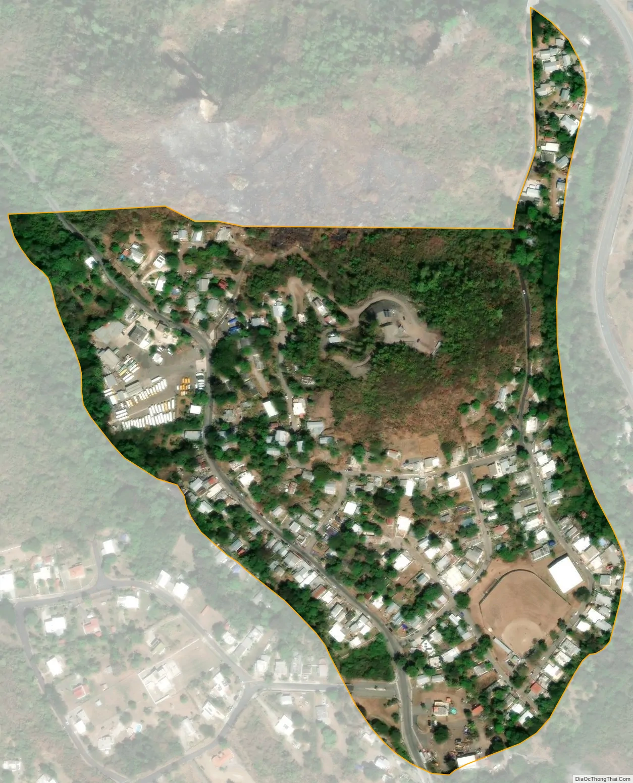
Vayas city Satellite Map
See also
Map of other states:- Alabama
- Alaska
- Arizona
- Arkansas
- California
- Colorado
- Connecticut
- Delaware
- District of Columbia
- Florida
- Georgia
- Hawaii
- Idaho
- Illinois
- Indiana
- Iowa
- Kansas
- Kentucky
- Louisiana
- Maine
- Maryland
- Massachusetts
- Michigan
- Minnesota
- Mississippi
- Missouri
- Montana
- Nebraska
- Nevada
- New Hampshire
- New Jersey
- New Mexico
- New York
- North Carolina
- North Dakota
- Ohio
- Oklahoma
- Oregon
- Pennsylvania
- Rhode Island
- South Carolina
- South Dakota
- Tennessee
- Texas
- Utah
- Vermont
- Virginia
- Washington
- West Virginia
- Wisconsin
- Wyoming