San Jose, officially the City of San José (Spanish for ‘Saint Joseph’ /ˌsæn hoʊˈzeɪ, -ˈseɪ/; Spanish: [saŋ xoˈse]), is the largest city in Northern California by both population and area. With a 2020 population of 1,013,240, it is the most populous city in both the Bay Area and the San Jose–San Francisco–Oakland Combined Statistical Area, which has a 2015 population of 7.7 million and 9.7 million people respectively, the third most populous city in California (after Los Angeles and San Diego), and the 12th most populous in the United States. Located in the center of the Santa Clara Valley on the southern shore of San Francisco Bay, San Jose covers an area of 179.97 sq mi (466.1 km). San Jose is the county seat of Santa Clara County and the main component of the San Jose–Sunnyvale–Santa Clara Metropolitan Statistical Area, with an estimated population of around two million residents in 2018.
San Jose is notable for its innovation, cultural diversity, affluence, and sunny and mild Mediterranean climate. Its connection to the booming high tech industry phenomenon known as Silicon Valley prompted Mayor Tom McEnery to adopt the city motto of “Capital of Silicon Valley” in 1988 to promote the city. Major global tech companies including Cisco Systems, eBay, Adobe Inc., PayPal, Broadcom, Samsung, Acer, and Zoom maintain their headquarters in San Jose. San Jose is one of the wealthiest major cities in the world, with the third-highest GDP per capita (after Zürich and Oslo) and the fifth-most expensive housing market. It is home to one of the world’s largest overseas Vietnamese populations, a Hispanic community that makes up over 40% of the city’s residents, and historic ethnic enclaves such as Japantown and Little Portugal.
Before the arrival of the Spanish, the area around San Jose was long inhabited by the Tamien nation of the Ohlone peoples of California. San Jose was founded on November 29, 1777, as the Pueblo de San José de Guadalupe, the first city founded in the Californias. It became a part of Mexico in 1821 after the Mexican War of Independence.
Following the American Conquest of California during the Mexican–American War, the territory was ceded to the United States in 1848. After California achieved statehood two years later, San Jose was designated as the state’s first capital. Following World War II, San Jose experienced an economic boom, with a rapid population growth and aggressive annexation of nearby cities and communities carried out in the 1950s and 1960s. The rapid growth of the high-technology and electronics industries further accelerated the transition from an agricultural center to an urbanized metropolitan area. Results of the 1990 U.S. census indicated that San Jose had officially surpassed San Francisco as the most populous city in Northern California. By the 1990s, San Jose had become the global center for the high tech and internet industries, making it California’s fastest-growing economy.
| Name: | San Jose city |
|---|---|
| LSAD Code: | 25 |
| LSAD Description: | city (suffix) |
| State: | California |
| County: | Santa Clara County |
| Incorporated: | March 27, 1850 |
| Elevation: | 82 ft (25 m) |
| Land Area: | 178.24 sq mi (461.63 km²) |
| Water Area: | 3.12 sq mi (8.09 km²) 1.91% |
| Population Density: | 5,684.69/sq mi (2,194.92/km²) |
| Area code: | 408/669 |
| FIPS code: | 0668000 |
| Website: | www.sanjoseca.gov |
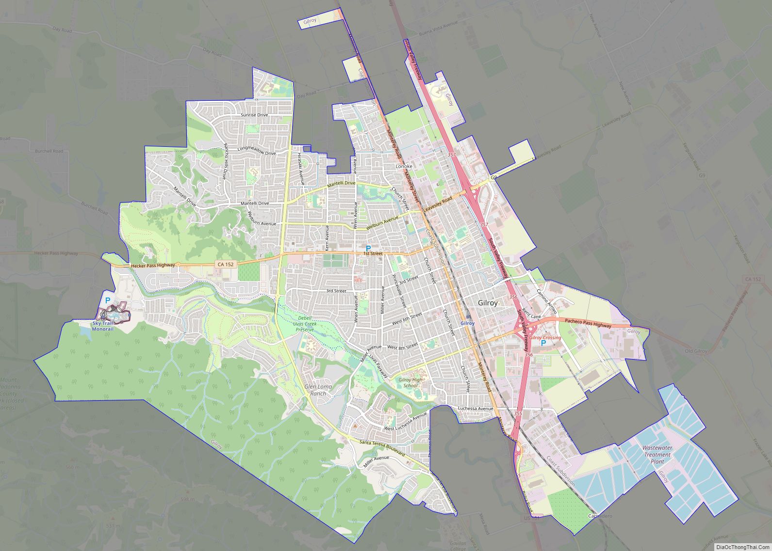
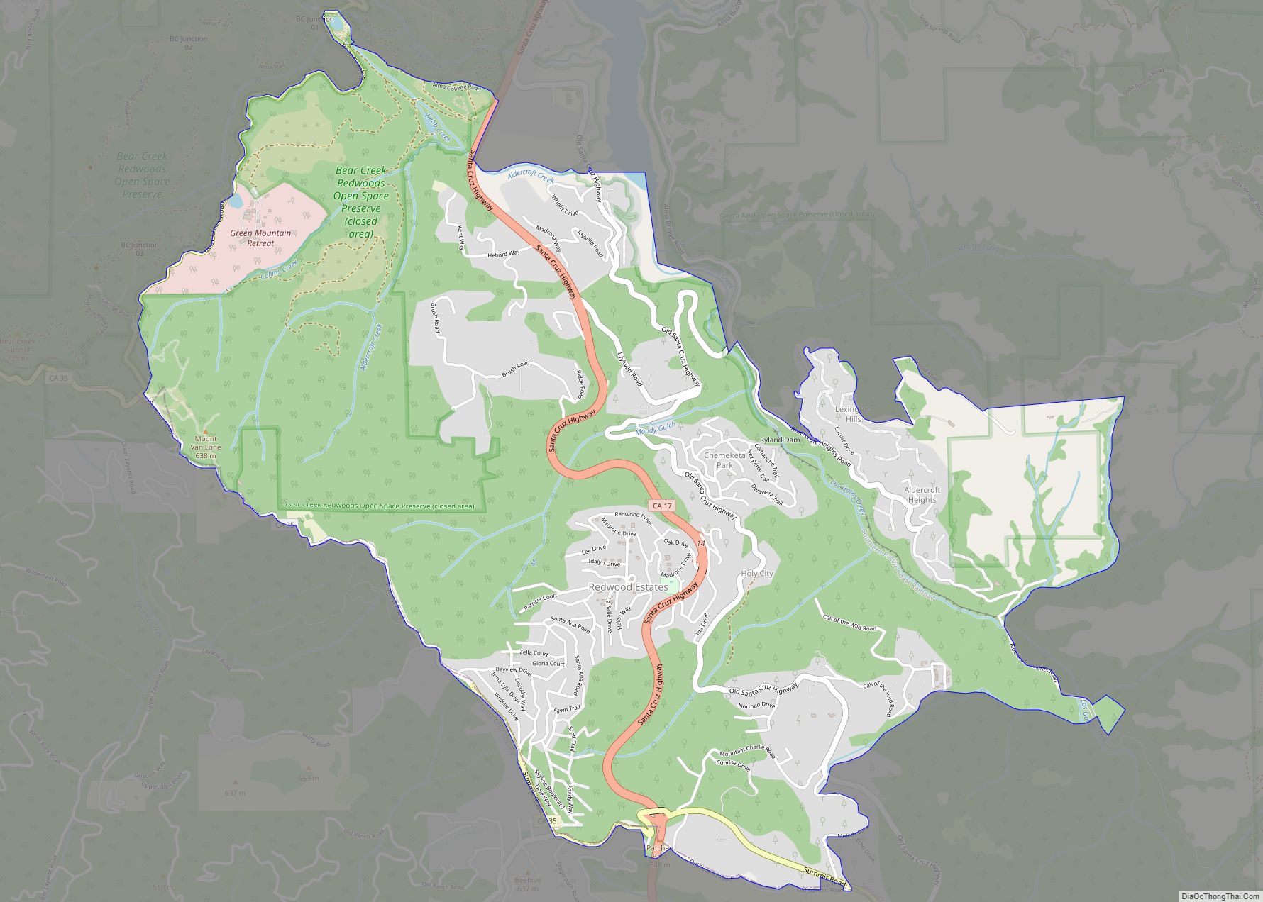
Discover the best places to visit in San Jose with our San Jose map collection. Our maps feature major highways, roads, and points of interest in the city and surrounding areas. With our interactive map of San Jose, you can explore the city in more detail and find the perfect places to visit.
From the iconic Golden Gate Bridge to the bustling downtown area, San Jose offers something for everyone. Whether you’re looking for a day trip or a longer stay, explore San Jose and the surrounding area with our San Jose map collection. Our maps feature major highways, roads, and points of interest in the city and surrounding areas. With our interactive map of San Jose, you can explore the city in more detail and find the perfect places to visit.
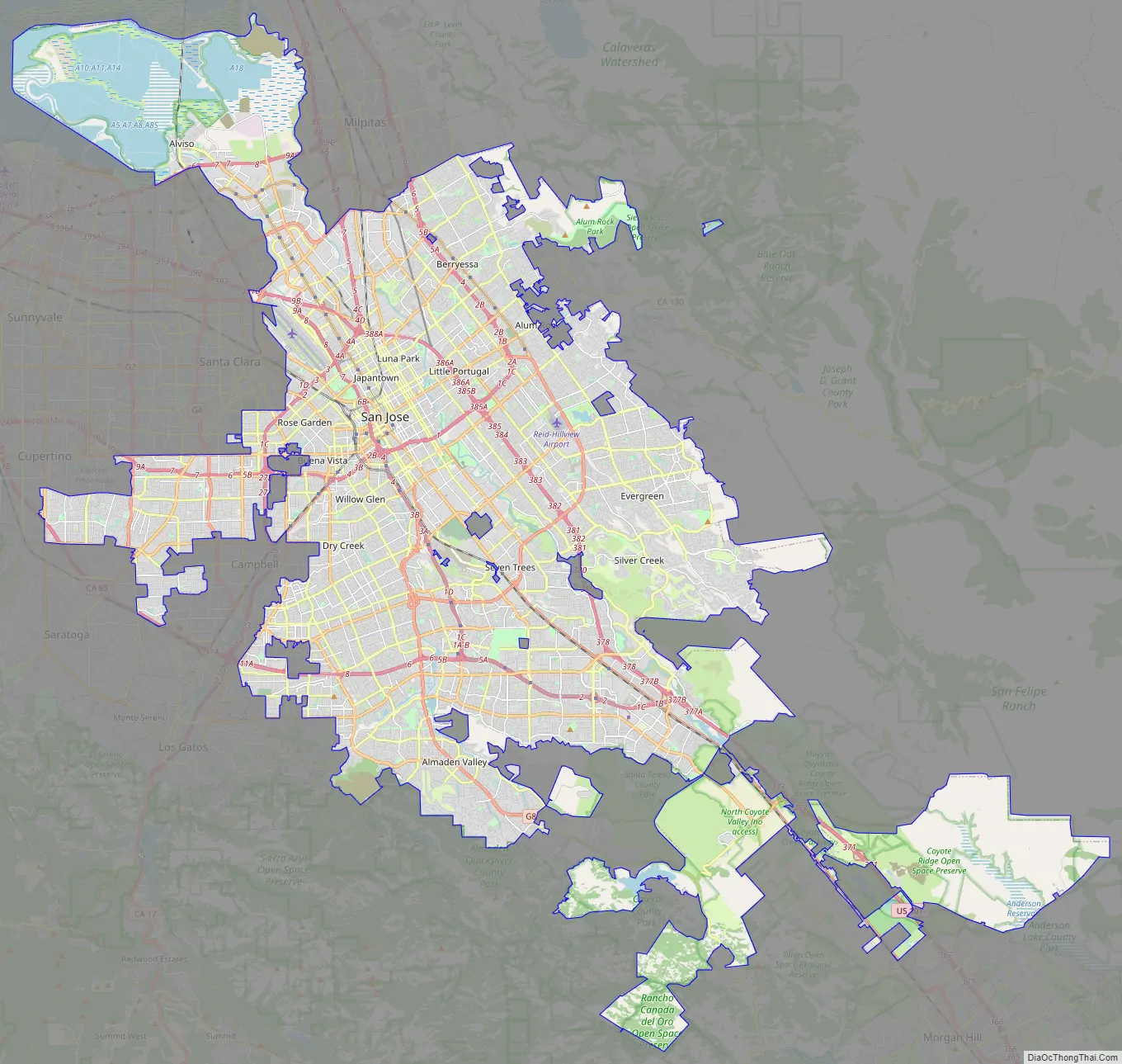
Online Interactive Map
Click on ![]() to view map in "full screen" mode.
to view map in "full screen" mode.
Get a sense of where everything is like the Diablo Mountain Range to the east and the Santa Cruz Mountains to the west. This map shows all the places of interest in San Jose, from museums to restaurants to shopping malls. This interactive map is perfect for city exploration, travel, or finding places to eat, drink, and stay out.
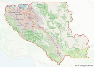
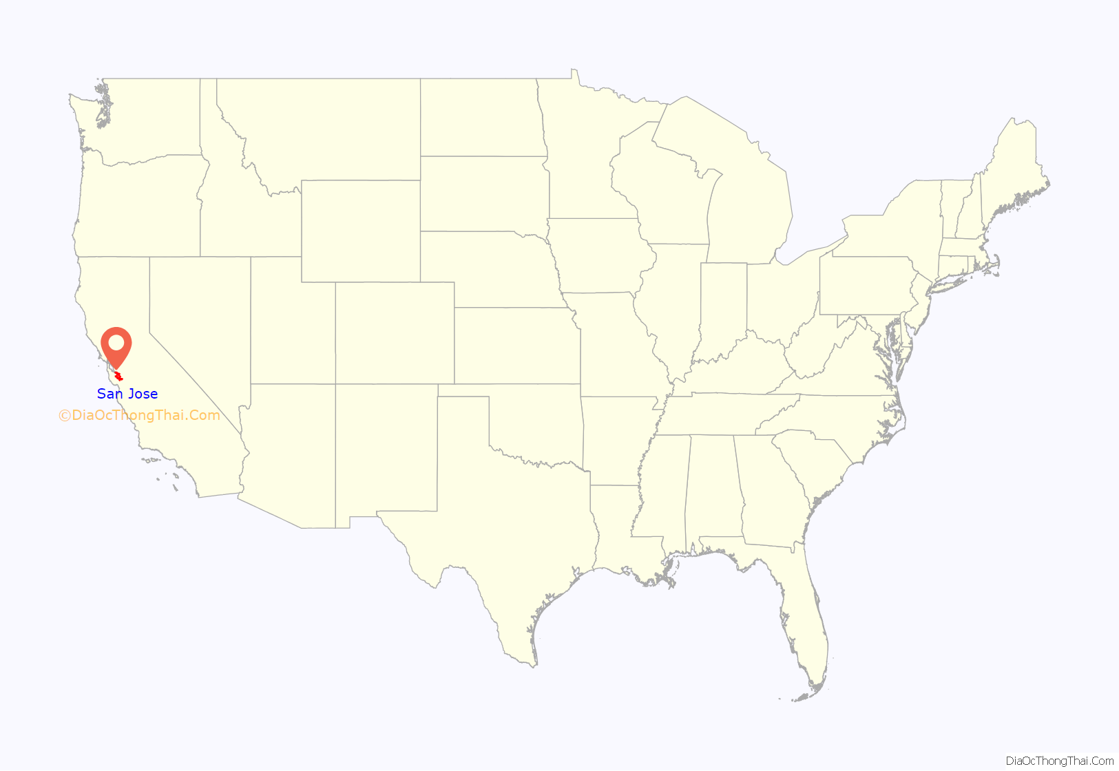
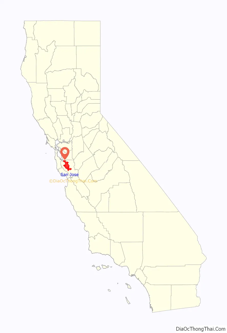
San Jose location map. Where is San Jose city?
History
Pre-colonial period
San Jose, along with most of the Santa Clara Valley, has been home to the Tamien group (also spelled as Tamyen, Thamien) of the Ohlone people since around 4,000 BC. The Tamien spoke Tamyen language of the Ohlone language family.
During the era of Spanish colonization and the subsequent building of Spanish missions in California, the Tamien people’s lives changed dramatically. From 1777 onward, most of the Tamien people moved into Mission Santa Clara de Asís or Mission San José where they were baptized and educated to be Catholic neophytes, also known as Mission Indians. This continued until the mission was secularized by the Mexican Government in 1833. A large majority of the Tamien died either from disease in the missions, or as a result of the state sponsored genocide. Some surviving families remained intact, migrating to Santa Cruz after their ancestral lands were granted to Spanish and Mexican Immigrants.
Spanish period
California was claimed as part of the Spanish Empire in 1542, when explorer Juan Rodríguez Cabrillo charted the Californian coast. During this time Alta California and the Baja California peninsula were administered together as Province of the Californias (Spanish: Provincia de las Californias). For nearly 200 years, the Californias remained a distant frontier region largely controlled by the numerous Native Nations and largely ignored by the government of the Viceroyalty of New Spain in Mexico City. Shifting power dynamics in North America—including the British/American victory and acquisition of North America, east of the Mississippi following the 1763 Treaty of Paris, as well as the start of Russian colonization of northwestern North America— prompted Spanish/Mexican authorities to sponsor the Portolá Expedition to survey Northern California in 1769.
In 1776, the Californias were included as part of the Captaincy General of the Provincias Internas, a large administrative division created by José de Gálvez, Spanish Minister of the Indies, in order to provide greater autonomy for the Spanish Empire’s borderlands. That year, King Carlos III of Spain approved an expedition by Juan Bautista de Anza to survey the San Francisco Bay Area, in order to choose the sites for two future settlements and their accompanying mission. Bautista initially chose the site for a military settlement in San Francisco, for the Royal Presidio of San Francisco, and Mission San Francisco de Asís. On his way back to Mexico from San Francisco, de Anza chose the sites in Santa Clara Valley for a civilian settlement, San Jose, on the eastern bank of the Guadalupe River, and a mission on its western bank, Mission Santa Clara de Asís.
San Jose was officially founded as California’s first civilian settlement on November 29, 1777, as the Pueblo de San José de Guadalupe by José Joaquín Moraga, under orders of Antonio María de Bucareli y Ursúa, Viceroy of New Spain. San Jose served as a strategic settlement along El Camino Real, connecting the military fortifications at the Monterey Presidio and the San Francisco Presidio, as well as the California mission network. In 1791, due to the severe flooding which characterized the pueblo, San Jose’s settlement was moved approximately a mile south, centered on the Pueblo Plaza (modern-day Plaza de César Chávez).
In 1800, due to the growing population in the northern part of the Californias, Diego de Borica, Governor of the Californias, officially split the province into two parts: Alta California (Upper California), which would eventually become a U.S. state, and Baja California (Lower California), which would eventually become two Mexican states.
Mexican period
San Jose became part of the First Mexican Empire in 1821, after Mexico’s War of Independence was won against the Spanish Crown, and in 1824, part of the First Mexican Republic. With its newfound independence, and the triumph of the republican movement, Mexico set out to diminish the Catholic Church’s power within Alta California by secularizing the California missions in 1833.
In 1824, in order to promote settlement and economic activity within sparsely populated California, the Mexican government began an initiative, for Mexican and foreign citizens alike, to settle unoccupied lands in California. Between 1833 and 1845, thirty-eight rancho land grants were issued in the Santa Clara Valley, 15 of which were located within modern-day San Jose’s borders. Numerous prominent historical figures were among those granted rancho lands in the Santa Valley, including James A. Forbes, founder of Los Gatos, California (granted Rancho Potrero de Santa Clara), Antonio Suñol, Alcalde of San Jose (granted Rancho Los Coches), and José María Alviso, Alcalde of San Jose (granted Rancho Milpitas).
In 1835, San Jose’s population of approximately 700 people included 40 foreigners, primarily Americans and Englishmen. By 1845, the population of the pueblo had increased to 900, primarily due to American immigration. Foreign settlement in San Jose and California was rapidly changing Californian society, bringing expanding economic opportunities and foreign culture.
By 1846, native Californios had long expressed their concern for the overrunning of California society by its growing and wealthy Anglo-American community. During the 1846 Bear Flag Revolt, Captain Thomas Fallon led nineteen volunteers from Santa Cruz to the pueblo of San Jose, which his forces easily captured. The raising of the flag of the California Republic ended Mexican rule in Alta California on July 14, 1846.
American period
By the end of 1847, the Conquest of California by the United States was complete, as the Mexican–American War came to an end. In 1848, the Treaty of Guadalupe Hidalgo formally ceded California to the United States, as part of the Mexican Cession. On December 15, 1849, San Jose became the capital of the unorganized territory of California. With California’s Admission to the Union on September 9, 1850, San Jose became the state’s first capital.
On March 27, 1850, San Jose was incorporated. It was incorporated on the same day as San Diego and Benicia; together, these three cities followed Sacramento as California’s earliest incorporated cities. Josiah Belden, who had settled in California in 1842 after traversing the California Trail as part of the Bartleson Party and later acquired a fortune, was the city’s first mayor. San Jose was briefly California’s first state capital, and legislators met in the city from 1849 to 1851. (Monterey was the capital during the period of Spanish California and Mexican California). The first capitol no longer exists; the Plaza de César Chávez now lies on the site, which has two historical markers indicating where California’s state legislature first met.
In the period 1900 through 1910, San Jose served as a center for pioneering invention, innovation, and impact in both lighter-than-air and heavier-than-air flight. These activities were led principally by John Montgomery and his peers. The City of San Jose has established Montgomery Park, a Monument at San Felipe and Yerba Buena Roads, and John J. Montgomery Elementary School in his honor. During this period, San Jose also became a center of innovation for the mechanization and industrialization of agricultural and food processing equipment.
Though not affected as severely as San Francisco, San Jose also suffered significant damage from the 1906 San Francisco earthquake. Over 100 people died at the Agnews Asylum (later Agnews State Hospital) after its walls and roof collapsed, and San Jose High School’s three-story stone-and-brick building was also destroyed. The period during World War II was tumultuous; Japanese Americans primarily from Japantown were sent to internment camps, including the future mayor Norman Mineta. Following the Los Angeles zoot suit riots, anti-Mexican violence took place during the summer of 1943. In 1940, the Census Bureau reported San Jose’s population as 98% white.
As World War II started, the city’s economy shifted from agriculture (the Del Monte cannery was the largest employer and closed in 1999) to industrial manufacturing with the contracting of the Food Machinery Corporation (later known as FMC Corporation) by the United States War Department to build 1,000 Landing Vehicle Tracked. After World War II, FMC (later United Defense, and currently BAE Systems) continued as a defense contractor, with the San Jose facilities designing and manufacturing military platforms such as the M113 Armored Personnel Carrier, the Bradley Fighting Vehicle, and various subsystems of the M1 Abrams battle tank.
IBM established its first West Coast operations in San Jose in 1943 with a downtown punch card plant, and opened an IBM Research lab in 1952. Reynold B. Johnson and his team developed direct access storage for computers, inventing the RAMAC 305 and the hard disk drive; the technological side of San Jose’s economy grew.
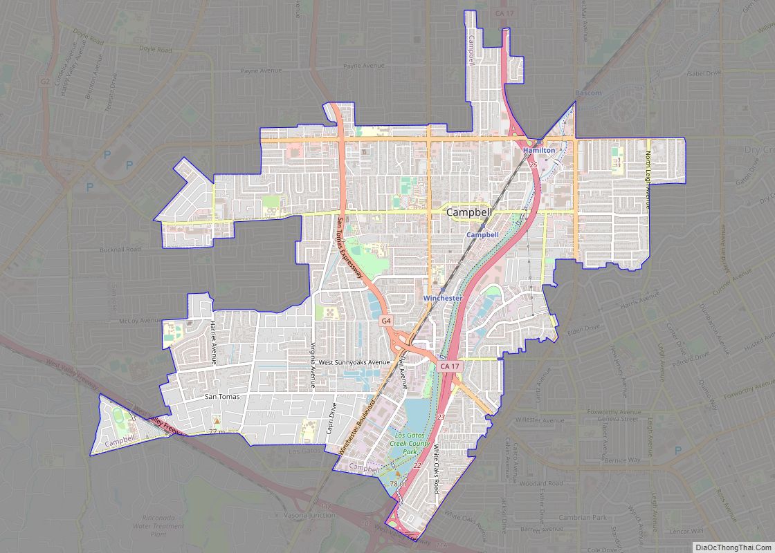
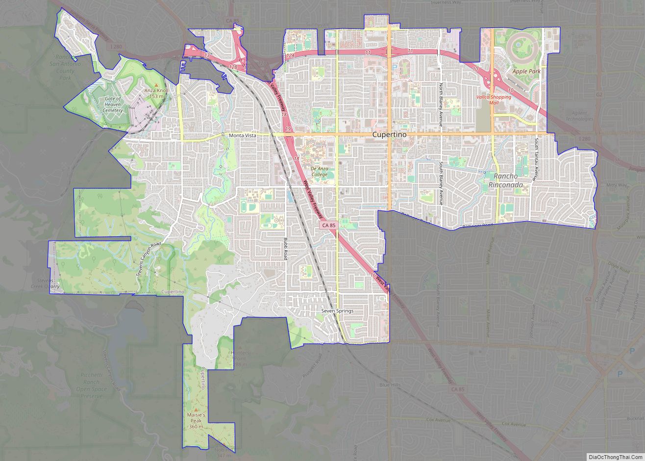
During the 1950s and 1960s, City Manager A. P. “Dutch” Hamann led the city in a major growth campaign. The city annexed adjacent areas, such as Alviso and Cambrian Park, providing large areas for suburbs. An anti-growth reaction to the effects of rapid development emerged in the 1970s, championed by mayors Norman Mineta and Janet Gray Hayes. Despite establishing an urban growth boundary, development fees, and the incorporations of Campbell and Cupertino, development was not slowed, but rather directed into already-incorporated areas.
San Jose’s position in Silicon Valley triggered further economic and population growth. Results from the 1990 U.S. Census indicated that San Jose surpassed San Francisco as the most populous city in the Bay Area for the first time. This growth led to the highest housing-cost increase in the nation, 936% between 1976 and 2001. Efforts to increase density continued into the 1990s when an update of the 1974 urban plan kept the urban growth boundaries intact and voters rejected a ballot measure to ease development restrictions in the foothills. Sixty percent of the housing built in San Jose since 1980 and over three-quarters of the housing built since 2000 have been multifamily structures, reflecting a political propensity toward Smart Growth planning principles.
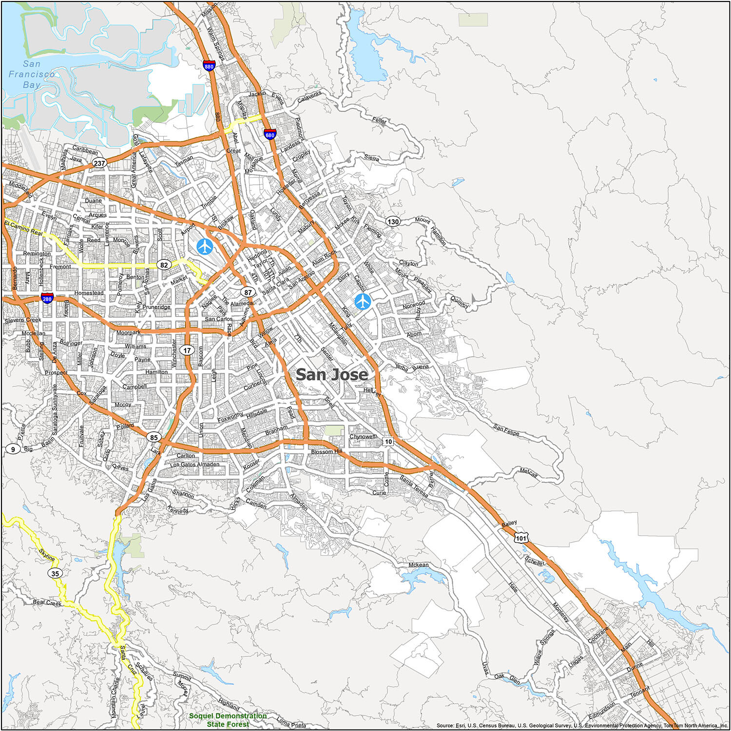
San Jose Road Map
Get a taste of the city, without going too far. This San Jose road map provides a concise overview of interstates, highways, and major roads of San Jose. With this road map, you’ll be able to find your way around San Jose easily and make the most of your time in the city. Download this printable map today to get a better idea of where you want to go and how to get there.
Interstate Highways: I-280, I-680, I-880
US Highways: 17, 82, 85, 87, 101, 130, 237, 280, Monterey Hwy, Old Bayshore Hwy
Expressways/Parkways: Almaden Expy, Capitol Expy, Great America Pky, Guadalupe Pky, Lawrence Expy, Montague Expy, San Tomas Expy, Southwest Expy
Major Roads: 1st St, Alum Rock Ave, Autumn St, Bernal Rd, Bird Ave, Branham Ln, Camden Ave, Capitol Ave, De Anza Blvd, Hillsdale Ave, Market St, Monterey Rd, Montgomery St, Narvaez Ave, Reed St, San Carlos St, San Clara St, Santa Clara St, Santa Teresa Blvd, Saratoga Ave, Silicon Valley Blvd, Stevens Creek Blvd, The Alameda
If you plan on making a road trip outside the city, make sure to check out a California road map with highway information.
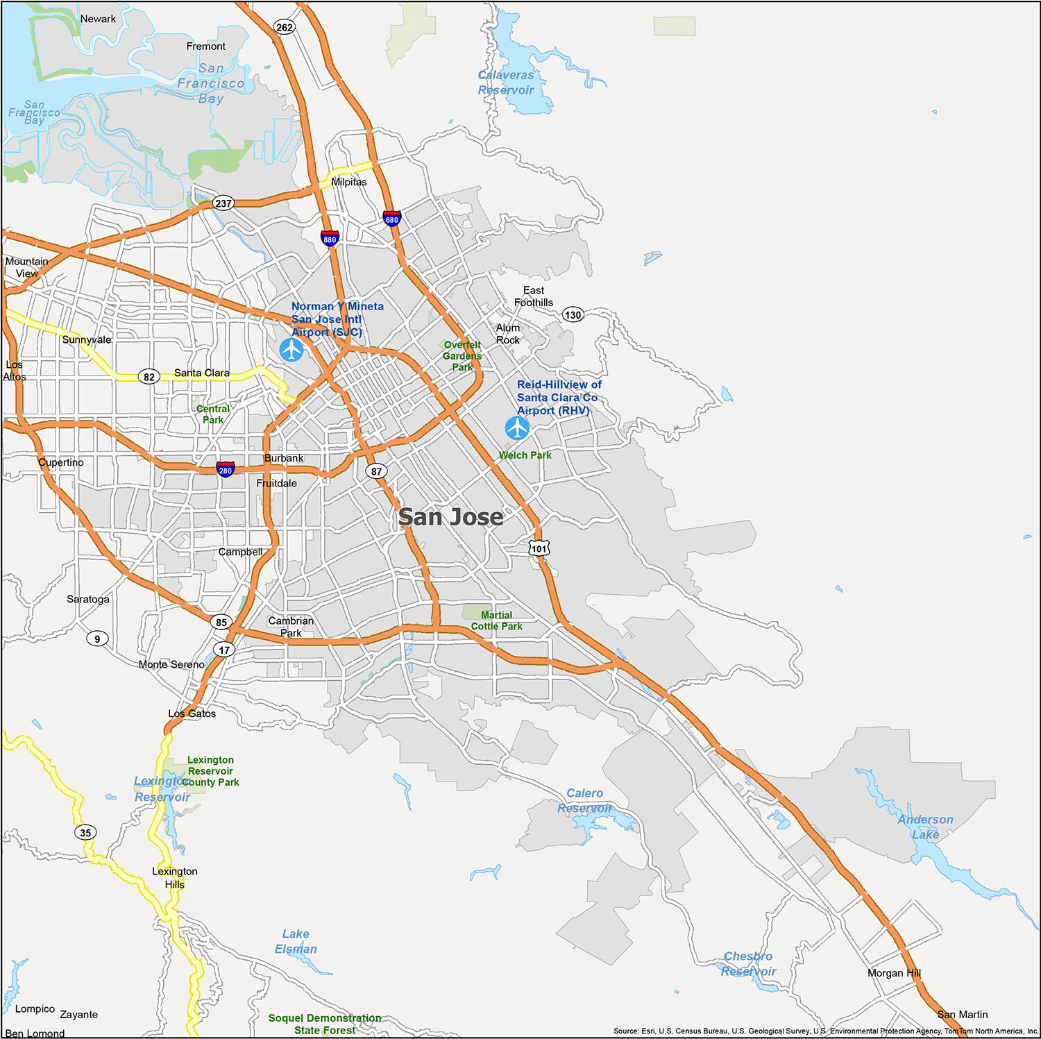
San Jose is a vibrant city full of attractions and activities to explore. Whether you’re looking for a place to relax or enjoy some outdoor fun, this reference map will help you plan your next trip. From airports to cities and towns, to parks and recreation areas, you can easily find what you’re looking for and plan your visit accordingly. So, what are you waiting for? Pack your bags and get ready to explore the many wonders of San Jose!
10 things to do in San Jose city
Whether you’re a first-time visitor or a local, this map of San Jose will help you plan your next trip. From the famous Winchester Mystery House to the Los Gatos Creek Trail, this map provides you with an overview of the city’s attractions. Use it to explore San Jose and plan your next trip.
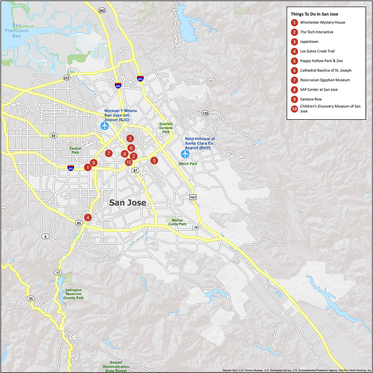
San Jose is an amazing city with a lot to offer. From architectural landmarks to affluent neighborhoods, there’s something for everyone. Plan your next trip to San Jose and explore these ten attractions:
- Winchester Mystery House
- The Tech Interactive
- Japantown
- Los Gatos Creek Trail
- Happy Hollow Park & Zoo
- Cathedral Basilica of St. Joseph
- Rosicrucian Egyptian Museum
- SAP Center at San Jose
- Santana Row
- Children’s Discovery Museum of San Jose
Are you looking for a quick way to see the sights of San Jose? This map is the perfect way to explore the city and plan your next trip. With the help of this map, you can easily view the attractions and landmarks in San Jose and plan your route accordingly. Get a quick and easy overview of the city and its attractions and use this map to plan your next trip to San Jose!
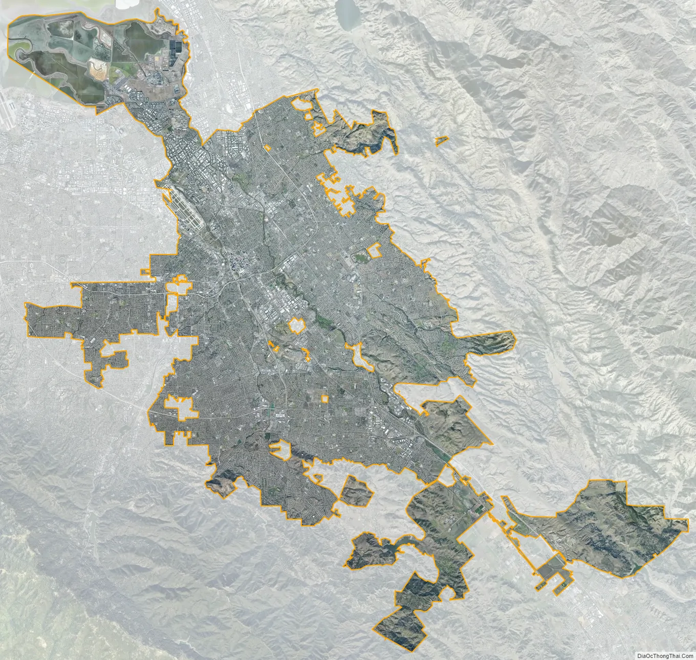
San Jose city Satellite Map
See also
Map of California State and its subdivision:- Alameda
- Alpine
- Amador
- Butte
- Calaveras
- Colusa
- Contra Costa
- Del Norte
- El Dorado
- Fresno
- Glenn
- Humboldt
- Imperial
- Inyo
- Kern
- Kings
- Lake
- Lassen
- Los Angeles
- Madera
- Marin
- Mariposa
- Mendocino
- Merced
- Modoc
- Mono
- Monterey
- Napa
- Nevada
- Orange
- Placer
- Plumas
- Riverside
- Sacramento
- San Benito
- San Bernardino
- San Diego
- San Francisco
- San Joaquin
- San Luis Obispo
- San Mateo
- Santa Barbara
- Santa Clara
- Santa Cruz
- Shasta
- Sierra
- Siskiyou
- Solano
- Sonoma
- Stanislaus
- Sutter
- Tehama
- Trinity
- Tulare
- Tuolumne
- Ventura
- Yolo
- Yuba
- Alabama
- Alaska
- Arizona
- Arkansas
- California
- Colorado
- Connecticut
- Delaware
- District of Columbia
- Florida
- Georgia
- Hawaii
- Idaho
- Illinois
- Indiana
- Iowa
- Kansas
- Kentucky
- Louisiana
- Maine
- Maryland
- Massachusetts
- Michigan
- Minnesota
- Mississippi
- Missouri
- Montana
- Nebraska
- Nevada
- New Hampshire
- New Jersey
- New Mexico
- New York
- North Carolina
- North Dakota
- Ohio
- Oklahoma
- Oregon
- Pennsylvania
- Rhode Island
- South Carolina
- South Dakota
- Tennessee
- Texas
- Utah
- Vermont
- Virginia
- Washington
- West Virginia
- Wisconsin
- Wyoming