Hollister is a city in and the county seat of San Benito County, located in the Central Coast region of California. With a 2020 United States census population of 41,678, Hollister is one of the largest cities in the Monterey Bay Area and a member of the Association of Monterey Bay Area Governments. The city is an agricultural town known primarily for its local Blenheim apricots, olive oil, vineyards, pomegranates, and chocolate.
| Name: | Hollister city |
|---|---|
| LSAD Code: | 25 |
| LSAD Description: | city (suffix) |
| State: | California |
| County: | San Benito County |
| Incorporated: | March 26, 1872 |
| Elevation: | 289 ft (88 m) |
| Total Area: | 7.84 sq mi (20.29 km²) |
| Land Area: | 7.84 sq mi (20.29 km²) |
| Water Area: | 0.00 sq mi (0.00 km²) 0% |
| Total Population: | 41,678 |
| Population Density: | 5,199.08/sq mi (2,007.43/km²) |
| ZIP code: | 95023 |
| Area code: | 831 |
| FIPS code: | 0634120 |
| Website: | www.hollister.ca.gov |
Online Interactive Map
Click on ![]() to view map in "full screen" mode.
to view map in "full screen" mode.
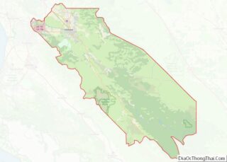
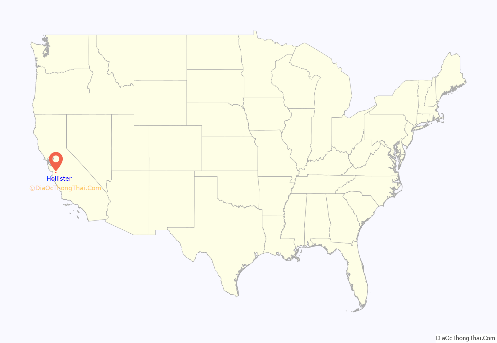
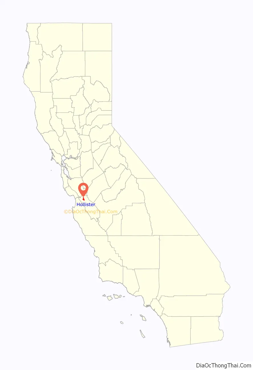
Hollister location map. Where is Hollister city?
History
The area of modern-day Hollister was historically inhabited by the Mutsun band of the Ohlone Native Americans. With the construction of Mission San Juan Bautista in 1797, the Ohlone were forced into the California mission system.
The town of Hollister was founded on November 19, 1868, by William Welles Hollister on the grounds of the former Mexican land-grant Rancho San Justo. At the time, Hollister was located within Monterey County, until San Benito County was formed by the California Legislature in 1874 from portions of Monterey, Merced, and Santa Cruz counties.
The city is intermittently the site of an annual motorcycle rally around July Fourth. The riot at the original 1947 event was the basis for the 1953 film The Wild One. The rally was revived in 1997 as the Hollister Independence Rally.
In 2005, the Hollister City Council discontinued their contract with the event organizers, the Hollister Independence Rally Committee, due to financial and public safety concerns. The event was canceled in 2006 due to lack of funding for security, but returned in 2007 and 2008. The format of the rally in 2007 differed markedly from previous rallies, with vendors on San Benito Street instead of motorcycles. The bikes were forced to park on side streets and a strict downtown curfew was imposed, with the entire area being locked up at 9:00 pm. This event was popular with bikers and some local establishments profited, but the city footed the bill for much of the expenses and was left liable when organizers filed bankruptcy.
The 2009–2012 rallies were canceled, but the annual rally was reinstated in 2013, and was expected to be profitable for the town. Following a biker gang shooting at the 2014 rally, Hollister mandated that bars must stop selling alcohol after midnight during the 2015 rally. The 2015 rally unexpectedly left the city with a $92,000 loss following a dispute with the promoter. In 2016, the city hired its third promoter in four years; turnout for the 2016 rally was expected to be around 40,000. The San Francisco Chronicle characterized the 2017 rally crowd as “retired, friendly, weather-worn and excruciatingly law abiding”, and estimated the motorcycle attendance around 10,000. The 2018 rally was cancelled due to loss of a major sponsor and concerns about the cost of workers compensation liability. However, 2018 and 2019 both saw non-city-sanctioned “rebel rallies”. The 2020 rally was cancelled due to “shelter in place” policies related to the 2019–20 coronavirus pandemic. A non-city-sanctioned rally occurred in 2021. The 2021 turnout was smaller than at the official rallies of the mid-2010s. In 2022 the city council declined to sponsor a rally amid a shortage of law enforcement officers.
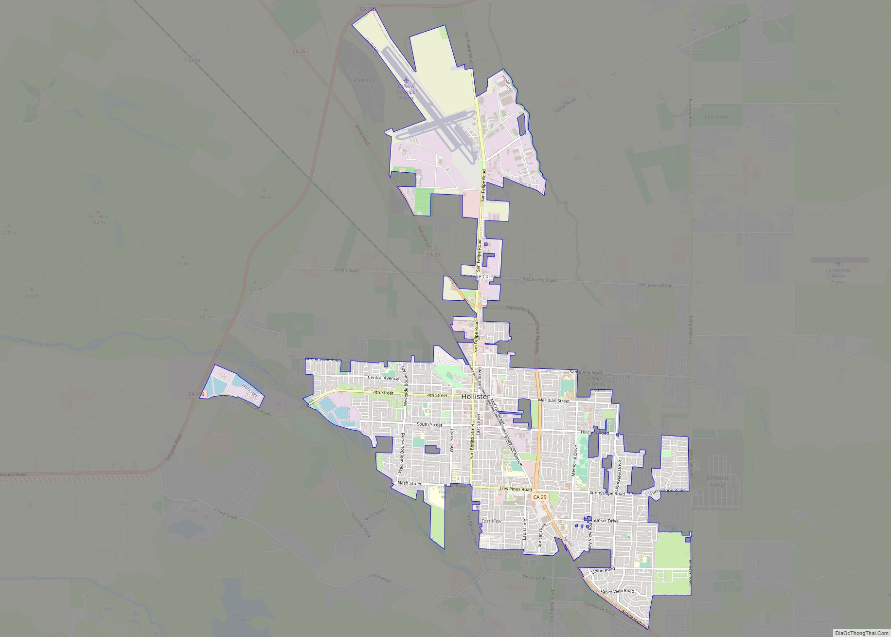
Hollister Road Map
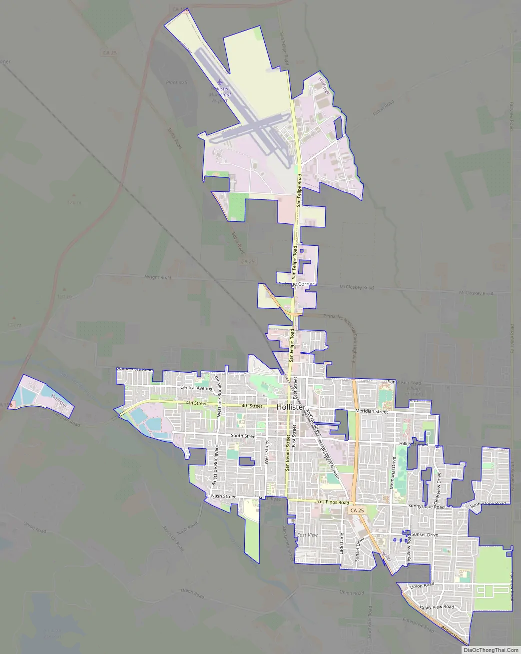
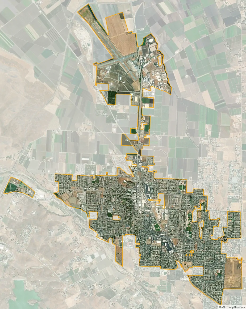
Hollister city Satellite Map
Geography
Climate
Hollister has a warm-summer Mediterranean climate (Köppen Csb) that has warmer summers than the Monterey–Salinas area but is cooler than many other inland cities in the Central Valley. Daytime temperatures of around 80 °F (26.7 °C) are typical between June and October, but heat extremes can be much more severe.
Geology
Hollister is well known among geologists because it represents one of the best examples of aseismic creep anywhere in the world. The Calaveras Fault (a branch of the San Andreas Fault system) bisects the city north and south, roughly along Locust Ave. and Powell St. The streets running east–west across the fault have significant visible offsets. The fault runs directly under several houses. Even though they are visibly contorted, the houses are still habitable as the owners have reinforced them to withstand the dislocation of their foundations.
Although there was extensive damage in the town after the 1989 Loma Prieta earthquake, and the governor of California came to visit, this was due to a slip of the San Andreas Fault proper and was not related to the aseismic creep on the Calaveras Fault. The San Andreas Fault (proper) (not to be confused with the Calaveras Fault) runs, at its closest, through San Juan Bautista to the west and through the Hollister Hills State Vehicular Recreation Area to the south.
Hollister is one of at least three California towns to claim the title of “Earthquake Capital of the World,” the other two being Coalinga and Parkfield.
Hollister sits on the western foothills of the Diablo Range.
See also
Map of California State and its subdivision:- Alameda
- Alpine
- Amador
- Butte
- Calaveras
- Colusa
- Contra Costa
- Del Norte
- El Dorado
- Fresno
- Glenn
- Humboldt
- Imperial
- Inyo
- Kern
- Kings
- Lake
- Lassen
- Los Angeles
- Madera
- Marin
- Mariposa
- Mendocino
- Merced
- Modoc
- Mono
- Monterey
- Napa
- Nevada
- Orange
- Placer
- Plumas
- Riverside
- Sacramento
- San Benito
- San Bernardino
- San Diego
- San Francisco
- San Joaquin
- San Luis Obispo
- San Mateo
- Santa Barbara
- Santa Clara
- Santa Cruz
- Shasta
- Sierra
- Siskiyou
- Solano
- Sonoma
- Stanislaus
- Sutter
- Tehama
- Trinity
- Tulare
- Tuolumne
- Ventura
- Yolo
- Yuba
- Alabama
- Alaska
- Arizona
- Arkansas
- California
- Colorado
- Connecticut
- Delaware
- District of Columbia
- Florida
- Georgia
- Hawaii
- Idaho
- Illinois
- Indiana
- Iowa
- Kansas
- Kentucky
- Louisiana
- Maine
- Maryland
- Massachusetts
- Michigan
- Minnesota
- Mississippi
- Missouri
- Montana
- Nebraska
- Nevada
- New Hampshire
- New Jersey
- New Mexico
- New York
- North Carolina
- North Dakota
- Ohio
- Oklahoma
- Oregon
- Pennsylvania
- Rhode Island
- South Carolina
- South Dakota
- Tennessee
- Texas
- Utah
- Vermont
- Virginia
- Washington
- West Virginia
- Wisconsin
- Wyoming