Oakland is the largest city and the county seat of Alameda County, California, United States. A major West Coast port, Oakland is the largest city in the East Bay region of the San Francisco Bay Area, the third largest city overall in the Bay Area and the eighth most populated city in California. With a population of 440,646 in 2020, it serves as the Bay Area’s trade center and economic engine: the Port of Oakland is the busiest port in Northern California, and the fifth busiest in the United States of America. The city was incorporated on May 4, 1852. Oakland is a charter city.
Oakland’s territory covers what was once a mosaic of California coastal terrace prairie, oak woodland, and north coastal scrub. In the late 18th century, it became part of a large rancho grant in the colony of New Spain. Its land served as a resource when its hillside oak and redwood timber were logged to build San Francisco. The fertile flatland soils helped it become a prolific agricultural region. In the late 1860s, Oakland was selected as the western terminal of the Transcontinental Railroad.
Following the catastrophic 1906 San Francisco earthquake, many San Francisco citizens moved to Oakland, enlarging the population, increasing its housing stock, and improving its infrastructure. It continued to grow in the 20th century with its busy port, shipyards, and a thriving automobile manufacturing industry. In the 21st century, Oakland suffered a disproportionate human toll from the Covid-pandemic within the San Francisco Bay Area, and between 2019 and 2023, Oakland became the first city in U.S. history to lose three professional major league sports teams to other cities within a span of five years: Oakland Raiders (NFL) went to Las Vegas; Golden State Warriors (NBA) to San Francisco; and Oakland Athletics (MLB), which is expected to relocate to Las Vegas.
| Name: | Oakland city |
|---|---|
| LSAD Code: | 25 |
| LSAD Description: | city (suffix) |
| State: | California |
| County: | Alameda County |
| Incorporated: | May 4, 1852 |
| Elevation: | 43 ft (13 m) |
| Total Area: | 78.03 sq mi (202.10 km²) |
| Land Area: | 55.93 sq mi (144.86 km²) |
| Water Area: | 22.10 sq mi (57.24 km²) |
| Total Population: | 440,646 |
| Population Density: | 7,878.53/sq mi (3,041.87/km²) |
| FIPS code: | 0653000 |
| Website: | www.oaklandca.gov#& |
Explore the city of Oakland with this comprehensive collection of maps. It includes highways, roads, places, and things to do. Plus, an interactive map to explore the city’s attractions and neighborhoods.
This Oakland map collection is perfect for planning a trip to the West Coast. Discover the beautiful panoramic views of the West Bay skyline, explore the vibrant and diverse city, and find all the things you’d like to see. Get the lay of the land with this comprehensive collection of maps.
Online Interactive Map
Click on ![]() to view map in "full screen" mode.
to view map in "full screen" mode.
Looking for a fun day of exploring the Bay Area? This interactive map is a must-have. The historic town of Oakland is located just east of San Francisco. The city is home to historic landmarks and hosts some of the most modern marvels and everything in between. With this interactive map, you can pinpoint your destination and learn about the city’s history, architecture, and culture. Whether you are a local or a visitor, this map is a must-have to find attractions in Oakland.
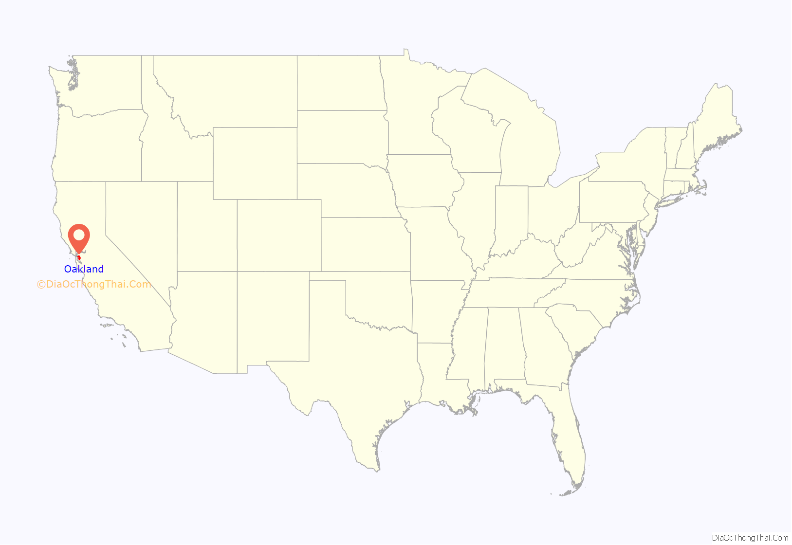
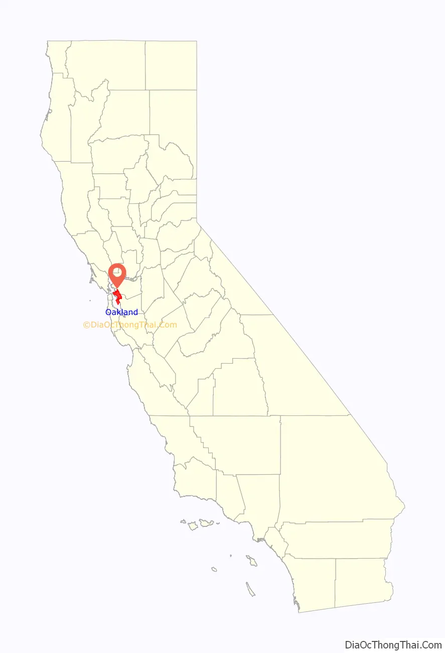
Oakland location map. Where is Oakland city?
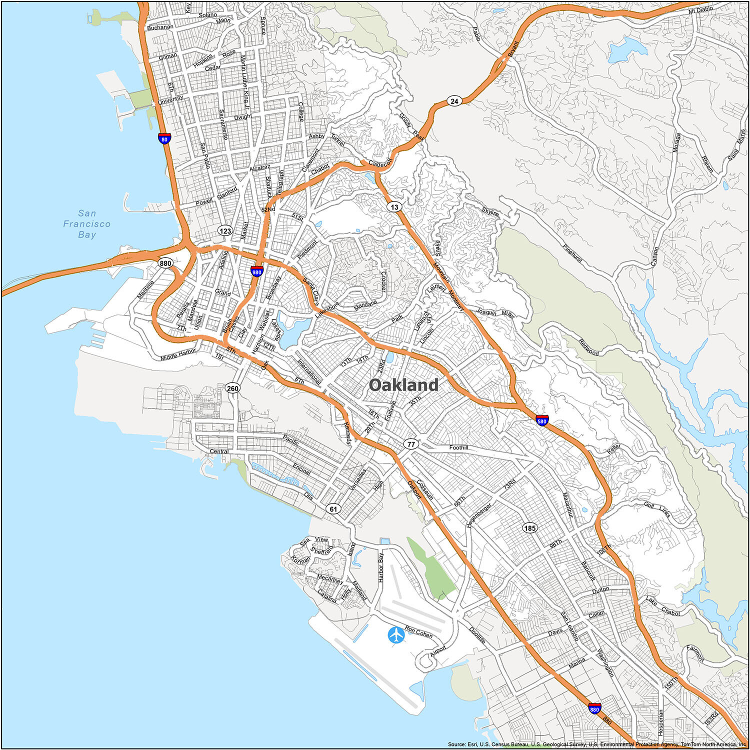
Oakland Road Map
It’s always helpful to have a map on hand when you’re visiting a new place. This printable Oakland road map offers travelers a great way to easily navigate the city. With this map, you can explore Oakland, California, and uncover all the hidden gems this charming city has to offer. Find everything from interstates, highways and major roads to hiking and biking trails. If you’re planning to travel outside the city, you’ll want to download our California road map for more highway information.
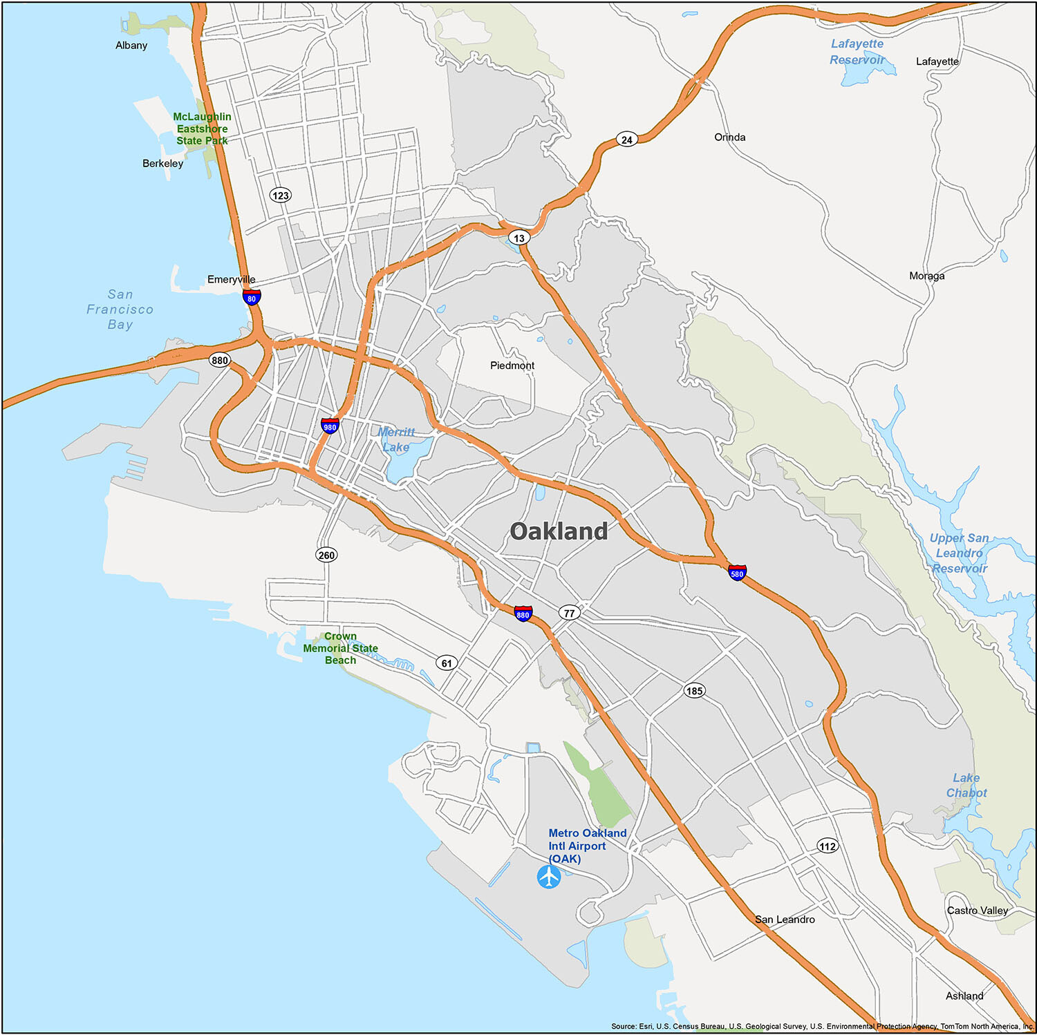
Oakland is an incredible city with plenty to explore. With its diverse population and stunning views, Oakland is a great place to visit or call home. With this reference map of Oakland, you can explore the city and get to know its neighborhoods and attractions. Discover state parks, airports, cities, towns, bays, and lakes in and around Oakland.
10 things to do in Oakland city
Explore Oakland with ease by using this easy-to-use map. With so many great sites and attractions, Oakland is a great place to visit. Whether you’re looking for a fun day trip or an extended stay, you’re sure to find something that suits your needs. From gorgeous parks to thrilling sports arenas, Oakland has something for everyone. So, don’t wait any longer. Start planning your Oakland adventure today!
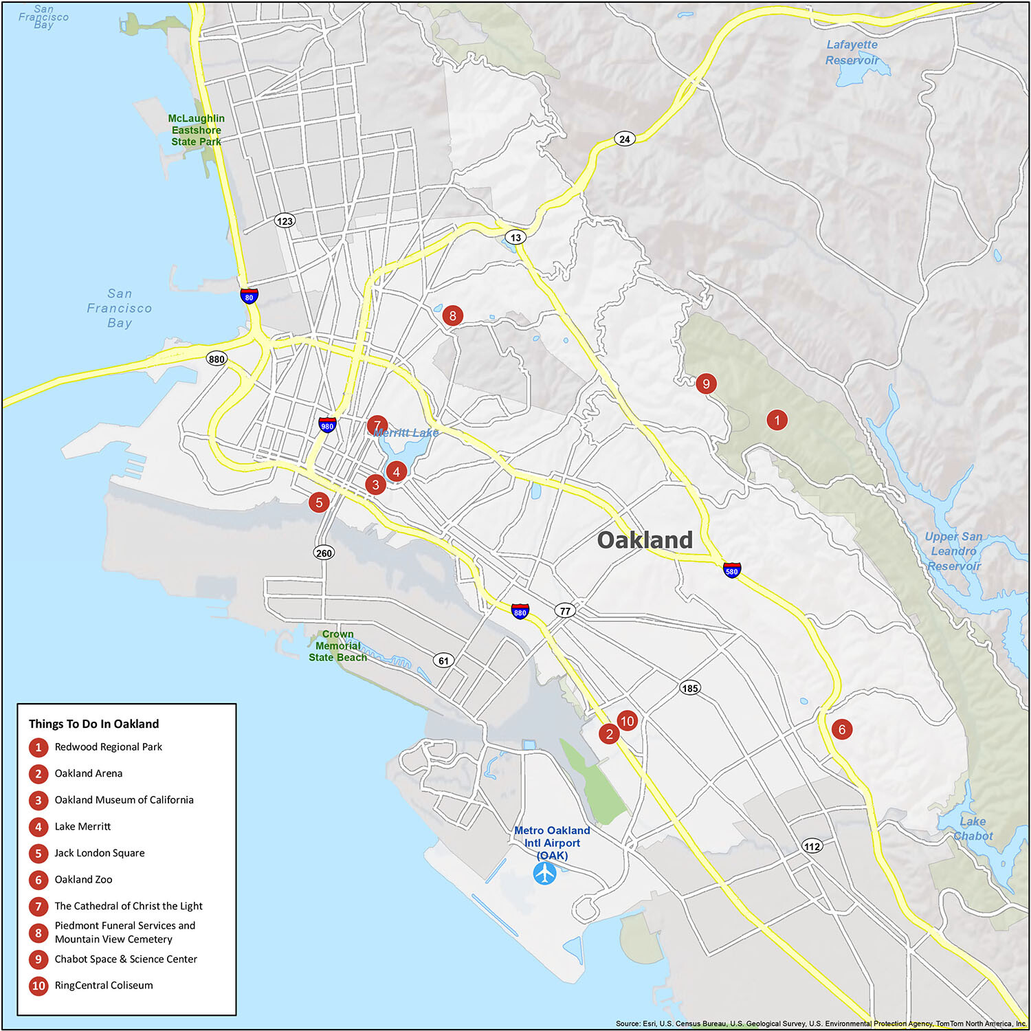
Oakland is home to many great attractions, and it’s easy to explore them all with an easy-to-use map. With so many sights to see, you’ll never run out of things to do. From museums and parks to sports arenas and art galleries, Oakland has something for everyone. So, don’t miss out on the amazing attractions Oakland has to offer. Start planning your trip today!
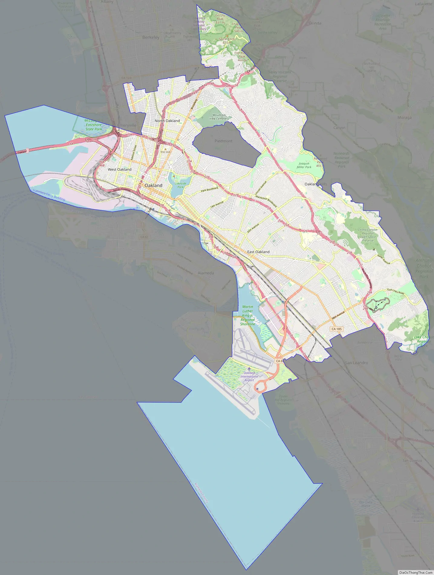
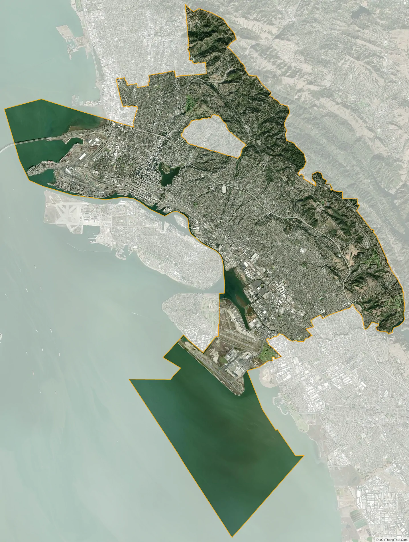
Oakland city Satellite Map
Geography
Oakland is in the eastern region of the San Francisco Bay. In 1991, the City Hall tower was at 37°48′19″N 122°16′21″W / 37.805302°N 122.272539°W / 37.805302; -122.272539 (NAD83). (The building still exists, but like the rest of the Bay Area, it has shifted northwest perhaps 0.6 meters in the last twenty years.)
The United States Census Bureau says the city’s total area is 78.0 square miles (202 km), including 55.8 square miles (145 km) of land and 22.2 square miles (57 km) (28.48 percent) of water.
Oakland’s highest point is near Grizzly Peak Blvd, east of Berkeley, just over 1,760 feet (540 m) above sea level at about 37°52′43″N 122°13′27″W / 37.8786°N 122.2241°W / 37.8786; -122.2241. Oakland has 19 miles (31 km) of shoreline, but Radio Beach is the only beach in Oakland.
Oaklanders refer to their city’s terrain as “the flatlands” and “the hills”. Until recent waves of gentrification, these terms also symbolized Oakland’s deep economic divide, with “the hills” being more affluent communities. About two-thirds of Oakland lies in the flat plain of the East Bay, with one-third rising into the foothills and hills of the East Bay range.
Ruptures along the nearby San Andreas Fault caused severe earth movement in the San Francisco Bay Area in 1906 and 1989. San Andreas quakes induces creep (movement occurring on earthquake faults) in the Hayward fault, which runs directly through Oakland, Berkeley, San Jose and other Bay Area cities.
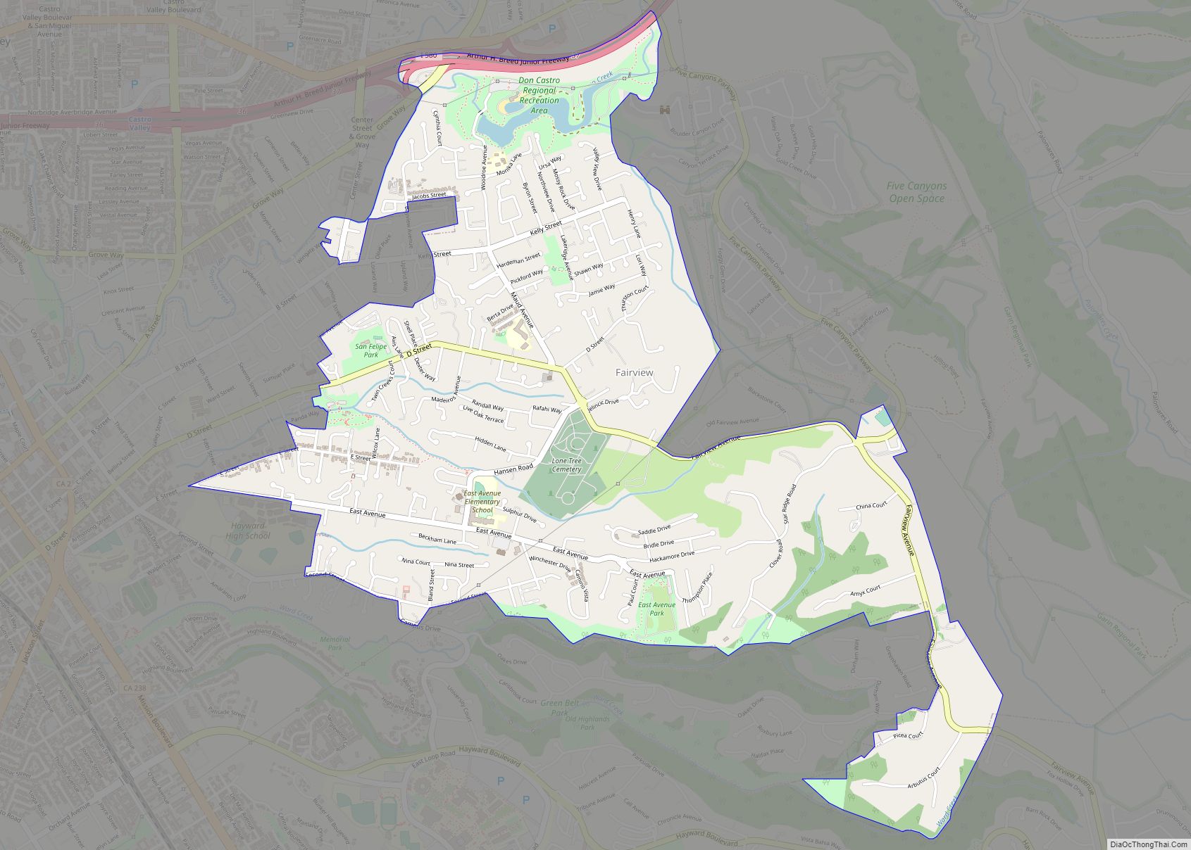
Neighborhoods
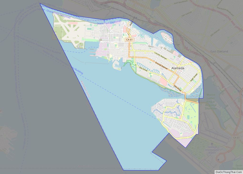
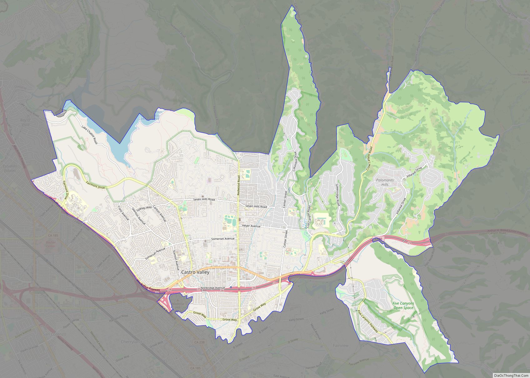
Oakland has more than 50 distinct neighborhoods. The city’s greater divisions include downtown Oakland and its greater Central Business District, Lake Merritt, East Oakland, North Oakland, West Oakland, and the Oakland Hills. East Oakland, which includes the East Oakland Hills, encompasses more than half of Oakland’s land area, stretching from Lakeshore Avenue on the east shore of Lake Merritt southeast to the San Leandro border. North Oakland encompasses the neighborhoods between downtown and Berkeley and Emeryville. West Oakland is the area between downtown and the Bay, partially surrounded by the Oakland Point, and encompassing the Port of Oakland. In 2011, Oakland was ranked the tenth most walkable city in the United States by Walk Score.
Lake Merritt, an urban estuary near downtown, is a mix of fresh and salt water draining in and out from the Oakland Harbor at the San Francisco Bay and one of Oakland’s most notable features. It was designated the United States’ first official wildlife refuge in 1870. Originally a marsh-lined wildlife haven, Lake Merritt was dredged and bordered with parks from the 1890s to the 1910s. Despite this reduction in habitat, Oakland is home to a number of rare and endangered species, many of which are localized to serpentine soils and bedrock. Lake Merritt is surrounded by residential and business districts, including downtown and Grand Lake.
The city of Piedmont, incorporated in Oakland’s central foothills after the 1906 earthquake, is a small independent city surrounded by the city of Oakland.
Climate
Oakland has a warm-summer Mediterranean climate (Köppen Csb) with an average of 260 sunny days per year. In general, the city features warm, dry summers, and cool, wet winters.
Based on data gathered by the National Oceanic and Atmospheric Administration, Oakland is ranked No. 1 in climate among U.S. cities. Oakland’s climate is typified by the temperate and seasonal Mediterranean climate. Summers are usually dry and warm and winters are cool and damp. It has features found in both nearby coastal cities such as San Francisco and inland cities such as San Jose, making it warmer than San Francisco and cooler than San Jose. Its position on San Francisco Bay across from the Bay Bridge means the northern part of the city can have cooling maritime fog. It is far enough inland that the fog often burns off by midday, allowing it to have typically sunny California days. The hills tend to have more fog than the flatlands, as the fog drifts down from Berkeley.
The U.S. Weather Bureau kept weather records in downtown Oakland from October 4, 1894, to July 31, 1958. During that time, the record high temperature was 104 °F (40 °C) on June 24, 1957, and the record low temperature was 24 °F (−4 °C) on January 23, 1949. Dry, warm offshore “Diablo” winds (similar to the Santa Ana winds of Southern California) sometimes occur, especially in fall, and raise the fire danger. In 1991, such an episode allowed the catastrophic Oakland Hills fire to spread and consume many homes.
Oakland, like much of Northern California, is susceptible to winter rainstorms and Atmospheric rivers. The wettest calendar year was 1983 with 44.28 inches (1,125 mm) and the driest year was 2013 with 4.11 inches (104 mm). The most rainfall in one month was 15.35 inches (390 mm) in January 1911. The most rainfall in 24 hours was 4.29 inches (109 mm) on January 26, 2008. Rainfall near the bayfront is only 23 inches (580 mm), but is higher in the Oakland Hills to the east (up to 30 inches [760 mm]), with nearly all precipitation falling between November and April.
Overnight lows are mild. Oakland seldom experiences warm nights with the warmest recorded night of 72 °F (22 °C) in September 1971 and an average of 64 °F (18 °C) for the annual warmest low. The coldest day of the year averages a mild 50 °F (10 °C) and has never been recorded below 36 °F (2 °C).
The National Weather Service today has two official weather stations in Oakland: Oakland International Airport and the Oakland Museum (established 1970).
Vegetation
The higher rainfall in the hills supports woods of oak, madrona, pine, fir and a few redwood groves in the wetter areas. Before being logged in the 19th century, some of the tallest redwood trees in California (used for navigation by ships entering the Golden Gate) may have stood in the Oakland Hills. One old stump 30 feet (9.1 m) in diameter can be seen near Redwood Regional Park. Sunny, drier slopes are grassy or covered in scattered oaks and chaparral brush. Australian eucalyptus trees have been extensively planted in many areas, as they come from a similar climate.
See also
Map of California State and its subdivision:- Alameda
- Alpine
- Amador
- Butte
- Calaveras
- Colusa
- Contra Costa
- Del Norte
- El Dorado
- Fresno
- Glenn
- Humboldt
- Imperial
- Inyo
- Kern
- Kings
- Lake
- Lassen
- Los Angeles
- Madera
- Marin
- Mariposa
- Mendocino
- Merced
- Modoc
- Mono
- Monterey
- Napa
- Nevada
- Orange
- Placer
- Plumas
- Riverside
- Sacramento
- San Benito
- San Bernardino
- San Diego
- San Francisco
- San Joaquin
- San Luis Obispo
- San Mateo
- Santa Barbara
- Santa Clara
- Santa Cruz
- Shasta
- Sierra
- Siskiyou
- Solano
- Sonoma
- Stanislaus
- Sutter
- Tehama
- Trinity
- Tulare
- Tuolumne
- Ventura
- Yolo
- Yuba
- Alabama
- Alaska
- Arizona
- Arkansas
- California
- Colorado
- Connecticut
- Delaware
- District of Columbia
- Florida
- Georgia
- Hawaii
- Idaho
- Illinois
- Indiana
- Iowa
- Kansas
- Kentucky
- Louisiana
- Maine
- Maryland
- Massachusetts
- Michigan
- Minnesota
- Mississippi
- Missouri
- Montana
- Nebraska
- Nevada
- New Hampshire
- New Jersey
- New Mexico
- New York
- North Carolina
- North Dakota
- Ohio
- Oklahoma
- Oregon
- Pennsylvania
- Rhode Island
- South Carolina
- South Dakota
- Tennessee
- Texas
- Utah
- Vermont
- Virginia
- Washington
- West Virginia
- Wisconsin
- Wyoming