San Joaquin County (/ˌsæn hwɑːˈkiːn/ (listen); Spanish: San Joaquín, meaning “St. Joachim”), officially the County of San Joaquin, is a county located in the U.S. state of California. As of the 2020 census, the population was 779,233. The county seat is Stockton.
San Joaquin County comprises the Stockton–Lodi–Tracy metropolitan statistical area within the regional San Jose–San Francisco–Oakland combined statistical area. The county is located in Northern California’s Central Valley just east of the very highly populated nine-county San Francisco Bay Area region and is separated from the Bay Area by the Diablo Range of low mountains with its Altamont Pass. One of the smaller counties by area in California, it has a high population density and is growing rapidly due to overflow from the Bay Area’s need for housing.
The City of San Joaquin, despite sharing its name with the county, is located in Fresno County.
| Name: | San Joaquin County |
|---|---|
| FIPS code: | 06-077 |
| State: | California |
| Founded: | 1850 |
| Named for: | San Joaquin River, which was named for St. Joachim |
| Seat: | Stockton |
| Largest city: | Stockton |
| Total Area: | 1,426 sq mi (3,690 km²) |
| Land Area: | 1,391 sq mi (3,600 km²) |
| Total Population: | 779,233 |
| Population Density: | 550/sq mi (210/km²) |
| Time zone: | UTC−8 (Pacific Standard Time) |
| Summer Time Zone (DST): | UTC−7 (Pacific Daylight Time) |
| Website: | www.sjgov.org |
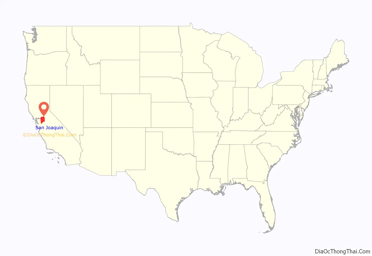
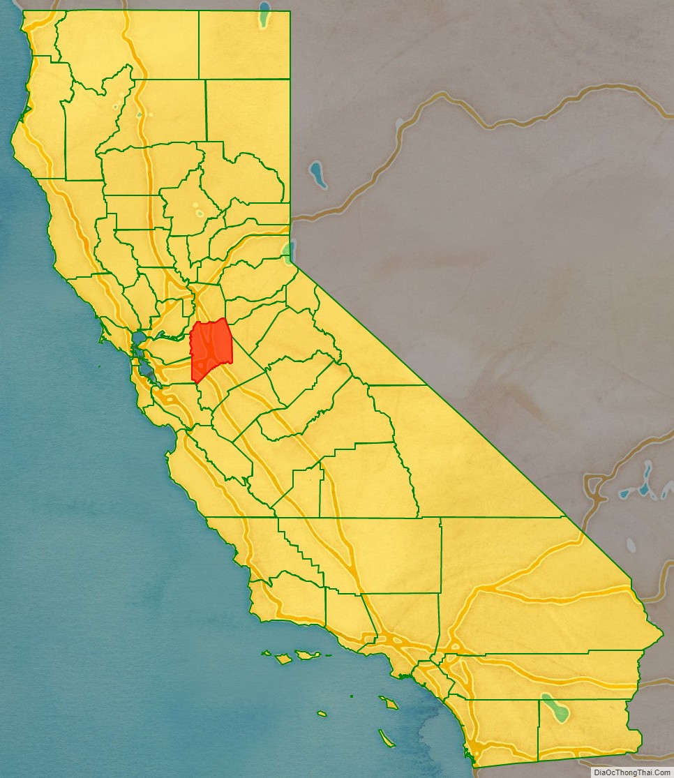
San Joaquin County location map. Where is San Joaquin County?
History
San Joaquin County was one of the original United States counties of California, created in 1850 at the time of statehood.
The county was named for the San Joaquin River which runs through it. In the early 19th century Lieutenant Gabriel Moraga, commanding an expedition in the lower great California Central Valley, gave the name of San Joaquin (meaning Joachim) to the San Joaquin River, which springs from the southern Sierra Nevada. San Joaquin County is the site of the San Joaquin Valley’s first permanent residence.
Prior to incorporation in 1850, the area now encompassing San Joaquin County was inhabited by the Yokuts and Miwok native peoples. These communities lived in villages throughout the region, consuming diverse diets that reflected the flora and fauna of the California Delta. Acorns from Valley Oak trees, salmon runs on the San Joaquin, Mokelumne, Calaveras, and Stanislaus rivers, and Tule Elk were staples of the native diet, which was supplemented with various native berries and plants. The native population of San Joaquin County fell dramatically during a statewide epidemic of malaria in 1828, and a subsequent rebellion of native peoples in the Central Valley, led by Chief Estanislao.
Between 1843 and 1846, during the era when California was a province of independent Mexico, five Mexican land grants were made in what would become San Joaquin County: Campo de los Franceses, Pescadero (Grimes), Pescadero (Pico), Sanjon de los Moquelumnes, and Thompson. The largest of these grants was the Rancho Campos de los Franceses, secured by Charles Weber and Guillermo Gulnac, which was eventually developed into the City of Stockton.
As the Gold Rush drew miners to the Sierra Nevada, Stockton grew into a major logistical and mercantile hub for the San Joaquin Valley and Mother Lode, which allowed for the City and County populations to rise significantly between 1850 and 1870. As the state’s gold economy waned in the 1870s, San Joaquin County transitioned into a major national center of agriculture, which it remains to this day. Reclamation of the California delta, which began in 1869, strongly benefited this agricultural growth. The importance of agriculture to the region’s economy led to the creation of a dynamic industrial engineering sector in Stockton, Lodi, and nearby Rio Vista in the 1880s. Notably, the Sperry Flour Company, Holt Manufacturing Company, the operation of R. G. LeTourneau, Samson Ironworks, and the canning empire of Tillie Lewis were firms of national and international significance. Holt Manufacturing, led by Benjamin Holt, would pioneer the industrial manufacturing and sales of the tractor, while R.G. LeTourneau patented the bulldozer in 1926.
Importance to railroads
The Central Pacific Railroad in the 1860s utilized San Joaquin County’s exceptionally flat terrain to construct a rail line from Sacramento to Stockton and then southwest through Altamont Pass to the San Francisco Bay. In 1909, a second railroad, the Western Pacific, utilized the same route through Stockton to reach the Bay Area. In the early 1900s, the Santa Fe Railroad constructed from Bakersfield and Fresno through Stockton north to reach Oakland. Smaller lines constructed at Stockton were the Tidewater Southern to Modesto and the Central California Traction to Sacramento. Both started as electrically powered. These railroads encouraged the growth of farms, orchards, and ranches in San Joaquin County and adjacent counties.
Tracy tire fire
On August 7, 1998, a tire fire ignited at S.F. Royster’s Tire Disposal just south of Tracy on South MacArthur Drive, near Linne Rd. The tire dump held over 7 million illegally stored tires and was allowed to burn for more than two years before it was extinguished. Allowing the fire to burn was considered to be a better way to avoid groundwater contamination than putting it out. However, the cleanup cost $19 million and local groundwater was still discovered to be contaminated.
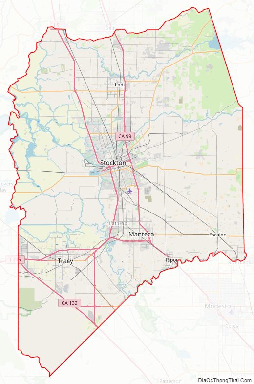
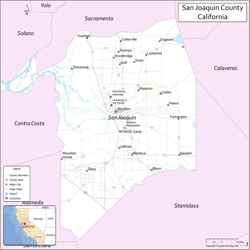
San Joaquin County Road Map
Geography
According to the U.S. Census Bureau, the county has a total area of 1,426 square miles (3,690 km), of which 1,391 square miles (3,600 km) is land and 35 square miles (91 km), comprising 2.5%, is water. The county has a very low inland elevation and a very flat drainage basin for the San Joaquin River and its numerous tributaries. With the resulting exceptionally high water table, the county is a marshy and swampy delta with a tendency to flood in the spring with melting snow runoff from the Sierra Mountains.
The geographical center of San Joaquin County is near Stockton at approximately 37°54’N 121°12’W (37.9,-121.2).
National protected area
- San Joaquin River National Wildlife Refuge (part)
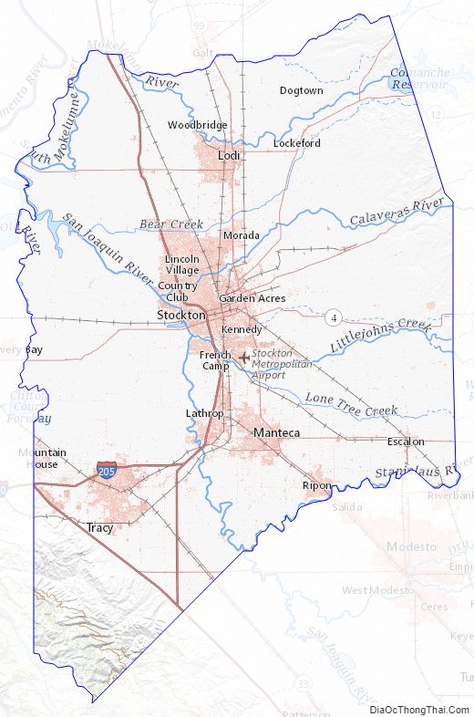
San Joaquin County Topographic Map
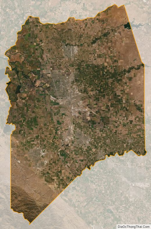
San Joaquin County Satellite Map
San Joaquin County Outline Map