Rio Vista (Spanish: Río Vista, meaning “River View”) is a city located in the eastern end of Solano County, California, in the Sacramento River Delta region of Northern California. The population was 7,360 at the 2010 census.
| Name: | Rio Vista city |
|---|---|
| LSAD Code: | 25 |
| LSAD Description: | city (suffix) |
| State: | California |
| County: | Solano County |
| Incorporated: | January 6, 1894 |
| Elevation: | 20 ft (6 m) |
| Total Area: | 7.09 sq mi (18.37 km²) |
| Land Area: | 6.59 sq mi (17.07 km²) |
| Water Area: | 0.50 sq mi (1.30 km²) 5.68% |
| Total Population: | 10,217 |
| Population Density: | 1,443.08/sq mi (556.18/km²) |
| ZIP code: | 94571 |
| Area code: | 707 |
| FIPS code: | 0660984 |
| Website: | www.riovistacity.com |
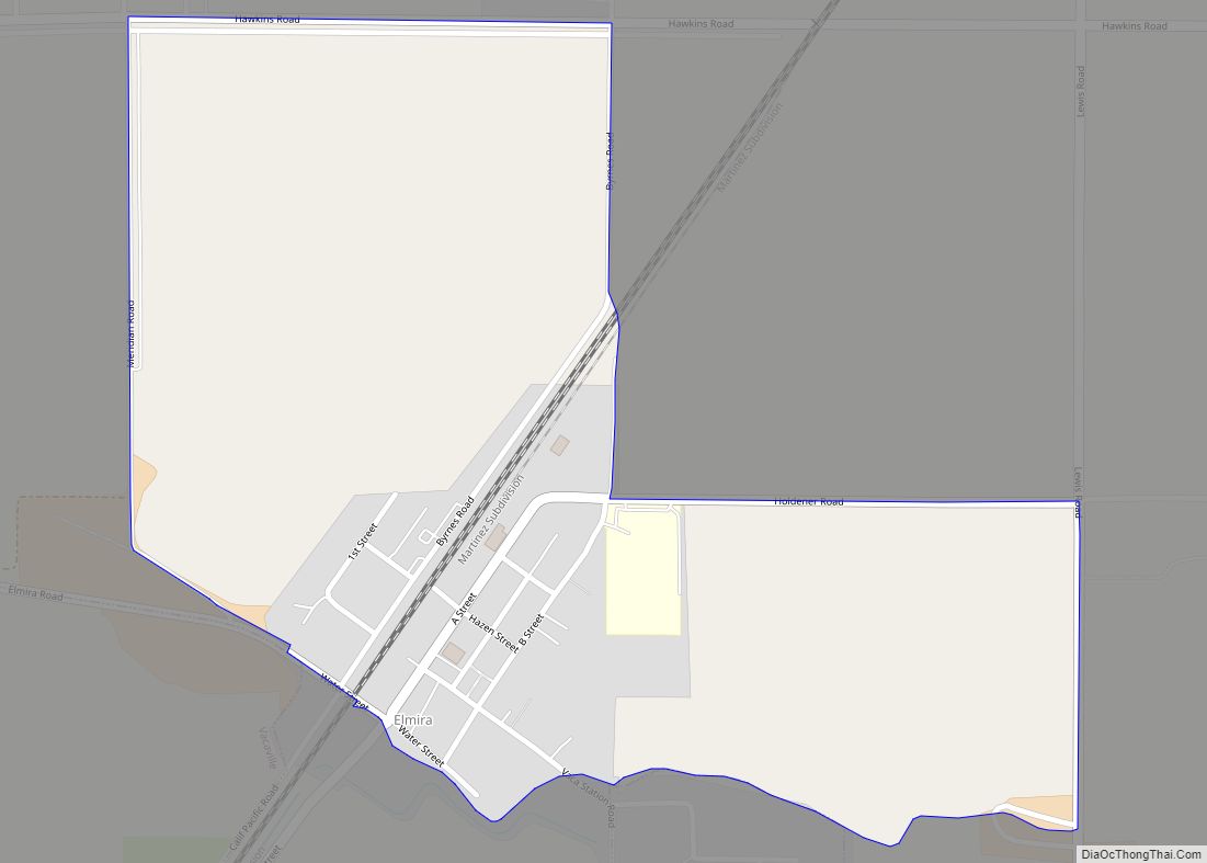
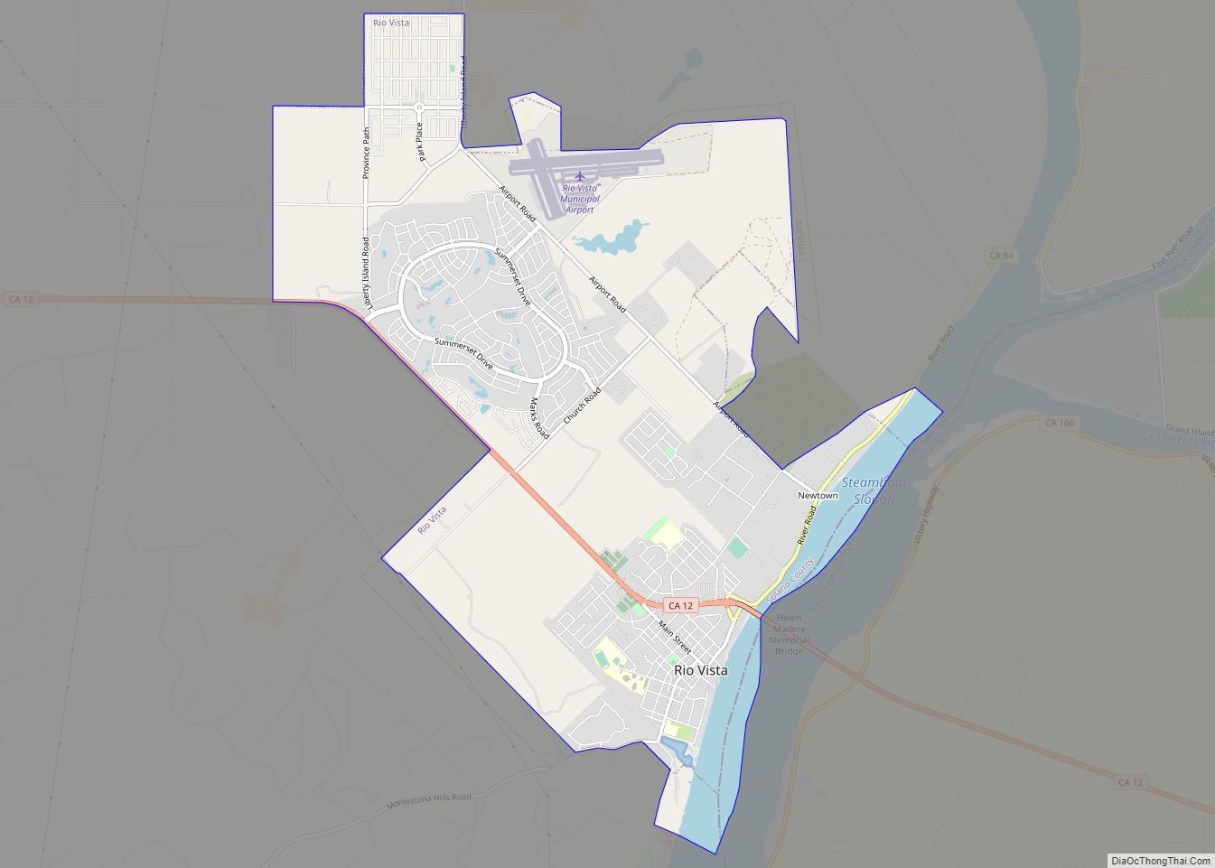
Online Interactive Map
Click on ![]() to view map in "full screen" mode.
to view map in "full screen" mode.
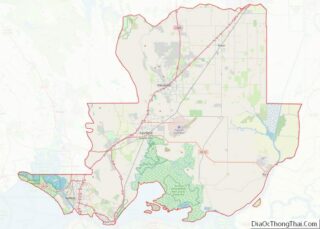
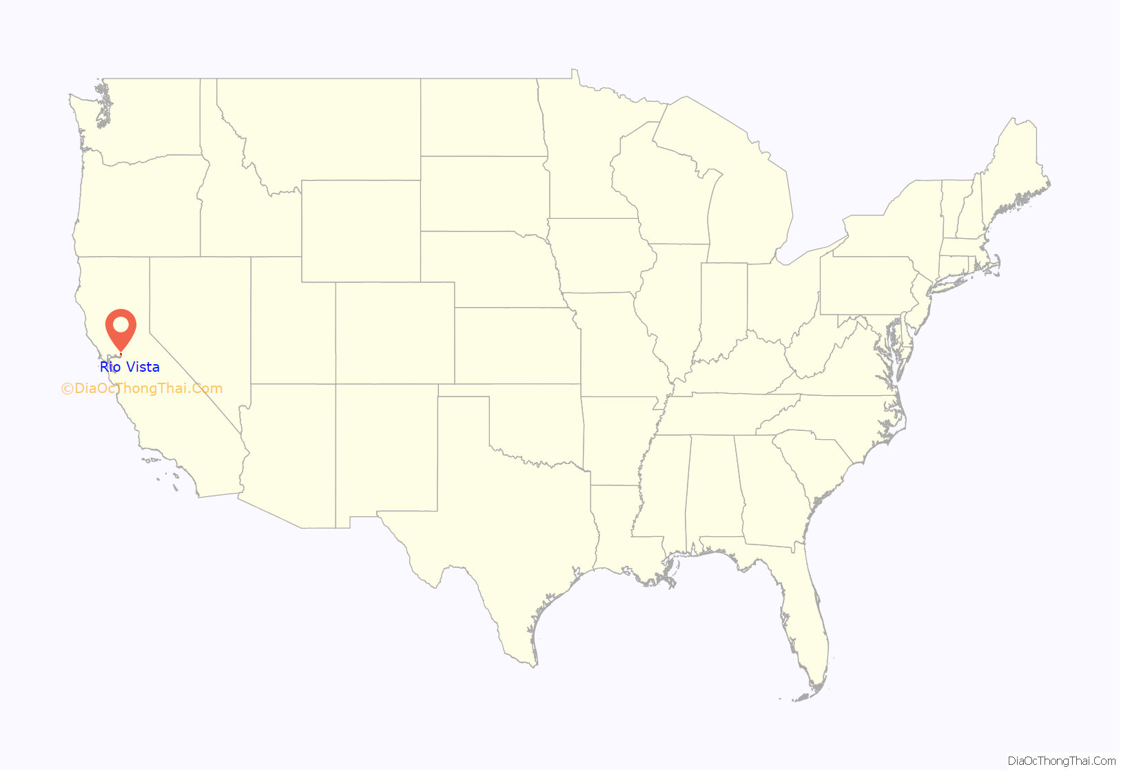
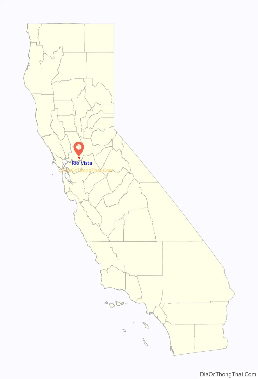
Rio Vista location map. Where is Rio Vista city?
History
The present location of Rio Vista is several miles south of the original settlement. Colonel Nathan H. Davis founded “Brazos del Rio” near the entrance of Cache Slough at the Sacramento River, on the Rancho Los Ulpinos Mexican land grant, in 1858. The settlement was renamed “Rio Vista” before a flood in 1862 that resulted in the town moving to its present location on higher ground. The city’s name combines the Spanish words for “river” and “view.” Post authorities established office in 1858. The community was officially incorporated as Rio Vista on December 30, 1893. The newspaper of record there is the River News-Herald and Isleton Journal, established in 1890.
From 1911 through 1992 Rio Vista was home to the United States Army Reserve Center, Rio Vista. The facility was initially established as a base for river control activities by the U.S. Army Corps of Engineers. During the 1950s it was used by the U.S. Army Transportation Corps to store and maintain harbor craft, and during the 1960s and 1970s it was used to prepare amphibious vehicles for transportation to Vietnam and to train troops in their use. In 1980 it was transferred to the U.S. Army Reserve and in 1992 it was closed due to a BRAC decision. The town also hosts a United States Coast Guard station, established in 1963.
Rio Vista was visited by a lost humpback whale in 1985, despite being 60 miles (100 kilometers) upriver from the Pacific Ocean. The young whale, nicknamed “Humphrey”, attracted throngs of curiosity seekers before he was eventually guided back to sea by rescuers. The Army Reserve Unit (481st Transportation Company (Heavy Boat)) was activated to use their vessels (Landing Craft Utility (LCU)) to assist in the guiding of Humphrey back to the sea. Again in May 2007, humpbacks were sighted in Rio Vista. “Delta” and “Dawn,” mother and calf, stopped at least twice in the river near the town.
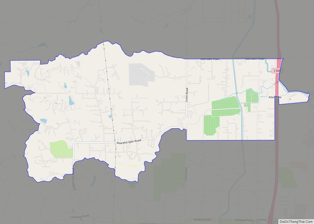
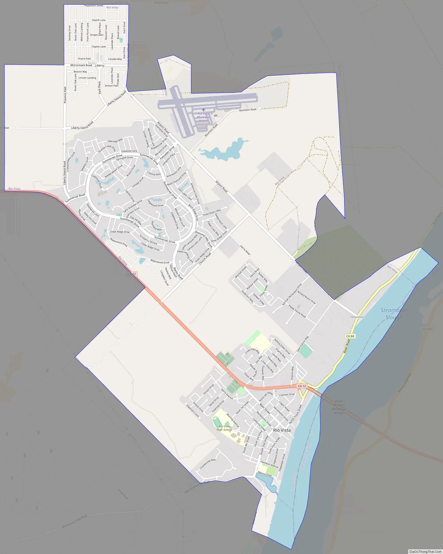
Rio Vista Road Map
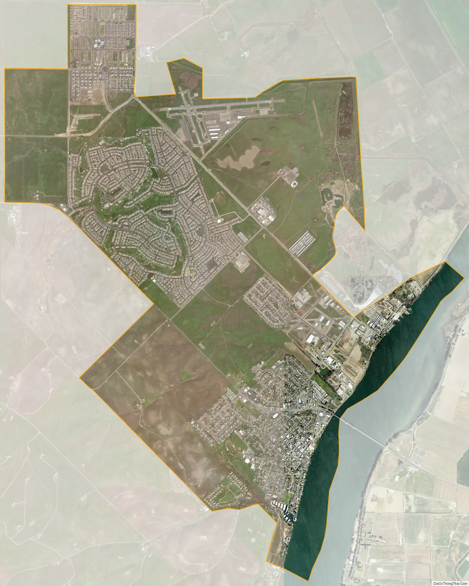
Rio Vista city Satellite Map
Geography
Rio Vista is a small rural town approximately 50 miles (80 km) south of Sacramento, on the Sacramento River in the Sacramento River Delta.
According to the United States Census Bureau, the city has a total area of 7.1 square miles (18 km), of which, 6.7 square miles (17 km) of it is land and 0.4 square miles (1.0 km) of it (5.68%) is water.
Climate
According to the Köppen Climate Classification system, Rio Vista has a warm-summer Mediterranean climate, abbreviated “Csa” on climate maps.
See also
Map of California State and its subdivision:- Alameda
- Alpine
- Amador
- Butte
- Calaveras
- Colusa
- Contra Costa
- Del Norte
- El Dorado
- Fresno
- Glenn
- Humboldt
- Imperial
- Inyo
- Kern
- Kings
- Lake
- Lassen
- Los Angeles
- Madera
- Marin
- Mariposa
- Mendocino
- Merced
- Modoc
- Mono
- Monterey
- Napa
- Nevada
- Orange
- Placer
- Plumas
- Riverside
- Sacramento
- San Benito
- San Bernardino
- San Diego
- San Francisco
- San Joaquin
- San Luis Obispo
- San Mateo
- Santa Barbara
- Santa Clara
- Santa Cruz
- Shasta
- Sierra
- Siskiyou
- Solano
- Sonoma
- Stanislaus
- Sutter
- Tehama
- Trinity
- Tulare
- Tuolumne
- Ventura
- Yolo
- Yuba
- Alabama
- Alaska
- Arizona
- Arkansas
- California
- Colorado
- Connecticut
- Delaware
- District of Columbia
- Florida
- Georgia
- Hawaii
- Idaho
- Illinois
- Indiana
- Iowa
- Kansas
- Kentucky
- Louisiana
- Maine
- Maryland
- Massachusetts
- Michigan
- Minnesota
- Mississippi
- Missouri
- Montana
- Nebraska
- Nevada
- New Hampshire
- New Jersey
- New Mexico
- New York
- North Carolina
- North Dakota
- Ohio
- Oklahoma
- Oregon
- Pennsylvania
- Rhode Island
- South Carolina
- South Dakota
- Tennessee
- Texas
- Utah
- Vermont
- Virginia
- Washington
- West Virginia
- Wisconsin
- Wyoming