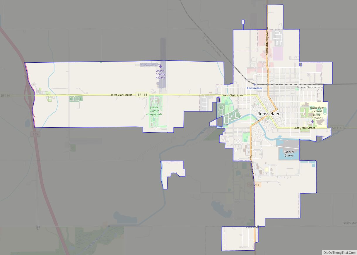
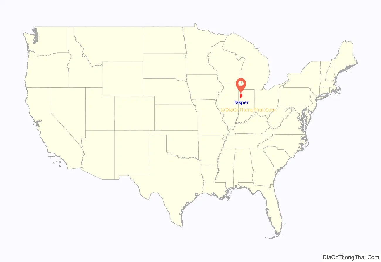
Jasper County is a county located in the U.S. state of Indiana. As of 2010, the population was 33,478. The county seat is Rensselaer.
Jasper County is included in the Chicago-Naperville–Elgin, IL-IN-WI Metropolitan Statistical Area.
| Name: | Jasper County |
|---|---|
| FIPS code: | 18-073 |
| State: | Indiana |
| Named for: | Sgt. William Jasper |
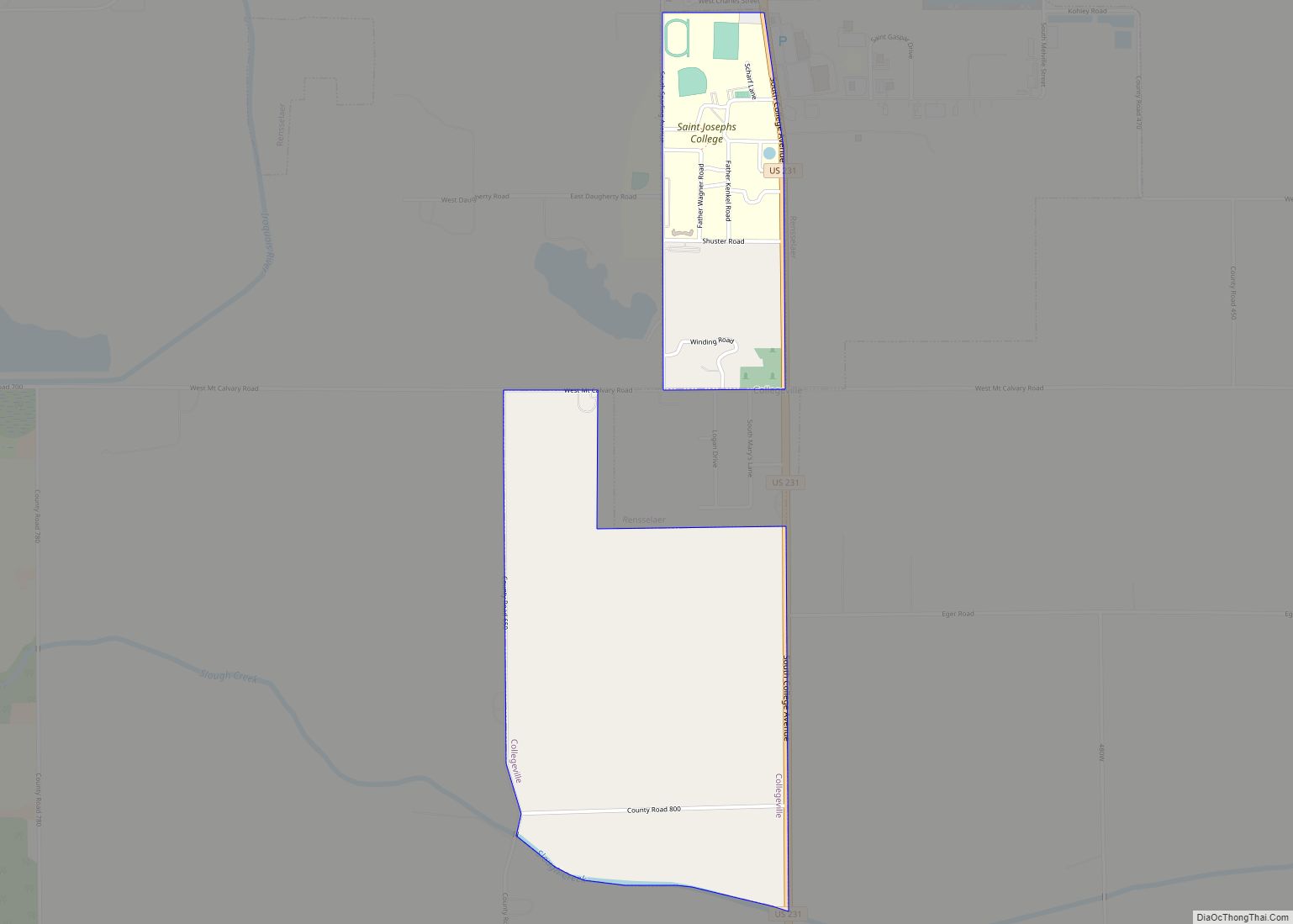
| Largest city: | Rensselaer |
| Land Area: | 559.62 sq mi (1,449.4 km²) |
| Population Density: | 59.5/sq mi (23.0/km²) |
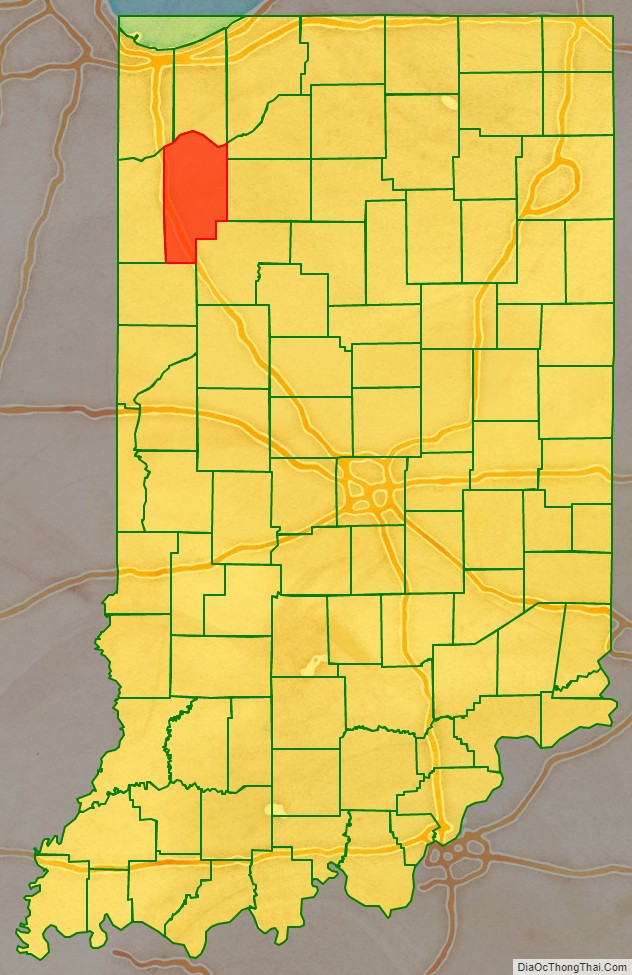
Jasper County location map. Where is Jasper County?
History
The lands of present NW Indiana were explored by French explorer Robert de LaSalle. At that time the area was inhabited by the Miami Confederation of Indians. Through White settlement, encroachment, and confrontation, the various indigenous groups were forced to cede their claim to the area. In October 1818, the Pottawattamies, Weas, and Delawares ceded their lands west of the Tippecanoe River to the government. In a treaty dated 23 October 1826, the Pottawattamies and Miamis ceded all their lands east of the Tippecanoe. A treaty dated 26 October 1832 with the Pottawattamies ceded control of the northwestern part of Indiana; on 27 October the Pottawattamies of Indiana and Michigan also relinquished all claim to any remaining land in those states.
Until the 1832 treaty of 1832, the future Jasper County area was not open to settlement; those who did come to Indiana before that time had flooded the southern parts of Ohio, Indiana and Illinois through the Ohio Valley. Northwestern Indiana was also less desirable for initial settlement, the land being described as alternate swamps, sterile sand ridges and flat, wet prairies. It did proliferate in game, however, and eventually settlers found it. The first recorded settler was William Donahue, who located in present-day Gillam Township. He was a justice of the peace during the period prior to the county’s establishment.
Although the settlers were sparse, the state legislature provided for two counties to be established in the area. The state legislature passed an omnibus bill that authorized thirteen counties and described their boundaries, although their governing structures were not established at that time. The new counties of Jasper and Newton were attached to White County for political and civil purposes.
In 1836 all the area north of the Kankakee River was partitioned from Jasper as Porter County. By 1837 preparations were being made to create the Jasper County governing structure, with a county commission being elected that year. They first met in January 1838 at the house of Robert Alexander in present-day Benton County. After that, the pro tem county seat was designated as the residence of George W. Spitler, in present-day Iroquois Township, Newton County, where the first meeting was held in March 1839. The official date of formation of the Jasper County government is given as 15 March 1838.
Jasper County was named for Sgt. William Jasper, a famous scout for the Continental Army during the American Revolutionary War. Jasper became famous in 1776, during the bombardment of Fort Moultrie, for erecting a new flagstaff under fire after the American flag had been shot down. Jasper was killed during the Siege of Savannah in 1779. Jasper County’s twin county, Newton County, was named after Jasper’s friend and comrade, John Newton.
A state legislature act dated 29 January 1839 caused the consolidation of Jasper and Newton, with Jasper retaining the name, and Newton (for the time being) being erased, and the consolidated area being seated at the Falls of the Iroquois River, with the name of Newton (the community’s name was changed to Rensselaer in 1844). In 1840 the county of Benton was formed from Jasper’s area. In 1859 the county of Newton was revived but with smaller area than before, leaving Jasper in its present form.
The Civil War
As early as 1825, the majority of the population were against slavery. By the time of the War, Jasper County was one of the few counties of Indiana that had a military organization under the law of 1855. The war greatly affected Jasper County when 935 soldiers were enlisted on behalf of the Union. This was considered an impressive amount at the time with the average population around 5,000. Although there were several companies from Indiana, the 9th Indiana Infantry Regiment produced Robert H. Milroy, the “Gray Eagle of the Army”. Milroy became famous for suppressing Confederate mountain rangers, which caused the Confederate Congress to declare a $100,000 bounty on his head. The 9th Indiana Infantry Regiment became known for its involvement in the Battle of Philippi, one of the earliest battles of the Civil War at Laurel Hill (now known as Laurel Mountain). In comparing the proportions of men able to fight, Indiana contributed more soldiers than any other state to the Union.
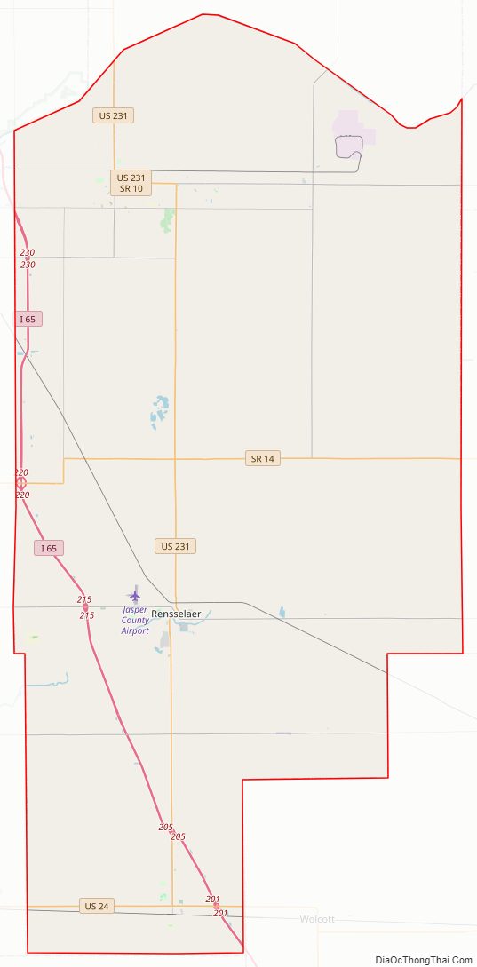
Jasper County Road Map
Geography
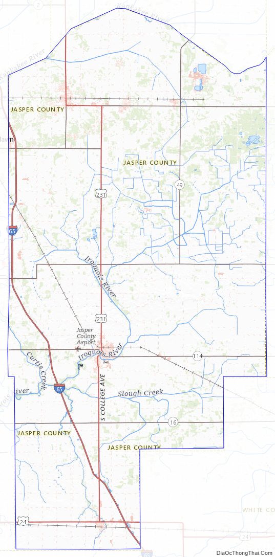
According to the 2010 census, the county has a total area of 561.39 square miles (1,454.0 km), of which 559.62 square miles (1,449.4 km) (or 99.68%) is land and 1.76 square miles (4.6 km) (or 0.31%) is water. Until the middle of the 19th century when it was drained to make farmland, this county was part of the second largest freshwater wetland in the US, with abundant flora and fauna. This is caused by the Iroquois River, one of the main tributaries of the Kankakee River that flows throughout Jasper County, a major water source for the area.
Major highways
- Interstate 65
- U.S. Route 24
- U.S. Route 231
- Indiana State Road 10
- Indiana State Road 14
- Indiana State Road 16
- Indiana State Road 49
- Indiana State Road 110
- Indiana State Road 114
Railroads
- CSX Transportation
- Norfolk Southern Railway
- Toledo, Peoria and Western Railway
Adjacent counties
- Porter County – north
- La Porte County – northeast
- Starke County – northeast
- Pulaski County – east
- White County – southeast
- Benton County – south
- Newton County – west
- Lake County – northwest
Jasper County Topographic Map
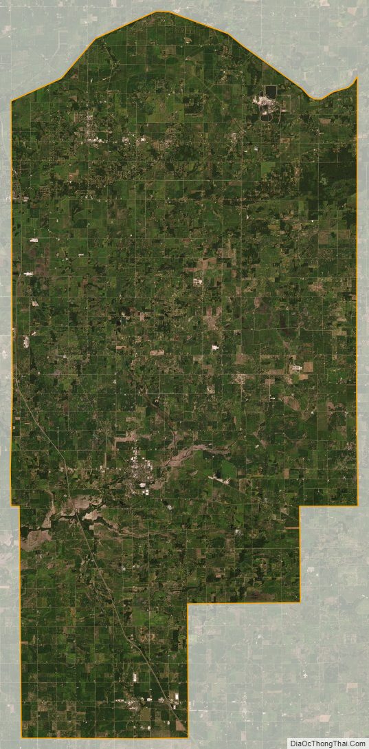
Jasper County Satellite Map
Jasper County Outline Map