| Name: | Kendall County |
|---|---|
| FIPS code: | 17-093 |
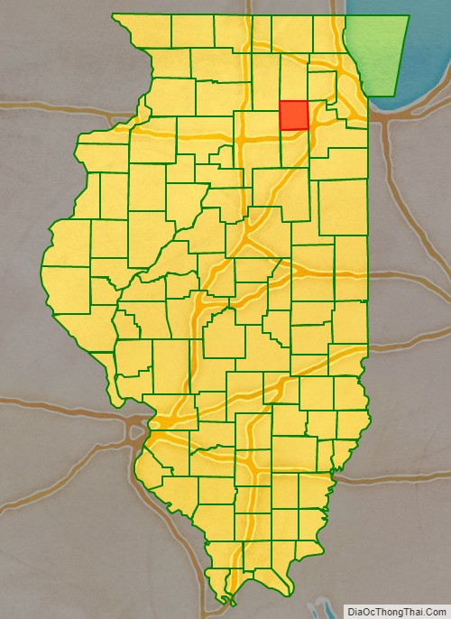
| State: | Illinois |
| Founded: | 1841 |
| Named for: | Amos Kendall |
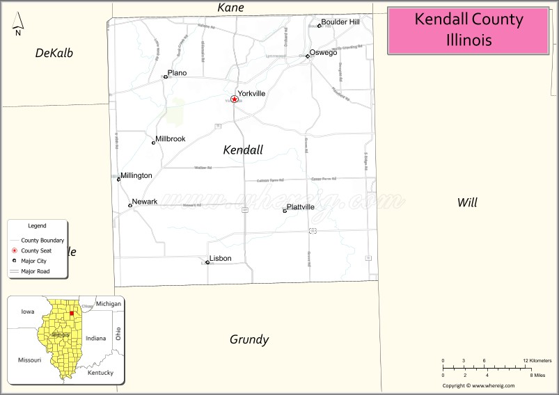
| Seat: | Yorkville |
| Total Area: | 322 sq mi (830 km²) |
| Land Area: | 320 sq mi (800 km²) |
| Total Population: | 131,869 |
| Time zone: | UTC−6 (Central) |
| Summer Time Zone (DST): | UTC−5 (CDT) |
| Website: | www.co.kendall.il.us |
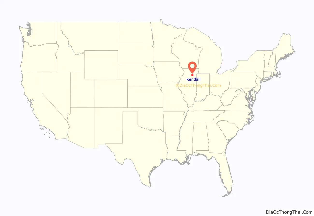
Kendall County location map. Where is Kendall County?
History
Kendall County was formed in 1841 out of LaSalle and Kane Counties.
The county is named after Amos Kendall, who was the editor of the Frankfort, Kentucky, newspaper, and went on to be an important advisor to President Andrew Jackson. Kendall became the U.S. Postmaster General in 1835.
Kendall County at the time of its creation in 1841
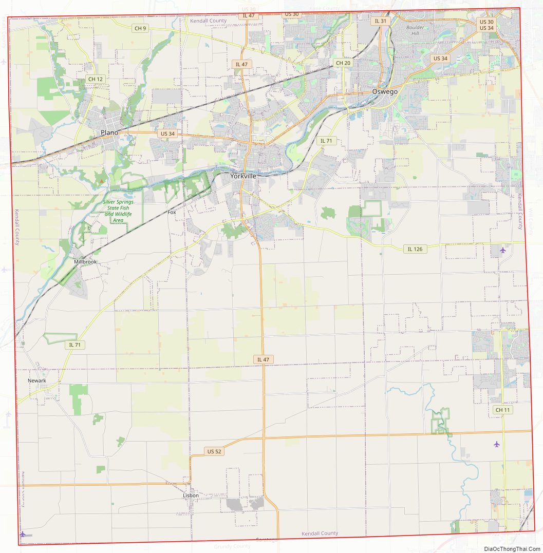
Kendall County Road Map
Geography
According to the U.S. Census Bureau, the county has an area of 322 square miles (830 km), of which 320 square miles (830 km) are land and 2.0 square miles (5.2 km) (0.6%) are covered by water.
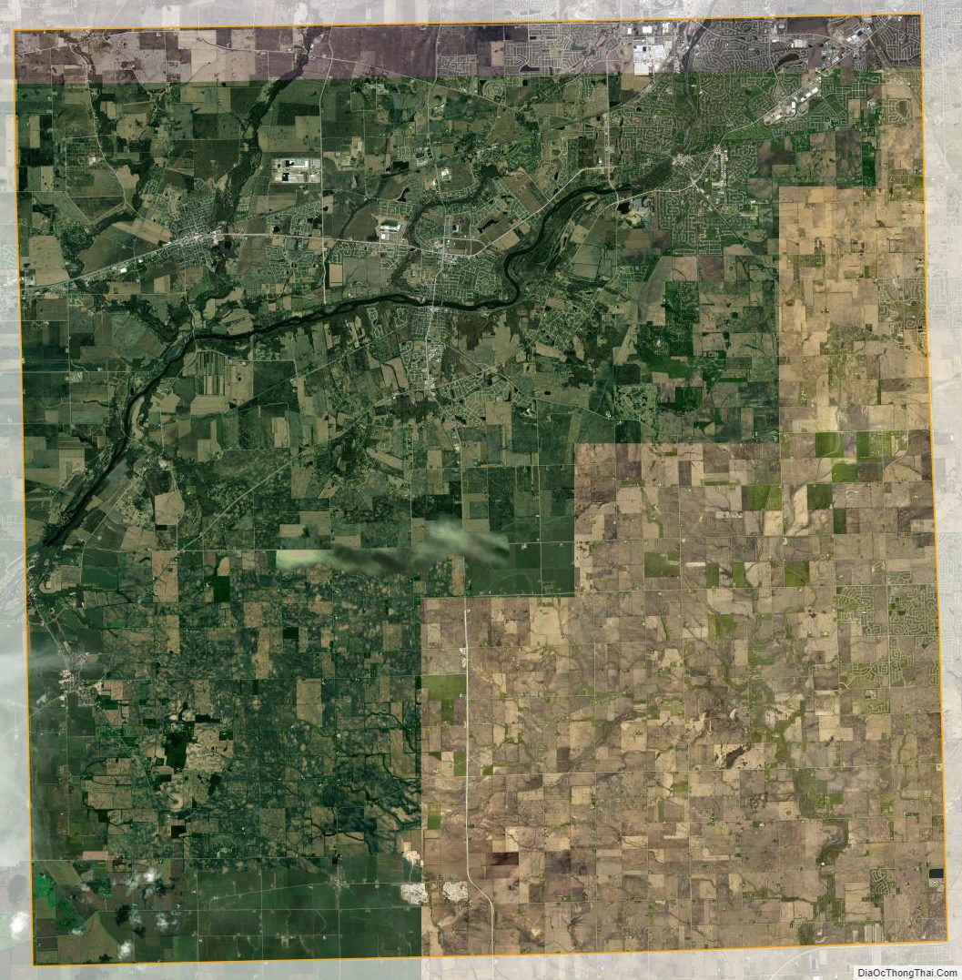
Kendall County is a small but rapidly growing county that has the majority of its population in the northeast and along the Fox River (the only river in the county), which runs through the county’s northwestern section. Many new subdivisions have been constructed in this county, which has produced considerable population growth. Southern Kendall still remains largely agricultural. Kendall County has two primary ranges of low-lying hills formed by what is known as an end moraine. Ransom, the more predominant of the two moraines, runs through the west and north-central part of the county. This moraine has created elevations over 800 feet (240 m), in contrast to elevations in southern Kendall County that drop to the lower 500-foot (150 m) range. Minooka, the other major end moraine ridge in Kendall County, runs along its entire eastern border with Will County. The two moraines intersect at almost a right angle in the township of Oswego. The county’s only designated state park is Silver Springs State Fish and Wildlife Area.
Climate and weather
In recent years, average temperatures in the county seat of Yorkville have ranged from a low of 10 °F (−12 °C) in January to a high of 84 °F (29 °C) in July, although a record low of −26 °F (−32 °C) was recorded in January 1985 and a record high of 111 °F (44 °C) was recorded in July 1936. Average monthly precipitation ranged from 1.52 inches (39 mm) in February to 4.39 inches (112 mm) in July.
Major highways
- Interstate 80
- U.S. Highway 30
- U.S. Highway 34
- U.S. Highway 52
- Illinois Route 25
- Illinois Route 31
- Illinois Route 47
- Illinois Route 71
- Illinois Route 126
Adjacent counties
- DeKalb County – northwest
- Kane County – north
- DuPage County – northeast
- Will County – east
- Grundy County – south
- LaSalle County – west
Kendall County Topographic Map

Kendall County Satellite Map
Kendall County Outline Map