Frankfort is the capital city of the Commonwealth of Kentucky, United States, and the seat of Franklin County. It is a home rule-class city; the population was 28,602 at the 2020 census. Located along the Kentucky River, Frankfort is the principal city of the Frankfort, Kentucky Micropolitan Statistical Area, which includes all of Franklin and Anderson counties.
| Name: | Frankfort city |
|---|---|
| LSAD Code: | 25 |
| LSAD Description: | city (suffix) |
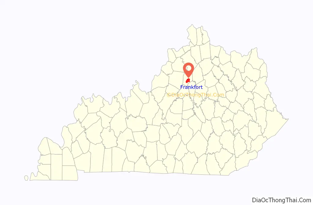
| State: | Kentucky |
| County: | Franklin County |
| Incorporated: | February 28, 1835 |
| Elevation: | 505 ft (154 m) |
| Total Area: | 15.07 sq mi (39.03 km²) |
| Land Area: | 14.77 sq mi (38.25 km²) |
| Water Area: | 0.30 sq mi (0.78 km²) |
| Total Population: | 28,602 |
| Population Density: | 1,900/sq mi (730/km²) |
| ZIP code: | 40601-40604, 40618-40622 |
| Area code: | 502 |
| FIPS code: | 2128900 |
| GNISfeature ID: | 517517 |
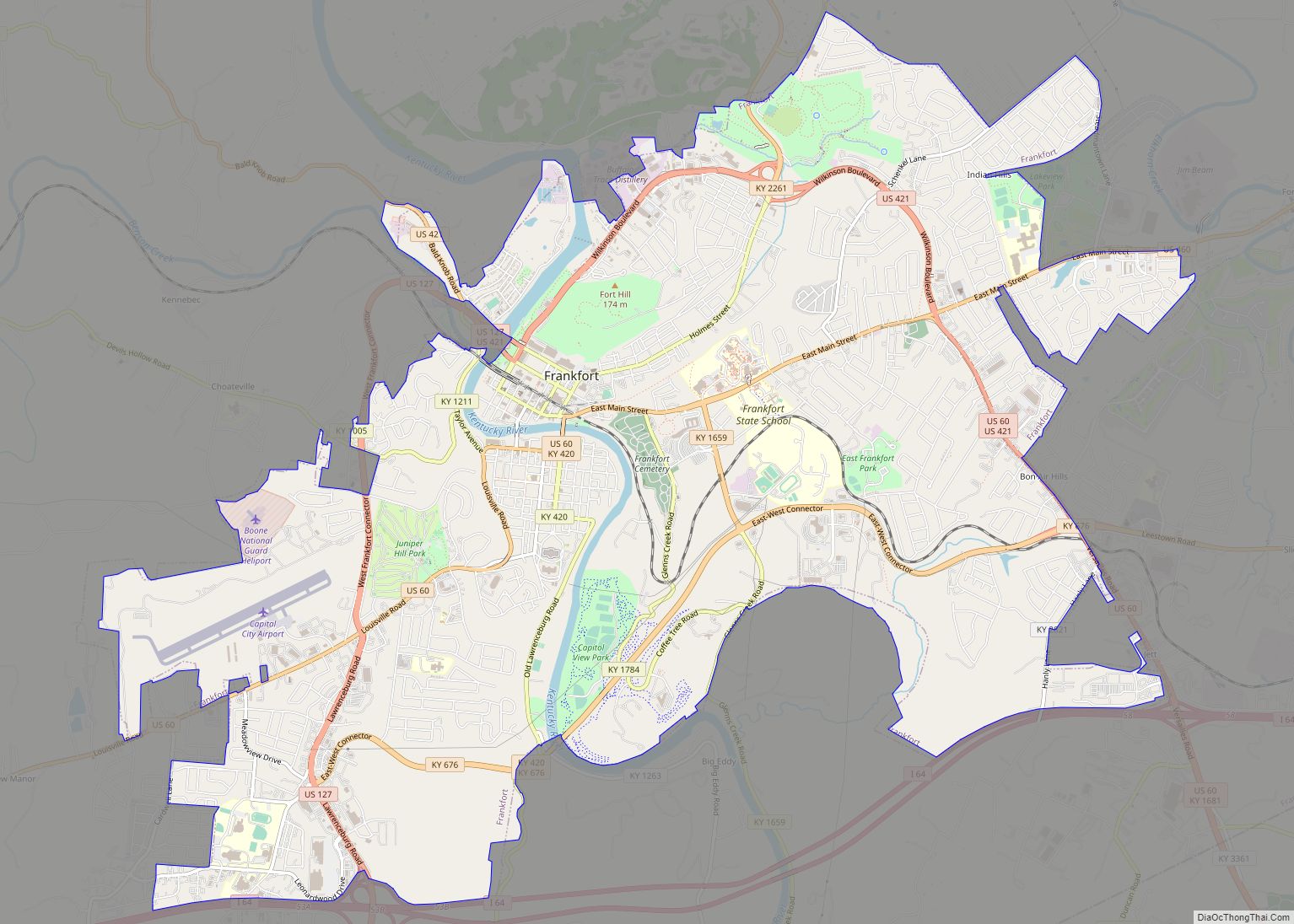
Online Interactive Map
Click on ![]() to view map in "full screen" mode.
to view map in "full screen" mode.
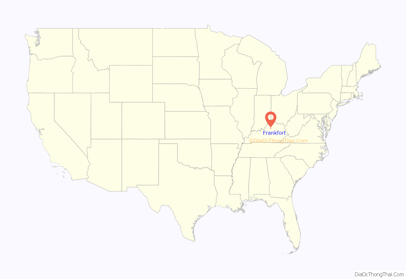
Frankfort location map. Where is Frankfort city?
History
Pre-1900
The town of Frankfort likely received its name from an event that took place in the 1780s. Native Americans attacked a group of early European colonists from Bryan Station, who were on their way to make salt at Mann’s Lick in Jefferson County. Pioneer Stephen Frank was killed at the Kentucky River and the settlers thereafter called the crossing “Frank’s Ford“. This name was later elided to Frankfort.
In 1786, James Wilkinson purchased a 260-acre (110 ha) tract of land on the north side of the Kentucky River, which developed as downtown Frankfort. He was an early promoter of Frankfort as the state capital. Wilkinson felt Frankfort would be a center of transportation using the Kentucky River to ship farm produce to the Ohio River and then to the Mississippi and on to New Orleans.
After Kentucky became the 15th state in 1792, five commissioners from various counties were appointed, on 20 June 1792, to choose a location for the capital. They were John Allen and John Edwards (both from Bourbon County), Henry Lee (from Mason), Thomas Kennedy (from Madison), and Robert Todd (from Fayette). A number of communities competed for this honor, but Frankfort won. According to early histories, the offer of Andrew Holmes’ log house as capitol for seven years, a number of town lots, £50 worth of locks and hinges, 10 boxes of glass, 1,500 pounds of nails, and $3,000 in gold helped the decision go to Frankfort.
Frankfort had a United States post office by 1794, with Daniel Weisiger as postmaster. On 1 October 1794, Weisiger sent the first quarterly account to Washington.
John Brown, a Virginia lawyer and statesman, built a home now called Liberty Hall in Frankfort in 1796. Before Kentucky statehood, he represented Virginia in the Continental Congress (1777−78) and the U.S. Congress (1789−91). While in Congress, he introduced the bill granting statehood to Kentucky. After statehood, he was elected by the state legislature as one of the state’s U.S. Senators.
In 1796, the Kentucky General Assembly appropriated funds to provide a house to accommodate the governor; it was completed two years later. The Old Governor’s Mansion is claimed to be the oldest official executive residence still in use in the United States. In 1829, Gideon Shryock designed the Old Capitol, Kentucky’s third, in Greek Revival style. It served Kentucky as its capitol from 1830 to 1910. The separate settlement known as South Frankfort was annexed by the city on 3 January 1850.
The Argus of Western America was published in Frankfort from 1808 until 1830.
During the American Civil War, the Union Army built fortifications overlooking Frankfort on what is now called Fort Hill. The Confederate Army also occupied Frankfort for a short time, starting on 3 September 1862, the only such time that Confederate forces took control of a Union capitol.
The Clinton Street High School, a segregated public school for African American students in Frankfort operated from either 1882 or 1884 until 1928.
20th-century
On 3 February 1900, William Goebel was assassinated in Frankfort while walking to the capitol on the way to the Kentucky Legislature. Former Secretary of State Caleb Powers and several others were later found guilty of a conspiracy to murder Goebel, however all were later pardoned.
The Mayo–Underwood School, the successor to the Clinton Street High School, was a public school for African American students in Frankfort and operated from 1929 until 1964. The school was torn down as part of an urban renewal plan, and to make way for the Capital Plaza.
The Capital Plaza was comprised the Capital Plaza Office Tower, the tallest building in the city, the Capital Plaza Hotel (formerly the Holiday Inn, Frankfort), and the Fountain Place Shoppes. The Capital Plaza Office Tower opened in 1972 and became a visual landmark for the center of the city. By the early 2000s, maintenance of the concrete structures had been neglected and the plaza had fallen into disrepair, with sections of the plaza closed to pedestrian activity out of concerns for safety.
Frankfort grew considerably with state government in the 1960s. A modern addition to the State Office Building was completed in 1967. The original building was completed in the 1930s on the location of the former Kentucky State Penitentiary. Some of the stone from the old prison was used for the walls surrounding the office building.
21st-century
Although there was some rapid economic and population growth in the 1960s, both tapered off in the 1980s and have remained fairly stable since that time.
In August 2008, state government officials recommended demolition of the Capital Plaza Office Tower and redevelopment of the area over a period of years. Ten years later, the demolition of the office tower was completed on Sunday, March 11, 2018, and was televised by WKYT-TV on WKYT-DT2, as well as streamed live on Facebook. Demolition of the nearby convention center, which opened in 1972 and has hosted sporting events, concerts, and other local events, was completed in spring 2018. State officials replaced the outdated office tower with a smaller building called the Mayo–Underwood Building (2019), in order to create a more pedestrian-oriented scale at the complex, to encourage street activity.
Frankfort is home to three distilleries including the Buffalo Trace Distillery (Kentucky Bourbon), Castle & Key Distillery (spirits), and Three Boys Farm Distillery (bourbon and whiskey).
In 2018, thousands of teachers protested at the city in response to Senate Bill 151 having been passed on 29 March 2018. The bill was shortly overturned on December 13, 2018 by the Kentucky Supreme Court as unconstitutional, which prevented the bill from going into effect on January 1, 2019.
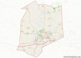
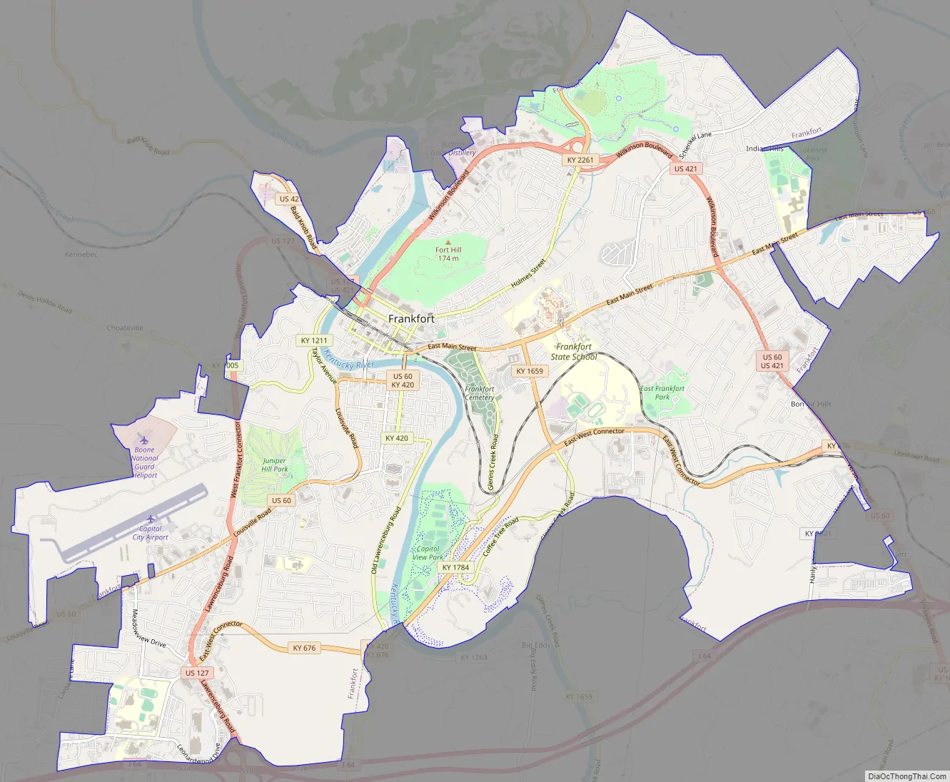
Frankfort Road Map
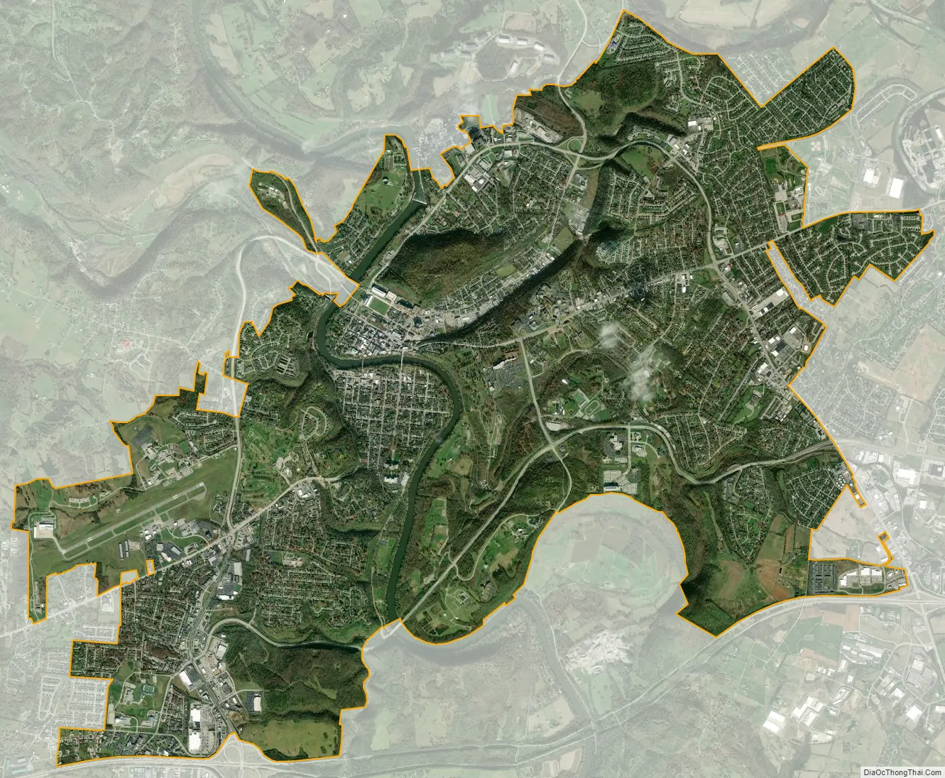
Frankfort city Satellite Map
Geography
Frankfort is located in the (inner) Bluegrass region of Central Kentucky. The city is bisected by the Kentucky River, which makes an s-turn as it passes through the center of town. The river valley widens at this point, which creates four distinct parts of town. The valley within the city limits contains Downtown and South Frankfort districts, which lie opposite one another on the river. A small neighborhood with its own distinct identity, Bellepoint, is located on the west bank of the river to the north of Benson Creek, opposite the river from the “downtown” district. The suburban areas on either side of the valley are respectively referred to as the “West Side” and “East Side” (or “West Frankfort” and “East Frankfort”).
According to the United States Census Bureau, the city has a total area of 14.6 square miles (37.8 km), of which 14.3 square miles (37.0 km) is land and 0.3 square miles (0.78 km) is water.
Frankfort does not have a commercial airport and travelers fly into Blue Grass Airport in Lexington, the closest; Cincinnati/Northern Kentucky International Airport near Covington or Louisville International Airport in Louisville. Capital City Airport serves general and military aviation.
Climate
Frankfort has a humid subtropical climate with four distinct seasons. Winter is generally cool with some snowfall. Spring and fall are both mild and relatively warm, with ample precipitation and thunderstorm activity. Summers are hot and humid.
See also
Map of Kentucky State and its subdivision:- Adair
- Allen
- Anderson
- Ballard
- Barren
- Bath
- Bell
- Boone
- Bourbon
- Boyd
- Boyle
- Bracken
- Breathitt
- Breckinridge
- Bullitt
- Butler
- Caldwell
- Calloway
- Campbell
- Carlisle
- Carroll
- Carter
- Casey
- Christian
- Clark
- Clay
- Clinton
- Crittenden
- Cumberland
- Daviess
- Edmonson
- Elliott
- Estill
- Fayette
- Fleming
- Floyd
- Franklin
- Fulton
- Gallatin
- Garrard
- Grant
- Graves
- Grayson
- Green
- Greenup
- Hancock
- Hardin
- Harlan
- Harrison
- Hart
- Henderson
- Henry
- Hickman
- Hopkins
- Jackson
- Jefferson
- Jessamine
- Johnson
- Kenton
- Knott
- Knox
- Larue
- Laurel
- Lawrence
- Lee
- Leslie
- Letcher
- Lewis
- Lincoln
- Livingston
- Logan
- Lyon
- Madison
- Magoffin
- Marion
- Marshall
- Martin
- Mason
- McCracken
- McCreary
- McLean
- Meade
- Menifee
- Mercer
- Metcalfe
- Monroe
- Montgomery
- Morgan
- Muhlenberg
- Nelson
- Nicholas
- Ohio
- Oldham
- Owen
- Owsley
- Pendleton
- Perry
- Pike
- Powell
- Pulaski
- Robertson
- Rockcastle
- Rowan
- Russell
- Scott
- Shelby
- Simpson
- Spencer
- Taylor
- Todd
- Trigg
- Trimble
- Union
- Warren
- Washington
- Wayne
- Webster
- Whitley
- Wolfe
- Woodford
- Alabama
- Alaska
- Arizona
- Arkansas
- California
- Colorado
- Connecticut
- Delaware
- District of Columbia
- Florida
- Georgia
- Hawaii
- Idaho
- Illinois
- Indiana
- Iowa
- Kansas
- Kentucky
- Louisiana
- Maine
- Maryland
- Massachusetts
- Michigan
- Minnesota
- Mississippi
- Missouri
- Montana
- Nebraska
- Nevada
- New Hampshire
- New Jersey
- New Mexico
- New York
- North Carolina
- North Dakota
- Ohio
- Oklahoma
- Oregon
- Pennsylvania
- Rhode Island
- South Carolina
- South Dakota
- Tennessee
- Texas
- Utah
- Vermont
- Virginia
- Washington
- West Virginia
- Wisconsin
- Wyoming