Boulder Hill is a census-designated place (CDP) in Oswego Township, Kendall County, Illinois, United States. Per the 2020 census, the population was 8,394. It is part of the Chicago metropolitan area on the Fox River, south of Aurora.
| Name: | Boulder Hill CDP |
|---|---|
| LSAD Code: | 57 |
| LSAD Description: | CDP (suffix) |
| State: | Illinois |
| County: | Kendall County |
| Elevation: | 663 ft (202 m) |
| Total Area: | 1.46 sq mi (3.79 km²) |
| Land Area: | 1.46 sq mi (3.78 km²) |
| Water Area: | 0.01 sq mi (0.02 km²) |
| Total Population: | 8,394 |
| Population Density: | 5,757.20/sq mi (2,222.47/km²) |
| ZIP code: | 60538 |
| Area code: | 630, 331 |
| FIPS code: | 1707419 |
| GNISfeature ID: | 2393344 |
Online Interactive Map
Click on ![]() to view map in "full screen" mode.
to view map in "full screen" mode.
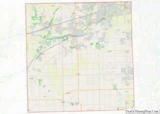
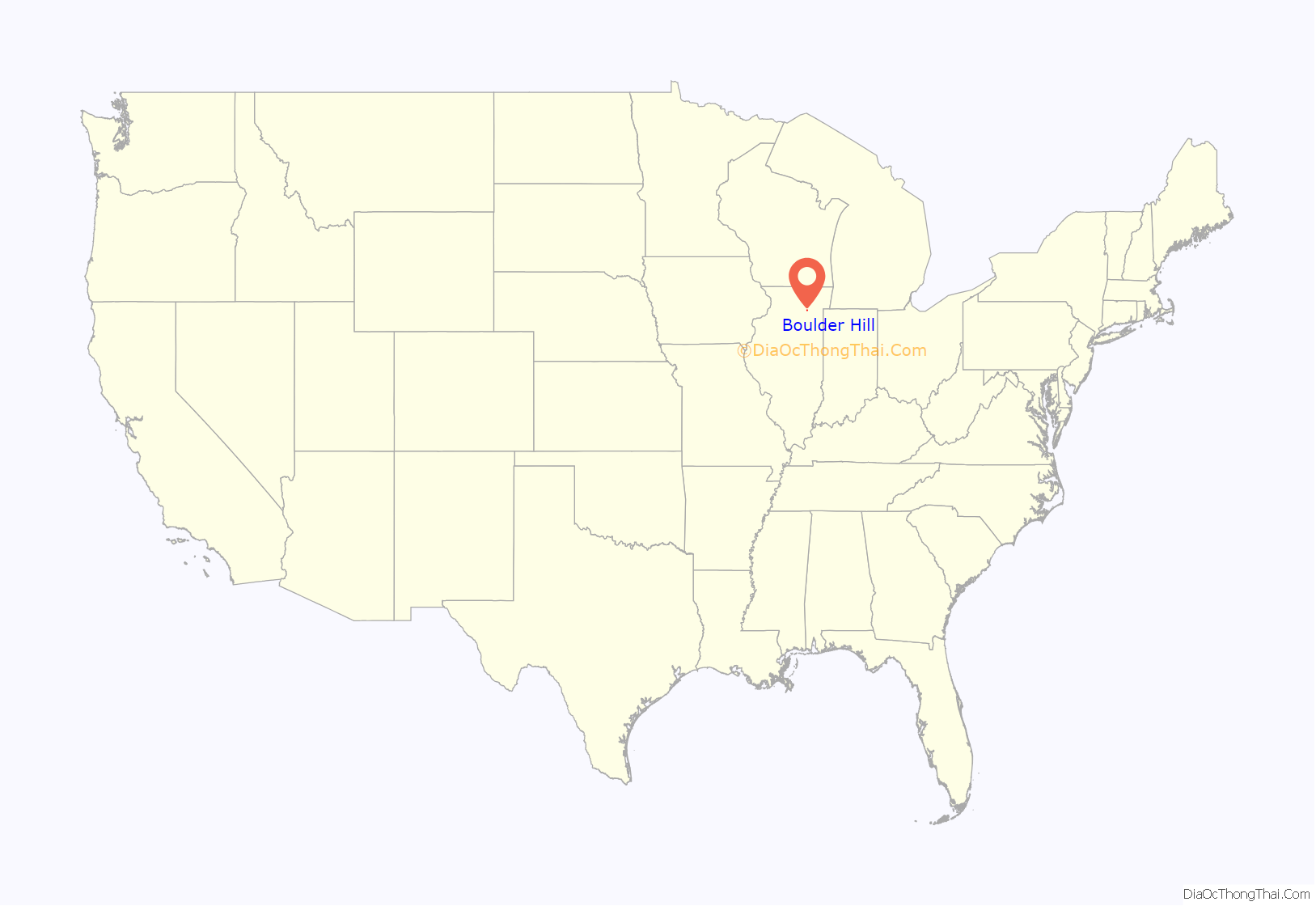
Boulder Hill location map. Where is Boulder Hill CDP?

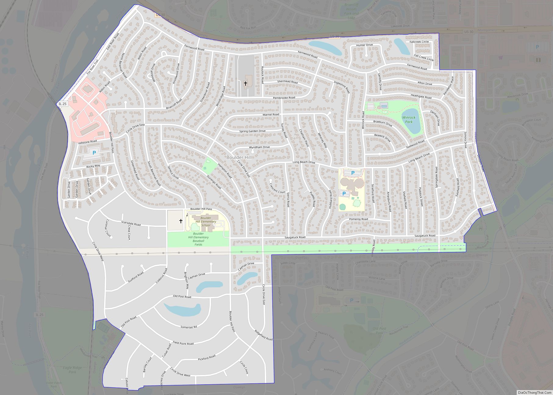
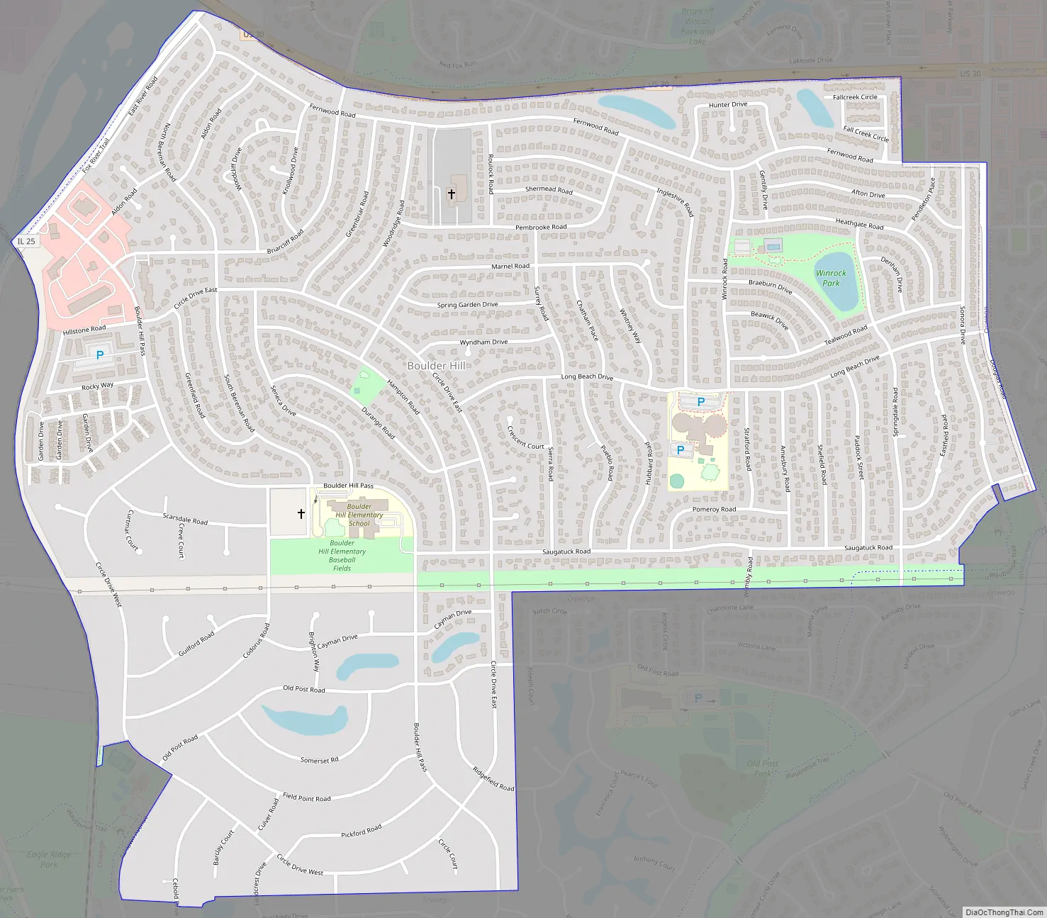
Boulder Hill Road Map
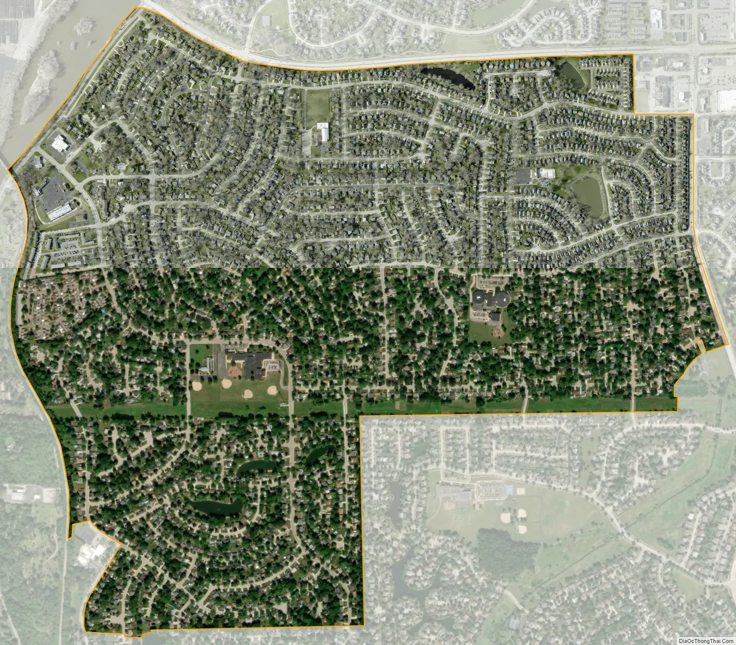
Boulder Hill city Satellite Map
Geography
Boulder Hill is located at 41°42′41″N 88°20′07″W / 41.71139°N 88.33528°W / 41.71139; -88.33528 (41.7113530, -88.3351400).
According to the United States Census Bureau, Boulder Hill has a total area of 1.45 square miles (3.8 km), of which 1.44 square miles (3.7 km) or 99% of its land and 0.01 square miles (0.026 km) or 1% of its water. Up until the early 2000s, the Boulder Hill subdivision had a small development area, equating to almost a town square. The community itself has a strong identity, as the people from Boulder Hill are not classified as being from Montgomery or Oswego, two nearby larger towns.
Postal service is provided to Boulder Hill via the Montgomery Post Office. While Boulder Hill is unincorporated and not part of the village of Montgomery, there is confusion due to Boulder Hill residents’ mailing addresses including “Montgomery” as the designated address. Governmental services provided to Boulder Hill primarily come from either Kendall County or Oswego Township offices.
The community has four churches, a grocery store, a small retail development, a gas station, three schools (two elementary and a middle school), a retirement facility, and the area used to have an automotive dealership. There is minimal vacant land left for development. The villages of Oswego and Montgomery have both expanded their communities up to the boundaries of Boulder Hill, so there is no room for further business expansion. Other than the Boulder Hill Market, most of the commercial businesses located in Boulder Hill are part of the village of Oswego.
Being unincorporated, Boulder Hill’s property taxes have risen in recent years as the various taxing bodies such as the Oswegoland Park District and the Oswego School District have expanded to keep up with the growth of adjacent communities such as Oswego. So while Boulder Hill was previously known for having low property taxes because it does not have its own government, that is no longer the case.
See also
Map of Illinois State and its subdivision:- Adams
- Alexander
- Bond
- Boone
- Brown
- Bureau
- Calhoun
- Carroll
- Cass
- Champaign
- Christian
- Clark
- Clay
- Clinton
- Coles
- Cook
- Crawford
- Cumberland
- De Kalb
- De Witt
- Douglas
- Dupage
- Edgar
- Edwards
- Effingham
- Fayette
- Ford
- Franklin
- Fulton
- Gallatin
- Greene
- Grundy
- Hamilton
- Hancock
- Hardin
- Henderson
- Henry
- Iroquois
- Jackson
- Jasper
- Jefferson
- Jersey
- Jo Daviess
- Johnson
- Kane
- Kankakee
- Kendall
- Knox
- La Salle
- Lake
- Lake Michigan
- Lawrence
- Lee
- Livingston
- Logan
- Macon
- Macoupin
- Madison
- Marion
- Marshall
- Mason
- Massac
- McDonough
- McHenry
- McLean
- Menard
- Mercer
- Monroe
- Montgomery
- Morgan
- Moultrie
- Ogle
- Peoria
- Perry
- Piatt
- Pike
- Pope
- Pulaski
- Putnam
- Randolph
- Richland
- Rock Island
- Saint Clair
- Saline
- Sangamon
- Schuyler
- Scott
- Shelby
- Stark
- Stephenson
- Tazewell
- Union
- Vermilion
- Wabash
- Warren
- Washington
- Wayne
- White
- Whiteside
- Will
- Williamson
- Winnebago
- Woodford
- Alabama
- Alaska
- Arizona
- Arkansas
- California
- Colorado
- Connecticut
- Delaware
- District of Columbia
- Florida
- Georgia
- Hawaii
- Idaho
- Illinois
- Indiana
- Iowa
- Kansas
- Kentucky
- Louisiana
- Maine
- Maryland
- Massachusetts
- Michigan
- Minnesota
- Mississippi
- Missouri
- Montana
- Nebraska
- Nevada
- New Hampshire
- New Jersey
- New Mexico
- New York
- North Carolina
- North Dakota
- Ohio
- Oklahoma
- Oregon
- Pennsylvania
- Rhode Island
- South Carolina
- South Dakota
- Tennessee
- Texas
- Utah
- Vermont
- Virginia
- Washington
- West Virginia
- Wisconsin
- Wyoming