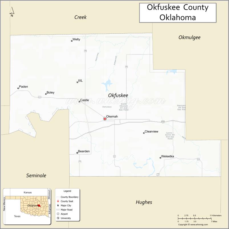
Okfuskee County is a county located in the U.S. state of Oklahoma. As of the 2010 census, its population was 12,191. Its county seat is Okemah. The county is named for a former Muscogee town in present Cleburne County, Alabama, that in turn was named for the Okfuskee, a Muscogee tribe.
| Name: | Okfuskee County |
|---|---|
| FIPS code: | 40-107 |
| State: | Oklahoma |
| Founded: | 1907 |
| Seat: | Okemah |
| Largest city: | Okemah |
| Total Area: | 629 sq mi (1,630 km²) |
| Land Area: | 619 sq mi (1,600 km²) |
| Total Population: | 12,191 |
| Population Density: | 20/sq mi (8/km²) |
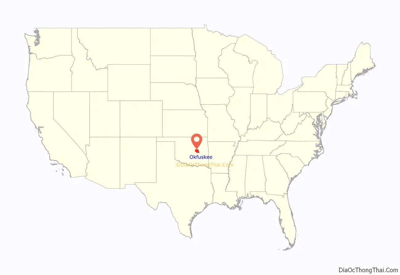
Okfuskee County location map. Where is Okfuskee County?
History
The area now covered by Okfuskee County was occupied by the Quapaw and Osage tribes until 1825, when they ceded the land to the United States government. The Creeks moved here in the early 1830s and built two towns, Greenleaf and Thlopthlocco. During the Civil War, Thlopthlocco served as headquarters for Confederate Col. Douglas H. Cooper. Greenleaf was where Chief Opothleyahola camped while he tried to retain unity among the Creeks, before leading over 5000 Creeks to Kansas to avoid the war.
After the war, the Creeks were required to free their African American slaves. Many of these people remained in the same area and founded all-black communities. These towns included Boley, Bookertee, Clearview, Chilesville, and Rusk. Okfuskee, a Creek town, grew up around Samuel Checote’s trading post after the Civil War.
The St. Louis and San Francisco Railway built a north–south line through this area during 1901–03. The Fort Smith and Western Railroad constructed an east–west line in 1903.
Okfuskee County was created at statehood from the former Creek Nation, and Okemah was designated as the county seat. Oil and gas production began in the county in 1914, when the Prairie Oil and Gas Company completed a well near Paden. Other wells followed elsewhere in the county, creating a population boom that peaked in 1930.
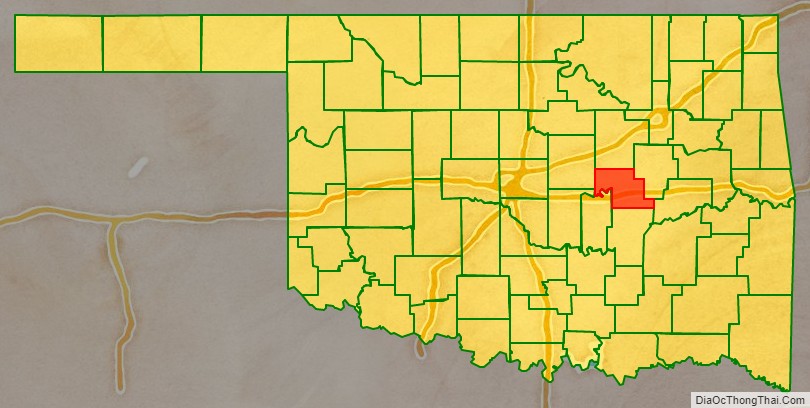
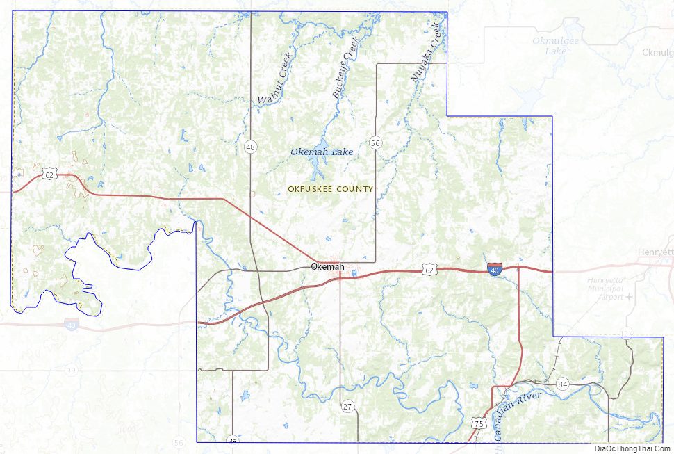
Okfuskee County Road Map
Geography
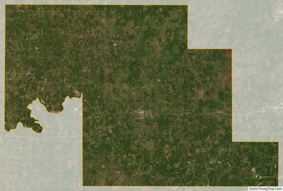
According to the U.S. Census Bureau, the county has a total area of 629 square miles (1,630 km), of which 619 square miles (1,600 km) are land and 10 square miles (26 km) (1.6%) are covered by water. The county lies within the Sandstone Hills physiographic region. The northeastern part is drained by the Deep Fork of the Canadian River, while the southern part is drained by the North Canadian River.
Major highways
- Interstate 40
- U.S. Highway 62
- U.S. Highway 75
- State Highway 48
- State Highway 56
Adjacent counties
- Creek County (north)
- Okmulgee County (east)
- McIntosh County (southeast)
- Hughes County (south)
- Seminole County (southwest)
- Pottawatomie County (southwest)
- Lincoln County (west)
Okfuskee County Topographic Map
Okfuskee County Satellite Map
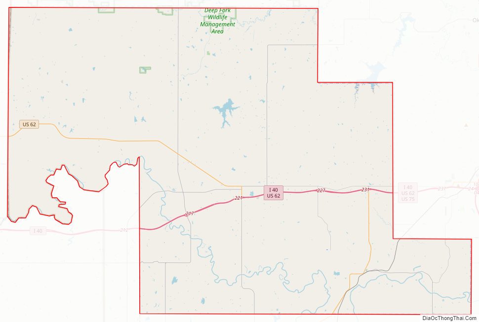
Okfuskee County Outline Map

See also
Map of Oklahoma State and its subdivision:- Adair
- Alfalfa
- Atoka
- Beaver
- Beckham
- Blaine
- Bryan
- Caddo
- Canadian
- Carter
- Cherokee
- Choctaw
- Cimarron
- Cleveland
- Coal
- Comanche
- Cotton
- Craig
- Creek
- Custer
- Delaware
- Dewey
- Ellis
- Garfield
- Garvin
- Grady
- Grant
- Greer
- Harmon
- Harper
- Haskell
- Hughes
- Jackson
- Jefferson
- Johnston
- Kay
- Kingfisher
- Kiowa
- Latimer
- Le Flore
- Lincoln
- Logan
- Love
- Major
- Marshall
- Mayes
- McClain
- McCurtain
- McIntosh
- Murray
- Muskogee
- Noble
- Nowata
- Okfuskee
- Oklahoma
- Okmulgee
- Osage
- Ottawa
- Pawnee
- Payne
- Pittsburg
- Pontotoc
- Pottawatomie
- Pushmataha
- Roger Mills
- Rogers
- Seminole
- Sequoyah
- Stephens
- Texas
- Tillman
- Tulsa
- Wagoner
- Washington
- Washita
- Woods
- Woodward
- Alabama
- Alaska
- Arizona
- Arkansas
- California
- Colorado
- Connecticut
- Delaware
- District of Columbia
- Florida
- Georgia
- Hawaii
- Idaho
- Illinois
- Indiana
- Iowa
- Kansas
- Kentucky
- Louisiana
- Maine
- Maryland
- Massachusetts
- Michigan
- Minnesota
- Mississippi
- Missouri
- Montana
- Nebraska
- Nevada
- New Hampshire
- New Jersey
- New Mexico
- New York
- North Carolina
- North Dakota
- Ohio
- Oklahoma
- Oregon
- Pennsylvania
- Rhode Island
- South Carolina
- South Dakota
- Tennessee
- Texas
- Utah
- Vermont
- Virginia
- Washington
- West Virginia
- Wisconsin
- Wyoming