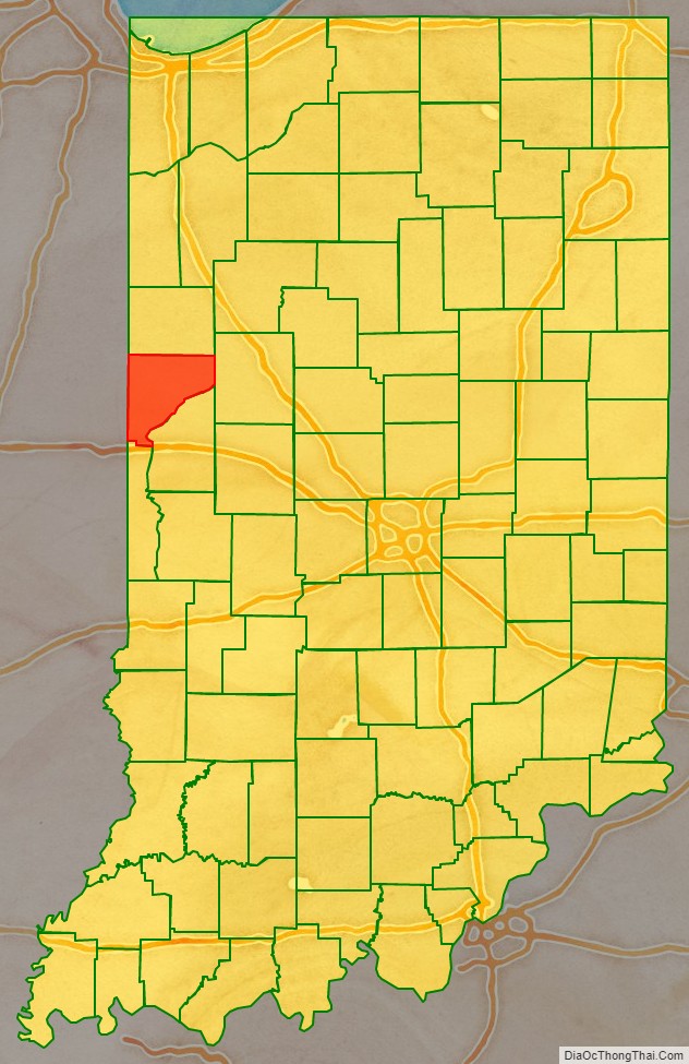
Warren County is a county in the U.S. state of Indiana. It lies in the western part of the state between the Illinois state line and the Wabash River. According to the 2010 census, it had a population of 8,440. Its county seat is Williamsport.
Before the arrival of non-indigenous settlers in the early 19th century, the area was inhabited by several Native American tribes. The county was officially established in 1827 and was the 55th county to be formed in Indiana.
It is one of the most rural counties in the state, with the third-smallest population and the lowest population density at about 23 inhabitants per square mile (8.9/km). The county has four incorporated towns with a total population of about 3,100, as well as many small unincorporated communities. The county is divided into 12 townships which provide local services.
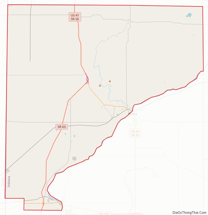
Much of the land in the county is given over to agriculture, especially on the open prairie in the northern and western parts; the county’s farmland is among the most productive in the state. Nearer the river along the southeastern border, the land has many hills, valleys, and tributary streams and is more heavily wooded. Agriculture, manufacturing, government, education, and health care each provide substantial portions of the jobs in the county. Four Indiana state roads cross the county, as do two U.S. Routes and one major railroad line.
| Name: | Warren County |
|---|---|
| FIPS code: | 18-171 |
| State: | Indiana |
| Founded: | March 1, 1827 |
| Named for: | Joseph Warren |
| Seat: | Williamsport |
| Largest town: | Williamsport |
| Total Area: | 366.40 sq mi (949.0 km²) |
| Land Area: | 364.68 sq mi (944.5 km²) |
| Population Density: | 23/sq mi (9/km²) |
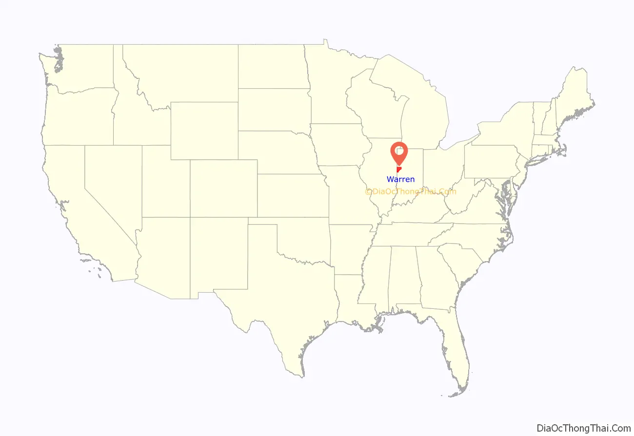
Warren County location map. Where is Warren County?
History
In the centuries before the arrival of European settlers, the area that became Warren County was on the boundary between the Miami and Kickapoo tribes. By the late 18th century, many Miami had moved further south; most of Indiana north of the Wabash was then occupied by the Potawatomi people. The first non-indigenous settler in the area was probably Zachariah Cicott, a French-Canadian who first traded with the Kickapoo and Potawatomi people around 1802. When General William Henry Harrison took an army from Vincennes to the Battle of Tippecanoe in late 1811, Cicott served as a scout; the trail taken by Harrison’s army passed through the area that later became Warren County on its way to and from the battle site in Tippecanoe County. Following the War of 1812, Cicott resumed his trading on the Wabash; the state of Indiana was established in 1816, and Cicott built a log house in 1817 at the location where he later founded the town of Independence. Other settlers came to the area, but probably not until around 1822.
The county was established on March 1, 1827, by the Indiana General Assembly. It was named for Dr. Joseph Warren, who was killed in 1775 at the Battle of Bunker Hill, in which he fought as a private because his commission as a general had not yet taken effect. The short-lived town of Warrenton was the original Warren County seat, chosen by commissioners in March 1828; the next year an act was passed calling for the seat to be relocated, and in June 1829 it was moved to Williamsport.
The first county courthouse was a log house in Warrenton that belonged to (and was occupied by) Enoch Farmer, one of the county’s earliest settlers. When the county seat moved to Williamsport, a log house belonging to the town’s founder, William Harrison, served this purpose for several years. The first purpose-built courthouse was completed in 1835 at a cost of $2,000; in 1872, it was replaced with a new building that cost $48,000. The third courthouse was built in 1886, in a new section of town that grew around the newly constructed railroad. That building burned in 1907, and the fourth and current Warren County courthouse was completed on the same site in 1908 at a cost of $115,000.
As the 19th century progressed, the United States government’s Indian removal policy pushed Native American tribes west of the Mississippi River. In 1830, the Indian Removal Act was signed into law, and though that act did not directly address the Potawatomi people of Indiana, it led to several additional treaties that resulted in their removal. In what came to be known as the Potawatomi Trail of Death, about 860 Potawatomi Indians who had refused to leave were forced to move from Indiana to Kansas. On September 14, 1838, the group camped near Williamsport, and on September 15 they camped in the southwestern part of the county before moving into Illinois. Before reaching their destination in Kansas, over 40 of them had died, many of them children; two children died and were buried at the second Warren County campsite.
When the county was established, the Wabash River was vital to transportation and shipping. Zachariah Cicott traded up and down the river, and cities like Attica, Perrysville, Baltimore and Williamsport were founded near the river’s banks and flourished because of it. In the 1840s, the Wabash and Erie Canal began to operate and provided even broader shipping opportunities, but the canal favored towns which were on the “right side” of the river; the canal was on the Fountain County side, and towns like Baltimore dwindled as a result. Some towns, such as Williamsport and Perrysville, managed to participate in canal traffic through the use of side-cuts that brought traffic from the canal across the river. When railroads were constructed starting in the 1850s, they in turn began to render the canals obsolete and allowed trade to reach towns that lacked water connections. The canal continued to be used through the early 1870s.
The first trains to run in Warren County operated on portions of the Toledo, Wabash and Western Railway (later the Wabash Railroad) in 1856. The railroad entered the county near Williamsport and was built westward, reaching the western border at State Line City by 1857. West Lebanon was the only other settlement near the railroad’s path, but the line bypassed it by about a mile; the town subsequently moved northward to be nearer the station. In 1869 the Indianapolis, Bloomington and Western Railway was built across Mound Township in the southern part of the county. A few years later, in 1872, a branch of the Chicago, Danville and Vincennes Railroad (known as the “Pumpkin Vine Railroad”) was built from Bismarck, Illinois, southeast through Warren County; it was built specifically to carry coal from the mines south of Covington. A labor riot at the mines in the late 1870s interrupted the flow of coal, and this combined with the poor financial state of the railroad led to the removal of most of the track by 1880; the remaining portion was removed a few years later. At about this time, in the early 1880s, the Chicago and Indiana Coal Railroad began operating a north–south line through the county. It became part of the Chicago and Eastern Illinois Railroad but was abandoned in 1920 due to financial difficulties; a new company operated the line as the Chicago, Attica and Southern Railroad starting in 1921, but financial problems affected the new company as well and the rails were removed in 1946. Another line, part of the New York Central Railroad, was built through the area in 1903; locally, it ran northeast from Danville into Warren County, then turned north through the small towns of Sloan and Stewart and continued north into Benton County. In the 1970s it became part of Penn Central, then Conrail; operations on the line ceased in the 1990s and the tracks were removed, though a portion running north from Stewart remained and became the Bee Line Railroad which serves the grain processing facility in Stewart.
The Wabash Cannonball was a passenger train that ran on the Wabash Railroad between Detroit, Michigan and Saint Louis, Missouri, starting in 1949. On September 19, 1964, the southbound Cannonball struck a truck loaded with concrete blocks at a crossing in Johnsonville. The driver of the truck was killed instantly, but although the train derailed, no other people died. On the train, the driver and fireman were severely injured when the engine caught fire, and about half of the 50 passengers were injured. Over 1,000 feet (300 m) of track was torn out, and the damage was estimated at over $500,000. The last run of the Cannonball was in 1969.
After peaking in the late 19th century, the county’s population declined during the 20th, in common with much of the rural Midwest. The widespread adoption of the automobile in the 1920s undercut small-town businesses, which were threatened further by the Great Depression of the 1930s. World War II and the economic revival of the late 1940s and 1950s drew people to better jobs in growing regional cities, and this further diminished small towns. The population shrank again in the 1980s due largely to the effects of the “farm crisis” of low crop prices, high farmer debt and other economic causes.
The first county fair involved both Fountain and Warren counties and was held in Independence on September 6 and 7, 1853. In following years, the fair was held in Fountain County, and participation by Warren County farmers diminished. In 1856, farmers in the northern part of the county held a fair just east of Pine Village, and this continued each year through 1864. West Lebanon became the next site of the county fair, and it ran successfully through 1883; the fairgrounds just to the northwest of town were well-developed. Later, the fair was held at the county seat of Williamsport, and this continues through the present day; it is now a 4H fair.
One location in the county, near the small town of Kramer, once had an international reputation: the Hotel Mudlavia. Built in 1890 at a cost of $250,000, it drew guests from around the world to nearby natural springs that were said to have healing qualities. People such as James Whitcomb Riley, John L. Sullivan and Harry Lauder are known to have stayed at the hotel, which burned down in 1920. Later, water from the springs was bottled and sold by Indianapolis-based Cameron Springs company, which was acquired by the Perrier Group of America in 2000 for about $10.5 million. As of 2008 the water was still being sold and was marketed under a variety of names.
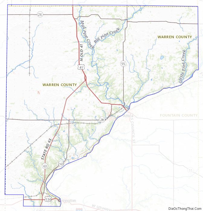
Warren County Road Map
Geography
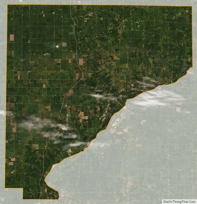
The Wabash River, coming out of Tippecanoe County to the east, defines the southeastern border of the county; the terrain here is hilly and wooded areas are common. Fountain County lies across the river. By contrast, the northwest region consists mainly of flat prairie farmland; this continues in Benton County to the north. Along the western side of the county is the border with Vermilion County, Illinois. The small southern border is shared with the north end of the similarly named Indiana county of Vermillion. The state capital of Indianapolis lies about 70 miles (110 km) to the southeast.
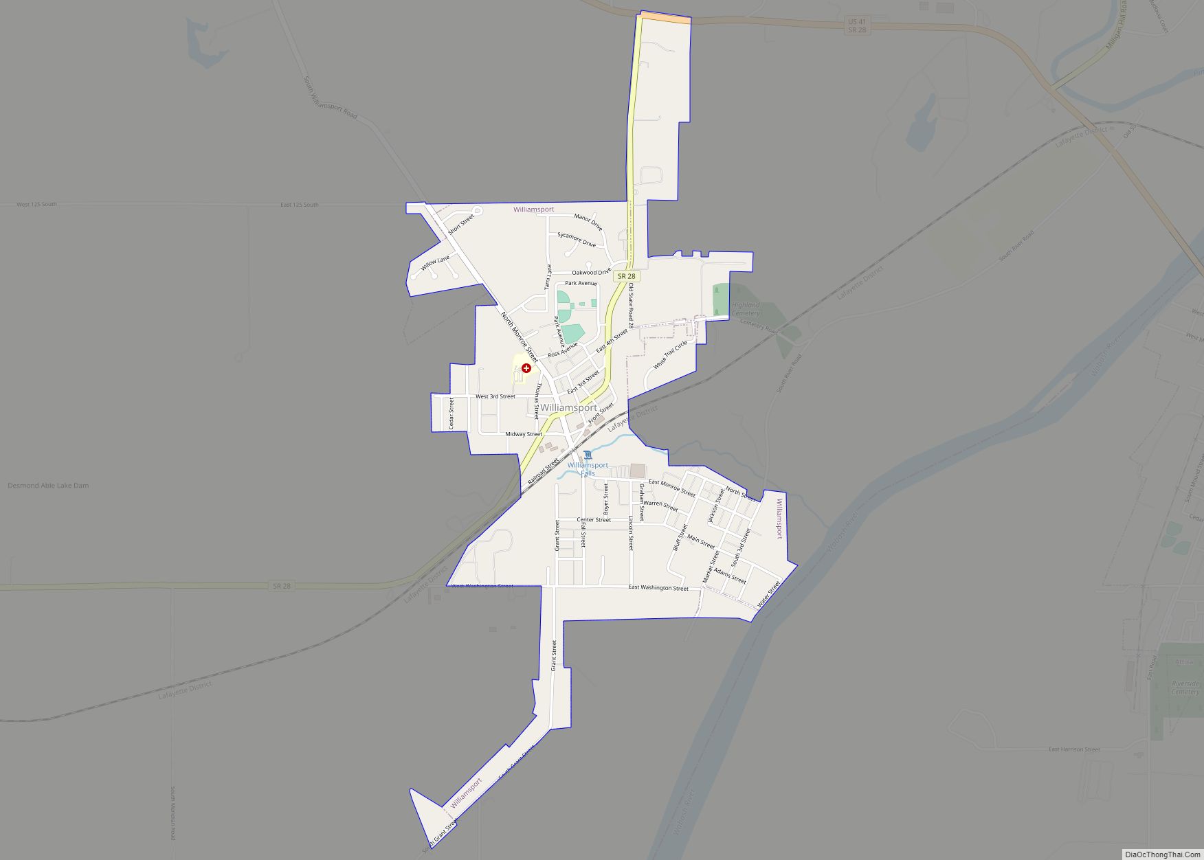
The highest free-falling waterfall in the state, Williamsport Falls, is located in downtown Williamsport; a stream named Fall Creek flows through the town and falls 90 feet (27 m) over a sandstone ledge less than 1,000 feet (300 m) from the county courthouse. Northeast of Independence is the Black Rock Barrens Nature Preserve, a rare siltstone glade area that, with the adjacent Weiler-Leopold Nature Reserve, supports a diversity of flora including sessile trillium, phlox and wild hyacinth in the moist lowlands and serviceberry, rue anemone, birdsfoot violet and yellow pimpernel on the drier slopes. Big Pine Creek is the county’s largest waterway after the Wabash River, and 10.5-mile (16.9 km) segment of it is designated by the Indiana Department of Natural Resources as a state natural and scenic river and passes near Fall Creek Gorge Nature Preserve, an area of cascades and potholes.
According to the 2010 census, the county has a total area of 366.40 square miles (949.0 km), of which 364.68 square miles (944.5 km) (or 99.53%) is land and 1.72 square miles (4.5 km) (or 0.47%) is water. Elevations in the county range from 480 feet (150 m) above sea level where the Wabash River enters Vermillion County to 830 feet (250 m) in northeastern Prairie Township. The landscape consists mostly of flat or gently sloping moraine overlaying silty and loamy glacial till, except along the Wabash River where sand, gravel, sandstone and shale are exposed. Various forms of silt loam constitute most of the county’s soil and are conducive to agriculture. Forests cover about 14% of the county, mainly around major waterways, and consist principally of deciduous hardwoods among which maple–beech and oak–hickory forests are the most common. The only coal mines in the county are located in the southeastern part of Steuben Township, near the Wabash River.
When the county was formed in 1827, it was divided into four townships: Medina, Warren, Pike and Mound. Over the following decades, many changes were made to the township borders and eight new townships were created. Pine and Washington were the first of these, in March 1830; Steuben followed in 1834. Liberty was formed in 1843, Adams in 1848, then Jordan in 1850. Kent and Prairie were the last to be created, in 1864. As of 2010, Prairie Township, at 5.4 inhabitants per square mile (2.1/km), has the lowest population density; it covers more area than any of the other townships—nearly 50 square miles (130 km)—and contains no incorporated towns. The highest density is in Washington Township, which has 120 inhabitants per square mile (46/km); it includes Williamsport, the county’s largest town, and covers only about 20 square miles (52 km).
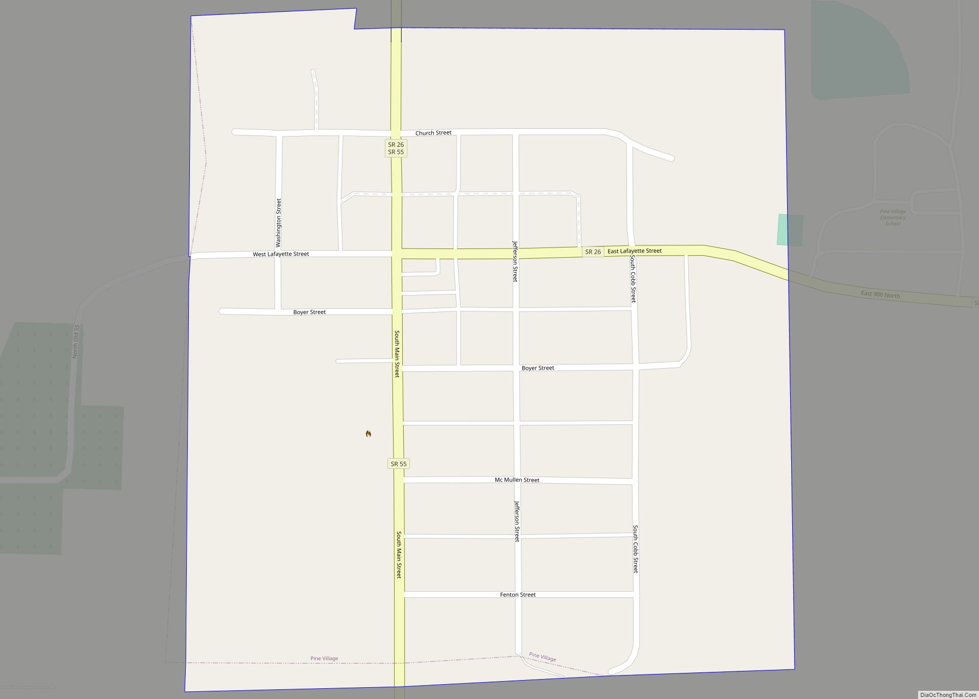
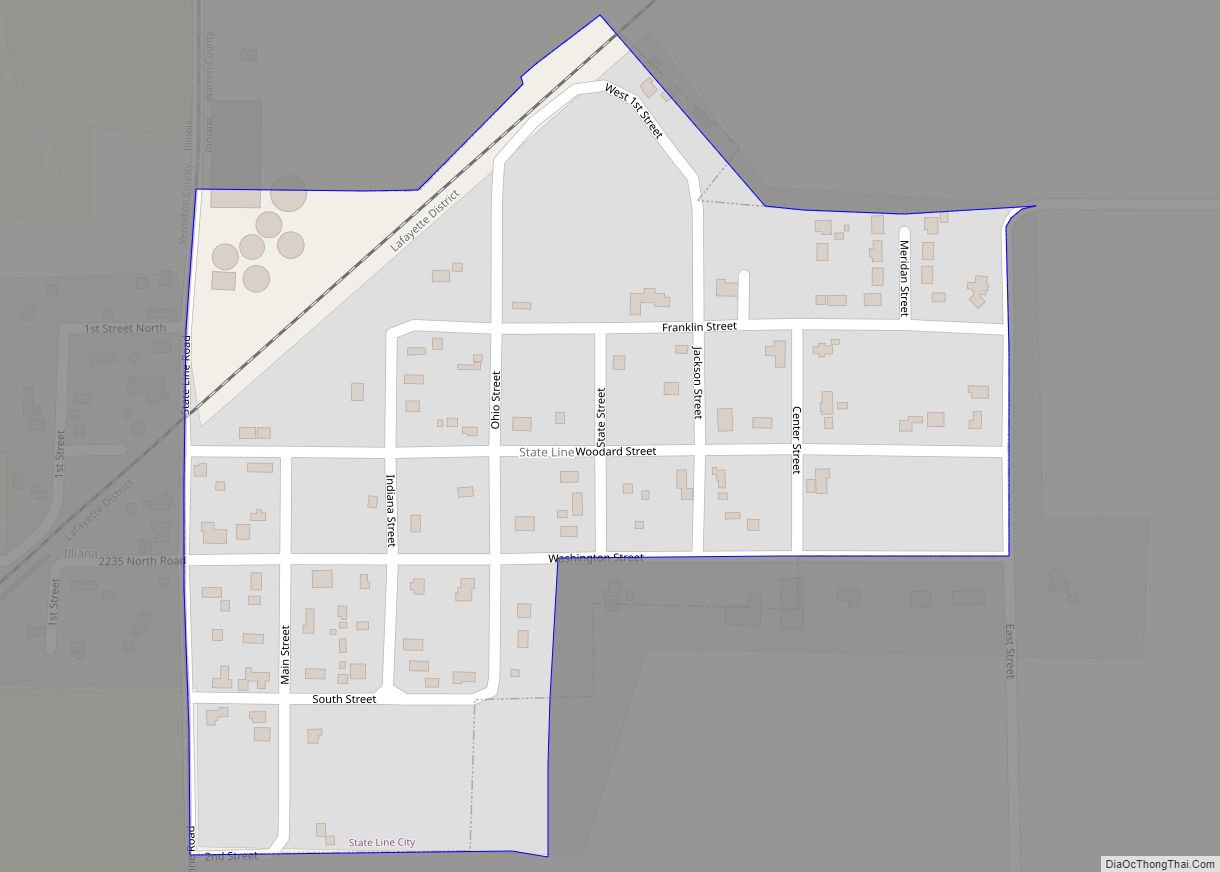
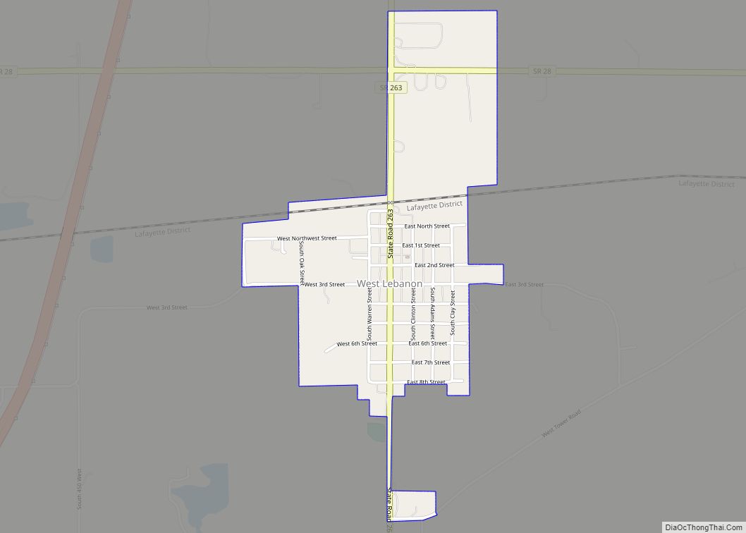
There are four incorporated towns in the county. The largest is Williamsport, which is on the western banks of the Wabash River in the eastern part of the county, just downstream of Attica (which is on the east side of the river in Fountain County); in 2010, its population was 1,898—nearly one-fourth of the county’s total. West Lebanon is about 5 miles (8.0 km) west of Williamsport on State Road 28, with a population of 723. The town of Pine Village lies about 11 miles (18 km) to the north of Williamsport where State Road 55 intersects State Road 26, near the northern edge of the county; 217 people live in Pine Village. State Line City is in the southwestern part of the county and shares its western border with the Illinois state line. A small Illinois community named Illiana lies immediately on the west side of the county road which runs along the state border (and which is also a street between the two communities). State Line City is the smallest of the towns, with a population of 143.
In addition to the incorporated towns, there are over a dozen small unincorporated communities in Warren County that are historical centers of activity. Now they consist mostly of dwellings, though several have churches and some still have small businesses. The small settlements of Hedrick, Pence and Stewart are in Jordan Township; Stewart consists of a grain processing facility and a single residence. In Steuben Township, Johnsonville has a church and a handful of residences. Marshfield has an automotive body repair shop, a grain elevator and a church. Independence, platted in 1832, is located on the site of a trading post set up by Zachariah Cicott. He is buried in a cemetery in Warren Township, just north of town. The township included the small settlement of Winthrop. Liberty Township has three unincorporated communities: Carbondale, Judyville and Kramer (near the site of the Mudlavia Hotel). Several townships contain only a single settlement. Foster is the only one in Mound Township and has a motel and several houses. In the northeast corner of the county, Green Hill is Medina Township’s only settlement. Tab is the only settlement in Prairie Township; most of this township is agricultural, and a large grain processing facility is Tab’s only remaining business. Pine Township’s only community is Rainsville.
Some settlements did not survive. The river town of Baltimore thrived and was a major center of trade until the river was overshadowed by the railroad for purposes of trade and transportation; a single house, built long after the town’s heyday, is all that remains. Warrenton had a promising start as the first county seat, but it began to wane after the seat moved, and today no trace is left. Chesapeake was the first settlement in Steuben Township, but it faded away so early that even an 1883 county history has little to say on the subject. Brisco was never large, though it did have a school house from the 1850s through the 1920s. It likewise disappeared by the end of the 20th century. Chatterton had a school, a store and a post office, but it has disappeared even though the name continues to appear on maps. Other communities were planned but did not develop. Dresser was never much more than a collection of houses, though it did have a post office for a few years around the turn of the 20th century. The settlements of Kickapoo, Locust Grove, Sloan and Walnut Grove were similar in this respect. Point Pleasant never developed much beyond the founder’s residence and a liquor store, and was later described as a “paper town”.
Warren County Topographic Map
Warren County Satellite Map
Warren County Outline Map