Perrysville is a town in Highland Township, Vermillion County, in the U.S. state of Indiana. The population was 456 at the 2010 census.
| Name: | Perrysville town |
|---|---|
| LSAD Code: | 43 |
| LSAD Description: | town (suffix) |
| State: | Indiana |
| County: | Vermillion County |
| Founded: | 1825 |
| Elevation: | 538 ft (164 m) |
| Total Area: | 0.26 sq mi (0.67 km²) |
| Land Area: | 0.26 sq mi (0.67 km²) |
| Water Area: | 0.00 sq mi (0.00 km²) |
| Total Population: | 456 |
| Population Density: | 1,774.32/sq mi (684.77/km²) |
| ZIP code: | 47974 |
| Area code: | 765 |
| FIPS code: | 1859238 |
| GNISfeature ID: | 441034 |
| Website: | http://perrysville.in/ |
Online Interactive Map
Click on ![]() to view map in "full screen" mode.
to view map in "full screen" mode.
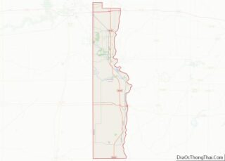
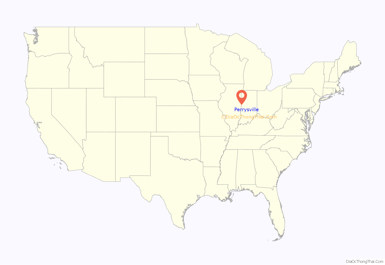
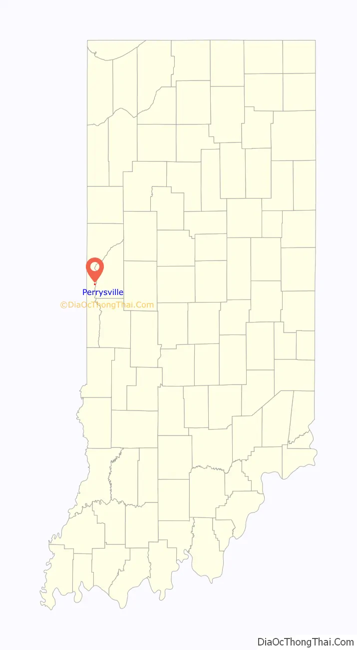
Perrysville location map. Where is Perrysville town?
History
Perrysville was platted and surveyed in 1825 by James Blair on a bluff on the west side of the Wabash River. The town is named for Commodore Oliver Hazard Perry, the hero of the Battle of Lake Erie. It became a local center for shipping products to New Orleans on flatboats via the Wabash, Ohio, and Mississippi Rivers, and it was also able to receive heavy equipment and manufactured items on steamboats. Prior to the advent of the railroad in the second half of the nineteenth century, the town’s location on the river made for a thriving community; it is reputed to have been the largest town between Chicago and Terre Haute at the height of its success. The arrival of the Wabash and Erie Canal enhanced its importance even further; a sidecut with locks allowed boats to be towed across the river to the town. Various roads intersected here, including a plank toll road from Danville, Illinois to the west, and stagecoach traffic became frequent. However, when the railroads did arrive, and failed to pass through the town, it spelled the eventual end of the vital river traffic, and of the importance of the town of Perrysville.
The Perrysville post office has been in operation since 1827.
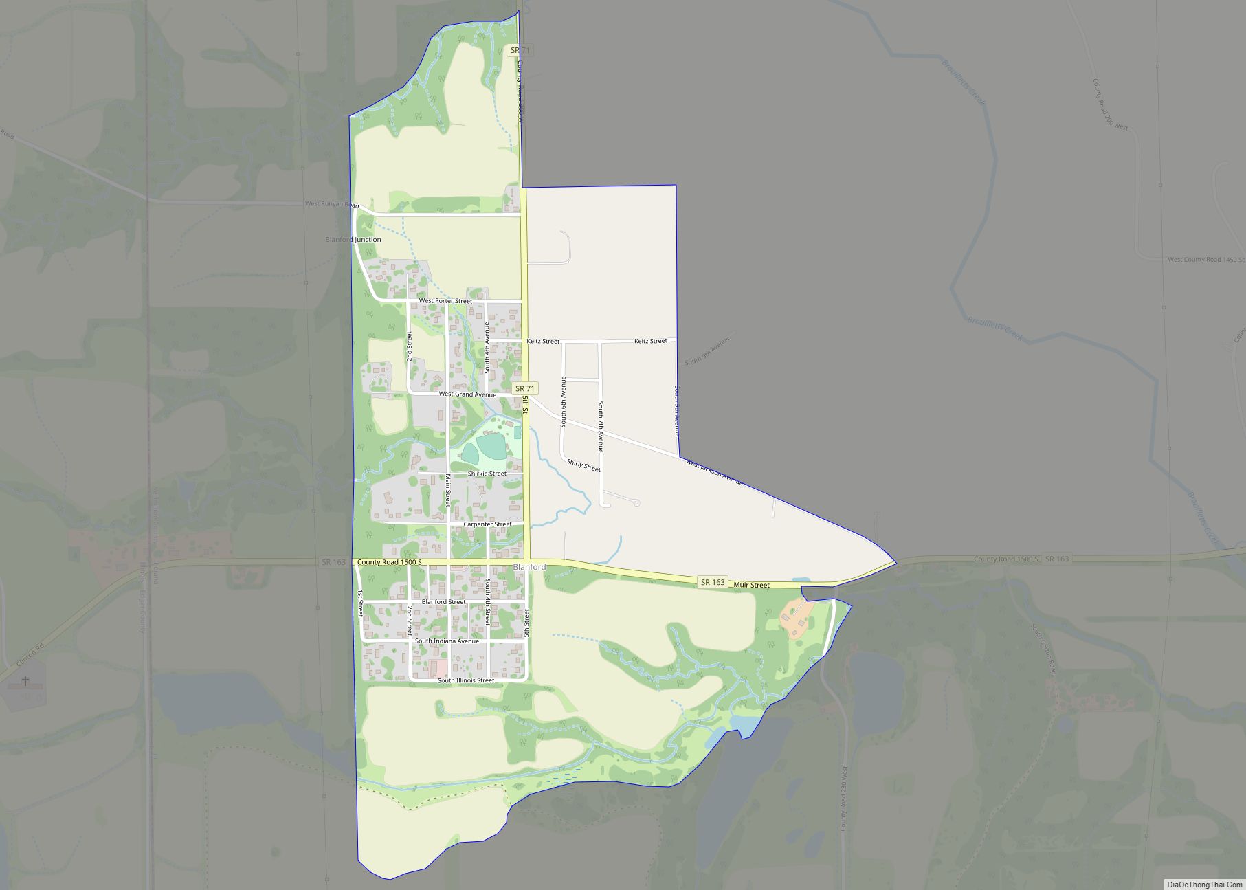
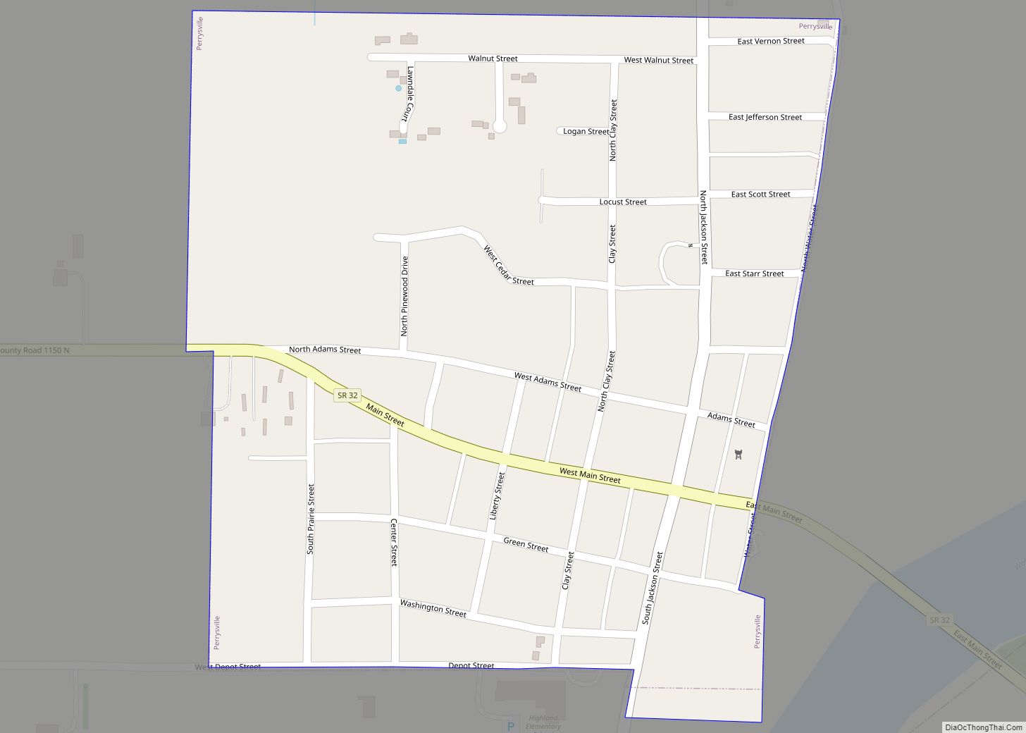
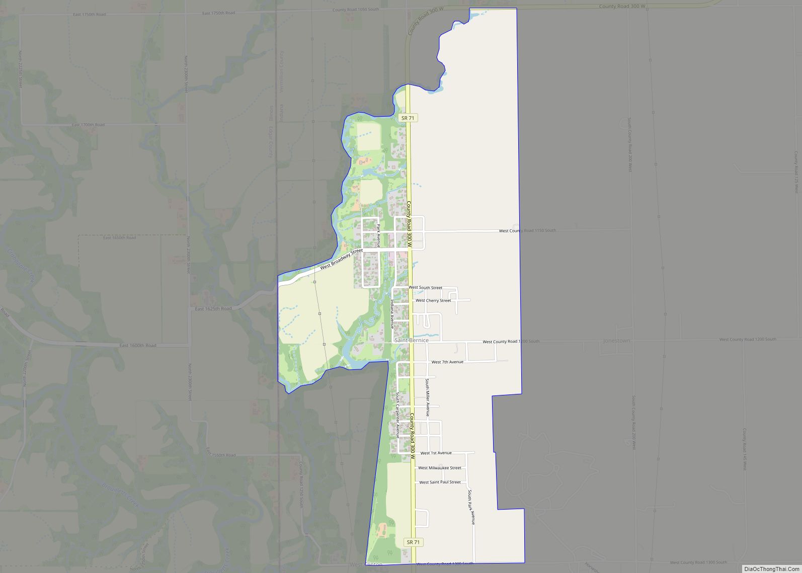
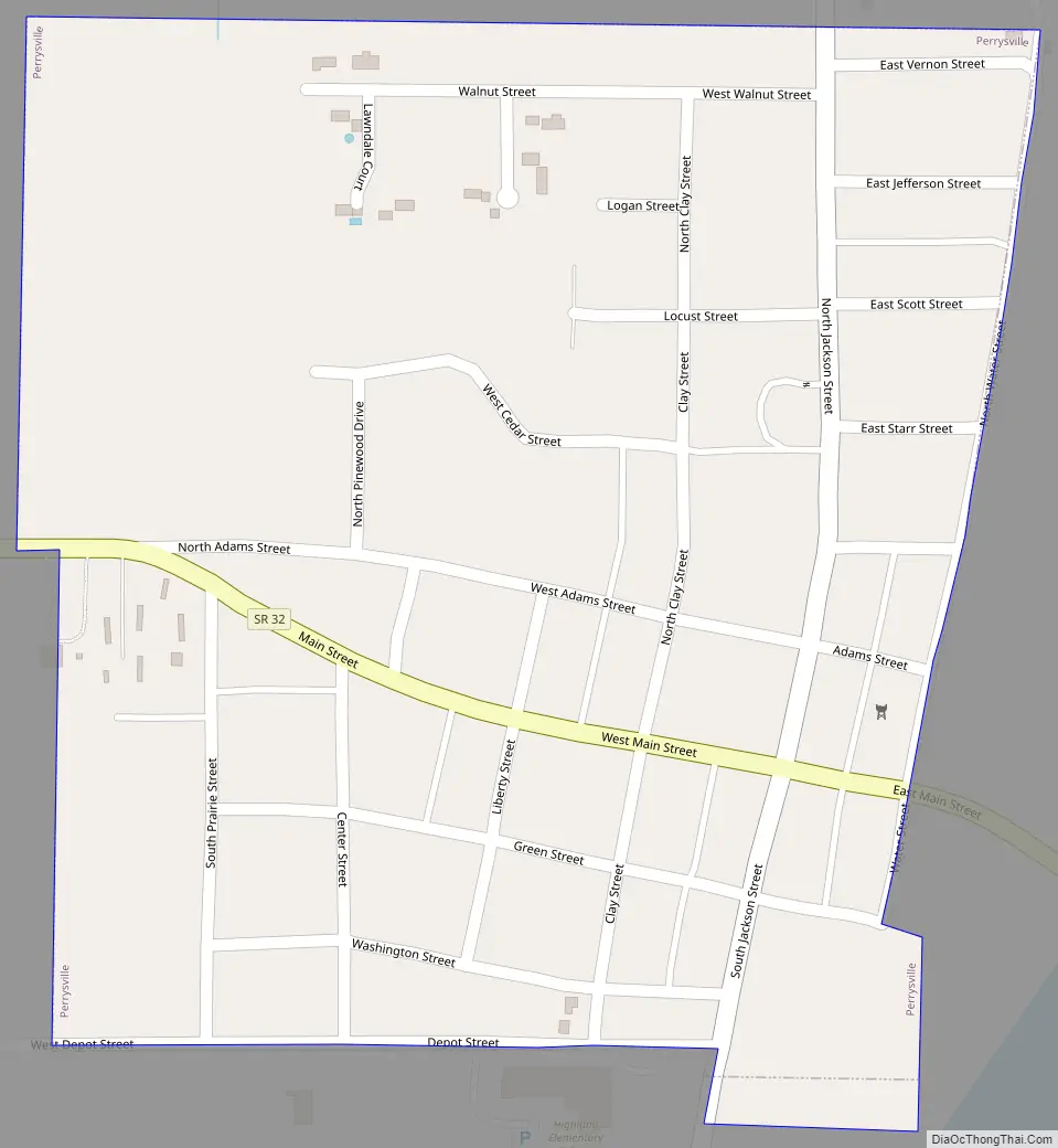
Perrysville Road Map
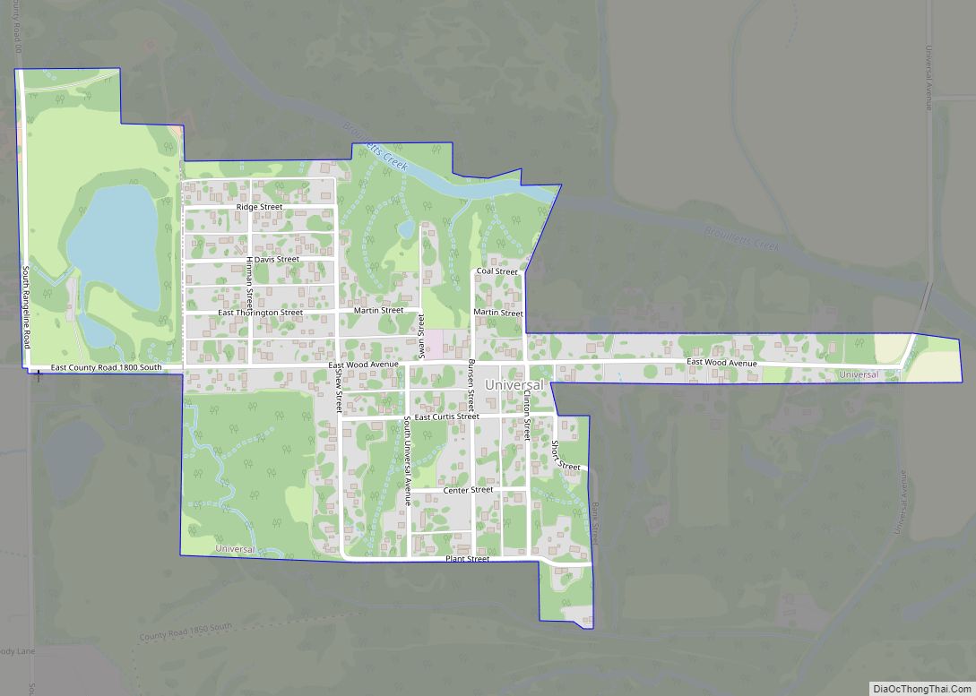
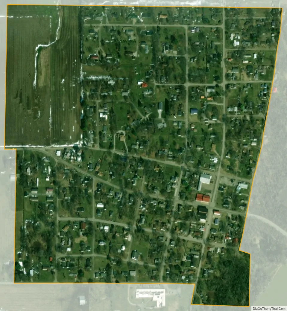
Perrysville city Satellite Map
Geography
Perrysville is located in the northeast part of the county on the western banks of the Wabash River. Indiana State Road 32 passes through the town.
According to the 2010 census, Perrysville has a total area of 0.26 square miles (0.67 km), all land.
See also
Map of Indiana State and its subdivision:- Adams
- Allen
- Bartholomew
- Benton
- Blackford
- Boone
- Brown
- Carroll
- Cass
- Clark
- Clay
- Clinton
- Crawford
- Daviess
- De Kalb
- Dearborn
- Decatur
- Delaware
- Dubois
- Elkhart
- Fayette
- Floyd
- Fountain
- Franklin
- Fulton
- Gibson
- Grant
- Greene
- Hamilton
- Hancock
- Harrison
- Hendricks
- Henry
- Howard
- Huntington
- Jackson
- Jasper
- Jay
- Jefferson
- Jennings
- Johnson
- Knox
- Kosciusko
- LaGrange
- Lake
- Lake Michigan
- LaPorte
- Lawrence
- Madison
- Marion
- Marshall
- Martin
- Miami
- Monroe
- Montgomery
- Morgan
- Newton
- Noble
- Ohio
- Orange
- Owen
- Parke
- Perry
- Pike
- Porter
- Posey
- Pulaski
- Putnam
- Randolph
- Ripley
- Rush
- Saint Joseph
- Scott
- Shelby
- Spencer
- Starke
- Steuben
- Sullivan
- Switzerland
- Tippecanoe
- Tipton
- Union
- Vanderburgh
- Vermillion
- Vigo
- Wabash
- Warren
- Warrick
- Washington
- Wayne
- Wells
- White
- Whitley
- Alabama
- Alaska
- Arizona
- Arkansas
- California
- Colorado
- Connecticut
- Delaware
- District of Columbia
- Florida
- Georgia
- Hawaii
- Idaho
- Illinois
- Indiana
- Iowa
- Kansas
- Kentucky
- Louisiana
- Maine
- Maryland
- Massachusetts
- Michigan
- Minnesota
- Mississippi
- Missouri
- Montana
- Nebraska
- Nevada
- New Hampshire
- New Jersey
- New Mexico
- New York
- North Carolina
- North Dakota
- Ohio
- Oklahoma
- Oregon
- Pennsylvania
- Rhode Island
- South Carolina
- South Dakota
- Tennessee
- Texas
- Utah
- Vermont
- Virginia
- Washington
- West Virginia
- Wisconsin
- Wyoming