Bismarck is a village in Newell Township, Vermilion County, Illinois, United States. It is part of the Danville, Illinois Metropolitan Statistical Area. The population was 579 at the 2010 census.
| Name: | Bismarck village |
|---|---|
| LSAD Code: | 47 |
| LSAD Description: | village (suffix) |
| State: | Illinois |
| County: | Vermilion County |
| Founded: | c. 1873 |
| Elevation: | 679 ft (207 m) |
| Total Area: | 0.74 sq mi (1.93 km²) |
| Land Area: | 0.74 sq mi (1.93 km²) |
| Water Area: | 0.00 sq mi (0.00 km²) |
| Total Population: | 582 |
| Population Density: | 783.31/sq mi (302.25/km²) |
| Area code: | 217 |
| FIPS code: | 1706184 |
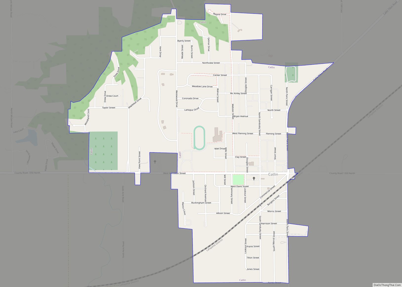
Online Interactive Map
Click on ![]() to view map in "full screen" mode.
to view map in "full screen" mode.
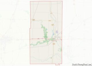
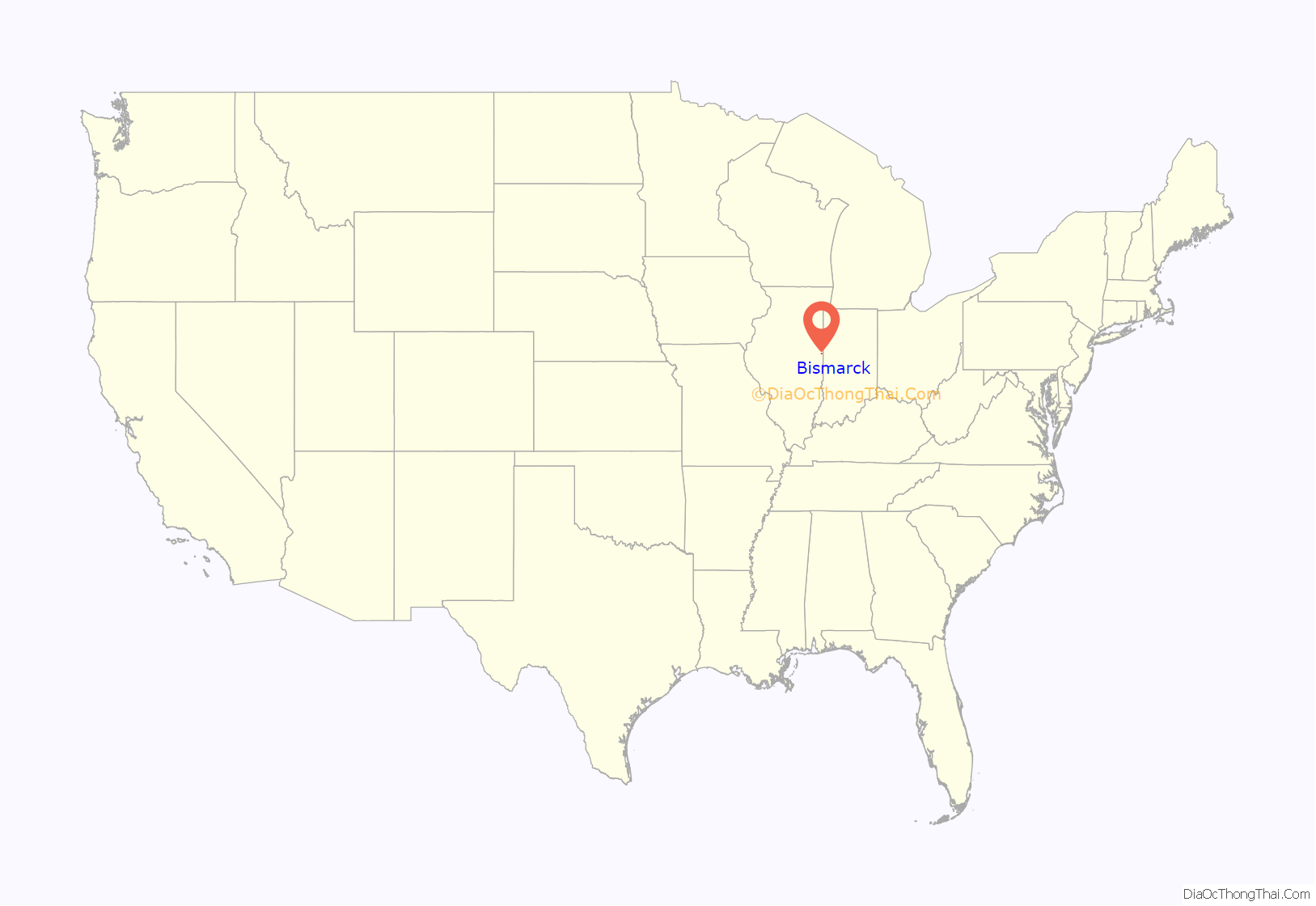
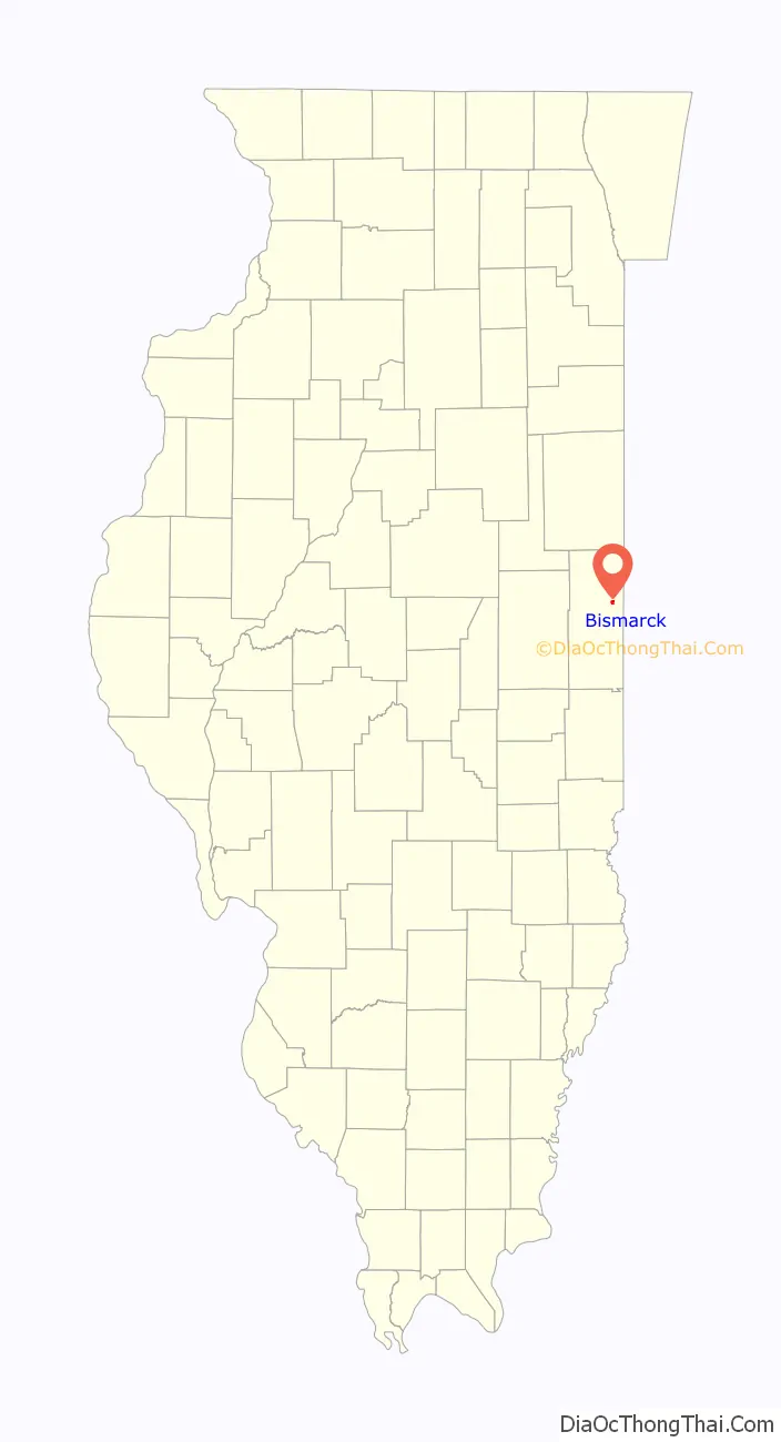
Bismarck location map. Where is Bismarck village?
History
The original settlement in this immediate area was to the west of Bismarck’s location, where the Hubbard Trail and the North Fork of the Vermilion River crossed. It was originally called Franklin when it was founded in 1837, but it lasted only a few years. Later, in 1843, Brothers John and Samuel Myers built a mill near the site of Franklin, and a town called Myersville later grew up there.
In 1872, the C&EI Railroad went through the area; the tracks did not go through Myersville, but passed one and a half miles to the east. Gradually, the town moved toward the railroad on land donated by Charles S. Young and Dr. John B. Holloway. Young named the town Bismarck after the German statesman and chancellor Otto von Bismarck, whom he admired.
On September 13, 1997, the community celebrated its 125th birthday. Festivities, which were attended by about 2,000 people, included a parade, contests, historical exhibits at the local grade school, and multiple performances.
In 1998, the village of Bismarck was incorporated. The members of the first village board were Mayor Eleanor White, Julie Boersma, Pat Kentner, Chuck Mockbee, Lyle Milner, Diane Holycross, Don Evans, Alvina Van Pelt, and Betty Lewis.
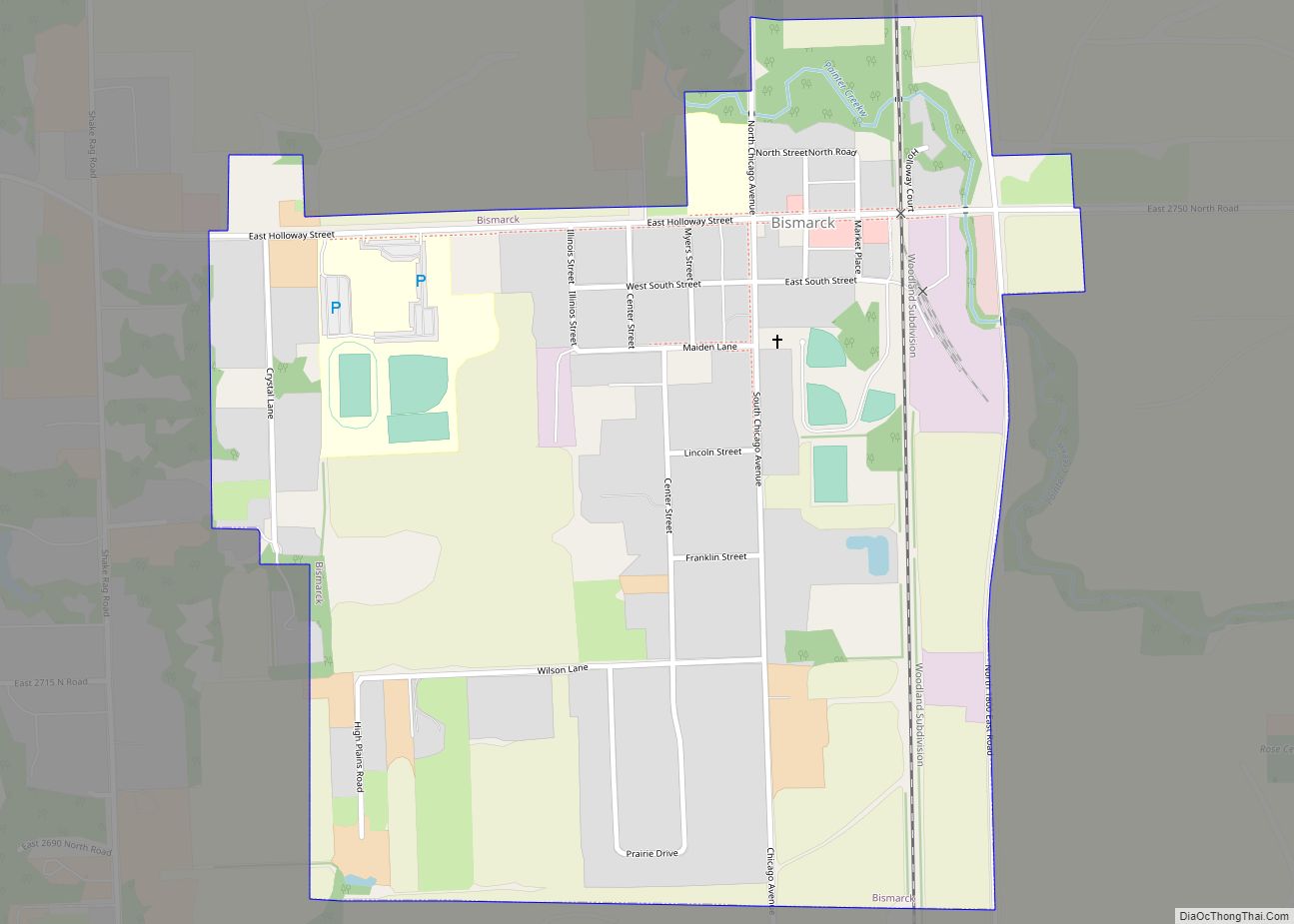
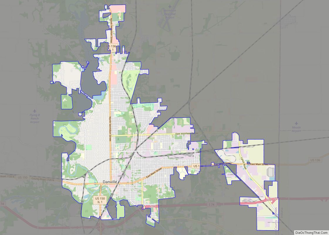
Bismarck Road Map
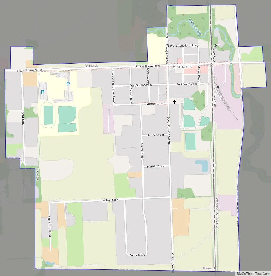
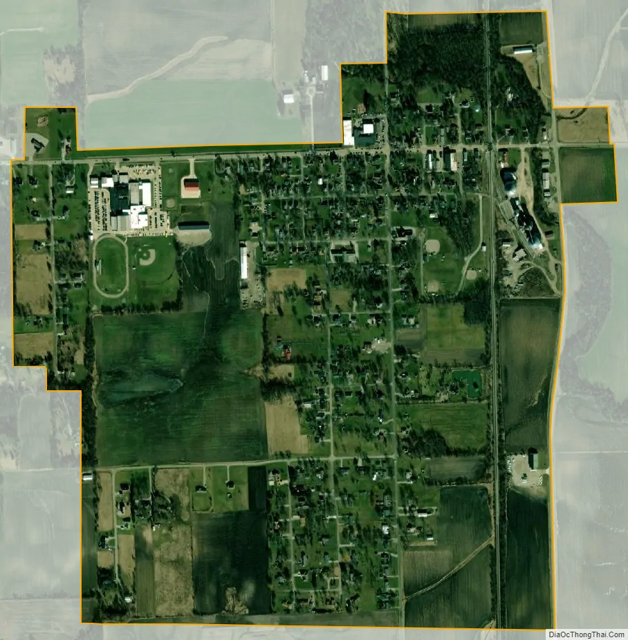
Bismarck city Satellite Map
Geography
Bismarck is located at 40°15′45″N 87°36′36″W / 40.26250°N 87.61000°W / 40.26250; -87.61000 (40.262371, -87.609876), about eight miles north of the county seat of Danville.
According to the 2010 census, Bismarck has a total area of 0.74 square miles (1.92 km), all land.
See also
Map of Illinois State and its subdivision:- Adams
- Alexander
- Bond
- Boone
- Brown
- Bureau
- Calhoun
- Carroll
- Cass
- Champaign
- Christian
- Clark
- Clay
- Clinton
- Coles
- Cook
- Crawford
- Cumberland
- De Kalb
- De Witt
- Douglas
- Dupage
- Edgar
- Edwards
- Effingham
- Fayette
- Ford
- Franklin
- Fulton
- Gallatin
- Greene
- Grundy
- Hamilton
- Hancock
- Hardin
- Henderson
- Henry
- Iroquois
- Jackson
- Jasper
- Jefferson
- Jersey
- Jo Daviess
- Johnson
- Kane
- Kankakee
- Kendall
- Knox
- La Salle
- Lake
- Lake Michigan
- Lawrence
- Lee
- Livingston
- Logan
- Macon
- Macoupin
- Madison
- Marion
- Marshall
- Mason
- Massac
- McDonough
- McHenry
- McLean
- Menard
- Mercer
- Monroe
- Montgomery
- Morgan
- Moultrie
- Ogle
- Peoria
- Perry
- Piatt
- Pike
- Pope
- Pulaski
- Putnam
- Randolph
- Richland
- Rock Island
- Saint Clair
- Saline
- Sangamon
- Schuyler
- Scott
- Shelby
- Stark
- Stephenson
- Tazewell
- Union
- Vermilion
- Wabash
- Warren
- Washington
- Wayne
- White
- Whiteside
- Will
- Williamson
- Winnebago
- Woodford
- Alabama
- Alaska
- Arizona
- Arkansas
- California
- Colorado
- Connecticut
- Delaware
- District of Columbia
- Florida
- Georgia
- Hawaii
- Idaho
- Illinois
- Indiana
- Iowa
- Kansas
- Kentucky
- Louisiana
- Maine
- Maryland
- Massachusetts
- Michigan
- Minnesota
- Mississippi
- Missouri
- Montana
- Nebraska
- Nevada
- New Hampshire
- New Jersey
- New Mexico
- New York
- North Carolina
- North Dakota
- Ohio
- Oklahoma
- Oregon
- Pennsylvania
- Rhode Island
- South Carolina
- South Dakota
- Tennessee
- Texas
- Utah
- Vermont
- Virginia
- Washington
- West Virginia
- Wisconsin
- Wyoming