Williamsport is a town in Washington Township, Warren County, in the U.S. state of Indiana. The population was 1,898 at the 2010 census. It is the county seat of Warren County and is the largest of the four incorporated towns in the county. Williamsport Falls is located in downtown Williamsport.
| Name: | Williamsport town |
|---|---|
| LSAD Code: | 43 |
| LSAD Description: | town (suffix) |
| State: | Indiana |
| County: | Warren County |
| Founded: | 1828 |
| Incorporated: | 1854 |
| Elevation: | 633 ft (193 m) |
| Total Area: | 1.30 sq mi (3.38 km²) |
| Land Area: | 1.30 sq mi (3.38 km²) |
| Water Area: | 0.00 sq mi (0.00 km²) |
| Total Population: | 1,950 |
| Population Density: | 1,494.25/sq mi (577.11/km²) |
| ZIP code: | 47993 |
| Area code: | 765 |
| FIPS code: | 1884410 |
| GNISfeature ID: | 446088 |
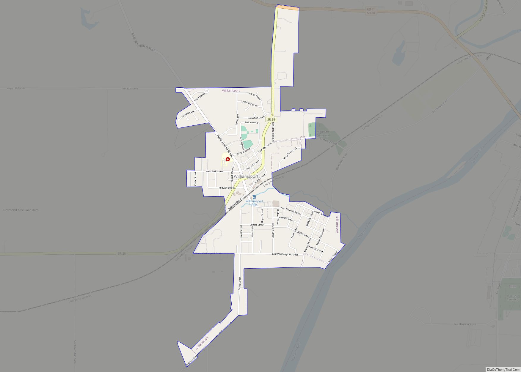
Online Interactive Map
Click on ![]() to view map in "full screen" mode.
to view map in "full screen" mode.
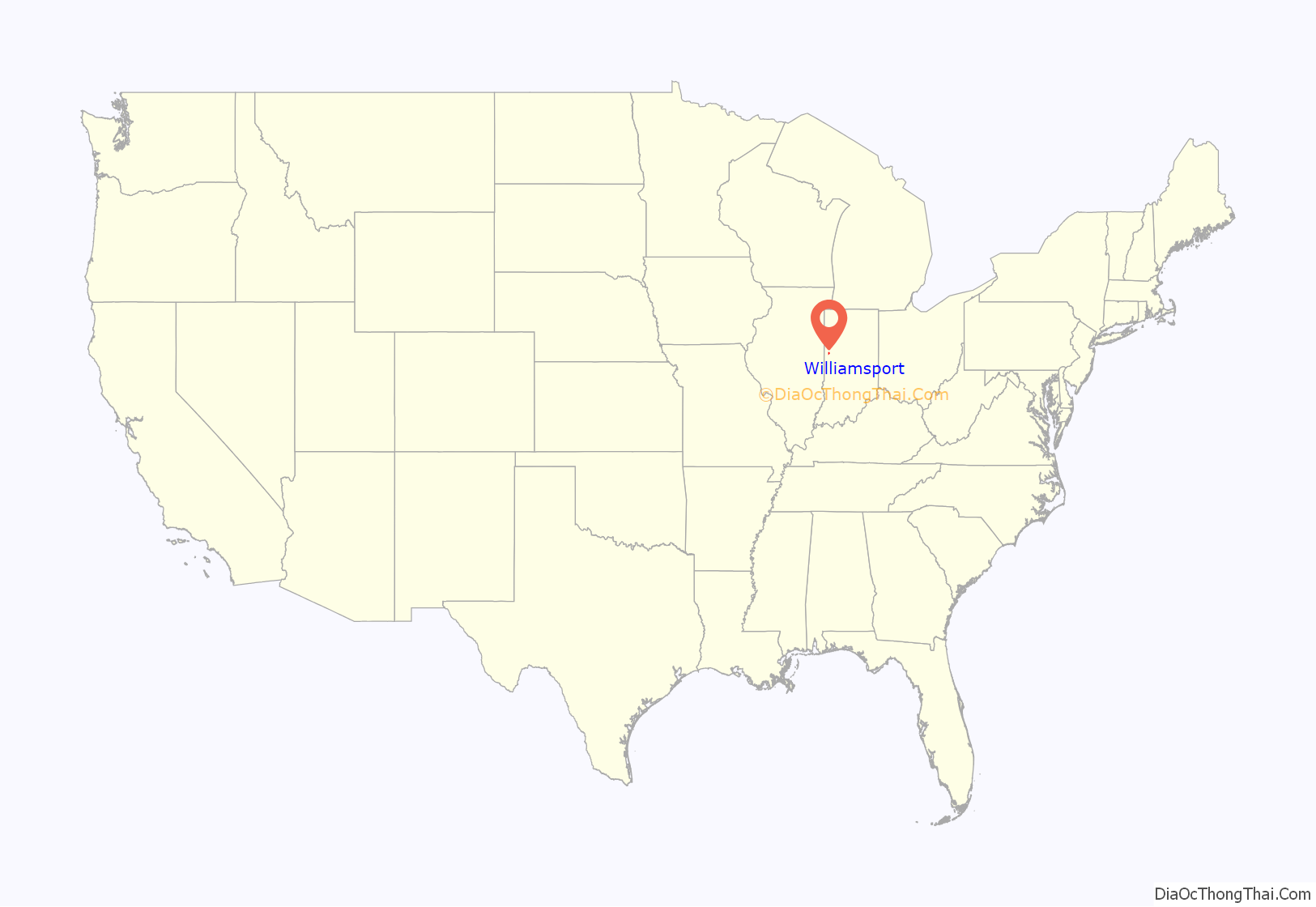
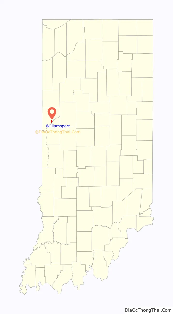
Williamsport location map. Where is Williamsport town?
History
Williamsport was platted by (and named for) William Harrison on December 11, 1828, on the south end of the eastern fractional part of the northeast quarter of section 11, township 21, range 8. Harrison was the first to occupy the town in the fall of 1828; he built a log house at the east end of Main Street near the river and operated a ferry crossing there for several years. Though located on the opposite side of the river from the Wabash and Erie Canal, Williamsport sought to draw shipping traffic by constructing a short cut-off canal. Finished around 1852, the project led to the nickname “Side-Cut City”.
Williamsport became the county seat in June 1829, taking the title away from short-lived Warrenton. Its post office was the first in the county and has operated since September 28, 1829. The town was incorporated in March 1854, at which time its population was 552.
The post office at Williamsport has been in operation since 1829.
James Frank Hanly, who was the Governor of Indiana from 1905 to 1909, lived and practiced law here from 1879 to 1896; he is buried at Hillside Cemetery, on the northeast side of town.
The Williamsport-Washington Township Public Library opened in 1917 as a Carnegie library, and moved to a new facility in 2002.
Historic places
The Williamsport Presbyterian Church at 15 Fall Street, built in 1889, appears on the Indiana Register of Historic Sites and Structures. It was closed in 1964 and stood vacant until 1991, when a non-profit corporation was set up to support the restoration effort. It was listed in 1998 after having received a new slate roof and other repairs. The building contains the original stained glass windows, bell, pulpit, and pews.
The “Tower House” can be found at 303 Lincoln Street and was constructed in 1854. The house was nicknamed due to its three-story tower on the northeast corner of the building. The house was originally constructed as a mirrored twin; the twin house was destroyed by a fire in the 1990s. The house has changed from its original construction. An enclosed front porch and side porch has been retooled to serve as the current family’s kitchen area. The house originally contained two large rooms upstairs, and three rooms downstairs. What appears to be the summer kitchen and original carriage house still stand. The house now has five bedrooms, one bath upstairs and seven rooms, an enclosed porch, and a bath downstairs. They were listed on the National Register of Historic Places in 1984 as the Kent and Hitchens Houses.
The Warren County Courthouse at 125 North Monroe Street was built in 1907-1908 and is on the United States National Register of Historic Places. It is the fourth purpose-built court house in the county’s history.
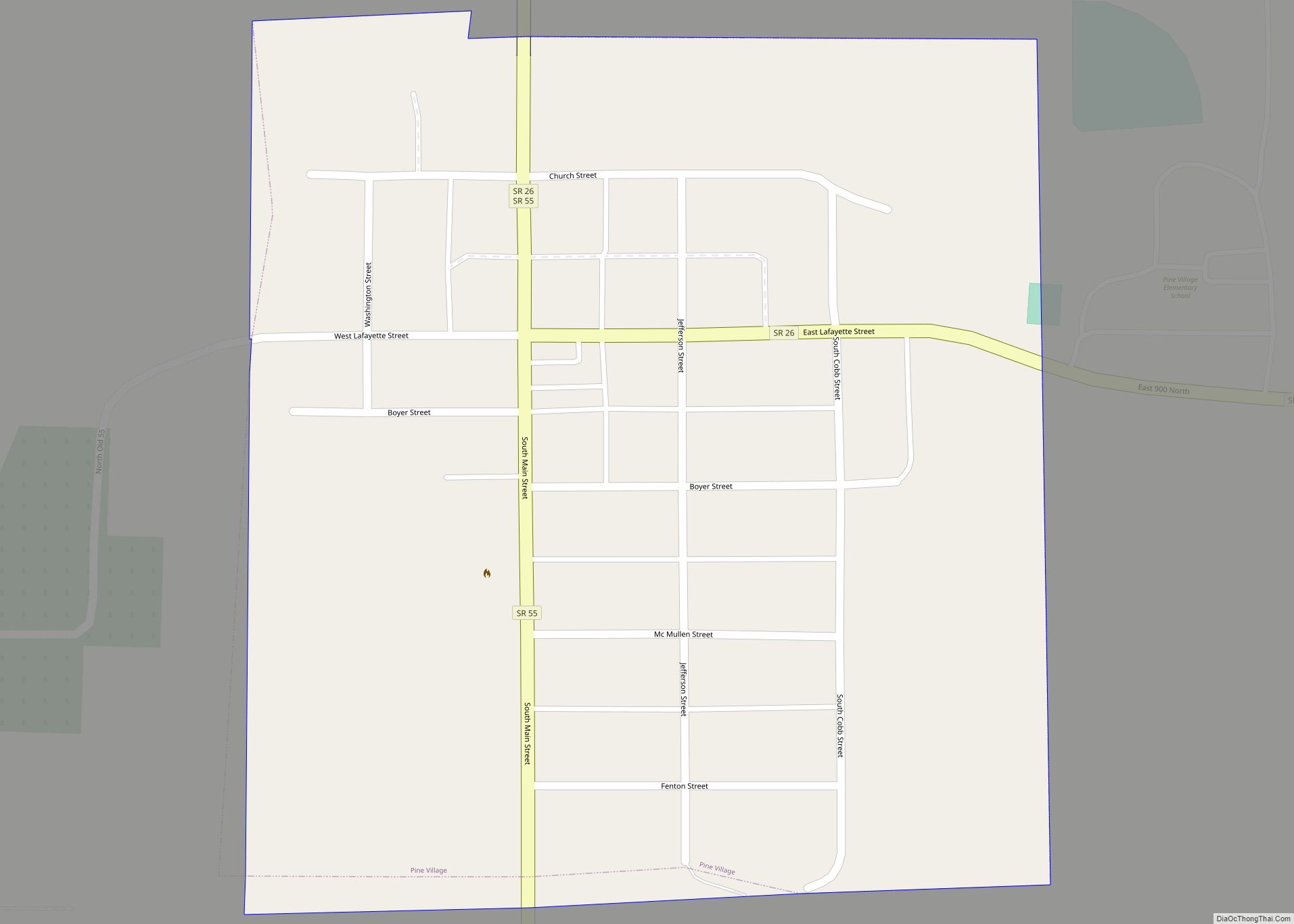
Williamsport Road Map
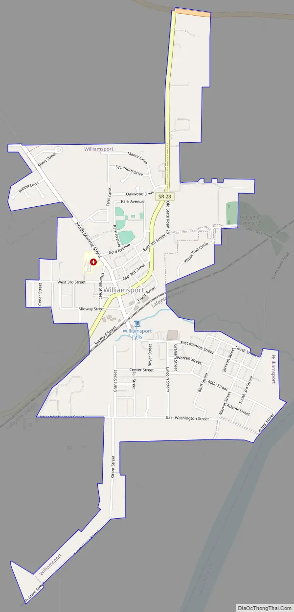
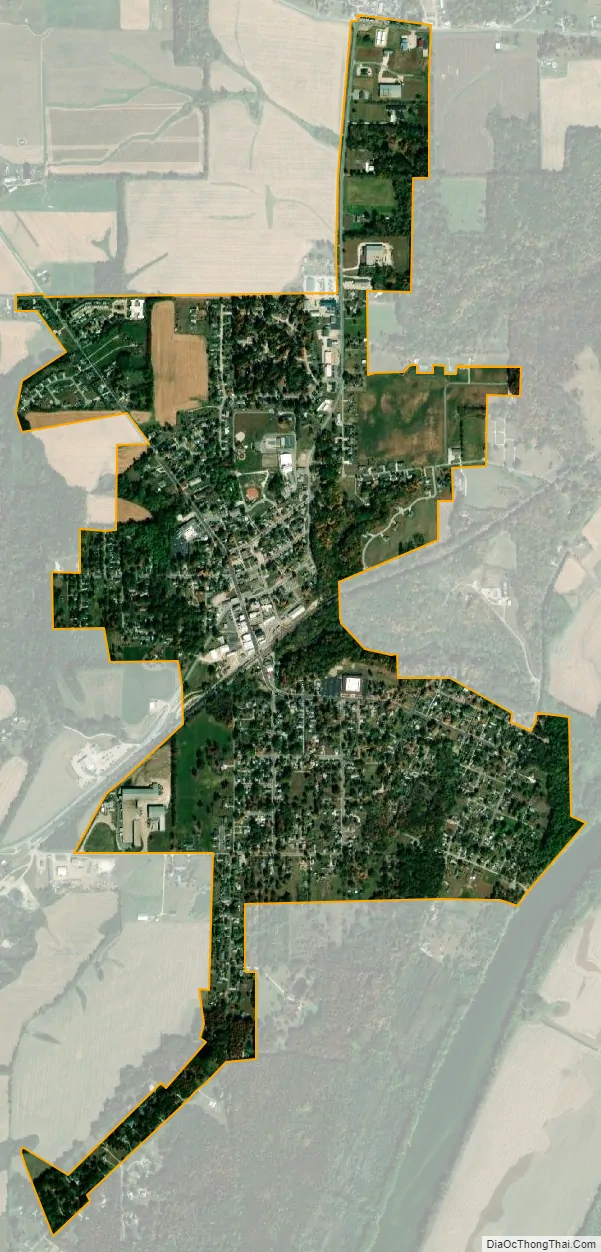
Williamsport city Satellite Map
Geography
Williamsport is located along State Road 28 near the shores of the Wabash River which forms the eastern border of the county. Its most striking natural feature is Williamsport Falls, a 90-foot waterfall near the center of town and Indiana’s tallest. Williamsport’s original section (“Old Town”) is in bottom land next to the river; “New Town” was built on the hill above it to be closer to the railroad. The rail line through town is currently operated by Norfolk Southern Railway.
According to the 2010 census, Williamsport has a total area of 1.3 square miles (3.37 km), all land.
See also
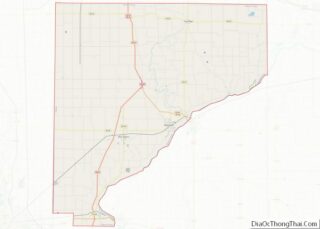
Map of Indiana State and its subdivision:- Adams
- Allen
- Bartholomew
- Benton
- Blackford
- Boone
- Brown
- Carroll
- Cass
- Clark
- Clay
- Clinton
- Crawford
- Daviess
- De Kalb
- Dearborn
- Decatur
- Delaware
- Dubois
- Elkhart
- Fayette
- Floyd
- Fountain
- Franklin
- Fulton
- Gibson
- Grant
- Greene
- Hamilton
- Hancock
- Harrison
- Hendricks
- Henry
- Howard
- Huntington
- Jackson
- Jasper
- Jay
- Jefferson
- Jennings
- Johnson
- Knox
- Kosciusko
- LaGrange
- Lake
- Lake Michigan
- LaPorte
- Lawrence
- Madison
- Marion
- Marshall
- Martin
- Miami
- Monroe
- Montgomery
- Morgan
- Newton
- Noble
- Ohio
- Orange
- Owen
- Parke
- Perry
- Pike
- Porter
- Posey
- Pulaski
- Putnam
- Randolph
- Ripley
- Rush
- Saint Joseph
- Scott
- Shelby
- Spencer
- Starke
- Steuben
- Sullivan
- Switzerland
- Tippecanoe
- Tipton
- Union
- Vanderburgh
- Vermillion
- Vigo
- Wabash
- Warren
- Warrick
- Washington
- Wayne
- Wells
- White
- Whitley
- Alabama
- Alaska
- Arizona
- Arkansas
- California
- Colorado
- Connecticut
- Delaware
- District of Columbia
- Florida
- Georgia
- Hawaii
- Idaho
- Illinois
- Indiana
- Iowa
- Kansas
- Kentucky
- Louisiana
- Maine
- Maryland
- Massachusetts
- Michigan
- Minnesota
- Mississippi
- Missouri
- Montana
- Nebraska
- Nevada
- New Hampshire
- New Jersey
- New Mexico
- New York
- North Carolina
- North Dakota
- Ohio
- Oklahoma
- Oregon
- Pennsylvania
- Rhode Island
- South Carolina
- South Dakota
- Tennessee
- Texas
- Utah
- Vermont
- Virginia
- Washington
- West Virginia
- Wisconsin
- Wyoming