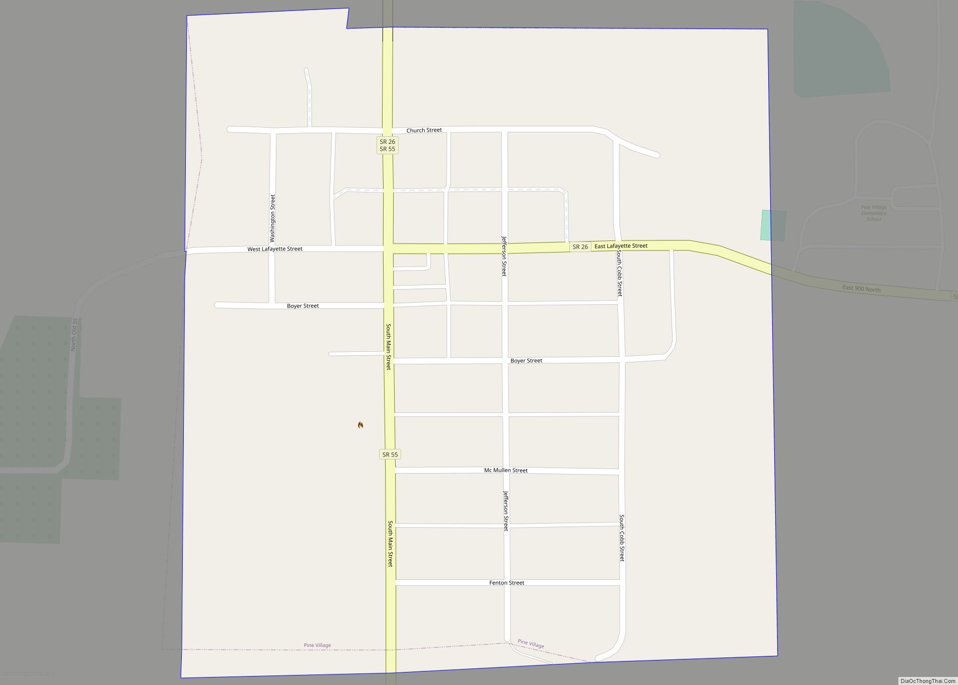
Pine Village is a town in Adams Township, Warren County, in the U.S. state of Indiana. The population was 217 at the 2010 census.
| Name: | Pine Village town |
|---|---|
| LSAD Code: | 43 |
| LSAD Description: | town (suffix) |
| State: | Indiana |
| County: | Warren County |
| Founded: | 1851 |
| Elevation: | 692 ft (211 m) |
| Total Area: | 0.12 sq mi (0.31 km²) |
| Land Area: | 0.12 sq mi (0.31 km²) |
| Water Area: | 0.00 sq mi (0.00 km²) |
| Total Population: | 212 |
| Population Density: | 1,766.67/sq mi (680.07/km²) |
| ZIP code: | 47975 |
| Area code: | 765 |
| FIPS code: | 1860084 |
| GNISfeature ID: | 441164 |
Online Interactive Map
Click on ![]() to view map in "full screen" mode.
to view map in "full screen" mode.
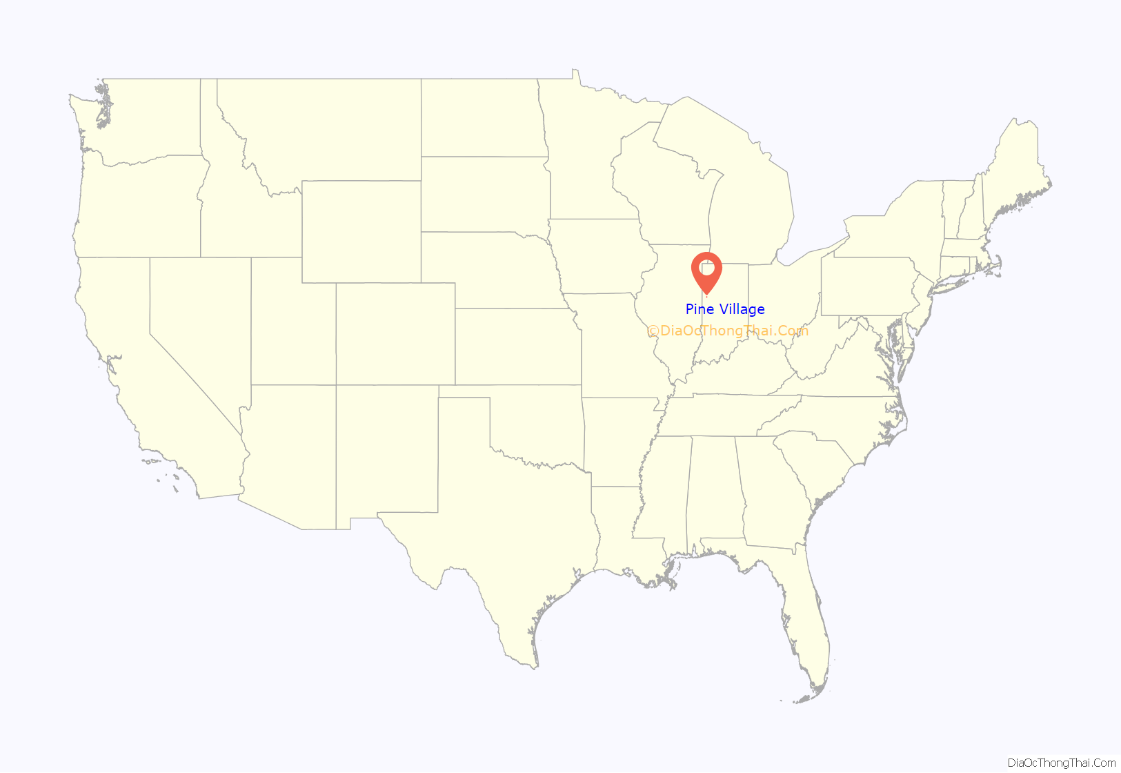
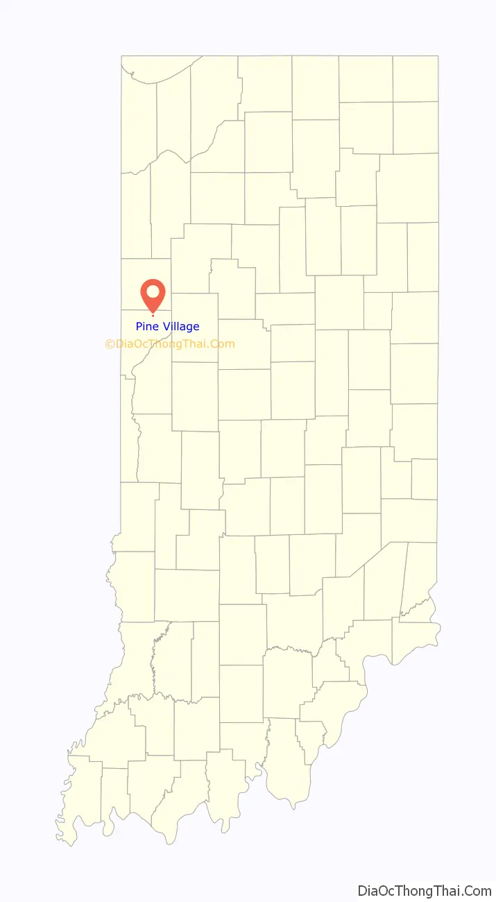
Pine Village location map. Where is Pine Village town?
History
The town was founded at the location of a trading post called Pine Village, which may have been named for a lone pine tree that stood on the bluff of Pine Creek, or it may have been named for the creek itself. The town was laid out in 1851 by Isaac and John R. Metsker, and the plat map was made by county surveyor Perrin Kent. The Methodist Church was already there; it was built several years earlier.
The post office at Pine Village has been in operation since 1854.
Rail service
Rail service reached the town in the 1870s. The year 1883 witnessed the completion of a north/south Chicago and Great Southern Railway (later the Chicago and Indiana Coal Railway) line between Attica and Fair Oaks, some 50 miles (80 km) to the north. The line was later part of the Chicago and Eastern Illinois Railroad. It came to be known as the “Coal Road” for the large quantities of coal transported along it. When the C&EI floundered in the early 1920s, Charles F. Propst purchased the Coal Road and in October 1922 incorporated it as the Chicago, Attica and Southern Railroad. The CA&S was placed in receivership on August 5, 1931, and incremental abandonment occurred over subsequent years. The line through Pine Village was scrapped in the fall of 1945, and the rails were pulled up using a Belgian horse and a block and tackle.
Professional football
During the mid-1910s, Pine Village hosted a prominent professional football team.
The football team of 1915
Pine Village Road Map
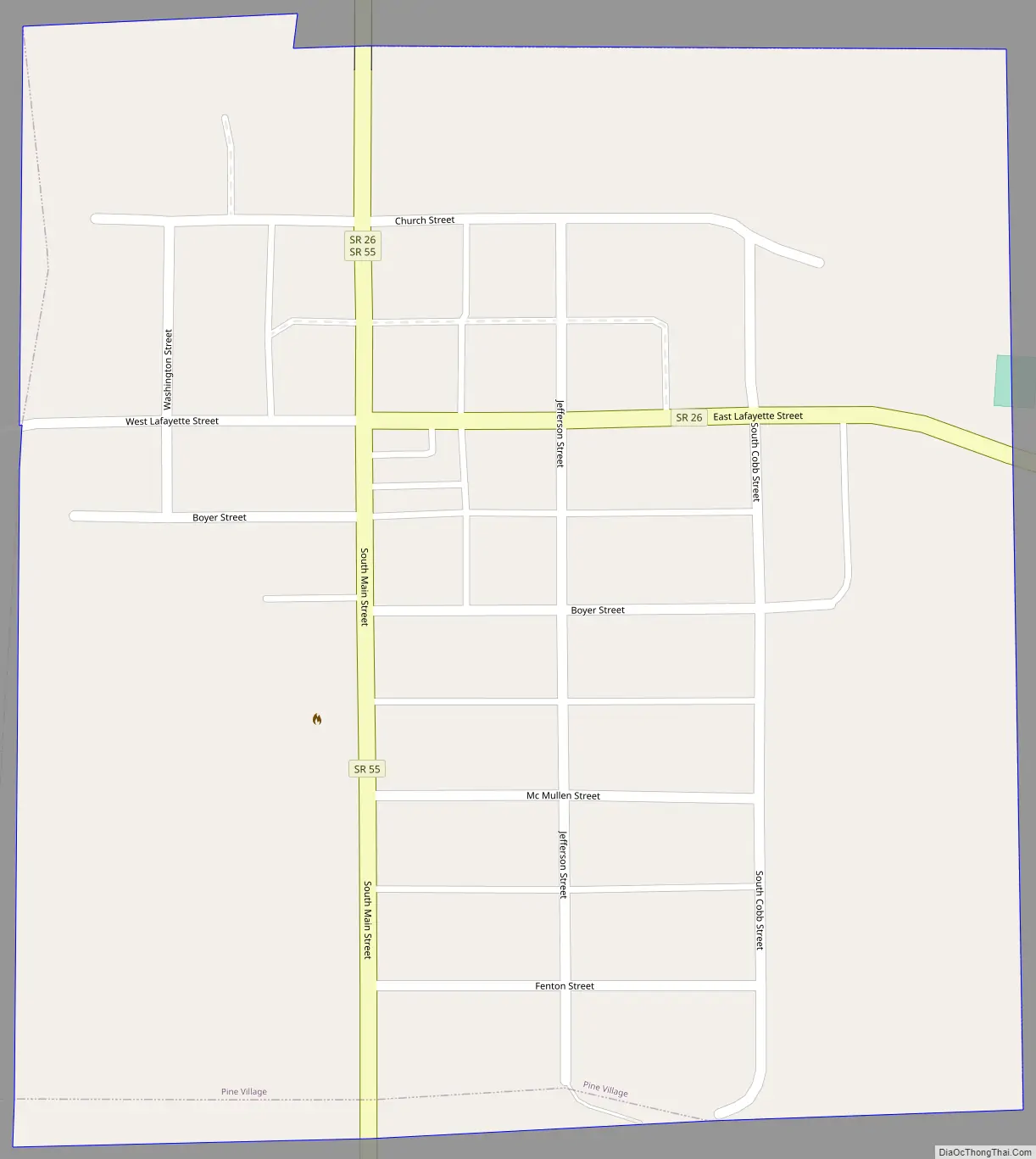
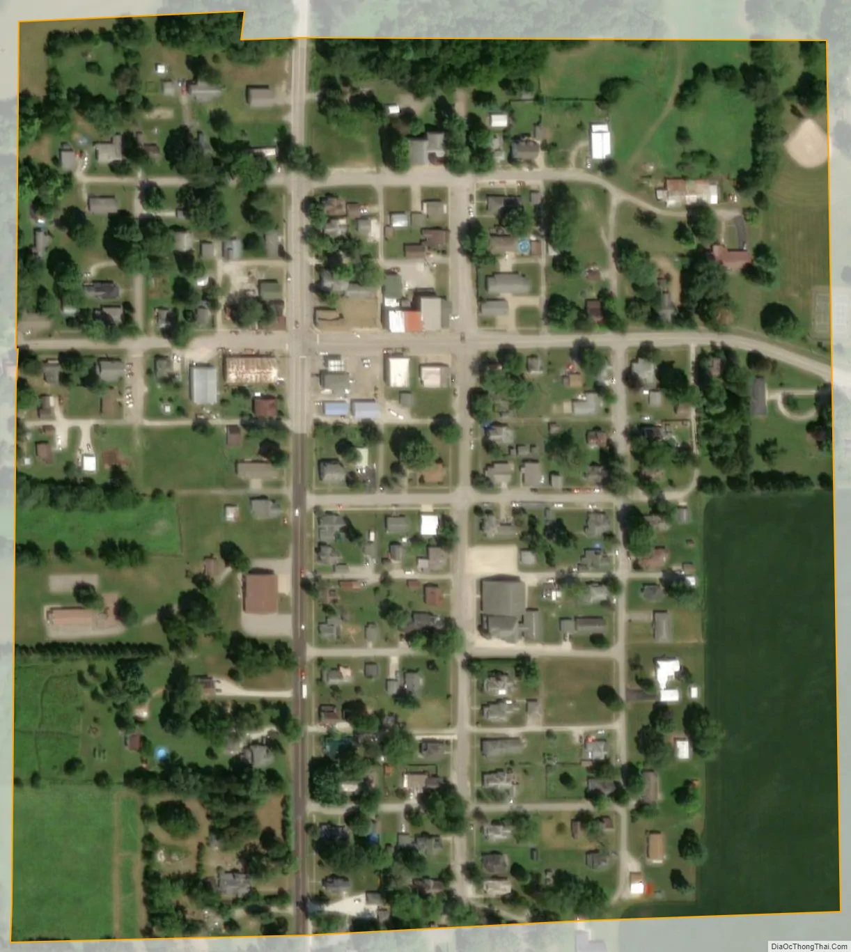
Pine Village city Satellite Map
Geography
Pine Village is located at the intersection of State Road 55 and State Road 26, near Big Pine Creek. It is about 20 miles (32 km) west of Lafayette and about 14 miles (23 km) east of the Illinois border. According to the 2010 census, Pine Village has a total area of 0.12 square miles (0.31 km), all land.
The area on the east side of Pine Village near the railroad, consisting of a grain elevator and some homes, was known as Oklahoma and is located at 40°26′59″N 87°14′42″W / 40.44972°N 87.24500°W / 40.44972; -87.24500 (Oklahoma).
See also
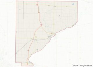
Map of Indiana State and its subdivision:- Adams
- Allen
- Bartholomew
- Benton
- Blackford
- Boone
- Brown
- Carroll
- Cass
- Clark
- Clay
- Clinton
- Crawford
- Daviess
- De Kalb
- Dearborn
- Decatur
- Delaware
- Dubois
- Elkhart
- Fayette
- Floyd
- Fountain
- Franklin
- Fulton
- Gibson
- Grant
- Greene
- Hamilton
- Hancock
- Harrison
- Hendricks
- Henry
- Howard
- Huntington
- Jackson
- Jasper
- Jay
- Jefferson
- Jennings
- Johnson
- Knox
- Kosciusko
- LaGrange
- Lake
- Lake Michigan
- LaPorte
- Lawrence
- Madison
- Marion
- Marshall
- Martin
- Miami
- Monroe
- Montgomery
- Morgan
- Newton
- Noble
- Ohio
- Orange
- Owen
- Parke
- Perry
- Pike
- Porter
- Posey
- Pulaski
- Putnam
- Randolph
- Ripley
- Rush
- Saint Joseph
- Scott
- Shelby
- Spencer
- Starke
- Steuben
- Sullivan
- Switzerland
- Tippecanoe
- Tipton
- Union
- Vanderburgh
- Vermillion
- Vigo
- Wabash
- Warren
- Warrick
- Washington
- Wayne
- Wells
- White
- Whitley
- Alabama
- Alaska
- Arizona
- Arkansas
- California
- Colorado
- Connecticut
- Delaware
- District of Columbia
- Florida
- Georgia
- Hawaii
- Idaho
- Illinois
- Indiana
- Iowa
- Kansas
- Kentucky
- Louisiana
- Maine
- Maryland
- Massachusetts
- Michigan
- Minnesota
- Mississippi
- Missouri
- Montana
- Nebraska
- Nevada
- New Hampshire
- New Jersey
- New Mexico
- New York
- North Carolina
- North Dakota
- Ohio
- Oklahoma
- Oregon
- Pennsylvania
- Rhode Island
- South Carolina
- South Dakota
- Tennessee
- Texas
- Utah
- Vermont
- Virginia
- Washington
- West Virginia
- Wisconsin
- Wyoming