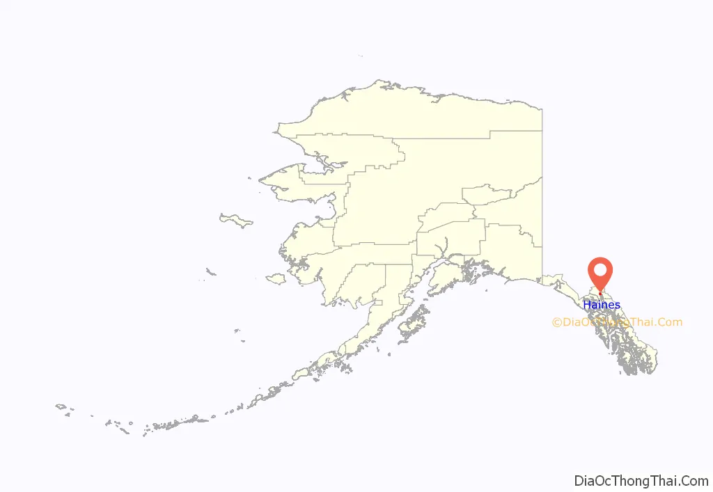
Haines (Tlingit: Deishú) is a census-designated place located in Haines Borough, Alaska, United States. It is in the northern part of the Alaska Panhandle, near Glacier Bay National Park and Preserve.
As of the 2020 census, the population of the Haines CDP was 1,657, down from 1,713 in 2010, concentrating 79.6% of Haines Borough’s total population.
| Name: | Haines CDP |
|---|---|
| LSAD Code: | 57 |
| LSAD Description: | CDP (suffix) |
| State: | Alaska |
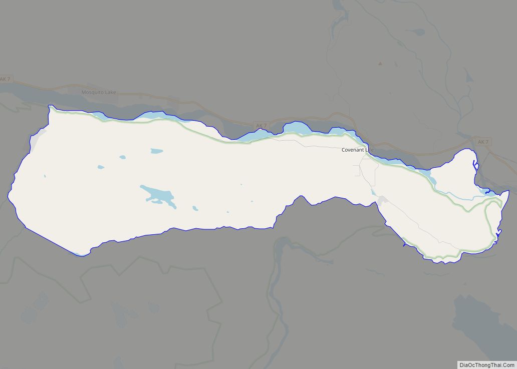
| County: | Haines Borough |
| Incorporated: | January 24, 1910 |
| Elevation: | 36 ft (11 m) |
| Total Area: | 20.69 sq mi (53.58 km²) |
| Land Area: | 13.25 sq mi (34.32 km²) |
| Water Area: | 7.43 sq mi (19.25 km²) |
| Total Population: | 1,657 |
| Population Density: | 125.03/sq mi (48.27/km²) |
| ZIP code: | 99827 |
| Area code: | 907 |
| FIPS code: | 0231050 |
| GNISfeature ID: | 1422400 |
| Website: | www.visithaines.com |
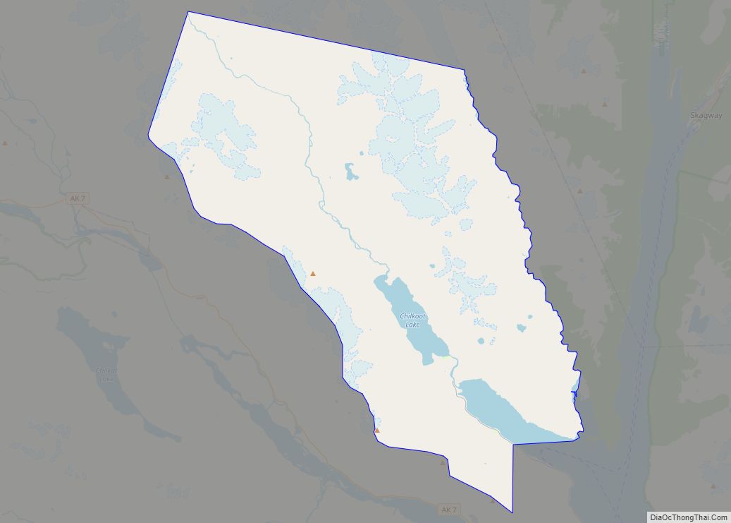
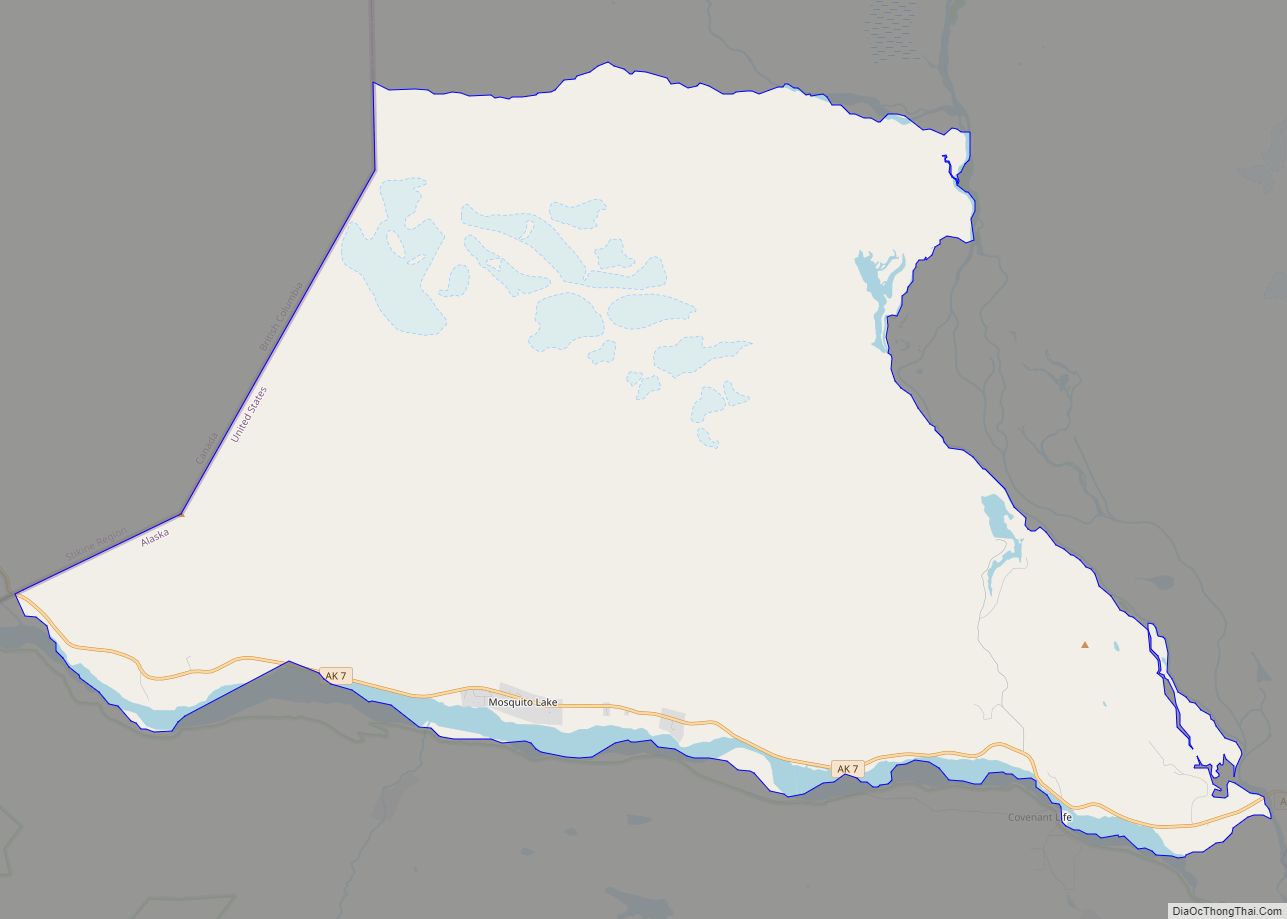
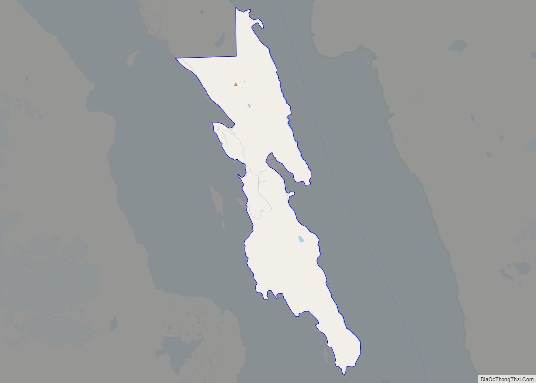
Online Interactive Map
Click on ![]() to view map in "full screen" mode.
to view map in "full screen" mode.
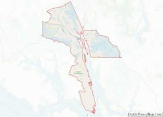
Haines location map. Where is Haines CDP?
History
The original Native name for Haines was Deishú, meaning “end of the trail” by the Chilkat group of Tlingit. It received this name because they could portage (carry) their canoes from the trail they used to trade with the interior, which began at the outlet of the Chilkat River, to Dtehshuh and save 20 miles (32 km) of rowing around the Chilkat Peninsula.
The first European, George Dickinson, an agent for the North West Trading Company, settled at Dtehshuh in 1879. In 1881, the Chilkat asked Sheldon Jackson to send missionaries to the area. Samuel Hall Young, a Presbyterian minister, was sent. Jackson built the Chilkat Mission and school at Dtehshuh in 1881, on land given to the church by the Chilkat. The Mission was renamed “Haines” in 1884 in honor of Francina E. Haines, the chairwoman of the committee that raised funds for its construction. Haines is the only town in Southeast Alaska to have been named after a woman.
At the time, the boundary between Canada and the U.S. was disputed and vaguely defined. There were overlapping land claims from the United States’ purchase of Alaska from Russia in 1867 and British claims along the coast.
The Klondike Gold Rush of 1896–1899 changed the region greatly. Haines became a supply center for the Dalton Trail from Chilkat Inlet offered a route to the Yukon for prospectors. Gold was also discovered 36 miles (58 km) from Haines in 1899 at the Porcupine District.
The sudden importance of the region increased the urgency of fixing an exact boundary. There were reports that Canadian citizens were harassed by the U.S. as a deterrent to making any land claims. In 1898 the national governments agreed on a compromise, but the government of British Columbia rejected it. U.S. President McKinley proposed a permanent lease of a port near Haines, but Canada rejected that compromise.
The economy continued to grow and diversify. Four canneries were constructed around the mission by 1900. However, the completion of the White Pass and Yukon Route railway in neighboring Skagway that same year led to the Dalton Trail’s eventual abandonment and Haines’ economic decline.
In 1903, the Hay-Herbert Treaty entrusted the border decision to arbitration by a mixed tribunal of six members, three American and three Canadian–British, who determined in favor of the United States, resulting in the present-day border.
Fort William H. Seward, a United States Army installation, was constructed south of Haines and completed by 1904, on property donated by the mission from its holdings. In 1922, the fort was renamed Chilkoot Barracks. It was the only United States Army post in Alaska before World War II. During World War II, it was used as a supply point for some U.S. Army activities in Alaska. The fort was deactivated in 1946 and sold as surplus property to a group of investors (Ted Gregg, Carl Heinmiller, Marty Cordes, Clarence Mattson, and Steve Homer) who called it “Port Chilkoot”, thus forming the Port Chilkoot Company. Port Chilkoot was incorporated as a city in 1956. In 1970, Port Chilkoot merged with Haines into one municipality. Heinmiller was Port Chilkoot’s mayor for the majority of its existence as a separate city. In 1972, the fort was designated a National Historic Landmark and the name, Fort William H. Seward, was restored.
Haines was the southern terminal of the Haines-Fairbanks Pipeline (not connected or related to the Trans-Alaska Pipeline System), which provided refined petroleum products to Fort Greely, Eielson Air Force Base, and Ladd Air Force Base (transferred to the Army as Fort Wainwright in 1961). This 626-mile (1,007 km), 8-inch (200 mm) pipeline carried diesel, automotive gas, jet fuel and aviation gas from Haines to Fairbanks from 1955 until it was retired by the U.S. Army in 1973, due to deterioration and prohibitive repair costs. An Army facility with storage tanks existed alongside the Haines Terminal, which was maintained by the Army for another decade. The construction and maintenance of the terminal and storage facility were a significant factor in the Haines economy for four decades.
All but one of the canneries had closed by 1972 due to declining fish stocks, thus leaving Haines Packing Co. as the sole remaining cannery presently located in Haines. Nonetheless, commercial fishing remains an important part of the local economy. Logging and sawing timber has been an industry around Haines but has declined also in recent years.
In October 2002, voters approved a measure consolidating the city of Haines and Haines Borough into a home rule borough.
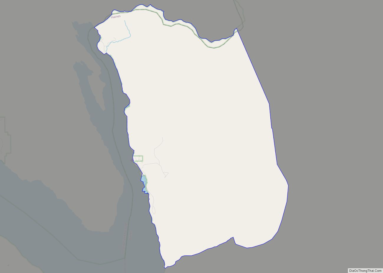
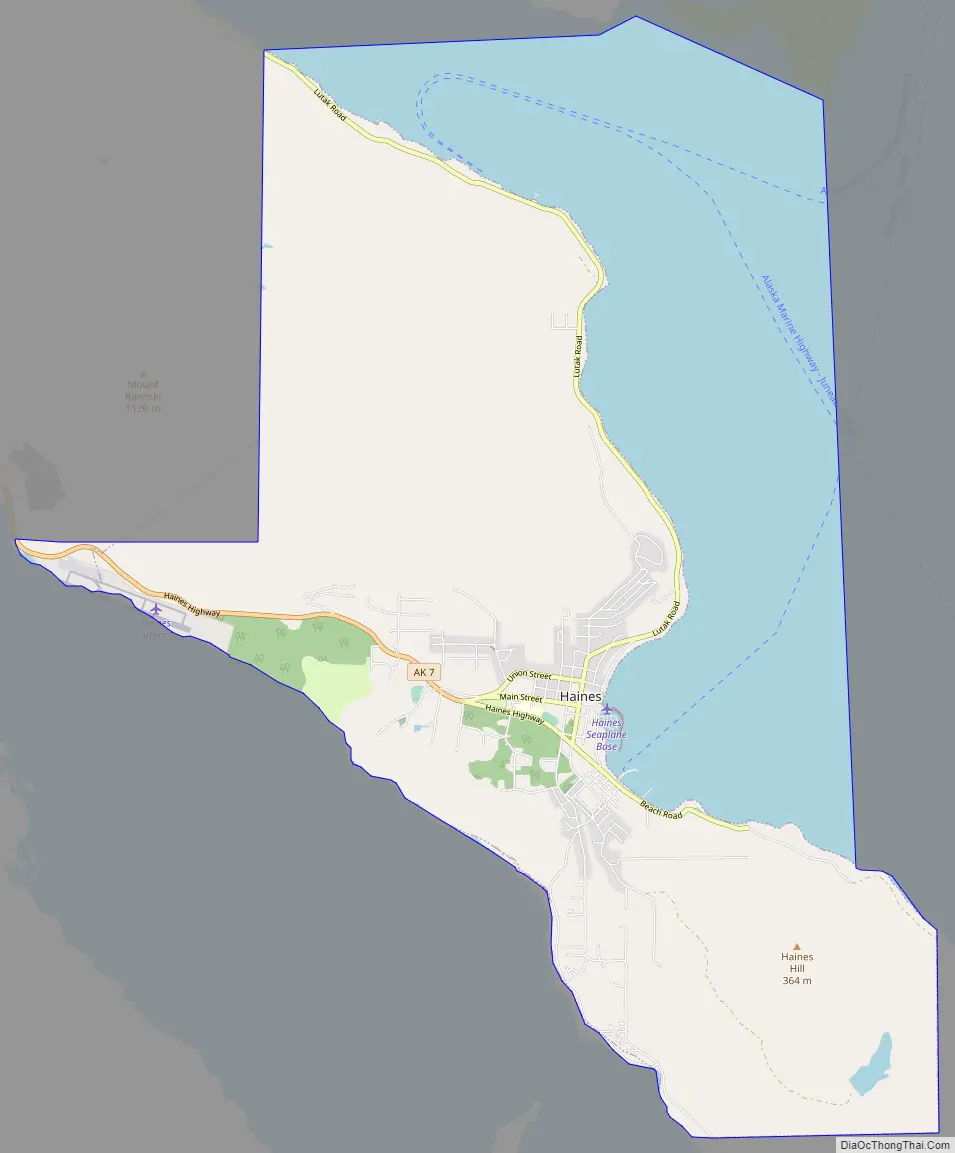
Haines Road Map
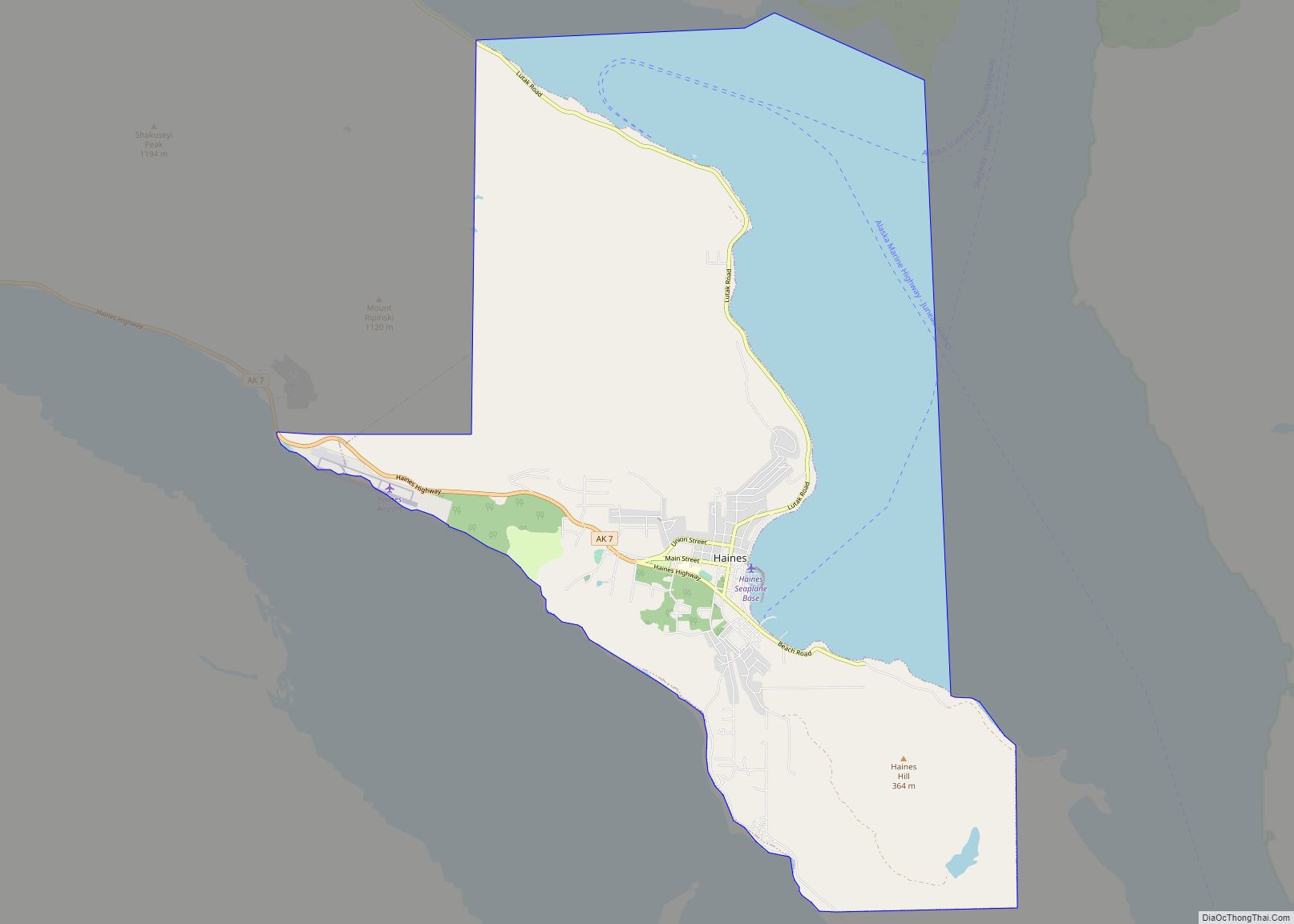
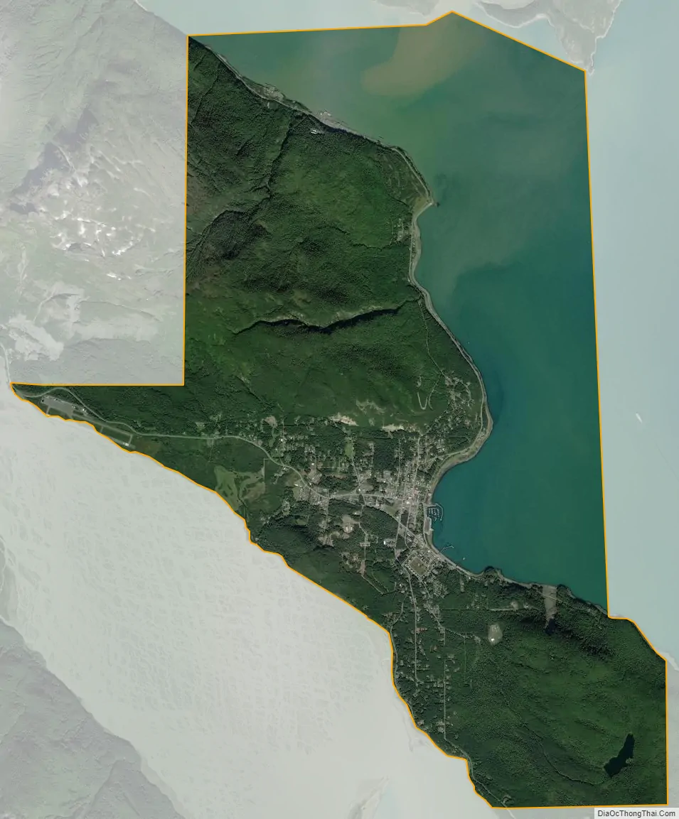
Haines city Satellite Map
Geography
Haines has a dry-summer humid continental climate with warm summers (Köppen: Dsb), although featuring nearly double the precipitation of nearby Skagway.
The Haines CDP is located in the north-central part of Haines Borough at 59°14′02″N 135°26′49″W / 59.233800°N 135.447009°W / 59.233800; -135.447009. The CDP is situated on the Chilkat Peninsula at a narrow spot called the Deshu Isthmus. The community is bounded by Portage Cove of Chilkoot Inlet to the east and by the Chilkat River at its mouth into the Chilkat Inlet to the west. To the south, down the Chilkat Peninsula, Haines is bordered by the CDP of Mud Bay, and, to the north, it is bordered by the Lutak CDP.
Alaska Route 7, the Haines Highway, terminates at Haines and leads northwest 39 miles (63 km) to the Canadian border near Pleasant Camp, British Columbia. The Haines Highway continues north to a junction with the Alaska Highway at Haines Junction, Yukon, 147 miles (237 km) from Haines.
According to the United States Census Bureau, the Haines CDP has a total area of 20.6 square miles (53.4 km), of which 13.2 square miles (34.2 km) are land and 7.5 square miles (19.3 km), or 36.02%, are water.
Winters are mild by Alaskan standards, with an average January high temperature around 30 °F or −1.1 °C, and the average low around 20 °F or −6.7 °C. Summers are cool to mild, with an average July high temperature of 65 °F or 18.3 °C, and an average low of 51 °F or 10.6 °C. Various days in the summer surpass 77 °F or 25 °C, with highest recorded temperature being 98 °F or 36.7 °C on July 31, 1976, and the record low is −18 °F or −27.8 °C on January 3, 1998.
During the 21st century, Haines has twice set a local record for snowfall: for the 2006−2007 season it received 309 inches (7.8 m) of snow, a record broken during the 2011−2012 season, when it received 360 inches (9.1 m).
See also
Map of Alaska State and its subdivision:- Aleutians East
- Aleutians West
- Anchorage
- Bethel
- Bristol Bay
- Denali
- Dillingham
- Fairbanks North Star
- Haines
- Juneau
- Kenai Peninsula
- Ketchikan Gateway
- Kodiak Island
- Lake and Peninsula
- Matanuska-Susitna
- Nome
- North Slope
- Northwest Arctic
- Prince of Wales-Outer Ketchi
- Sitka
- Skagway-Yakutat-Angoon
- Southeast Fairbanks
- Valdez-Cordova
- Wade Hampton
- Wrangell-Petersburg
- Yukon-Koyukuk
- Alabama
- Alaska
- Arizona
- Arkansas
- California
- Colorado
- Connecticut
- Delaware
- District of Columbia
- Florida
- Georgia
- Hawaii
- Idaho
- Illinois
- Indiana
- Iowa
- Kansas
- Kentucky
- Louisiana
- Maine
- Maryland
- Massachusetts
- Michigan
- Minnesota
- Mississippi
- Missouri
- Montana
- Nebraska
- Nevada
- New Hampshire
- New Jersey
- New Mexico
- New York
- North Carolina
- North Dakota
- Ohio
- Oklahoma
- Oregon
- Pennsylvania
- Rhode Island
- South Carolina
- South Dakota
- Tennessee
- Texas
- Utah
- Vermont
- Virginia
- Washington
- West Virginia
- Wisconsin
- Wyoming