Franklin County is located in the U.S. state of Missouri. At the 2020 census, the population was 104,682. Its county seat is Union. The county was organized in 1818 and is named after Founding Father Benjamin Franklin.
Franklin County is part of the St. Louis, MO-IL Metropolitan Statistical Area and contains some of the city’s exurbs. It is located along the south side of the Missouri River.
The county has wineries that are included in the Hermann AVA (American Viticultural Area) and is part of the region known as the Missouri Rhineland, which extends on both sides of the Missouri River.
| Name: | Franklin County |
|---|---|
| FIPS code: | 29-071 |
| State: | Missouri |
| Founded: | December 11, 1818 |
| Named for: | Benjamin Franklin |
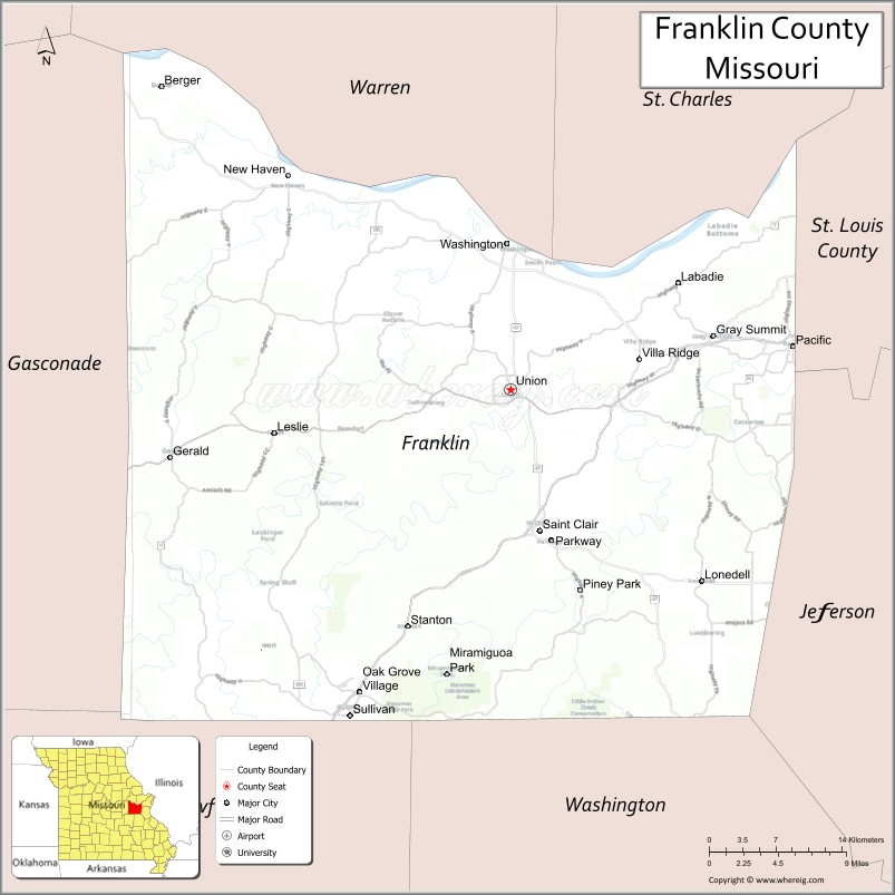
| Seat: | Union |
| Largest city: | Washington |
| Total Area: | 931 sq mi (2,410 km²) |
| Land Area: | 923 sq mi (2,390 km²) |
| Total Population: | 104,682 |
| Population Density: | 110/sq mi (43/km²) |
| Time zone: | UTC−6 (Central) |
| Summer Time Zone (DST): | UTC−5 (CDT) |
| Website: | www.franklinmo.org |
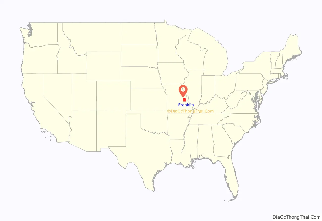
Franklin County location map. Where is Franklin County?

History
Occupied by succeeding cultures of indigenous peoples, this area was populated by the historic Osage tribe at the time of European encounter. The region was first settled by Europeans during the rule of the Spanish Empire. The Spanish log fort San Juan del Misuri (1796–1803) was built in present-day Washington. After the American Revolutionary War, migrants from the new United States started moving West. Among them were the family and followers of Daniel Boone, an explorer from Kentucky who settled the area starting in 1799. For the next two decades, most settlers came from the Upper South, especially Kentucky and Virginia, bringing their slaves with them to work the land.
In 1833 substantial numbers of German immigrant families began settling in the area, and soon they outnumbered the slave owners in the county. The German newcomers were opposed to slavery, and their sons would become Union supporters during the U.S. Civil War. Former governor and then Confederate General Sterling Price led his cavalry through the county during his Missouri raid of 1864.
Before the war Franklin County had been served by steamboats that moved freight and passenger traffic on the Missouri River. Afterwards, it became a railroad transportation center. Manufacturing industries were established at the end of the Civil War and successive ones have continued.
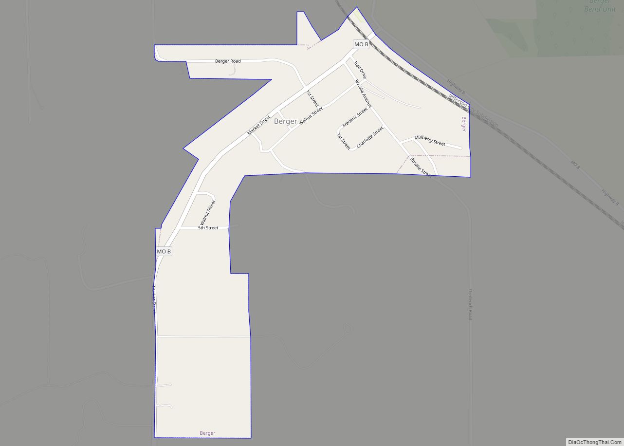
Bias Vineyard, near the small city of Berger, is located within the Hermann American Viticultural Area (AVA), designated in 1983. Röbller Vineyard and Winery near New Haven is also in the Hermann AVA. Wineries along both sides of the Missouri River are part of the Missouri Rhineland, whose vineyards were started by German immigrants in the mid-19th century. Before Prohibition, Missouri was the second-largest wine-producing state in the nation. Everything was closed down except for limited production of wine allowed for religious purposes. The state’s wine industry had to be completely rebuilt, which has been taking place since the 1960s.
The rural county has had severe problems with local production, distribution and consumption of methamphetamine. The struggles of the county with adverse effects of the drug, was explored in a 2005 A&E documentary entitled Meth: A County in Crisis.
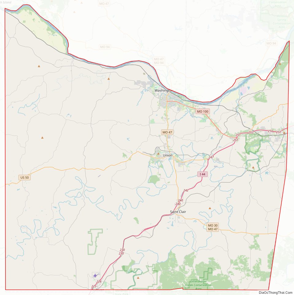
Franklin County Road Map
Geography
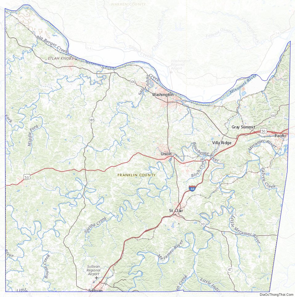
According to the U.S. Census Bureau, the county has a total area of 931 square miles (2,410 km), of which 923 square miles (2,390 km) is land and 8.0 square miles (21 km) (0.9%) is water. It is the fourth-largest county in Missouri by land area and third-largest by total area.
The center of the Missouri River forms the nominal northern border of the county, although the river has changed its course since boundaries were first established: a portion of St. Charles County near St. Albans is now south of the river, while a portion of Franklin County near Augusta is north of the river.
The Bourbeuse River flows for 107 miles through the county. It cuts a deep, narrow valley and is very crooked. It empties into the Meramec River near Union. This river is mostly undeveloped, with limited access and few bridges over it. During low water, a number of fords allow crossing.
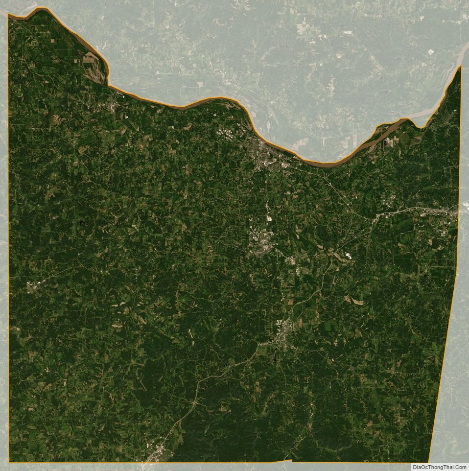
The county is located in the Ozarks region, with steep hills and deep valleys, caves, springs, and sinkholes characteristic of karst areas. The underlying rock is typically carbonate, including limestone and dolomite. Mining activity in the county included ores of lead, copper, zinc, and deposits of refractory clay. The soils in most of the county tend to be thin, rocky red clay, and are poor for most agriculture, while the soil near the Missouri River is dark, rich, and thick, and used primarily for row crops such as corn, wheat, and soybeans. Much of the county is covered with thick forests, reestablished since the 1920s.
Urbanization is increasing in the county, especially surrounding Washington and Union, and along Interstate 44. St. Albans is now a continuation of the suburban region of St. Louis County while the majority of the county retains a rural character and includes extensive wilderness areas, typical of exurban areas.
Adjacent counties
- Warren County (north)
- St. Charles County (northeast)
- St. Louis County (northeast)
- Jefferson County (east)
- Washington County (southeast)
- Crawford County (southwest)
- Gasconade County (west)
Major highways
- Interstate 44
- U.S. Route 50
- U.S. Route 66 (1926–79)
- Route 30
- Route 47
- Route 100
- Route 185
Franklin County Topographic Map
Franklin County Satellite Map
Franklin County Outline Map