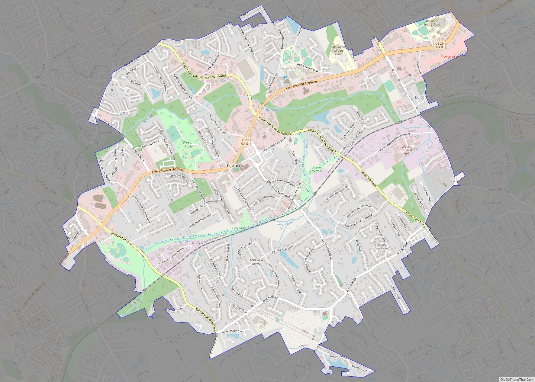
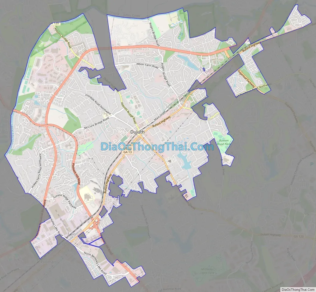
Duluth is a city in Gwinnett County, Georgia, United States. Located north of Interstate 85, it is approximately 22 miles (35 km) northeast of Atlanta.
As of the 2020 census, Duluth had a population of 31,873, and the United States Census Bureau estimated the population to be 31,864 as of 2021.
This Atlanta suburb is home to Gwinnett Place Mall, the Gwinnett Civic and Cultural Center, Gas South Arena, Hudgens Center for the Arts, and the Red Clay Theater. It is also home to Northside Hospital–Duluth, an 81-bed hospital constructed in 2006, as well as GMC’s Glancy Campus, a 30-bed facility located near downtown. The agricultural manufacturer AGCO is based in Duluth.
| Name: | Duluth city |
|---|---|
| LSAD Code: | 25 |
| LSAD Description: | city (suffix) |
| State: | Georgia |
| County: | Gwinnett County |
| Elevation: | 1,060 ft (320 m) |
| Total Area: | 10.38 sq mi (26.89 km²) |
| Land Area: | 10.22 sq mi (26.47 km²) |
| Water Area: | 0.16 sq mi (0.42 km²) |
| Population Density: | 3,118.69/sq mi (1,204.08/km²) |
| ZIP code: | 30026, 30029, 30095-30099 |
| Area code: | 470/678/770/404 |
| FIPS code: | 1324600 |
| GNISfeature ID: | 2403514 |
| Website: | www.duluthga.net |
Online Interactive Map
Click on ![]() to view map in "full screen" mode.
to view map in "full screen" mode.
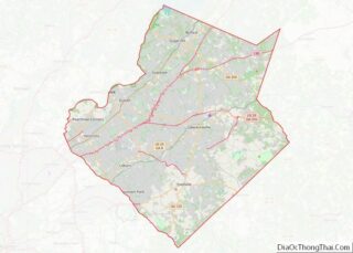
Duluth location map. Where is Duluth city?


History
Duluth was originally Cherokee territory. When Duluth was established in the early 19th century, it was primarily forested land occupied by tribespeople. An Indian trail, called Old Peachtree Road by the settlers, was extended through the area during the War of 1812 to connect Fort Peachtree in present-day Atlanta with Fort Daniel near present-day Dacula. When Gwinnett County was established in 1818, white settlement of the area accelerated.
Cotton merchant Evan Howell constructed a road connecting his cotton gin at the Chattahoochee River with Old Peachtree Road, creating Howell’s Cross Roads. The settlement later became known as “Howell’s Crossing”. Howell was the grandfather of Atlanta Mayor Evan P. Howell and great-grandfather of Atlanta Constitution publisher Clark Howell.
Railroad era and new name
Howell’s Crossing was renamed “Duluth” in 1871 after Congress funded a north–south railroad line into the community. It was named after the city of Duluth, Minnesota. The Midwestern city had gotten its own railroad connection not long before, which had prompted Rep. J. Proctor Knott, a Kentucky Democrat, to make a speech in Congress mocking the project as wasteful. That speech drew national attention. According to contemporary reports, Evan P. Howell himself jokingly suggested the name change in a speech about the arrival of railroad service in the Georgia town. (Duluth, Minnesota, is named for Daniel Greysolon, Sieur du Lhut (1636–1710), a French captain and explorer of the upper Midwest, who negotiated peace between the Chippewa and the Sioux nation.)
The railroad encouraged the growth of Duluth’s economy. A schoolhouse was built in 1871 on the site of what is now Coleman Middle School (formerly Duluth Middle School and Duluth Elementary School). The first Methodist church was organized in 1871, and the first Baptist congregation formed in 1886. Both churches continue today at new locations along State Route 120. The Bank of Duluth was charted in 1904, followed by the Farmers and Merchants Bank in 1911. Neither survived the Great Depression.
In 1922, Duluth elected Georgia’s first female mayor, Alice Harrell Strickland. She donated 1-acre (4,000 m) of land for a “community forest” and began efforts to conserve land for public recreation.
Post-war and modern era
Duluth grew rapidly in the 1970s and 1980s, along with the rest of Gwinnett County. Georgia Governor George Busbee became a resident of Duluth in 1983 after leaving office, moving to the Sweet Bottom Plantation subdivision developed by Scott Hudgens. A major revitalization of the Duluth downtown area was undertaken in the early 21st century. Development along Sugarloaf Parkway has continued with the construction of the Gwinnett Arena near the Gwinnett Convention Center.
In much of the 20th century, when Gwinnett County was still rural, Duluth was known in the area as being one of the few small towns with its own hospital, Joan Glancy Memorial Hospital. Consequently, many older residents of the area who call other towns home were actually born in Duluth. Joan Glancy was replaced with Gwinnett Medical Center – Duluth in 2006. The site of the old Joan Glancy hospital is now GMC’s Glancy Campus, home to the Glancy Rehabilitation Center, the Duluth location of GMC’s Diabetes & Nutrition Education Center and the Duluth location of GMC’s Center for Sleep Disorder.
The city made national headlines twice in 2005. In March, Fulton County Courthouse shooting suspect Brian Nichols was captured in a Duluth apartment after holding a woman hostage. In April, local resident Jennifer Wilbanks was reported missing a few days before her planned wedding to John Mason. She was found a few days later in Albuquerque, New Mexico, where she admitted to having lied about being kidnapped.
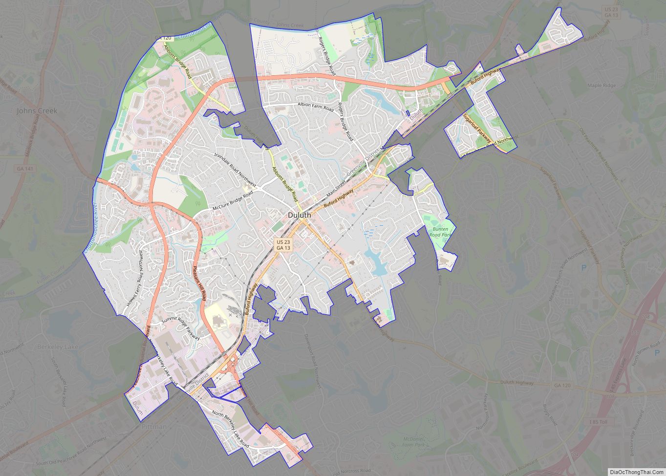
Duluth Road Map
Duluth city Satellite Map

Geography
Duluth is located in the northeastern section of the Atlanta metropolitan area. Approximately 25 mi (40 km) from Downtown Atlanta, the city lies in the west-central section of Gwinnett County, bounded to the north by the Chattahoochee River (which also acts as the county line), northeast by Suwanee, south by unincorporated land, and west by Berkeley Lake.
Unincorporated portions of Forsyth County use a Duluth ZIP code despite being outside Duluth city limits in a different county. A significant part of the nearby city of Johns Creek in Fulton County shares at least one ZIP code with Duluth.
Duluth has a humid subtropical climate (Cfa.) The monthly averages range from 41.0 °F in January to 78.3° in July. [4] The local hardiness zone is 7b.
See also
Map of Georgia State and its subdivision:- Appling
- Atkinson
- Bacon
- Baker
- Baldwin
- Banks
- Barrow
- Bartow
- Ben Hill
- Berrien
- Bibb
- Bleckley
- Brantley
- Brooks
- Bryan
- Bulloch
- Burke
- Butts
- Calhoun
- Camden
- Candler
- Carroll
- Catoosa
- Charlton
- Chatham
- Chattahoochee
- Chattooga
- Cherokee
- Clarke
- Clay
- Clayton
- Clinch
- Cobb
- Coffee
- Colquitt
- Columbia
- Cook
- Coweta
- Crawford
- Crisp
- Dade
- Dawson
- Decatur
- DeKalb
- Dodge
- Dooly
- Dougherty
- Douglas
- Early
- Echols
- Effingham
- Elbert
- Emanuel
- Evans
- Fannin
- Fayette
- Floyd
- Forsyth
- Franklin
- Fulton
- Gilmer
- Glascock
- Glynn
- Gordon
- Grady
- Greene
- Gwinnett
- Habersham
- Hall
- Hancock
- Haralson
- Harris
- Hart
- Heard
- Henry
- Houston
- Irwin
- Jackson
- Jasper
- Jeff Davis
- Jefferson
- Jenkins
- Johnson
- Jones
- Lamar
- Lanier
- Laurens
- Lee
- Liberty
- Lincoln
- Long
- Lowndes
- Lumpkin
- Macon
- Madison
- Marion
- McDuffie
- McIntosh
- Meriwether
- Miller
- Mitchell
- Monroe
- Montgomery
- Morgan
- Murray
- Muscogee
- Newton
- Oconee
- Oglethorpe
- Paulding
- Peach
- Pickens
- Pierce
- Pike
- Polk
- Pulaski
- Putnam
- Quitman
- Rabun
- Randolph
- Richmond
- Rockdale
- Schley
- Screven
- Seminole
- Spalding
- Stephens
- Stewart
- Sumter
- Talbot
- Taliaferro
- Tattnall
- Taylor
- Telfair
- Terrell
- Thomas
- Tift
- Toombs
- Towns
- Treutlen
- Troup
- Turner
- Twiggs
- Union
- Upson
- Walker
- Walton
- Ware
- Warren
- Washington
- Wayne
- Webster
- Wheeler
- White
- Whitfield
- Wilcox
- Wilkes
- Wilkinson
- Worth
- Alabama
- Alaska
- Arizona
- Arkansas
- California
- Colorado
- Connecticut
- Delaware
- District of Columbia
- Florida
- Georgia
- Hawaii
- Idaho
- Illinois
- Indiana
- Iowa
- Kansas
- Kentucky
- Louisiana
- Maine
- Maryland
- Massachusetts
- Michigan
- Minnesota
- Mississippi
- Missouri
- Montana
- Nebraska
- Nevada
- New Hampshire
- New Jersey
- New Mexico
- New York
- North Carolina
- North Dakota
- Ohio
- Oklahoma
- Oregon
- Pennsylvania
- Rhode Island
- South Carolina
- South Dakota
- Tennessee
- Texas
- Utah
- Vermont
- Virginia
- Washington
- West Virginia
- Wisconsin
- Wyoming